York Tourist Map: Top Attractions & Bus Stops
By Jake Dawson · Updated · Affiliate links, explained in my disclosure
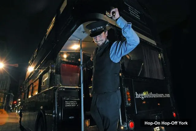
The Ghost Bus Tours Ltd
Comedy Horror Show: York Ghost Bus Tour
4.4 (3,555) · from $26.55
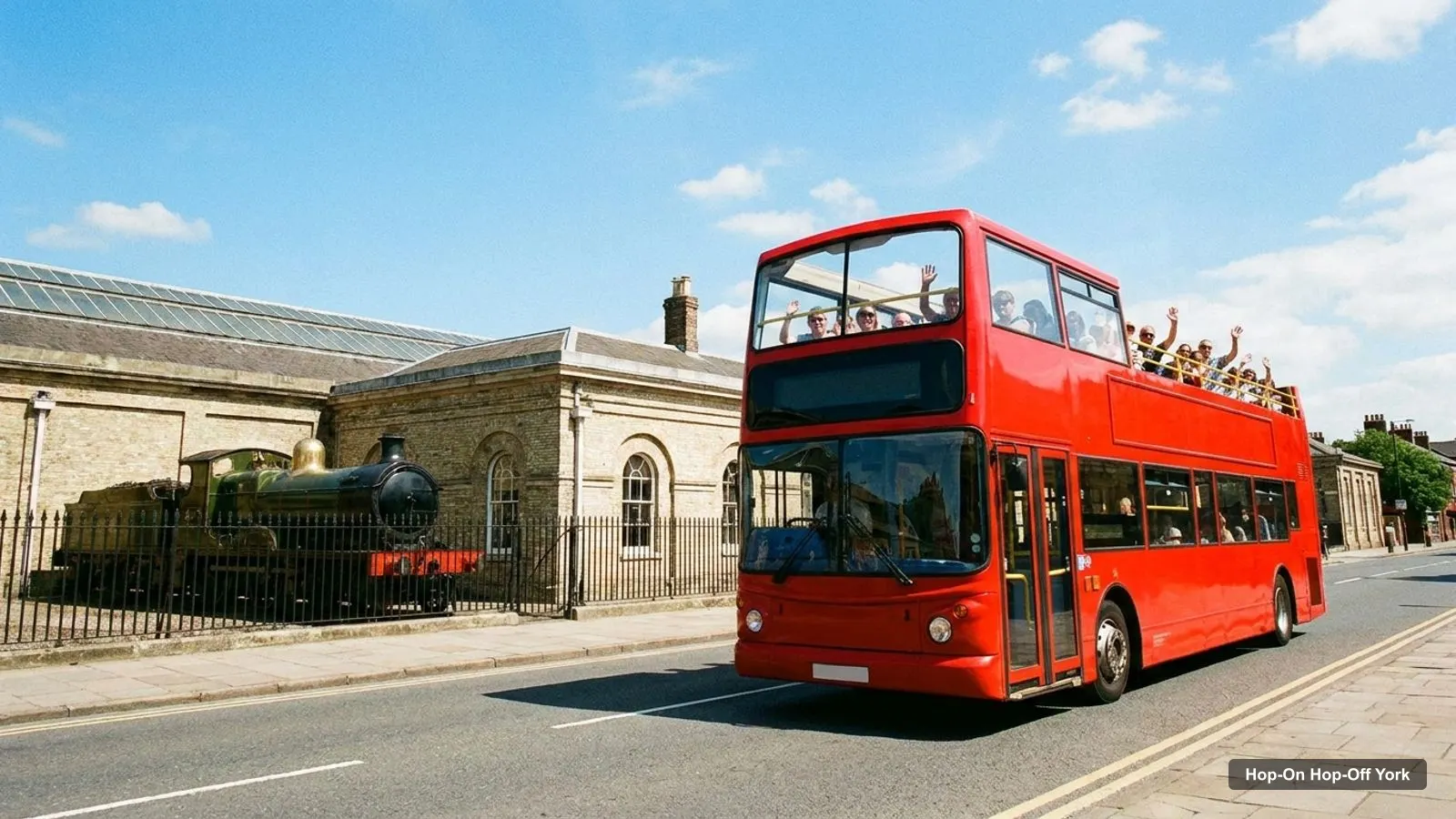
A York tourist map is most useful when it shows two things together: where the sights are and where the bus stops. I put both in one place. Below you’ll find the sightseeing bus stops with Google Maps links, the top 20 attractions by Google reviews with coordinates, and a short guide to which sights sit in the same cluster. If you want the ticket comparison first, go to my guide to hop-on hop-off York.
I’m Jake, and everything here comes from the data in my files: the City Sightseeing stop list, the Google Maps place cards, and distances I measured from the coordinates. I haven’t drawn the map by hand, so use the Google Maps links when you need the exact pin.
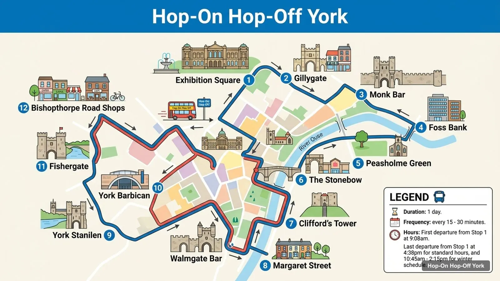
Stops on the route
- 1Exhibition Square
- 2Gillygate
- 3Monk Bar
- 4Foss Bank
- 5Peasholme Green
- 6The Stonebow
- 7Clifford's Tower
- 8Margaret Street
- 9Walmgate Bar
- 10York Barbican
- 11Fishergate
- 12Bishopthorpe Road Shops
York Tourist Map: The Bus Stops
These are the first 12 stops on the City Sightseeing loop, in order, starting at Exhibition Square. The listing names 21 stops in all, and the remaining nine run on through Bishopthorpe Road, Campleshon Road, Blossom Street, The Mount, the Railway Station, Memorial Gardens and Museum Gardens. Each link opens a Google Maps search for the stop name in York, so check the pin on the day, because stops can move.
| # | Stop | Map |
|---|---|---|
| 1 | Exhibition Square | Find on Google Maps |
| 2 | Gillygate | Find on Google Maps |
| 3 | Monk Bar | Find on Google Maps |
| 4 | Foss Bank | Find on Google Maps |
| 5 | Peasholme Green | Find on Google Maps |
| 6 | The Stonebow | Find on Google Maps |
| 7 | Clifford’s Tower | Find on Google Maps |
| 8 | Margaret Street | Find on Google Maps |
| 9 | Walmgate Bar | Find on Google Maps |
| 10 | York Barbican | Find on Google Maps |
| 11 | Fishergate | Find on Google Maps |
| 12 | Bishopthorpe Road Shops | Find on Google Maps |
The loop is easier to understand when you see it as three arms. The first arm covers the centre and the north-east: Exhibition Square, Gillygate, Monk Bar, Foss Bank and Peasholme Green. The second arm crosses the middle at The Stonebow and Clifford’s Tower, then loops to Walmgate Bar, York Barbican and Fishergate. The third runs out to Bishopthorpe Road and returns by Blossom Street and the Railway Station.
York Tourist Attractions: The Top 20 on the Map
This table ranks the 20 most-reviewed attractions in my Google Maps data. I removed bus stops, park-and-ride sites, tour operators and places that are not visitor sights. The coordinates are latitude and longitude, and each map link opens the place on Google Maps. Three of the 20 are far from the centre: Castle Howard, the Yorkshire Air Museum and Beningbrough Hall.
| # | Attraction | Rating | Reviews | Coordinates | Map |
|---|---|---|---|---|---|
| 1 | National Railway Museum York | 4.7 | 32,194 | 53.9605, -1.0964 | Open map |
| 2 | York Minster | 4.7 | 24,807 | 53.9623, -1.0819 | Open map |
| 3 | JORVIK Viking Centre | 4.6 | 14,635 | 53.9574, -1.0803 | Open map |
| 4 | Museum Gardens | 4.7 | 9,397 | 53.9615, -1.0881 | Open map |
| 5 | Castle Howard | 4.6 | 8,998 | 54.1218, -0.9061 | Open map |
| 6 | The York Dungeon | 4.6 | 7,632 | 53.9570, -1.0819 | Open map |
| 7 | York Castle Museum | 4.6 | 7,535 | 53.9552, -1.0784 | Open map |
| 8 | York’s Chocolate Story | 4.6 | 7,184 | 53.9600, -1.0804 | Open map |
| 9 | Clifford’s Tower, York | 4.3 | 6,191 | 53.9558, -1.0799 | Open map |
| 10 | Yorkshire Air Museum and Allied Air Forces Memorial | 4.7 | 5,729 | 53.9254, -0.9657 | Open map |
| 11 | Beningbrough Hall, Gallery and Gardens | 4.5 | 4,209 | 54.0249, -1.2117 | Open map |
| 12 | Rowntree Park | 4.6 | 3,039 | 53.9485, -1.0817 | Open map |
| 13 | York City Walls | 4.7 | 2,724 | 53.9622, -1.0774 | Open map |
| 14 | Yorkshire Museum | 4.5 | 2,522 | 53.9617, -1.0877 | Open map |
| 15 | City Cruises - Boat Tours (King’s Staith) | 4.4 | 2,148 | 53.9563, -1.0829 | Open map |
| 16 | Merchant Adventurers’ Hall | 4.6 | 1,405 | 53.9579, -1.0788 | Open map |
| 17 | Treasurer’s House, York | 4.6 | 1,350 | 53.9630, -1.0808 | Open map |
| 18 | The Bar Convent Living Heritage Centre | 4.7 | 1,079 | 53.9553, -1.0913 | Open map |
| 19 | York Cold War Bunker | 4.7 | 1,003 | 53.9569, -1.1168 | Open map |
| 20 | Barley Hall | 4.4 | 996 | 53.9609, -1.0826 | Open map |
Which Attractions Sit Together
York is small enough that clusters matter more than distance. Here is how I group the top sights, using the coordinates above.
The Minster cluster. York Minster, Treasurer’s House, Barley Hall, the Roman Bath Museum and the Yorkshire Museum are all within about 0.4 km of each other or of Exhibition Square. York Minster is about 0.24 km from the first bus stop. Treasurer’s House is about 0.11 km from the Minster. Plan a morning here, and allow time for the gardens.
The Clifford’s Tower cluster. Clifford’s Tower, York Castle Museum, the York Army Museum, Fairfax House, the York Dungeon and JORVIK all sit within roughly 0.3 km of the tower. The Castle Museum is about 0.12 km from the tower and the Dungeon is about 0.18 km. Because the tower is a named bus stop, this is the easiest cluster to reach by bus.
The Shambles side. York’s Chocolate Story is about 0.28 km from the Minster and about 0.29 km from JORVIK, which makes a good walking link between the two clusters above.
The station cluster. The National Railway Museum is about 0.46 km from the Rail stop, and the Bar Convent is about 0.22 km from it. Blossom Street is on the bus route. It is the part of the loop most visitors skip, and it is worth the stop.
The walls. The York City Walls run through the map, and Monk Bar and Walmgate Bar are both named stops. You can hop off at one and walk toward the other.
Outside the centre. Rowntree Park is about 1.61 km from Exhibition Square, near the South Bank and Bishopthorpe Road stops. Castle Howard is about 21 km away, Beningbrough Hall about 11 km and the Yorkshire Air Museum about 9 km. None are on the bus route.
York Tourist Information and Getting Around
If you want a paper map, the Visit York Information Centre & Gift Shop is at 28 Back Swinegate. It has a 4.5 rating from 563 Google reviews and is about 0.34 km from Exhibition Square. The listing shows 9 AM to 5 PM on Mondays. The official Visit York site has current events and opening times, and I would check it for anything you plan on the day.
There are two park-and-ride sites in my data, Askham Bar and Monks Cross. Askham Bar is about 4.3 km from Exhibition Square, rated 4.6 on Google and open from 5:30 AM to 11 PM on Mondays in the listing. Monks Cross is about 3.1 km out. Neither is a hop-on hop-off stop, so treat them as a way to reach the centre, then board the sightseeing bus at Exhibition Square.
For the bus itself, City Sightseeing runs every 15 to 30 minutes, with a first departure of 9:08am and a last departure of 4:38pm from Stop 1 on standard hours. In winter that shrinks to 10:45am to 2:15pm. Golden Tours runs hourly from 9:23 AM to 4:23 PM. These are the listing’s numbers, so check them on the booking page for your date.
Reading the Map: What the Numbers Tell You
A few patterns stand out when you look at the table. The National Railway Museum leads with 32,194 reviews and a 4.7 rating, and York Minster follows with 24,807 reviews at 4.7. The Minster is the one to put at the centre of your York tourist map, because five more attractions sit within a few hundred metres of it. Museum Gardens has 9,397 reviews, which is a lot for a park, and it is a named stop on the route.
Ratings are tightly bunched. Of the 20 places in the table, only Clifford’s Tower (4.3), Barley Hall (4.4), City Cruises (4.4) and the Yorkshire Museum (4.5) fall below 4.6, so I would not choose between them on the score alone. Distance and opening hours matter more. Clifford’s Tower is a smaller site, which is probably why its rating sits lower, but it’s a named bus stop and has the best views of the castle area.
Use the coordinates to build your own pins. If you copy a latitude and longitude pair into Google Maps, it drops a pin you can save to a list. That is how I would prepare a trip: save the three or four attractions you care most about, then add the bus stops closest to them from the stop table. The 12 stops listed above are the first half of the loop, so add Blossom Street and the Railway Station if you want the western side.
One more tip: the Ghost Bus meeting point is in the rail station area, postcode YO1 6JT. If you are planning an evening show, put that on the map too. It is not a hop-on hop-off stop, so it will not appear in the stop table above.
Using the Map With a Ticket
The easiest way to use this page is to pick three or four sights from the table, check which cluster each belongs to, and then choose the nearest stops. The 24 or 48-hour City Sightseeing ticket at $22.57 covers all 21 stops. If you’re planning days, my York itinerary puts these clusters into one, two and three-day plans, and the best things to do in York ranks the sights with a short note on each.
When you’re ready to book, jump back to hop-on hop-off York for prices and ratings of every ticket. And for the rest of the site, the home page has more cities.
Frequently asked questions
Where can I get a York tourist map?
The Visit York Information Centre & Gift Shop is at 28 Back Swinegate, rated 4.5 on Google from 563 reviews, and about 0.34 km from Exhibition Square. This page also lists every bus stop and the top 20 attractions with coordinates and Google Maps links, so you can save the points on your phone.
Where does the York hop-on hop-off bus start?
The City Sightseeing listing starts at Exhibition Square, which is Stop 1, with the first departure at 9:08am and the last at 4:38pm on standard hours. The Golden Tours listing also says the first bus stop is at Exhibition Square, with the first bus at 9:23 AM and then hourly until 4:23 PM.
How many stops does the York sightseeing bus have?
The City Sightseeing listing names 21 stops, from Exhibition Square and Monk Bar to Clifford's Tower, Walmgate Bar, Bishopthorpe Road, the Railway Station and Museum Gardens. The TouringBee listing also mentions 21 bus stops. Golden Tours does not publish a full stop list, so check its booking page.
Is York city centre walkable?
Yes. In my coordinates, York Minster, Museum Gardens, the Chocolate Story, JORVIK and Clifford's Tower are all within about 1 km of Exhibition Square. The sights that are further out, like the National Railway Museum, Rowntree Park and Bishopthorpe Road, are where the bus helps.
Tours I compared in York
My full review of each one, in the order I rank them:
- Comedy Horror Show: York Ghost Bus Tour★ 4.4 · from $26.55
- York: City Sightseeing Hop-On Hop-Off Bus Tour★ 4.6 · from $22.57
- York: Visit York Pass with 30+ Attractions & Hop-On Hop-Off★ 4.3 · from $93.46
- York: Golden Tours Hop-on Hop-off Sightseeing Bus Tour★ 4.6 · from $21.24
- York Walking Tour with Audioguide & HO-HO Bus Tour Optionfrom $11.26