Victoria Tourist Map: Top Attractions & Bus Stops
By Jake Dawson · Updated · Affiliate links, explained in my disclosure
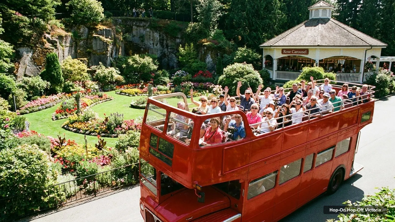
A good tourist map of Victoria answers one question: what is close to what. I built this page from Google Maps data, so every attraction below has coordinates, a rating, a review count and a map link. If you’re planning a sightseeing bus day, my guide to hop-on hop-off in Victoria lists what to check on the route before you buy.
I couldn’t verify an operator’s published stop list, so the places below are attractions, not confirmed bus stops. Distances are straight-line figures from the Inner Harbour, calculated from the coordinates in each row.
Victoria Tourist Attractions: Ten Places to Anchor Your Map
These are the ten places I’d pin first, in the order of my stop list. Use the links to open each place in Google Maps.
| # | Place | Address | Google Maps |
|---|---|---|---|
| 1 | The Butchart Gardens | 800 Benvenuto Ave, Brentwood Bay, BC V8M 1J8, Canada | Search |
| 2 | Victoria Butterfly Gardens | 1461 Benvenuto Ave, Brentwood Bay, BC V8M 1J5, Canada | Search |
| 3 | Hatley Castle | 2005 Sooke Rd, Victoria, BC V9C 1Y8, Canada | Search |
| 4 | Fisherman’s Wharf Park | 12 Erie St, Victoria, BC V8V 0B2, Canada | Search |
| 5 | Ogden Point | 211 Dallas Rd, Victoria, BC V8V 1A1, Canada | Search |
| 6 | Royal BC Museum | 675 Belleville St., Victoria, BC V8W 9W2, Canada | Search |
| 7 | Miniature World | 649 Humboldt St, Victoria, BC V8W 1A7, Canada | Search |
| 8 | Victoria’s Chinatown National Historic Site | 500 Fisgard St, Victoria, BC V8W 1R4, Canada | Search |
| 9 | Craigdarroch Castle | 1050 Joan Crescent, Victoria, BC V8S 3L5, Canada | Search |
| 10 | Beacon Hill Park | 100 Cook St, Victoria, BC V8V 4Z8, Canada | Search |
Victoria BC Tourist Map: Top 20 Attractions
This table ranks the 20 most-reviewed attractions in my Victoria data, leaving out tour operators and the smallest listings. The distance column is from the Inner Harbour, which is where I’d start most days.
| Attraction | Rating | Reviews | From Inner Harbour | Coordinates | Google Maps |
|---|---|---|---|---|---|
| The Butchart Gardens | 4.8 | 29,629 | 17.4 km | 48.5636, -123.4706 | Map |
| Royal BC Museum | 4.5 | 11,446 | 0.3 km | 48.4198, -123.3674 | Map |
| Beacon Hill Park | 4.7 | 9,610 | 1.2 km | 48.4122, -123.3628 | Map |
| Fisherman’s Wharf Park | 4.5 | 9,296 | 1.0 km | 48.4220, -123.3830 | Map |
| Craigdarroch Castle | 4.5 | 6,765 | 1.9 km | 48.4226, -123.3437 | Map |
| Victoria’s Chinatown National Historic Site | 4.3 | 6,329 | 0.8 km | 48.4294, -123.3673 | Map |
| Victoria Butterfly Gardens | 4.7 | 4,856 | 16.6 km | 48.5645, -123.4392 | Map |
| Hatley Castle | 4.6 | 4,357 | 7.8 km | 48.4345, -123.4727 | Map |
| Ogden Point | 4.6 | 3,847 | 1.4 km | 48.4152, -123.3841 | Map |
| Miniature World | 4.6 | 3,670 | 0.1 km | 48.4224, -123.3669 | Map |
| Legislative Assembly of British Columbia | 4.8 | 2,536 | 0.3 km | 48.4196, -123.3703 | Map |
| Clover Point Park | 4.6 | 2,520 | 2.2 km | 48.4063, -123.3525 | Map |
| Saxe Point Park | 4.8 | 2,151 | 3.7 km | 48.4215, -123.4189 | Map |
| Mile Zero Monument | 4.4 | 1,543 | 1.5 km | 48.4091, -123.3690 | Map |
| Haunted Manor: Mini-Golf + Ping Pong Lounge | 4.8 | 1,429 | 0.5 km | 48.4260, -123.3643 | Map |
| Victoria Harbour Ferry | 4.6 | 1,400 | 0.0 km | 48.4223, -123.3689 | Map |
| Fort Rodd Hill and Fisgard Lighthouse NHS | 4.7 | 1,357 | 5.9 km | 48.4304, -123.4476 | Map |
| Breakwater Lighthouse | 4.7 | 1,123 | 2.1 km | 48.4135, -123.3938 | Map |
| BC Aviation Museum | 4.8 | 846 | 24.6 km | 48.6405, -123.4211 | Map |
| Art Gallery of Greater Victoria | 4.6 | 683 | 1.6 km | 48.4221, -123.3477 | Map |
How to Read This Victoria Map
Every row gives latitude and longitude, so you can paste the coordinates into any map app. The Google Maps link opens the place directly. The ratings are Google ratings, not mine, and the review counts show how much weight to give them. A 4.8 from 29,629 reviews, like The Butchart Gardens, is a much stronger signal than a 5.0 from a handful.
The illustrated map below sketches ten of these sights. It is my own sketch, not an operator’s bus route, and three of its pins (Butchart Gardens, the Butterfly Gardens and Hatley Castle) are out of town.
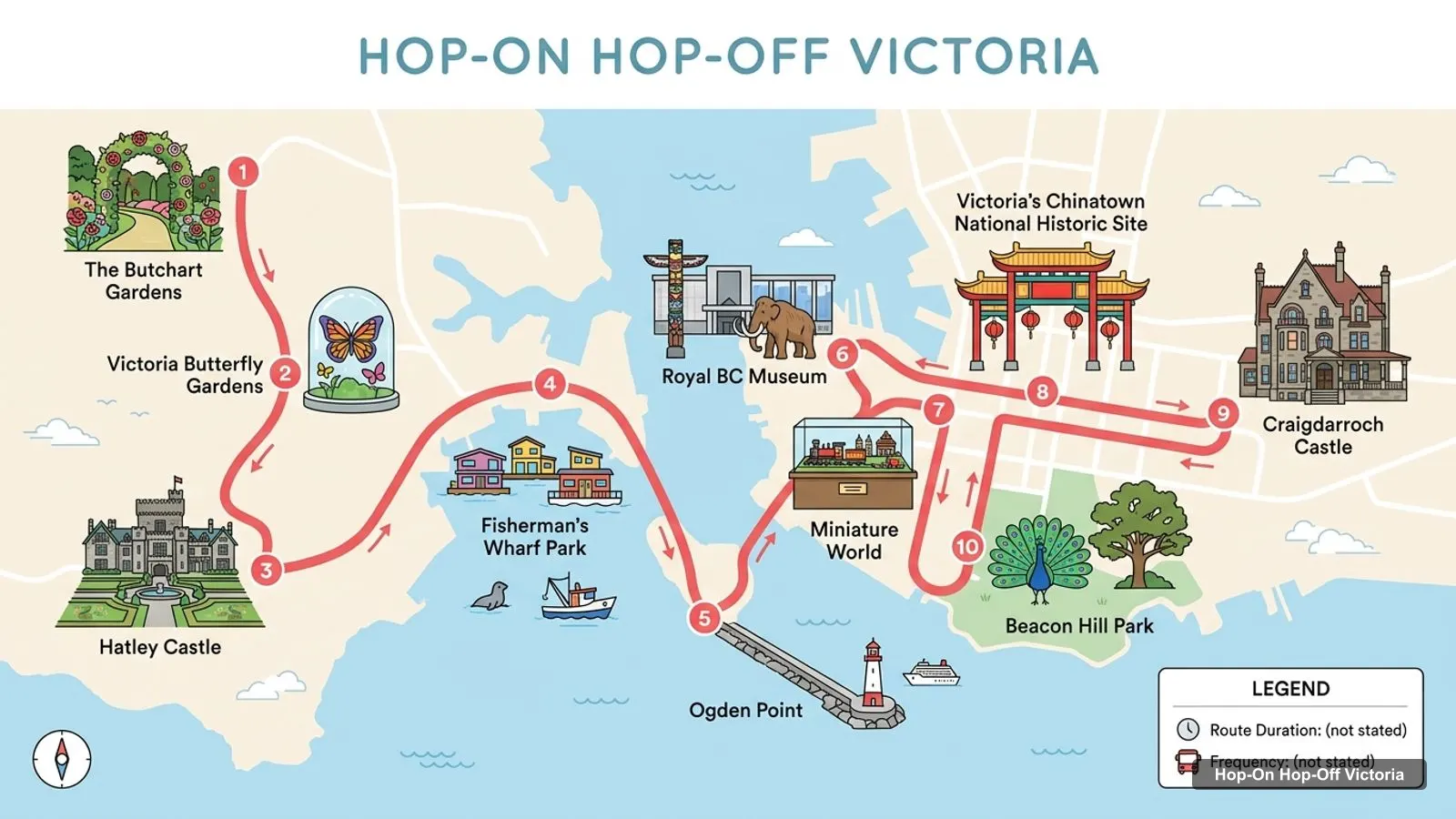
Stops on the route
- 1The Butchart Gardens
- 2Victoria Butterfly Gardens
- 3Hatley Castle
- 4Fisherman's Wharf Park
- 5Ogden Point
- 6Royal BC Museum
- 7Miniature World
- 8Victoria’s Chinatown National Historic Site
- 9Craigdarroch Castle
- 10Beacon Hill Park
The distance column helps you plan a day. Anything under about 1 km, such as Miniature World, the Royal BC Museum, the Legislative Assembly of British Columbia and Chinatown, is a short walk. Between 1 and 2.5 km, such as Beacon Hill Park, Ogden Point, Craigdarroch Castle and Clover Point Park, is a comfortable walk or a short ride. Over about 5 km, such as Fort Rodd Hill, Hatley Castle and The Butchart Gardens, I’d plan transport.
Victoria BC Attractions Map: Clusters
The table is easier to use when you split it into clusters.
Inner Harbour and downtown. Miniature World, the Royal BC Museum, the Legislative Assembly of British Columbia, Chinatown and the Haunted Manor mini-golf lounge are all within about 0.8 km of the harbour. This is the walking core, and the Victoria Harbour Ferry leaves from the Inner Harbour Lower Causeway.
South waterfront and parks. Beacon Hill Park (about 1.2 km), Mile Zero Monument (about 1.5 km), Ogden Point (about 1.4 km), Breakwater Lighthouse (about 2.1 km) and Clover Point Park (about 2.2 km) line the Dallas Road shoreline. A bike or a bus helps here.
East and uphill. Craigdarroch Castle (about 1.9 km) and the Art Gallery of Greater Victoria (about 1.6 km) sit on the hill above downtown. Expect a climb if you walk.
West and coast. Fisherman’s Wharf Park (about 1.0 km), Saxe Point Park (about 3.7 km), Fort Rodd Hill (about 5.9 km) and Hatley Castle (about 7.8 km) run along the water towards Colwood.
North, Saanich Peninsula. The Butchart Gardens (about 17.4 km), Victoria Butterfly Gardens (about 16.6 km) and the BC Aviation Museum (about 24.6 km) need a car, taxi or tour.
A Cruise Port Day on the Victoria Map
If you arrive at Ogden Point, you start about 1.4 km from the Inner Harbour in a straight line. The walk follows the waterfront, and the first cluster you reach is the downtown core. For a short port stop, I’d limit yourself to the harbour, the Royal BC Museum and Chinatown, then return along Beacon Hill Park if time allows. Breakwater Lighthouse, about 2.1 km from the harbour, is a good short walk if you only want fresh air before you re-board.
Rainy Day Pins on the Victoria Map
Pin the indoor places before you travel. The Royal BC Museum, Miniature World, the Art Gallery of Greater Victoria and the Maritime Museum of British Columbia (744 Douglas Street) are all close to the harbour. The Victoria Chinatown Museum on Fan Tan Alley rates 4.8 from 96 reviews. If you head to the Saanich Peninsula, Victoria Butterfly Gardens is a covered option beside The Butchart Gardens.
Photo Spots and Viewpoints on the Victoria Tourist Map
Some places on the map are mainly for the view. Clover Point Park (4.6 from 2,520 reviews) and Finlayson Point (4.8 from 439 reviews) both sit on the Dallas Road shoreline, and Saxe Point Park is rated 4.8 from 2,151 reviews. The Inner Harbour, with the Legislative Assembly of British Columbia behind it, is the classic skyline shot, and Johnson Street Bridge (4.5 from 665 reviews), about 0.7 km north of the harbour, makes a good frame for the working side of the water. Fisherman’s Wharf Park is the colourful one. I’d visit the park viewpoints in the morning or near sunset, when the light is softer, and check the tide and weather before you head out to a headland.
Walking Times Between the Core Sights
Walking time depends on your pace, but straight-line distances give a rough guide. At a steady walking pace, 1 km takes about 12 to 15 minutes, so the Royal BC Museum to Chinatown is a short walk of about 1 km, and Chinatown to Beacon Hill Park is a little longer. Adding hills and street detours, I’d budget 20 minutes from the Inner Harbour to Beacon Hill Park and 30 to 40 minutes to Craigdarroch Castle, which is uphill. If the weather is poor or your group includes small children, treat anything over 1.5 km as a ride rather than a walk.
For a sightseeing bus, the same logic applies. A loop is most useful for the outer clusters, and the downtown core is quicker on foot, which is why I treat any bus ticket as an add-on, not a necessity.
Victoria Tourism Map: Getting Between Clusters
Walking works inside a cluster. Between them, BC Transit runs the local buses and sells a DayPASS, according to BC Transit. Check its service alerts before a travel day. The Tourism Victoria site has events and seasonal information.
Victoria Sightseeing Map and Travel Map Tips
- Save the Google Maps links above to a list on your phone, so they work offline-first when signal is patchy.
- Start with the cluster nearest the harbour, then move outward.
- Allow extra time for Craigdarroch Castle because it is uphill.
- Book transport for The Butchart Gardens in advance.
- Check opening hours on each attraction’s own site, since seasonal hours change.
To turn this map into days, use my Victoria itinerary. To decide what to see first, my best things to do in Victoria ranks the sights by reviews, and the home page links to other cities. If a sightseeing bus is the way you want to cover the far clusters, read my Victoria bus tour guide before you buy a ticket.
Frequently asked questions
Where is the best place to start a Victoria sightseeing day?
I'd start at the Inner Harbour. The Royal BC Museum, the Parliament Buildings and Miniature World are all within about 0.3 km of it, and Chinatown is about 0.8 km away. From there you can walk to Beacon Hill Park, or catch a bus or taxi to Craigdarroch Castle and the outer attractions.
Is Victoria, BC walkable for tourists?
Downtown is very walkable. Most central sights sit within about 1.2 km of the Inner Harbour. The exceptions are Craigdarroch Castle at about 1.9 km, Hatley Castle at about 7.8 km and The Butchart Gardens at about 17.4 km, which are best reached by transit, taxi or tour.