Turin Tourist Map: Top Attractions & Bus Stops
By Jake Dawson · Updated · Affiliate links, explained in my disclosure
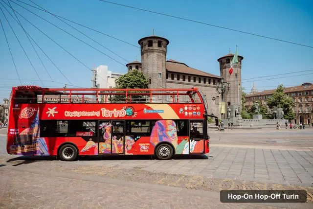
Sightseeing Experience
Turin: Hop-on Hop-off Bus Tour with 24 or 48-Hour Ticket
4.2 (1,102) · from $21.39
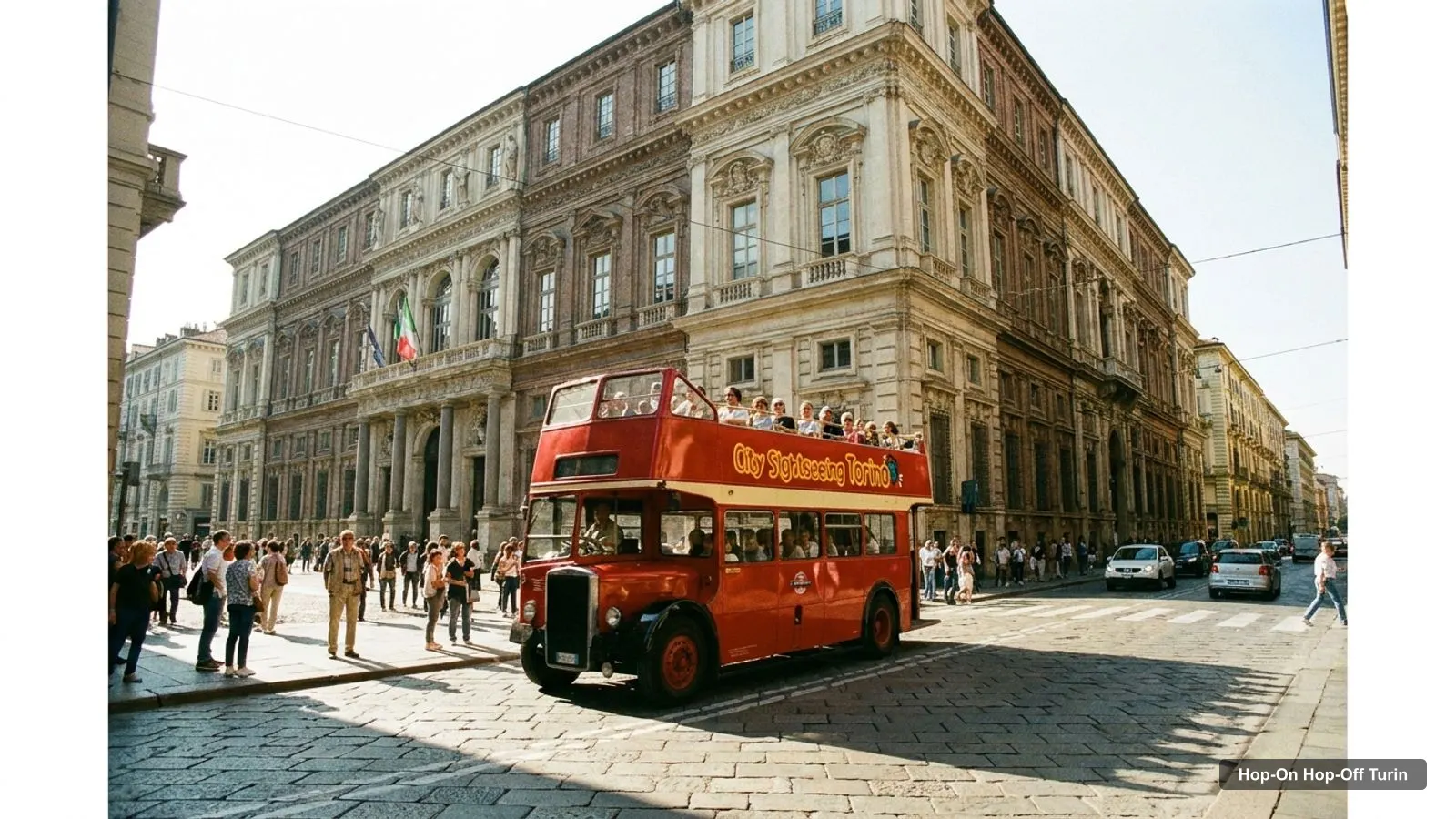
A Turin tourist map is mostly a map of one compact centre and a ring of bigger sights beyond it. I built this page from the Google Maps data behind my hop-on hop-off Turin guide: the stops of the three City Sightseeing lines, plus the 20 most-reviewed attractions with their coordinates. Distances are straight lines from Piazza Castello, measured from the coordinates, not walking routes. Ratings and review counts are from Google Maps, checked October 2026.
Use the map as a planner. The stop order comes from the standard GetYourGuide listing and the lines change by season, so treat the list as what you can reach and not as a timetable.
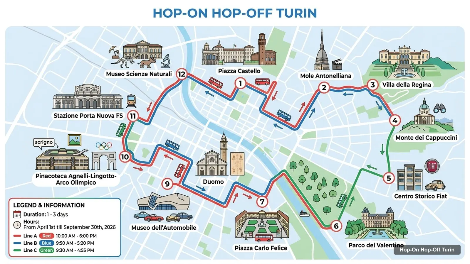
Stops on the route
- 1Piazza Castello
- 2Mole Antonelliana
- 3Villa della Regina
- 4Monte dei Cappuccini
- 5Centro Storico Fiat
- 6Parco del Valentino
- 7Piazza Carlo Felice
- 8Duomo
- 9Museo dell'Automobile
- 10Pinacoteca Agnelli-Lingotto-Arco Olimpico
- 11Stazione Porta Nuova FS
- 12Museo Scienze Naturali
Turin Sightseeing Map: The Bus Stops
The Turin sightseeing map has three colours, and Piazza Castello is stop 1 on all of them. The Red Line has eight stops, the Blue Line seven and the Green Line eight, which makes 23 listed stops but 19 different places, because Piazza Castello is on all three lines and the Mole and the Valentino are on two. The table gives each stop in the listing’s order with a Google Maps search link. City Sightseeing says all three lines run from April to October, and only the Red Line from November to March.
| Line | # | Stop | Google Maps |
|---|---|---|---|
| Red | 1 | Piazza Castello | Open in Google Maps |
| Red | 2 | Mole Antonelliana | Open in Google Maps |
| Red | 3 | Villa della Regina | Open in Google Maps |
| Red | 4 | Monte dei Cappuccini | Open in Google Maps |
| Red | 5 | Centro Storico Fiat | Open in Google Maps |
| Red | 6 | Parco del Valentino | Open in Google Maps |
| Red | 7 | Piazza Carlo Felice | Open in Google Maps |
| Red | 8 | Duomo | Open in Google Maps |
| Blue | 1 | Piazza Castello | Open in Google Maps |
| Blue | 2 | Mole Antonelliana | Open in Google Maps |
| Blue | 3 | Parco del Valentino | Open in Google Maps |
| Blue | 4 | Museo dell’Automobile | Open in Google Maps |
| Blue | 5 | Pinacoteca Agnelli-Lingotto-Arco Olimpico | Open in Google Maps |
| Blue | 6 | Stazione Porta Nuova FS | Open in Google Maps |
| Blue | 7 | Museo Scienze Naturali | Open in Google Maps |
| Green | 1 | Piazza Castello | Open in Google Maps |
| Green | 2 | Nuvola Lavazza | Open in Google Maps |
| Green | 3 | Porta Palazzo | Open in Google Maps |
| Green | 4 | Basilica di Santa Maria Ausiliatrice | Open in Google Maps |
| Green | 5 | Allianz Stadium & Juventus Museum | Open in Google Maps |
| Green | 6 | La Venaria Reale | Open in Google Maps |
| Green | 7 | Parco Dora | Open in Google Maps |
| Green | 8 | Stazione Porta Susa | Open in Google Maps |
Blue and Red share the Mole Antonelliana and the Parco del Valentino. The listing’s own list calls the south stop Museo dell’Automobile, and a second listing says the museum is directly in front of stop 4 of the Blue Line. I could not confirm the exact street position of each stop, so use the Google Maps links as a guide to the area and follow the signs at the stop.
Turin Tourist Attractions Map: Top 20 by Google Reviews
These are the 20 most-reviewed Turin attractions in my Google Maps data, after I removed tour operators, bus companies and offices. The distance column shows how far each is from Piazza Castello in a straight line, so you can see at a glance which ones belong on a walk and which need a bus.
| # | Attraction | Rating | Reviews | Km from Piazza Castello | Coordinates | Map |
|---|---|---|---|---|---|---|
| 1 | Museo Egizio | 4.7 | 68,860 | 0.3 | 45.0684, 7.6844 | Map |
| 2 | Mole Antonelliana | 4.6 | 58,607 | 0.7 | 45.0692, 7.6932 | Map |
| 3 | Parco del Valentino | 4.6 | 49,644 | 2.2 | 45.0514, 7.6851 | Map |
| 4 | Piazza San Carlo | 4.7 | 30,719 | 0.5 | 45.0677, 7.6825 | Map |
| 5 | Museo Nazionale dell’Automobile | 4.7 | 23,914 | 4.5 | 45.0316, 7.6740 | Map |
| 6 | Basilica of Superga | 4.7 | 20,388 | 6.6 | 45.0809, 7.7677 | Map |
| 7 | Royal Palace of Turin | 4.8 | 12,043 | 0.2 | 45.0728, 7.6863 | Map |
| 8 | Palazzo Madama | 4.6 | 11,904 | 0.1 | 45.0711, 7.6855 | Map |
| 9 | National Cinema Museum (Museo Nazionale del Cinema) | 4.6 | 10,944 | 0.7 | 45.0691, 7.6931 | Map |
| 10 | Piazza Castello | 4.8 | 8,535 | 0.0 | 45.0715, 7.6851 | Map |
| 11 | Piazza Solferino | 4.5 | 7,692 | 0.7 | 45.0689, 7.6771 | Map |
| 12 | Cattedrale di San Giovanni Battista | 4.6 | 7,637 | 0.2 | 45.0734, 7.6852 | Map |
| 13 | Giardini Reali di Torino | 4.5 | 7,560 | 0.4 | 45.0723, 7.6895 | Map |
| 14 | Villa della Regina | 4.4 | 6,452 | 2.4 | 45.0581, 7.7083 | Map |
| 15 | GAM Turin (modern art gallery) | 4.4 | 6,336 | 1.4 | 45.0649, 7.6692 | Map |
| 16 | Juventus Museum | 4.6 | 6,069 | 5.4 | 45.1099, 7.6429 | Map |
| 17 | Museum of Oriental Art | 4.6 | 5,475 | 0.5 | 45.0747, 7.6802 | Map |
| 18 | Museo Lavazza | 4.6 | 5,364 | 1.1 | 45.0805, 7.6918 | Map |
| 19 | Fountain of the 12 Months | 4.6 | 5,250 | 2.7 | 45.0468, 7.6831 | Map |
| 20 | Galleria Sabauda | 4.7 | 4,461 | 0.2 | 45.0729, 7.6862 | Map |
Turin Tourist Attractions: The Clusters
Turin tourist attractions fall into four clusters on this map. The first is the Piazza Castello cluster, with Palazzo Madama (0.05 km), the Royal Palace (0.18 km), the cathedral (0.21 km), the Royal Gardens (0.35 km) and the Egyptian Museum (0.34 km). This is the walking core, and none of it needs a bus.
The second is the Mole cluster, 0.69 km to the east: the Mole Antonelliana and the Cinema Museum share an address on Via Montebello, and the Accorsi-Ometto Museum is nearby. The third is the riverside and hill cluster on the Red Line, with the Parco del Valentino (2.23 km), Villa della Regina (2.35 km) and the Fountain of the 12 Months (2.75 km). The fourth is the outer ring on the Blue and Green lines: the Lavazza Museum (1.14 km), the Automobile Museum (4.52 km), the Juventus Museum (5.41 km) and the Basilica of Superga (6.57 km), which is not on any bus stop list in my data.
Is Turin a Good Place to Visit? A Walkability Check
Is Turin a good place to visit on foot? The centre is. A walk from Piazza Castello to Piazza San Carlo is 0.47 km, and to Piazza Solferino 0.69 km. Past the first kilometre the gaps widen, and that is where the bus lines come in. I did not pull current metro or tram fares and map lines, so check the GTT site for those before you plan around them.
The official tourism board describes City Sightseeing’s lines on its Turismo Torino page, and I’d read it before you buy a pass. Travellers’ reviews add one caution I repeat on every bus page: buses can be an hour apart, so leave time for a wait.
Turin Top 10 Attractions: Where the Bus Helps
For the Turin top 10 attractions, the bus matters for five. The Mole Antonelliana and the Cinema Museum share a Red and Blue Line stop, the Parco del Valentino is on both lines, the Automobile Museum is on the Blue Line, and Piazza San Carlo is an Eco City Tour photo stop. The other five, the Egyptian Museum, the Royal Palace, Palazzo Madama, Piazza Castello and the Basilica of Superga, are either walkable from the square or, in Superga’s case, off the bus lines.
If you only have one day, see the planned order in my Turin itinerary. To compare the tickets, go back to the Turin hop-on hop-off bus tickets, and for a ranked list with notes on each sight see my best things to do in Turin. The homepage has my other cities.
Turin on the Map of Italy: Where It Sits
Turin sits in the north-west of Italy at about 239 metres above sea level, according to the Open-Meteo elevation API. On a map of Italy it is the gateway to Piedmont, and the nearest cities I cover are Genoa at 123 km, Milan at 125 km, Monaco at 149 km, Lyon at 236 km and Verona at 262 km, measured in a straight line between city centres. That makes Turin an easy add-on to a Milan or Genoa trip, and a hop-on hop-off pass is a good way to spend a day if you arrive by train.
The city is built on a grid, with the river Po along the east side and the hills behind it. That is why the Red Line climbs to Villa della Regina and Monte dei Cappuccini: they sit on the hill across the water from the centre. The Valentino Park runs along the river to the south. If you keep the Po on your left as you walk south from the Mole, you will pass the park and reach the Fountain of the 12 Months, which Google Maps lists at Viale Boiardo.
Which Cluster to Pick on a Short Stay
If you have half a day, stay in the Piazza Castello cluster and add the Mole. With one full day, add the riverside cluster by Red Line. With two days, choose between the Automobile Museum on the Blue Line and the Green Line out to the Lavazza and Juventus museums. I’d give the Blue Line the nod for most visitors, because two reviewers found the Green Line less interesting from the bus.
Opening days shape the choice too. On a Tuesday the Mole, Palazzo Madama and the Cinema Museum are closed, and on Mondays the Villa della Regina, the Oriental Art Museum and the Lavazza Museum are. Check the closing days in my best things to do page before you fix the day.
How I Chose the Top 20
I started from the Google Maps places I collected for Turin, removed City Sightseeing’s own office and a free walking tour operator, and sorted the rest by review count. I computed distances with the haversine formula from each pair of coordinates, so they are straight-line figures. Where I name hours, they come from the Google Maps listing in October 2026, and they can change with holidays and exhibitions.
Frequently asked questions
Where are the Turin tourist attractions on a map?
Most sit within 0.7 km of Piazza Castello, which is stop 1 on all three bus lines: the Royal Palace (0.18 km), the Egyptian Museum (0.34 km) and the Mole Antonelliana (0.69 km). The Parco del Valentino is 2.23 km away, the Automobile Museum 4.52 km and the Basilica of Superga 6.57 km.
Is there a hop-on hop-off map for Turin?
City Sightseeing runs three lines, Red, Blue and Green, and the table on this page lists their stops with Google Maps links. I couldn't find a current official PDF map in the text I could read, so check the line map you get with your ticket at Piazza Castello for the latest stop order.
What are the top 10 attractions in Turin?
By Google reviews: the Egyptian Museum, the Mole Antonelliana, the Parco del Valentino, Piazza San Carlo, the National Automobile Museum, the Basilica of Superga, the Royal Palace, Palazzo Madama, the Cinema Museum and Piazza Castello. Seven of them are within 0.7 km of Piazza Castello.
Is Turin a good place to visit?
Yes, if you want museums, squares and royal palaces in a compact centre. The Royal Palace is rated 4.8, the Egyptian Museum 4.7 from 68,860 reviews, and the main sights are walkable. The Automobile and Juventus museums are farther out, which is where the bus lines are useful.
Which Turin attractions are on the bus route?
The Red Line stops at the Mole Antonelliana, Villa della Regina, the Parco del Valentino and the Duomo. The Blue Line adds the Automobile Museum and the Lingotto. The Green Line reaches Nuvola Lavazza, the Allianz Stadium and Juventus Museum, and the Reggia di Venaria.
Tours I compared in Turin
My full review of each one, in the order I rank them:
- Turin: Hop-on Hop-off Bus Tour with 24 or 48-Hour Ticket★ 4.2 · from $21.39
- Turin: Cinema Museum and Bus Tour★ 4.3 · from $42.79
- Turin: City Electric Bus Tour with Interactive Audio Guide★ 4.0 · from $16.89
- Turin: 24/48-Hour Hop-On Bus & National Automobile Museum★ 4.5 · from $50.67
- Turin: Hop-on Hop-off Bus Tour & Lavazza Museum Entry Ticket★ 4.1 · from $41.66