
Big Bus Tours - Madrid
Toledo: Big Bus Hop-on, Hop-off Sightseeing Tour
- 3.8 (54 reviews)
- 2-day ticket
My pick: The only bus on this map: a 60-minute loop or 24 and 48 hour passes from $22.52, with the Jewish Quarter walk included.
By Jake Dawson · Updated · Affiliate links, explained in my disclosure
Big Bus Tours - Madrid
Toledo: Big Bus Hop-on, Hop-off Sightseeing Tour
3.8 (54) · from $22.52
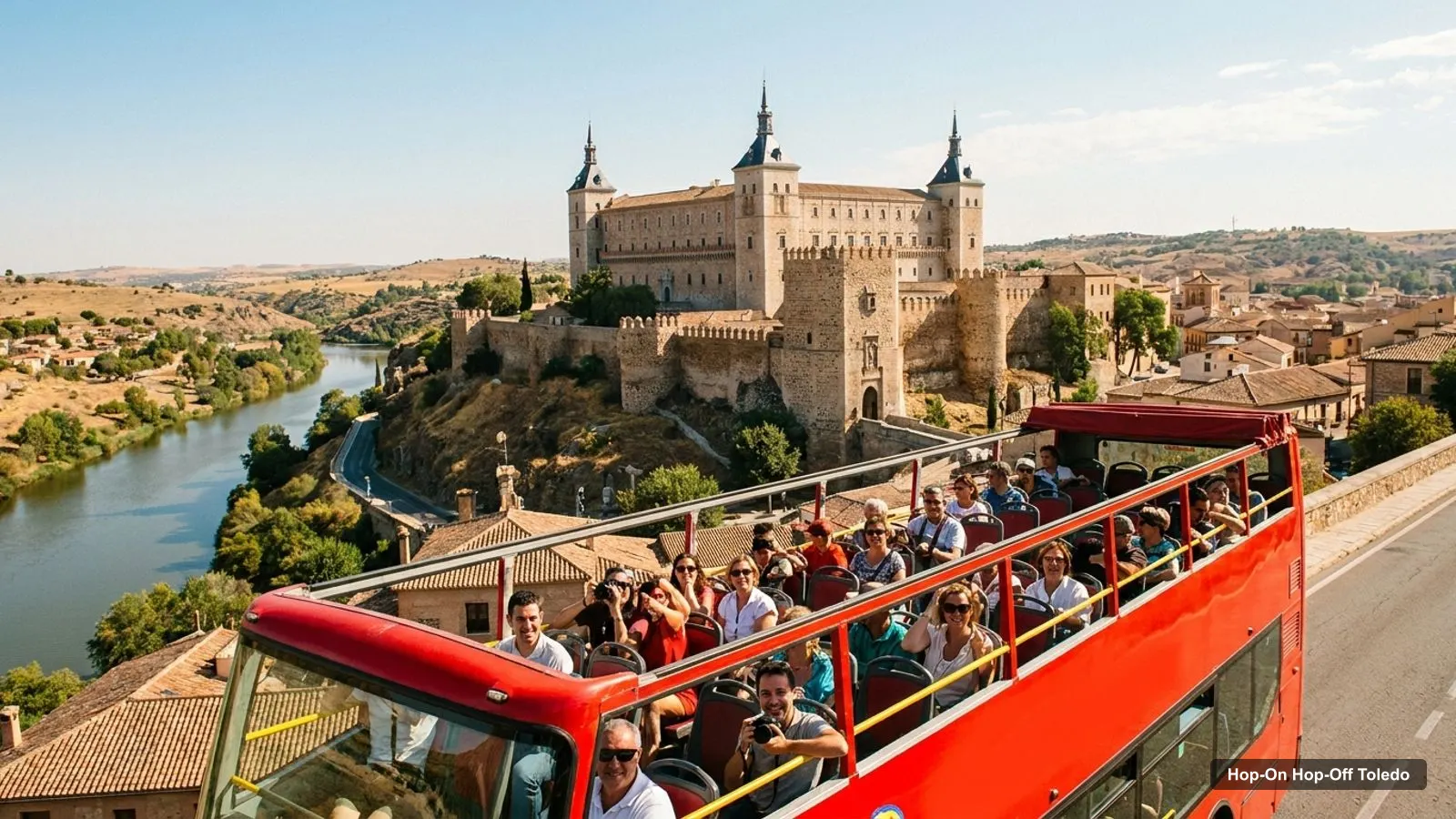
A good Toledo tourist map should answer two questions: where are the sights, and which of them can you reach by bus? This page does both. It has the bus stops named in the GetYourGuide listing, the top twenty attractions from Google Maps with coordinates, and clusters that show what you can combine on foot. The bus itself is explained in my guide to hop on hop off Toledo.
This map covers Toledo in Castilla-La Mancha, Spain. The data is from Google Maps and the listing, checked October 2026, and distances are straight lines from the Alcázar, the bus’s Stop 1.
The image shows the old city and the numbered places along the bus route. It is my own sketch built from place names, not a survey, so use it for orientation and Google Maps for navigation.
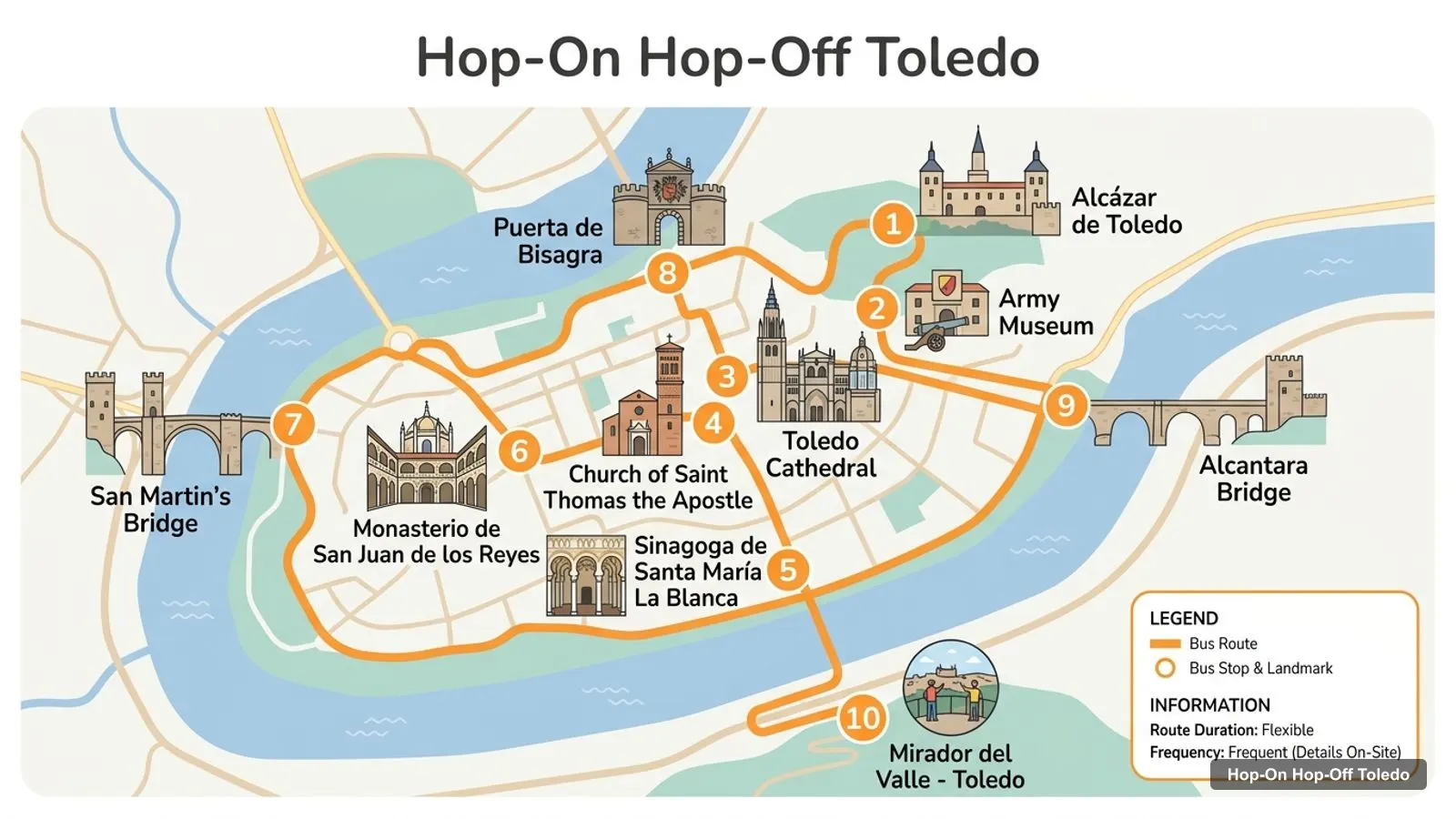
Stops on the route
The picture lists ten places, but the operator’s own list is the one printed on the bus. The listing names four bus stops, which are below with their walking minutes.
The GetYourGuide listing names the Alcázar as Stop 1 and three more places: Toledo Cathedral, the Church of Santo Tomé and the Mirador del Valle. The Jewish Quarter is covered by a walking tour, not a bus stop. I could not load the operator’s website, so I will not give a numbered list beyond Stop 1.
| Stop | Walk from the Alcázar (OpenStreetMap routing) | Map |
|---|---|---|
| Alcázar de Toledo (Stop 1) | start | Open in Google Maps |
| Toledo Cathedral | 5 min, 363 m | Open in Google Maps |
| Church of Santo Tomé | 12 min, 880 m | Open in Google Maps |
| Mirador del Valle | 21 min, 1,546 m | Open in Google Maps |
| Plaza de Zocodover (walking tour meeting point) | 2 min, 124 m | Open in Google Maps |
One reviewer wrote that there is one stop at the Alcázar and the rest are on the periphery of the old city. That matches the map: the viewpoint is across the river, and the bus is how you reach it without the 21-minute walk.
These are the ten places drawn on my route sketch, with their Google ratings and distance from the Alcázar. They are the places I plotted, not a claim that the bus stops at each.
| # | Place on my route sketch | Google Maps rating | From the Alcázar | Map |
|---|---|---|---|---|
| 1 | Alcázar de Toledo | 4.6 from 40,000 reviews | 0.00 km | Open in Google Maps |
| 2 | Army Museum | 4.5 from 6,542 reviews | 0.11 km | Open in Google Maps |
| 3 | Toledo Cathedral | 4.7 from 39,557 reviews | 0.27 km | Open in Google Maps |
| 4 | Church of Saint Thomas the Apostle | 4.4 from 6,793 reviews | 0.68 km | Open in Google Maps |
| 5 | Sinagoga de Santa María La Blanca | 4 from 7,274 reviews | 0.87 km | Open in Google Maps |
| 6 | Monasterio de San Juan de los Reyes | 4.7 from 9,622 reviews | 0.96 km | Open in Google Maps |
| 7 | San Martin’s Bridge | 4.7 from 12,787 reviews | 1.17 km | Open in Google Maps |
| 8 | Puerta de Bisagra | 4.7 from 12,023 reviews | 0.66 km | Open in Google Maps |
| 9 | Alcantara Bridge | 4.7 from 10,639 reviews | 0.40 km | Open in Google Maps |
| 10 | Mirador del Valle - Toledo | 4.8 from 14,567 reviews | 0.83 km | Open in Google Maps |
Nine of the ten are within about one kilometre of the Alcázar in a straight line, and only the San Martín bridge is farther, at 1.17 km. That is why I treat Toledo as a walking city with a bus for the long legs.
How should you read a Toledo tourist map like this one? Start with the ratings. The viewpoint scores highest at 4.8, while Santa María la Blanca scores lowest at 4.0 from 7,274 reviews. Next look at the distances, because a place that is close on the map can still be a steep walk. Then check the opening days, since several museums close on Mondays. This Toledo tourist map is built to make those three checks quick.
This table ranks the top twenty attractions by Google review count. I left out the tour office, a ticketed train ride, a restaurant outside the city and a few smaller commercial museums. The table was generated from my data, not typed by hand.
| # | Attraction | Coordinates | Google rating | From the Alcázar | Map |
|---|---|---|---|---|---|
| 1 | Alcázar de Toledo | 39.85775, -4.02050 | 4.6 (40,000) | 0.00 km | Open in Google Maps |
| 2 | Toledo Cathedral | 39.85710, -4.02357 | 4.7 (39,557) | 0.27 km | Open in Google Maps |
| 3 | Mirador del Valle - Toledo | 39.85036, -4.02188 | 4.8 (14,567) | 0.83 km | Open in Google Maps |
| 4 | San Martin’s Bridge | 39.85670, -4.03417 | 4.7 (12,787) | 1.17 km | Open in Google Maps |
| 5 | Puerta de Bisagra | 39.86246, -4.02519 | 4.7 (12,023) | 0.66 km | Open in Google Maps |
| 6 | Alcantara Bridge | 39.86043, -4.01741 | 4.7 (10,639) | 0.40 km | Open in Google Maps |
| 7 | Monasterio de San Juan de los Reyes | 39.85787, -4.03174 | 4.7 (9,622) | 0.96 km | Open in Google Maps |
| 8 | Sinagoga de Santa María La Blanca | 39.85697, -4.03068 | 4 (7,274) | 0.87 km | Open in Google Maps |
| 9 | Church of Saint Thomas the Apostle | 39.85670, -4.02832 | 4.4 (6,793) | 0.68 km | Open in Google Maps |
| 10 | Army Museum | 39.85877, -4.02057 | 4.5 (6,542) | 0.11 km | Open in Google Maps |
| 11 | Museo de El Greco | 39.85565, -4.02870 | 4.4 (6,401) | 0.74 km | Open in Google Maps |
| 12 | Mezquita del Cristo de la Luz | 39.86060, -4.02419 | 4.2 (5,755) | 0.45 km | Open in Google Maps |
| 13 | Sinagoga del Tránsito | 39.85561, -4.02963 | 4.5 (5,018) | 0.82 km | Open in Google Maps |
| 14 | Real Colegio Doncellas Nobles | 39.85902, -4.02936 | 4.2 (1,921) | 0.77 km | Open in Google Maps |
| 15 | Museum of Santa Cruz | 39.85972, -4.02041 | 4.5 (1,884) | 0.22 km | Open in Google Maps |
| 16 | Puerta del Cambrón | 39.85930, -4.03229 | 4.7 (1,577) | 1.02 km | Open in Google Maps |
| 17 | Termas Romanas | 39.85848, -4.02524 | 4.1 (1,437) | 0.41 km | Open in Google Maps |
| 18 | MUSEO CROMÁTICA | 39.85999, -4.01979 | 4.9 (1,280) | 0.26 km | Open in Google Maps |
| 19 | Castillo de San Servando | 39.86040, -4.01557 | 4.2 (1,138) | 0.51 km | Open in Google Maps |
| 20 | Puerta del Sol | 39.86106, -4.02397 | 4.7 (1,009) | 0.47 km | Open in Google Maps |
The top of the table is no surprise. The Alcázar, the cathedral and the viewpoint come first, and the two historic bridges and the Bisagra gate are the best free sights.
A note on the data. Coordinates come from Google Maps and are given to five decimals, which is more precision than you need on a hillside, so use them to paste a place into any map app. Review counts are Google’s, not the operator’s, and the Alcázar’s figure is shown as 40,000, which looks like a cap, so I describe it as about 40,000. Ratings change slowly, but opening hours do not, so check the official page before a long trip.
Toledo falls into four clusters. The first is the Alcázar and Zocodover, with the Army Museum, the Museum of Santa Cruz and the arch of Arco de la Sangre all within about 0.25 km. The second is the cathedral area, with the Museo de La España Mágica and the Templars museum a short way off. The third is the western monuments: Santo Tomé, Santa María la Blanca, San Juan de los Reyes and the San Martín bridge. The fourth is the river and the viewpoint: the Alcántara Bridge, San Servando castle and the Mirador del Valle.
This grouping is how I would plot a day. Pick a cluster, spend two hours there, and use the bus only to move between clusters.
On this Toledo tourist map, the cathedral and the Alcázar are the two anchors. Everything else is a short walk from one of them, apart from the viewpoint and the western bridge. If you are short of time, those two anchors plus the viewpoint make a complete visit, and the rest is detail you can add as your legs allow.
Use the Alcázar stop for the Army Museum and Zocodover, the cathedral stop for the cathedral and the narrow streets around it, Santo Tomé for the Jewish Quarter and the western monuments, and the viewpoint stop for the river view. The bus runs every 60 minutes, so decide before you hop off where you will board again.
If you arrive by train, the City Sightseeing Toledo office appears on Google Maps at the Renfe station, about 1.4 km from the Alcázar by OpenStreetMap routing, around 19 minutes on foot. So the first decision of the day is whether to walk from the station or start the bus loop there. I have not verified that the bus boards at the station, so check the voucher.
Toledo is hilly, and a straight line understates the effort. The viewpoint is 0.83 km from the Alcázar in a straight line but 1,546 m by foot, and the routing says 21 minutes. In July and August the 2025 highs were 35.3 and 36.3 degrees Celsius, so walk early or late.
Opening days matter on a map too. The Alcázar, the Army Museum, the El Greco museum and the Sinagoga del Tránsito show as closed on Mondays, while the bridges, gates and the viewpoint are open 24 hours.
There is only one bus, and its 24-hour pass is the one I would use for this map. It does not include entry to the monuments, but the listing offers a Tourist Wristband upgrade for seven of them. The lowest fare in my data is 22.52 US dollars.
Big Bus Tours - Madrid
My pick: The only bus on this map: a 60-minute loop or 24 and 48 hour passes from $22.52, with the Jewish Quarter walk included.
For a plan by day, use my Toledo itinerary, and for the sights ranked by reviews, see the best things to do in Toledo. To compare the ticket again, go back to the hop-on hop-off bus guide for Toledo, and for the rest of my city guides, start at the home page.
By Google Maps reviews, the Alcázar (about 40,000 reviews, 4.6), Toledo Cathedral (39,557, 4.7) and the Mirador del Valle viewpoint (14,567, 4.8) lead. San Martín bridge, Puerta de Bisagra and Alcántara bridge follow. The table below ranks twenty with coordinates and Google Maps links so you can plot your own route.
The listing names the Alcázar as Stop 1, then Toledo Cathedral, the Church of Santo Tomé and the Mirador del Valle, with a Jewish Quarter walking tour that meets at Plaza de Zocodover. I could not load the operator's full numbered list, so I do not give one. Check your voucher for the exact stops.
No. Everything here is in Toledo, Castilla-La Mancha, Spain. The old centre is around 39.86 north, 4.03 west. Searches for a Toledo attractions map also return Toledo, Ohio, so check the address and coordinates before you plan.
Small enough to cross on foot, but hilly. From the Alcázar the cathedral is about 0.27 km away in a straight line, Puerta de Bisagra 0.66 km, San Juan de los Reyes 0.96 km and the San Martín bridge 1.17 km. The Mirador del Valle is 0.83 km in a straight line but 1,546 m on foot.
I do not host a PDF. The tables here give coordinates and Google Maps links for each place, and the hop-on hop-off operator publishes its own route map with the ticket. Use my tables for planning and the operator map for exact bus roads.
My full review of each one, in the order I rank them: