Tallinn Tourist Map: Top Attractions & Bus Stops
By Jake Dawson · Updated · Affiliate links, explained in my disclosure

City Sightseeing Europe
Tallinn: City Sightseeing Hop-On Hop-Off Bus Tour
4.0 (562) · from $36.03
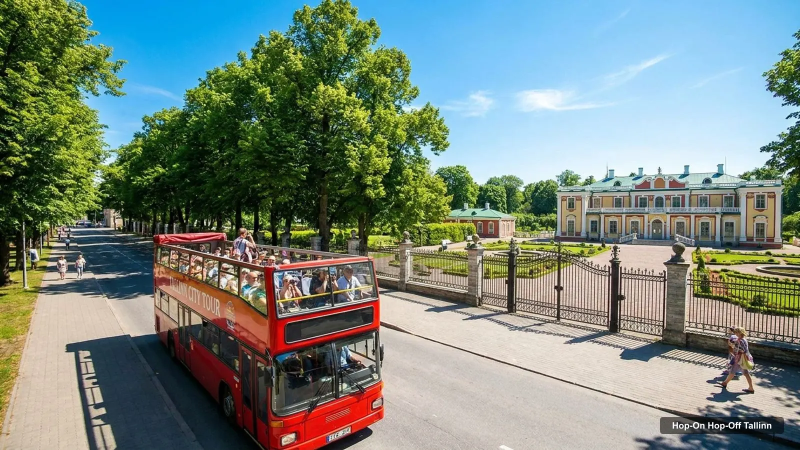
A Tallinn tourist map is easier to use when it shows where the sights cluster and where the bus stops. This page gives you both: the stops of the two City Sightseeing lines, the 20 best-reviewed attractions with coordinates and Google Maps links, and walking times from Stop 1. For the ticket, the price and the season, see my hop-on hop-off Tallinn guide.
Distances in the top-20 table are straight lines from Stop 1 at Mere pst 5, taken at 59.43852, 24.75337 from Google Maps. Ratings and review counts are from Google Maps, fetched in October 2026. Walking times come from OpenStreetMap foot routing, fetched 8 October 2026. I generated the tables from the data files and did not type the numbers by hand.
Tallinn On Map: The Sights Map
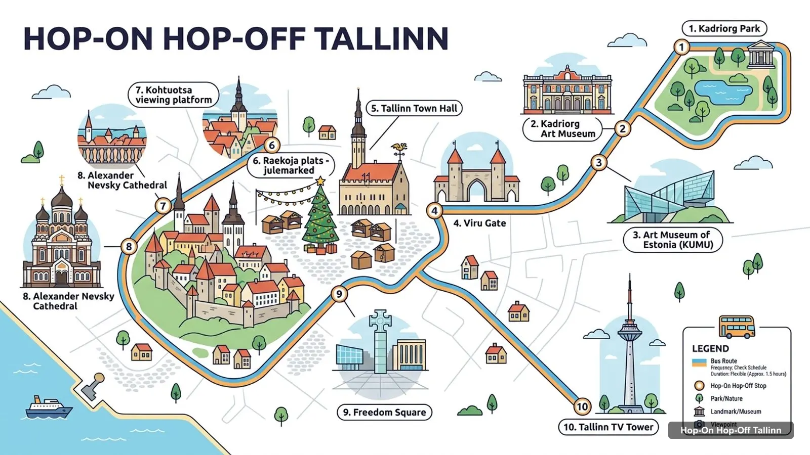
Tallinn on a map is a small Old Town on a hill and a flat plain, with the sea to the north and the rest of the sights strung east along the coast. The infographic below numbers ten of the best-reviewed sights, from Kadriorg Park in the east to Freedom Square at the edge of the Old Town. It is a sightseeing map, not an official route.
Stops on the route
- 1Mere Pst. 5 / City Centre
- 2Kadriorg Park/ Swan Lake
- 3Song Festival Grounds
- 4City Harbour D-Terminal
- 5Swissotel/ Radisson Blu
- 6Old Town/ Toompea Castle
- 7Towers Square/ Railway Station
- 8City Harbour A-Terminal
- 9City Harbour Cruise Ship Terminal
- 10Seaplane Harbour Museum/ Patarei Prison (only served on departures after 1pm)
- 11Fat Margaret Tower (only served on departures after 1pm)
- 12Mere Pst. 5 (in front of Russian Cultural Centre)
The bus stops on the map
The red line has 11 stops and the green line 17, copied from the GetYourGuide listing. Stops 10 and 11 on the red line are served only on departures after 1pm. Stop names are the operator’s, and I linked each one to a Google Maps search, so check the pin against the signs on the street. The Toompea stop, number 6 on the red line, was moved to Wismari street from 14 September according to the operator.
| # | Red line stop | Map |
|---|---|---|
| 1 | Mere Pst. 5 / City Centre | Find on Google Maps |
| 2 | Kadriorg Park/ Swan Lake | Find on Google Maps |
| 3 | Song Festival Grounds | Find on Google Maps |
| 4 | City Harbour D-Terminal | Find on Google Maps |
| 5 | Swissotel/ Radisson Blu | Find on Google Maps |
| 6 | Old Town/ Toompea Castle | Find on Google Maps |
| 7 | Towers Square/ Railway Station | Find on Google Maps |
| 8 | City Harbour A-Terminal | Find on Google Maps |
| 9 | City Harbour Cruise Ship Terminal | Find on Google Maps |
| 10 | Seaplane Harbour Museum/ Patarei Prison (only served on departures after 1pm) | Find on Google Maps |
| 11 | Fat Margaret Tower (only served on departures after 1pm) | Find on Google Maps |
The green line shares Stop 1 and several harbour and park stops with the red line, and adds the suburbs. The listing gives the order below.
| # | Green line stop | Map |
|---|---|---|
| 1 | Mere Pst. 5 (in front of Russian Cultural Centre) | Find on Google Maps |
| 2 | Seaplane Harbour/ Patarei Prison | Find on Google Maps |
| 3 | Fat Margaret Tower | Find on Google Maps |
| 4 | Rotermann Quarter | Find on Google Maps |
| 5 | Swissotel/ Radisson Blu | Find on Google Maps |
| 6 | Kadriorg Park/ Swan Lake | Find on Google Maps |
| 7 | Song Festival Grounds/ Beachwalk | Find on Google Maps |
| 8 | Maarjamae Castle | Find on Google Maps |
| 9 | Pirita Convent | Find on Google Maps |
| 10 | Botanic Garden | Find on Google Maps |
| 11 | TV Tower | Find on Google Maps |
| 12 | Pirita (to town) | Find on Google Maps |
| 13 | Russalka Monument/ Beachwalk | Find on Google Maps |
| 14 | City Harbour D-Terminal | Find on Google Maps |
| 15 | St. Simeon’s and St. Anne’s Church | Find on Google Maps |
| 16 | City Harbour A-Terminal | Find on Google Maps |
| 17 | City Harbour Cruise Ship Terminal | Find on Google Maps |
Must See in Tallinn
The must see in Tallinn list, by reviews, starts with Kadriorg Park, Freedom Square, Viru Gate, the Town Hall and Alexander Nevsky Cathedral. Those five have between 9,577 and 18,073 reviews each and ratings between 4.6 and 4.8. If you only see five things, I’d take those.
After them come the TV Tower at 4.6 from 9,161 reviews, the Kadriorg Art Museum at 4.6 from 8,603 and the Kohtuotsa viewing platform at 4.8 from 7,181. The viewpoints rate highest of the free sights, and they cost no ticket.
Tallinn Tourist Attractions
The Tallinn tourist attractions below are the 20 most-reviewed places in my Google Maps data. I left out the bus operator’s own office, which appeared in the search, because it is not a sight. The coordinates are the ones Google returns for each place, and each map link opens the exact place.
| # | Sight | Rating | Reviews | Lat, Lng | From Stop 1 (straight line) | Map |
|---|---|---|---|---|---|---|
| 1 | Kadriorg Park | 4.8 | 18,073 | 59.43890, 24.79304 | 2.2 km | Open in Google Maps |
| 2 | Freedom Square | 4.6 | 15,184 | 59.43383, 24.74422 | 0.7 km | Open in Google Maps |
| 3 | Viru Gate | 4.7 | 12,475 | 59.43658, 24.75013 | 0.3 km | Open in Google Maps |
| 4 | Tallinn Town Hall | 4.7 | 11,207 | 59.43702, 24.74529 | 0.5 km | Open in Google Maps |
| 5 | Alexander Nevsky Cathedral | 4.6 | 9,577 | 59.43584, 24.73944 | 0.8 km | Open in Google Maps |
| 6 | Tallinn TV Tower | 4.6 | 9,161 | 59.47121, 24.88745 | 8.4 km | Open in Google Maps |
| 7 | Kadriorg Art Museum | 4.6 | 8,603 | 59.43853, 24.79081 | 2.1 km | Open in Google Maps |
| 8 | Raekoja plats - julemarked | 4.7 | 8,485 | 59.43733, 24.74534 | 0.5 km | Open in Google Maps |
| 9 | Kohtuotsa viewing platform | 4.8 | 7,181 | 59.43781, 24.74188 | 0.7 km | Open in Google Maps |
| 10 | Art Museum of Estonia (KUMU) | 4.7 | 6,130 | 59.43622, 24.79620 | 2.4 km | Open in Google Maps |
| 11 | Patkuli Viewing Platform | 4.8 | 5,864 | 59.43858, 24.74113 | 0.7 km | Open in Google Maps |
| 12 | Estonian Open Air Museum | 4.7 | 5,580 | 59.43149, 24.63806 | 6.6 km | Open in Google Maps |
| 13 | Telliskivi Creative City | 4.6 | 5,491 | 59.43984, 24.72899 | 1.4 km | Open in Google Maps |
| 14 | Russalka Memorial | 4.7 | 4,673 | 59.44340, 24.79396 | 2.4 km | Open in Google Maps |
| 15 | Estonian Maritime Museum - Fat Margaret | 4.6 | 4,485 | 59.44253, 24.74945 | 0.5 km | Open in Google Maps |
| 16 | Fotografiska Tallinn | 4.6 | 4,360 | 59.43845, 24.72846 | 1.4 km | Open in Google Maps |
| 17 | Kiek in de Kök Fortification Museum | 4.6 | 4,072 | 59.43469, 24.74123 | 0.8 km | Open in Google Maps |
| 18 | Danish King’s Garden | 4.7 | 3,018 | 59.43570, 24.74095 | 0.8 km | Open in Google Maps |
| 19 | Birgitta Convent Ruins | 4.6 | 2,698 | 59.46652, 24.83599 | 5.6 km | Open in Google Maps |
| 20 | St. Nicholas’ Church & Museum | 4.6 | 2,587 | 59.43594, 24.74271 | 0.7 km | Open in Google Maps |
Tallinn Estonia Attractions: Clusters
The Tallinn, Estonia attractions fall into four clusters, and planning by cluster saves more time than planning by rank.
- Old Town and Toompea. Town Hall, Viru Gate, Alexander Nevsky Cathedral, Kohtuotsa, Patkuli, Danish King’s Garden and Kiek in de Kok. Stop 1 is within 5 to 13 minutes on foot of the first five.
- Kadriorg. The park, the Kadriorg Art Museum and KUMU. The Kadriorg Park / Swan Lake stop is 184 metres from the museum and 580 metres from KUMU.
- Harbour. Fat Margaret Tower with the Maritime Museum, the Seaplane Harbour and the cruise terminal stops. Fat Margaret is 656 metres, 9 minutes, from Stop 1.
- Pirita and the far side. The Russalka monument, Maarjamae Castle, Birgitta Convent ruins and the TV Tower, all on the green line.
Telliskivi Creative City and Fotografiska sit apart, on the west side of the centre, and neither bus line serves them.
Tallinn Estonia Tourist Map: Walking Times From the Stops
The Tallinn, Estonia tourist map is most useful when you know how far each hop is on foot. The table below gives OpenStreetMap foot routing between a bus stop and the sight it serves. The Toompea rows are measured from the castle’s coordinates, and the real stop has moved, so use them as a guide.
| From | To | Metres | Minutes |
|---|---|---|---|
| Stop 1, Mere pst 5 | Viru Gate | 356 | 5 |
| Stop 1, Mere pst 5 | Tallinn Town Hall | 652 | 9 |
| Stop 1, Mere pst 5 | Freedom Square | 825 | 11 |
| Stop 1, Mere pst 5 | Fat Margaret (Maritime Museum) | 656 | 9 |
| Stop 1, Mere pst 5 | Alexander Nevsky Cathedral | 1,009 | 13 |
| Kadriorg Park stop | Kadriorg Art Museum | 184 | 3 |
| Kadriorg Park stop | KUMU | 580 | 8 |
| Towers Square stop | Tallinn Town Hall | 500 | 7 |
| Towers Square stop | Kiek in de Kok museum | 799 | 11 |
| Toompea Castle (stop moved) | Kohtuotsa viewing platform | 454 | 6 |
| Toompea Castle (stop moved) | Alexander Nevsky Cathedral | 105 | 1 |
I found no walking time from the cruise terminal to the Old Town in my data, so I won’t quote one. The City Harbour stops are on both lines, and the Google Maps walking link for your ship’s berth will give the live route.
Tallinn Tourist Map Pdf
A Tallinn tourist map PDF is available from the operator, and the ticket also includes an information booklet with a map and offers on local attractions. I did not download the PDF, so I can’t tell you how current its stops are. The operator’s summer timetable page also lists its 2026 winter schedule as a single-loop panoramic tour, so the map you need changes after the summer season.
If you prefer a map on your phone, save the Google Maps links from the tables above. For a day plan built on this map, my Tallinn itinerary uses the same clusters, and my best things to do in Tallinn ranks the sights with opening days.
How to Read the Stop Tables
The stop tables are the operator’s list, not a survey of the street, and three details change how you use them. First, the same name can appear on both lines: Kadriorg Park / Swan Lake is stop 2 on the red line and stop 6 on the green, and the City Harbour D-Terminal and A-Terminal also appear on both. When a stop shares a name, check which line’s bus you are boarding before you hop on.
Second, the red line is 55 minutes and the green line 80 minutes, so the green stops further down the table are the ones that cost you time. Pirita and the Botanic Garden sit late in the green sequence, and the TV Tower is stop 11 of 17. Third, the listing gives departures only from Stop 1, not from the later stops, so I would not promise myself a bus every few minutes at a mid-route stop.
Seasons matter again here. Between 1 May and 4 October the listing has five red departures and two or three green ones a day, and in the off-season the red line runs twice a day as an audio-guided tour. If your visit falls in October, use the top-20 table and the walking times as your map, and treat the bus as optional.
Getting Around Between Clusters
I could not open the city’s public transport fares page in this run, so I have no ticket prices or line numbers to give you. What I can say from the data is that Wikipedia reports public transport as free for residents, and that the airport has tram connections to downtown. Check the Tallinn transport site for visitor tickets.
For the clusters on the map, the bus is the simplest link between Old Town and Kadriorg, and walking is the simplest link inside the Old Town. When you are done with the map, go back to hop-on hop-off Tallinn to compare the ticket with walking, or to the homepage for other cities.
Frequently asked questions
Where is Stop 1 of the Tallinn hop-on hop-off bus?
Stop 1 is Mere pst 5, in front of the Russian Cultural Centre, at about 59.43852, 24.75337 on Google Maps. Both lines start there, and you can join at any stop. The Google Maps listing for the operator at that address is rated 3.4 from 144 reviews.
Is there a Tallinn tourist map PDF?
The operator publishes a brochure PDF with its own map on its website, and the ticket includes an information booklet with a map. I did not download either, so I can't say how current the stops are. The Toompea stop was moved to Wismari street on 14 September.
How far is the TV Tower from the centre?
About 8.4 km in a straight line from Stop 1, by the coordinates in my data. It is a stop on the green line, but one reviewer who got off there waited long for the bus back and took a taxi. Check the next departure before you hop off.
What is the most visited place on the Tallinn map?
By Google Maps review count, Kadriorg Park, with 18,073 reviews and a 4.8 rating. Freedom Square follows with 15,184 reviews and Viru Gate with 12,475. Review counts are my only measure of popularity, so treat the order as a guide.
Can I walk between the Old Town sights?
Yes. By OpenStreetMap foot routing, Stop 1 is 356 metres from Viru Gate, 652 metres from the Town Hall and 1,009 metres from Alexander Nevsky Cathedral. The outer sights, such as Kadriorg and the TV Tower, are too far to walk comfortably, so I'd ride.
Tours I compared in Tallinn
My full review of each one, in the order I rank them:
- Tallinn: City Sightseeing Hop-On Hop-Off Bus Tour★ 4.0 · from $36.03