Stuttgart Tourist Map: Top Attractions & Bus Stops
By Jake Dawson · Updated · Affiliate links, explained in my disclosure
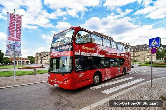
Willms-Touristik GmbH & Co.KG
Stuttgart 24-Hour Hop-On Hop-Off Sightseeing Bus Tour
4.3 (1,792) · from $27.02
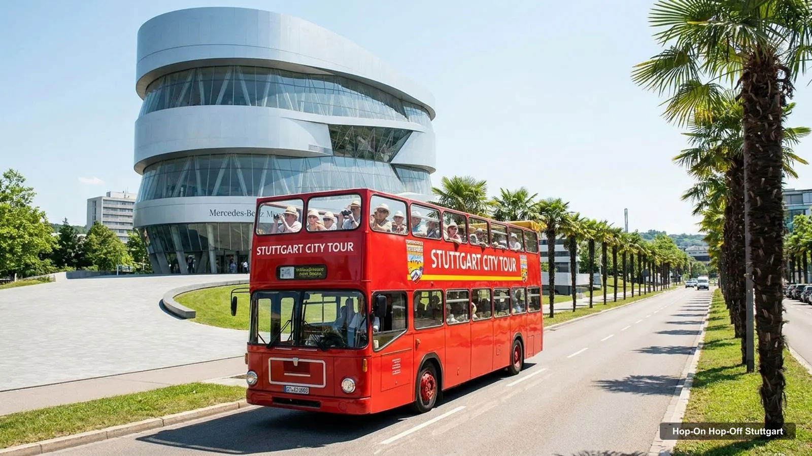
A good Stuttgart tourist map does two jobs: it shows where the sights are and where the bus stops. Below I’ve done both, with a stop table for the blue and green routes, a table of the top 20 attractions with coordinates and Google Maps links, and the clusters I would group them into. If you are still choosing a ticket, my hop-on hop-off Stuttgart comparison lays out the price and timetable.
All coordinates, ratings and review counts come from Google Maps data checked in October 2026. The stop names come from the GetYourGuide listing, which names 13 different stops across two routes. The route map below shows 12 of them, numbered in order. Karlshoehe, the last stop on the green route, is the one missing from the picture, and it is in the table.
Stuttgart Tourist Attractions
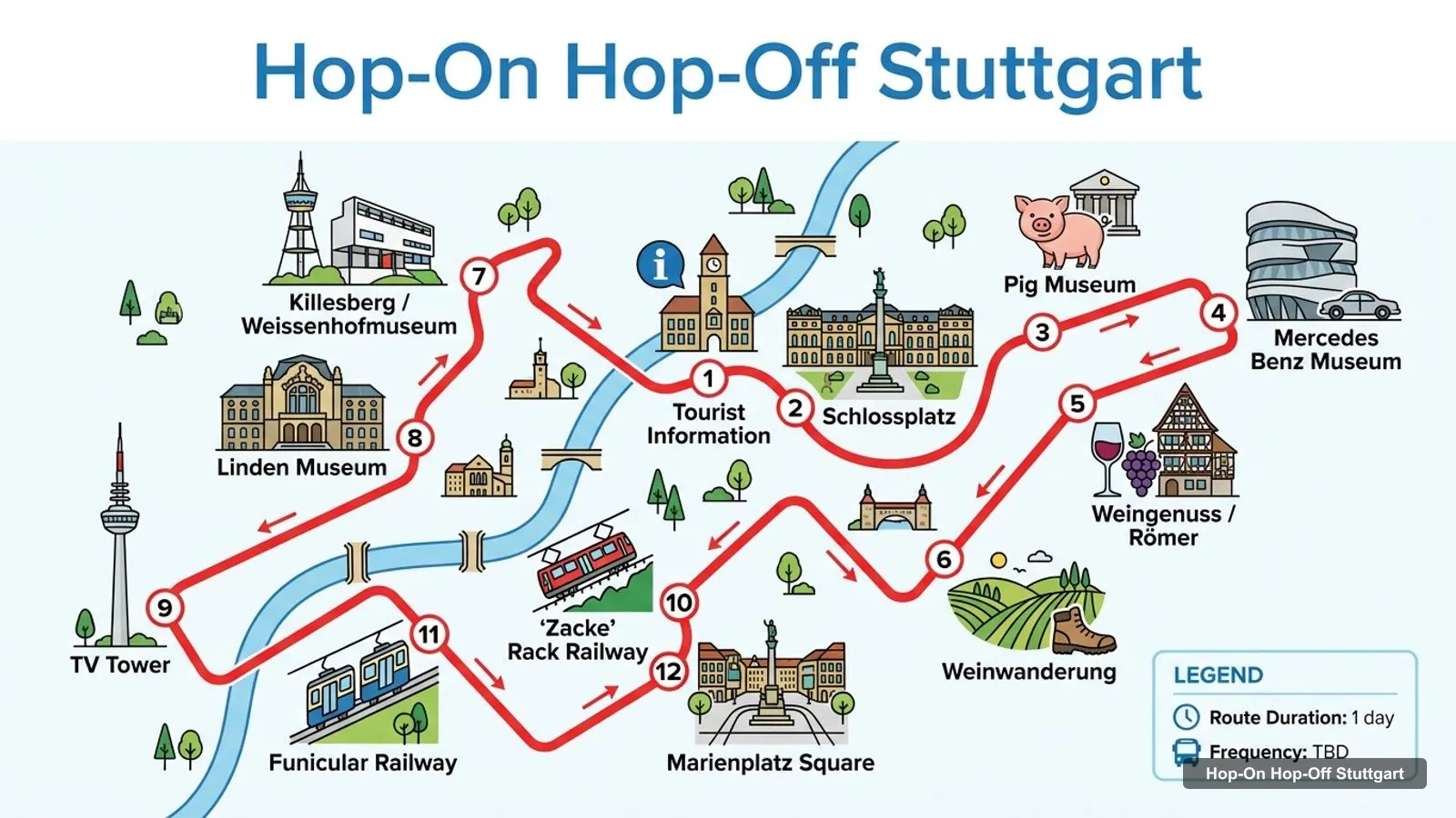
Stops on the route
- 1Tourist Information
- 2Schlossplatz
- 3Pig Museum
- 4Mercedes Benz Museum
- 5Weingenuss / Römer
- 6Weinwanderung
- 7Killesberg / Weissenhofmuseum
- 8Linden Museum
- 9TV Tower
- 10'Zacke' Rack Railway
- 11Funicular Railway
- 12Marienplatz Square
The map above is the one to screenshot. The table below gives the same stops, with the route each one belongs to and a Google Maps search link so you can open any of them on your phone. The Tourist Information office, Schlossplatz and the Linden Museum are shared by both routes.
| # | Stop | Route | Map |
|---|---|---|---|
| 1 | Tourist Information | Blue and green | Find on Google Maps |
| 2 | Schlossplatz | Blue and green | Find on Google Maps |
| 3 | Pig Museum | Blue | Find on Google Maps |
| 4 | Mercedes Benz Museum | Blue | Find on Google Maps |
| 5 | Weingenuss / Römer | Blue | Find on Google Maps |
| 6 | Weinwanderung | Blue | Find on Google Maps |
| 7 | Killesberg / Weissenhofmuseum | Blue | Find on Google Maps |
| 8 | Linden Museum | Blue and green | Find on Google Maps |
| 9 | TV Tower | Green | Find on Google Maps |
| 10 | ‘Zacke’ Rack Railway | Green | Find on Google Maps |
| 11 | Funicular Railway | Green | Find on Google Maps |
| 12 | Marienplatz Square | Green | Find on Google Maps |
| 13 | Karlshöhe | Green | Find on Google Maps |
The blue route runs from stop 1 to stop 8 and ends at the Linden Museum, which is about 0.8 km from Schlossplatz. The green route goes from stop 1 and stop 2 to stops 9 to 13 and then the Linden Museum. The two routes take about 100 and 60 minutes, and the green route only runs from April to October.
Stuttgart City Map: The Top 20 Attractions
These are the 20 most reviewed attractions in my places data, after leaving out the tour agency, the construction site entry, the market square and Ludwigsburg Residential Palace, which is 13.5 km from the centre. The coordinates are latitude and longitude, and each Open map link goes straight to the place in Google Maps.
| # | Attraction | Rating | Reviews | Coordinates | Map |
|---|---|---|---|---|---|
| 1 | Mercedes-Benz Museum | 4.8 | 57,196 | 48.7881, 9.2340 | Open map |
| 2 | Schlossplatz | 4.6 | 46,879 | 48.7786, 9.1796 | Open map |
| 3 | Porsche Museum | 4.7 | 40,320 | 48.8342, 9.1526 | Open map |
| 4 | Stuttgart TV Tower | 4.6 | 16,226 | 48.7559, 9.1901 | Open map |
| 5 | Höhenpark Killesberg | 4.7 | 9,951 | 48.8041, 9.1738 | Open map |
| 6 | State Museum of Natural History Stuttgart | 4.6 | 6,553 | 48.8053, 9.1901 | Open map |
| 7 | Schloss Solitude | 4.6 | 6,428 | 48.7868, 9.0843 | Open map |
| 8 | Grave chapel on the Wuerttemberg | 4.7 | 4,998 | 48.7821, 9.2686 | Open map |
| 9 | Staatsgalerie Stuttgart | 4.6 | 4,607 | 48.7801, 9.1866 | Open map |
| 10 | Chinese Garden Stuttgart | 4 | 3,425 | 48.7872, 9.1760 | Open map |
| 11 | Museum der Illusionen Stuttgart | 4.1 | 3,416 | 48.7900, 9.1837 | Open map |
| 12 | Schillerplatz | 4.5 | 2,351 | 48.7772, 9.1784 | Open map |
| 13 | SchweineMuseum Stuttgart | 4.4 | 2,070 | 48.7858, 9.2200 | Open map |
| 14 | Old Castle | 4.7 | 2,068 | 48.7771, 9.1795 | Open map |
| 15 | Wilhelm Palais | 4.6 | 1,556 | 48.7760, 9.1842 | Open map |
| 16 | Neues Schloss Stuttgart | 4.6 | 1,461 | 48.7780, 9.1819 | Open map |
| 17 | Linden Museum Stuttgart | 4.5 | 1,386 | 48.7828, 9.1702 | Open map |
| 18 | Heslacher Wasserfälle | 4 | 1,301 | 48.7575, 9.1235 | Open map |
| 19 | Landesmuseum Württemberg | 4.5 | 1,290 | 48.7773, 9.1796 | Open map |
| 20 | Bismarckturm Stuttgart | 4.6 | 1,235 | 48.7936, 9.1613 | Open map |
Four of the top five are on or next to a bus stop: the Mercedes-Benz Museum, Schlossplatz, the TV tower and Killesberg. The Old Castle and the Landesmuseum Wuerttemberg share a building and the same coordinates, so I list both as they appear in the data.
Stuttgart Map of Germany
If you searched for a Stuttgart map of Germany, you want to know where the city sits. Stuttgart is in the south-west, the capital of Baden-Wuerttemberg, and the straight-line distances in my data are 151 km to Frankfurt, 163 km to Zurich and 190 km to Munich. Those are distances as the crow flies, not driving or rail distances, so check a journey planner for travel times.
The city lies at about 249 metres above sea level according to the Open-Meteo elevation service. It is built in a basin, and many sights are on slopes, which is one more reason the bus is handy for the TV tower and Killesberg.
Stuttgart On a Map: Clusters
The coordinates fall into five groups, and I would plan a day around one or two of them rather than zig-zagging.
The palace square. Schlossplatz, the Old Castle, the New Palace, the Wilhelm Palais and the House of History all sit within about 0.5 km of one another. The State Gallery is 0.5 km away and the Linden Museum 0.8 km. You do not need a bus here, only walking shoes.
The north. Killesberg park and the Weissenhof Museum are about 0.56 km apart, and both are on one blue stop. The Natural History Museum is about 1.2 km from the park. The Bismarck Tower is about 1.5 km from Killesberg and 2.1 km from Schlossplatz.
Bad Cannstatt and the east. The Mercedes-Benz Museum, the Pig Museum and the grave chapel are in the east. The Pig Museum is about 1.1 km from the Mercedes-Benz Museum and the grave chapel about 2.6 km. This is the blue route’s far end and it is where the bus earns its fare.
The south. The TV tower is 2.6 km from Schlossplatz and is on the green route. The Heslach waterfalls are about 4.9 km from the tower and are not on a route.
The outer ring. The Porsche Museum is 6.5 km from Schlossplatz and about 3.7 km from Killesberg. Schloss Solitude is 7.0 km west. Neither is a bus stop, so I would use the regional trains, trams or a taxi and check VVS for the route.
How to Use the Map
Use the stop table to decide where to board, and the attraction table to decide where to get off. My own approach is to pick the two or three attractions I care about most, find the nearest stop to each, and then draw the day between them. If the Mercedes-Benz Museum is your priority, take the blue route. If the TV tower is, take the green route.
Two cautions. Some names in my Google data differ from the bus operator’s, for example Killesberg and Weissenhofmuseum is one stop name for two places, and the Pig Museum appears as the SchweineMuseum on the map. The coordinates in the table are for the attraction itself, not the nearest stop, so use them for planning and check your voucher on the day.
Is Stuttgart Germany Worth Visiting
Stuttgart is worth a visit for the museums and the centre alone. On the map you can see that the palace square sits within a short walk of five sights, and a single 24-hour bus ticket from $27.02 reaches the museum district, the TV tower and the park. If you only have a day, you will see more than you expect. If you have three, you can add the outer ring.
Stuttgart Tourist Map PDF
I don’t have an official Stuttgart tourist map PDF in my data, and I would rather say so than point you to a file I haven’t seen. The simplest substitute is to open the Google Maps links above and save the area for offline use. For printed visitor material, the city tourist site at stuttgart-tourist.de is the official starting point.
Getting Around Without the Bus
The city’s public transport is run by VVS, and its journey planner is at vvs.de. I haven’t used it and I don’t have fares or line numbers in my data, so check the site for current prices. The bus routes include a funicular railway and a rack railway as stops, which tells you the city has some unusual transport of its own, but I can’t give you timetables for either.
Which Stops Matter Most
If I had to circle only four stops on the map, I would pick Schlossplatz, the Mercedes Benz Museum, Killesberg and the TV tower. Schlossplatz is shared by both routes and sits next to the Old Castle and the New Palace. The Mercedes-Benz Museum is the best-reviewed sight at 57,196 reviews. Killesberg pairs a park open around the clock with the Weissenhof Museum, which has 1,168 reviews at 4.6. The TV tower has 16,226 reviews and opens until 10 PM.
The wine stops, Weingenuss at Roemer and Weinwanderung, are the ones I can say least about, because the listing gives only their names and not what you do there. Check the voucher or the operator before you plan a tasting around them.
Plan Your Visit
For a day-by-day plan using these stops, see my Stuttgart itinerary. For the ranked list of sights with hours and addresses, read my best things to do in Stuttgart. When you are ready to buy, the Stuttgart bus tour tickets page has the card with the price. For other cities with maps like this, start from the homepage.
Frequently asked questions
Is Stuttgart worth visiting?
I think so, even for a short stay. The Mercedes-Benz Museum alone has 57,196 Google reviews at 4.8, and the 24-hour hop-on hop-off ticket from $27.02 links the museum, the palace square and the TV tower on two routes. The centre is compact, so the map below is easy to follow on foot.
Is there a Stuttgart tourist map I can use offline?
Each stop and attraction in the tables below has a Google Maps link, and Google Maps lets you save an area for offline use before you travel. I don't have an official PDF map in my data, so check the city tourist site at stuttgart-tourist.de, which publishes visitor material, for a printable version.
How far apart are the main sights in Stuttgart?
The centre is tight and the rest is spread out. From the coordinates, the Old Castle is 0.2 km from Schlossplatz and the State Gallery 0.5 km. The TV tower is 2.6 km away, Killesberg 2.9 km, the Mercedes-Benz Museum 4.1 km and the Porsche Museum 6.5 km, which is where the bus or a tram helps.
Tours I compared in Stuttgart
My full review of each one, in the order I rank them:
- Stuttgart 24-Hour Hop-On Hop-Off Sightseeing Bus Tour★ 4.3 · from $27.02