
Tours & Tickets
Stockholm: Hop-On Hop-Off Bus or Boat Option
- 3.9 (4,449 reviews)
- 24-hour ticket
My pick: The ticket I'd use with this map: 22 bus stops plus 8 boat stops from $22.52.
By Jake Dawson · Updated · Affiliate links, explained in my disclosure
Tours & Tickets
Stockholm: Hop-On Hop-Off Bus or Boat Option
3.9 (4,449) · from $22.52
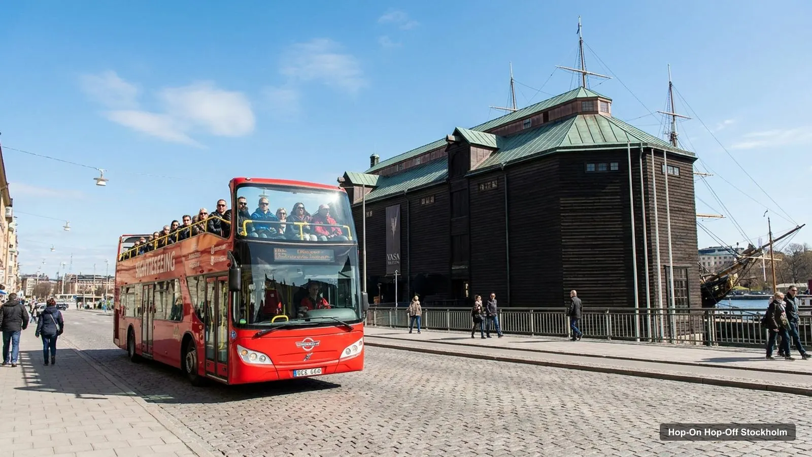
A Stockholm tourist map is most useful when it shows two things together: where the sights are, and where the sightseeing bus stops. This page does both. The route map below is built from the stop list of the Bus or Boat Option, and the tables use my Google Maps data for the top 20 attractions, with coordinates and a map link for each. If you want to see how the bus tickets compare, start with my Stockholm hop-on hop-off page.
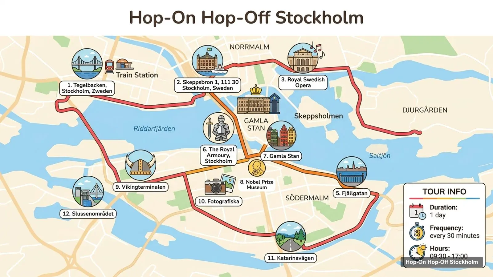
Stops on the route
The loop starts at the Royal Swedish Opera, runs through Gamla Stan and along the waterfront, crosses to Djurgarden, and comes back through the city centre. The stop numbers on the image are the same as in the table below, so you can match each one to a map link. The route may change during city events, which the 24-hour Stromma listing warns about, so always check the stop on the day.
These are the 12 stops shown on the route map, from the Bus or Boat Option listing. The first two are alternative starting points, and the full listing has more, including Monteliusvagen, Mariatorget, Stadshuset and Stockholm Central Station. The map links are Google Maps searches, so check the pin matches the stop on the street.
| # | Stop | Map |
|---|---|---|
| 1 | Tegelbacken, Stockholm, Zweden | Open map |
| 2 | Skeppsbron 1, 111 30 Stockholm, Sweden | Open map |
| 3 | Royal Swedish Opera | Open map |
| 4 | Royal Palace, Stockholm | Open map |
| 5 | Fjällgatan | Open map |
| 6 | The Royal Armoury, Stockholm | Open map |
| 7 | Gamla Stan | Open map |
| 8 | Nobel Prize Museum | Open map |
| 9 | Vikingterminalen | Open map |
| 10 | Fotografiska | Open map |
| 11 | Katarinavägen | Open map |
| 12 | Slussenområdet | Open map |
Here is my top 10, ranked by Google Maps review count. The Vasa Museum leads with 4.8 from 72,112 reviews, then the Royal Palace, Skansen, the King’s Garden, ABBA The Museum, Fotografiska, Sergels torg, the Nordic Museum, the Museum of Technology and the Nobel Prize Museum. Most of them are on or near the bus route. The exceptions are Sergels torg and the Museum of Technology, which I couldn’t match to a stop in any listing. For descriptions and opening hours, see my best things to do in Stockholm.
The table below lists the top 20 by reviews, with coordinates and a Google Maps link. I left out tour operators, bus departure points and places far outside the centre, such as Drottningholm Palace.
| # | Attraction | Rating | Reviews | Coordinates | Map |
|---|---|---|---|---|---|
| 1 | Vasa Museum | 4.8 | 72,112 | 59.3280, 18.0914 | Open map |
| 2 | The Royal Palace | 4.5 | 45,628 | 59.3268, 18.0717 | Open map |
| 3 | Skansen | 4.5 | 36,098 | 59.3263, 18.1059 | Open map |
| 4 | King’s Garden | 4.5 | 30,291 | 59.3311, 18.0719 | Open map |
| 5 | ABBA The Museum | 4.5 | 21,712 | 59.3251, 18.0968 | Open map |
| 6 | Fotografiska Museum Stockholm | 4.4 | 20,171 | 59.3180, 18.0848 | Open map |
| 7 | Sergels torg | 4.1 | 14,994 | 59.3324, 18.0645 | Open map |
| 8 | Nordic Museum | 4.3 | 11,472 | 59.3290, 18.0943 | Open map |
| 9 | Museum of Technology | 4.3 | 9,554 | 59.3324, 18.1188 | Open map |
| 10 | Nobel Prize Museum | 4.1 | 9,385 | 59.3253, 18.0707 | Open map |
| 11 | National Museum | 4.6 | 8,375 | 59.3285, 18.0782 | Open map |
| 12 | The Viking Museum | 4.3 | 7,807 | 59.3266, 18.0952 | Open map |
| 13 | Swedish History Museum | 4.5 | 7,148 | 59.3346, 18.0908 | Open map |
| 14 | Stockholm City Hall | 4.7 | 4,976 | 59.3278, 18.0552 | Open map |
| 15 | Army Museum | 4.6 | 4,853 | 59.3347, 18.0802 | Open map |
| 16 | Skinnarviksberget | 4.7 | 4,663 | 59.3200, 18.0507 | Open map |
| 17 | The Royal Armoury | 4.6 | 3,887 | 59.3267, 18.0730 | Open map |
| 18 | The Hallwyl Museum | 4.5 | 3,181 | 59.3331, 18.0745 | Open map |
| 19 | Storkyrkan | 4.5 | 3,059 | 59.3258, 18.0704 | Open map |
| 20 | Stockholm’s narrowest street (Mårten Trotzigs gränd) | 4.4 | 2,935 | 59.3230, 18.0728 | Open map |
The sights fall into three clusters, and the bus route links them. Gamla Stan is the first: the Royal Palace, the Royal Armoury, Storkyrkan, Stortorget, the Nobel Prize Museum and Stockholm’s narrowest street, Marten Trotzigs grand, are all within a few hundred metres of one another. The second is Djurgarden: the Vasa Museum, the Nordic Museum, ABBA The Museum, the Viking Museum and Skansen. The Vasa Museum and the Nordic Museum are about 0.2 km apart, and Skansen is about 0.84 km from the Vasa Museum. The third is the centre around Kungstradgarden, Sergels torg, the Hallwyl Museum and Stureplan.
Two sights sit outside the clusters. Fotografiska is on the waterfront at Slussen, about 1.2 km from the Royal Palace, and the Stockholm City Hall is about 0.9 km from the palace on Kungsholmen. My ticket advice follows from the map: if you will mostly stay in one cluster, walk, and use a bus or boat ticket for the day you cross between them.
The question I get most from readers is which sights the bus actually reaches, so here is the match from the ticket listings. These sights are on a stop list: the Royal Palace, Skansen, the King’s Garden (Kungstradgarden), ABBA The Museum, the Vasa Museum and Nordic Museum stop, Stockholm City Hall. These are listed as pass-by points on the bus in the Bus or Boat Option: the Royal Armoury, the Nobel Prize Museum, Fotografiska, the Swedish History Museum and the Hallwyl Museum. Fotografiska also has a boat stop on that ticket, which matters outside winter.
These I could not match to any stop list in my data: the National Museum, the Museum of Technology, the Army Museum, Sergels torg, Skinnarviksberget and the Viking Museum. Several of them are still easy to reach on foot from a nearby stop. The Viking Museum on Djurgardsvagen is about 0.2 km from ABBA The Museum on the map, so I’d treat it as part of the same stop, but I’d check on the day. For the National Museum, the closest option is a walk from the Royal Palace, about 1.1 km in a straight line.
I use the map in three steps. First, I pick the cluster I’ll spend the morning in, usually Gamla Stan or Djurgarden, and save its Google Maps links to my phone. Second, I check the first and last departures of my ticket: the City Sightseeing bus leaves Stop 1 at 10am and the last departure is at 5pm, while the Stromma tickets list a last departure of 16:00 or 17:00. Third, I keep the stop signs in mind, because reviewers of the Stromma bus or boat ticket say stops were poorly labelled and hard to find, so I look at the map link and the street before I walk off.
One more practical point: the stop numbers in the table follow the order of the Bus or Boat Option listing, not the order the bus passes them in every direction. Routes may change, and the listing says so. If you are on a cruise, the City Sightseeing route also has three cruise terminal stops, at Frihamnen and Stadsgarden, which aren’t on the numbered map above.
These straight-line distances come from the coordinates in the table above. The Vasa Museum to ABBA The Museum is about 0.45 km. The Vasa Museum to Skansen is about 0.84 km. The Royal Palace to Fotografiska is about 1.2 km, and the Royal Palace to Stockholm City Hall about 0.9 km. The Royal Palace to Skansen is the longest of the useful hops at about 1.9 km. Those numbers say the same thing as the clusters: on Djurgarden, walk; between Gamla Stan and Djurgarden, ride.
Yes, and the map shows why. In a small area you get a royal palace, a 17th-century warship, the world’s oldest open-air museum as described in the Stromma listing, a pop museum and a waterfront with boats. A bus ticket isn’t essential, but the cheapest one I found is $22.52 for 24 hours, and it makes the Djurgarden loop easy. If you stay longer (my home page lists other cities too), use SL public transport from sl.se and the official guide at Visit Stockholm for events.
Pick the stops you want first, then check them against the ticket’s stop list. The Bus or Boat Option lists 22 bus stops and 8 boat stops. The City Sightseeing ticket lists 18 starting points. The Stromma listings use a loop of about 15 stops. My Stockholm itinerary turns the map into one, two and three day plans, and when you’re ready to buy, the Stockholm sightseeing bus I’d book is the Bus or Boat Option.
Tours & Tickets
My pick: The ticket I'd use with this map: 22 bus stops plus 8 boat stops from $22.52.
This page works as one. The route map image shows the sightseeing bus loop with numbered stops, and the tables below list the top 20 attractions and the bus stops with coordinates. Print the page, or open any Google Maps link and save the places to your phone for offline use.
In three clusters. Gamla Stan has the Royal Palace, the Royal Armoury, the Nobel Prize Museum and Storkyrkan. Djurgarden has the Vasa Museum, Skansen, ABBA The Museum and the Nordic Museum. The centre around Kungstradgarden and Sergels torg has the park, the Hallwyl Museum and the shopping streets.
The Royal Palace to the Vasa Museum is about 1.1 km in a straight line, and the palace to Skansen is about 1.9 km. On Djurgarden the Vasa Museum, Nordic Museum and ABBA The Museum are within about half a kilometre of each other, so you can walk between them once you're there.
My full review of each one, in the order I rank them: