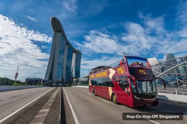
 Night tour
Singapore DUCKtours Pte Ltd
Singapore: Big Bus Hop-On Hop-Off Tour by Open-Top Bus
- 4.5 (3,984 reviews)
- 2-day ticket
My pick: Covers the most of this map: 16 named sights on two routes, from Marina Bay to Chinatown and Little India.
By Jake Dawson · Updated · Affiliate links, explained in my disclosure
Singapore DUCKtours Pte Ltd
Singapore: Big Bus Hop-On Hop-Off Tour by Open-Top Bus
4.5 (3,984) · from $52.45
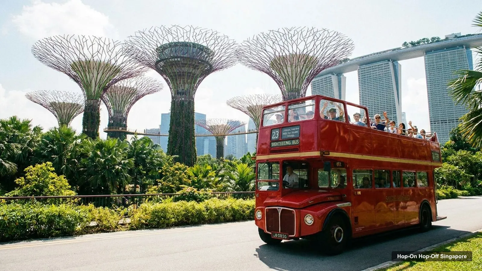
A Singapore tourist map is simpler than it looks once you see that almost everything circles one bay. I’ve put the top 20 attractions (ranked by Google Maps reviews) and the main sightseeing bus stops on one page, with coordinates, the straight-line distance from the Merlion and a Google Maps link for each. The route image follows the order of the main sights on the Big Bus listing. To pick the ticket that rides it, see my comparison of hop-on hop-off in Singapore.
The Singapore tourism map below shows the 12 main sights on the Big Bus routes, from Marina Bay Sands round to the National Museum. Big Bus runs two loops from Stop 1 at the Suntec City Tourist Hub: the Yellow Route (City Tour) and the Red Route (Heritage Tour). The first tour leaves at 9:30 AM, with buses every 25 to 40 minutes until 5:20 PM, depending on the time of year.
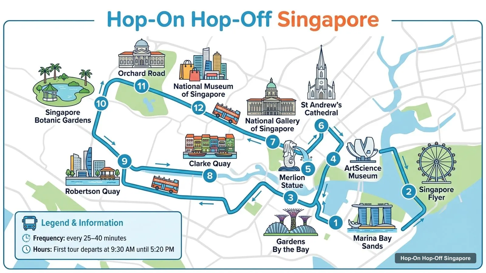
Stops on the route
| # | Stop | Map |
|---|---|---|
| 1 | Marina Bay Sands | Find on Google Maps |
| 2 | Singapore Flyer | Find on Google Maps |
| 3 | Gardens By the Bay | Find on Google Maps |
| 4 | ArtScience Museum | Find on Google Maps |
| 5 | Merlion Statue | Find on Google Maps |
| 6 | St Andrew’s Cathedral | Find on Google Maps |
| 7 | National Gallery of Singapore | Find on Google Maps |
| 8 | Clarke Quay | Find on Google Maps |
| 9 | Robertson Quay | Find on Google Maps |
| 10 | Singapore Botanic Gardens | Find on Google Maps |
| 11 | Orchard Road | Find on Google Maps |
| 12 | National Museum of Singapore | Find on Google Maps |
The Big Bus listing also names Raffles Hotel, Little India, Kampong Glam and Chinatown, which are on the Red Route through the heritage districts. Use the Big Bus app for exact stop positions: riders say the stops aren’t well signed, and the app shows stop photos and live bus tracking.
This is the Singapore tour map in table form, ranked by Google Maps reviews, with exact coordinates and the straight-line distance from the Merlion. I left out tour companies, and I merged the Merlion statue’s own listing into Merlion Park. Each link opens the place in Google Maps, where you can save it to a list before you travel.
| # | Attraction | Coordinates | Google rating | From the Merlion | Big Bus stop | Map |
|---|---|---|---|---|---|---|
| 1 | Gardens by the Bay | 1.28157, 103.86361 | 4.7 (159,163) | 1.2 km | Gardens By the Bay | Open in Google Maps |
| 2 | Merlion Park | 1.28674, 103.85439 | 4.6 (76,926) | 0.0 km | Merlion Statue | Open in Google Maps |
| 3 | Marina Bay Sands Singapore | 1.28376, 103.85911 | 4.7 (64,885) | 0.6 km | Marina Bay Sands | Open in Google Maps |
| 4 | Supertree Grove | 1.28196, 103.86391 | 4.7 (54,863) | 1.2 km | Gardens By the Bay (short walk) | Open in Google Maps |
| 5 | Flower Dome | 1.28463, 103.86470 | 4.7 (26,831) | 1.2 km | Gardens By the Bay (short walk) | Open in Google Maps |
| 6 | Singapore Flyer | 1.28930, 103.86314 | 4.6 (24,441) | 1.0 km | Singapore Flyer | Open in Google Maps |
| 7 | ArtScience Museum | 1.28627, 103.85927 | 4.4 (18,493) | 0.5 km | ArtScience Museum | Open in Google Maps |
| 8 | National Gallery Singapore | 1.29022, 103.85152 | 4.6 (17,048) | 0.5 km | National Gallery of Singapore | Open in Google Maps |
| 9 | National Museum of Singapore | 1.29661, 103.84851 | 4.5 (16,668) | 1.3 km | National Museum of Singapore | Open in Google Maps |
| 10 | SkyPark Observation Deck | 1.28520, 103.86103 | 4.6 (13,968) | 0.8 km | Marina Bay Sands | Open in Google Maps |
| 11 | Fort Canning Park | 1.29439, 103.84580 | 4.6 (12,067) | 1.3 km | National Museum of Singapore (0.4 km walk) | Open in Google Maps |
| 12 | Madame Tussauds Singapore | 1.25404, 103.81762 | 4.4 (11,013) | 5.5 km | None | Open in Google Maps |
| 13 | Science Centre Singapore | 1.33317, 103.73564 | 4.6 (10,879) | 14.2 km | None | Open in Google Maps |
| 14 | Singapore Discovery Centre | 1.33269, 103.67894 | 4.7 (9,130) | 20.2 km | None | Open in Google Maps |
| 15 | Museum of Ice Cream Singapore | 1.30251, 103.81217 | 4.5 (7,121) | 5.0 km | None | Open in Google Maps |
| 16 | Asian Civilisations Museum | 1.28750, 103.85139 | 4.6 (6,377) | 0.3 km | National Gallery of Singapore (0.3 km walk) | Open in Google Maps |
| 17 | Red Dot Design Museum | 1.28013, 103.85622 | 4.4 (5,914) | 0.8 km | Marina Bay Sands (0.5 km walk) | Open in Google Maps |
| 18 | The Helix Bridge | 1.28748, 103.86063 | 4.7 (5,383) | 0.7 km | Marina Bay Sands (0.5 km walk) | Open in Google Maps |
| 19 | Chinatown Heritage Centre | 1.28353, 103.84420 | 4.6 (4,461) | 1.2 km | Chinatown | Open in Google Maps |
| 20 | Singapore City Gallery | 1.27985, 103.84506 | 4.6 (3,001) | 1.3 km | None | Open in Google Maps |
Read the coordinates above and you’ll see four groups on the Singapore sightseeing map:
Plan one cluster per half day and you won’t waste time crossing the city. My best things to do in Singapore guide has what to see at each place.
The Singapore tourist map gets easier once you know which stop serves which sight. Here’s how the main attractions line up with the stops in the operators’ listings:
Each operator draws its own Singapore tourist map. Big Bus lists 16 top sights over its Yellow and Red Routes, and its route map is the one plotted above. FunVee describes over 32 stops on two lines: a City Line with 23 stops past the Esplanade, Merlion Park, Fullerton Bay, Robertson Quay, the Botanic Gardens and Orchard Road, and a Marina Line with 14 stops including the Singapore Flyer, Marina Bay Sands, Gardens by the Bay, Chinatown and Little India. FunVee’s meeting point is the Marina City Tourist Hub in Marina Square. On the water, the Albatross speedboat runs a 23 km loop from Resorts World Sentosa and Ola Beach Club to Lazarus, Kusu and Sisters’ Islands.
The Southern Islands are the part of the Singapore tourist map most visitors miss. The Albatross speedboat links them to Sentosa. The CEBU pass publishes a timetable: boats leave Ola Beach Club for the islands at ten past every hour from 12:10 pm to 5:10 pm. Pickups run hourly at Sisters’ Islands from 12:30 pm, at Lazarus from 12:40 pm and at Kusu from 12:50 pm, and the last boats leave at 6:30 pm, 6:40 pm and 6:50 pm. Missing the last pickup is the one mistake you can’t fix, so I’d note those three times before you step off.
If you want a Singapore tourist map PDF, print this page with your browser’s “Print to PDF” option. The route image and the two tables fit on a few sheets, and the Google Maps links stay clickable on a phone or tablet. The same works if you’re after a Singapore tourism map PDF to share with the people you’re travelling with. I’d also save the 20 attractions to a starred list in Google Maps, which takes a couple of minutes with the links above and works offline once downloaded.
Everything on this Singapore tourist map is free to use: the coordinates and links come straight from Google Maps. For official maps and event listings, Visit Singapore, the tourism board’s site, is the place to check. The Big Bus Tours app is free too, and shows the live route and stops once you add your booking.
If you’re walking rather than riding, stay on the waterfront. From Merlion Park you can follow the bay past the ArtScience Museum to Marina Bay Sands, then on to Gardens by the Bay, in about 1.4 km of straight-line distance. Cross the Helix Bridge to reach the Singapore Flyer. Walk early or late, because the heat makes midday walking hard. For the longer hops, to Chinatown, Little India or the Botanic Gardens, use the bus or the MRT.
Big Bus covers the most of this Singapore tourist map in my data, with 16 named sights on two routes, from Gardens by the Bay to the Botanic Gardens and the three heritage districts. It’s also the only bus with a long review record, 4.5 from 3,984 reviews. If you want to split the map into days, my Singapore itinerary does it for 1, 2 and 3 days. For the bus tour I’d book in Singapore, see my Singapore sightseeing bus comparison, and the rest of my city maps start from the homepage.
Night tourSingapore DUCKtours Pte Ltd
My pick: Covers the most of this map: 16 named sights on two routes, from Marina Bay to Chinatown and Little India.
This page works as one. The route map image shows the 12 main sights on the Big Bus routes in order, and the tables below list those stops and the top 20 attractions with coordinates. Print the page or save it as a PDF, or open any Google Maps link to save the places to your phone for offline use.
Around Marina Bay. Gardens by the Bay, Marina Bay Sands, the ArtScience Museum, the Singapore Flyer, the Helix Bridge and Merlion Park all sit within about 1.2 km of the Merlion. The Civic District museums are just north-west of it, Chinatown about 1.2 km south-west, and Sentosa about 5.5 km south-west.
Closer than most visitors expect. Merlion Park to Marina Bay Sands is about 600 metres across the water, and Marina Bay Sands to Gardens by the Bay about 560 metres. The National Museum is about 1.3 km from the Merlion, and Little India's Indian Heritage Centre about 2.1 km, which is where the bus saves the most time.
My full review of each one, in the order I rank them: