Seoul Tourist Map: Top Attractions & Bus Stops
By Jake Dawson · Updated · Affiliate links, explained in my disclosure
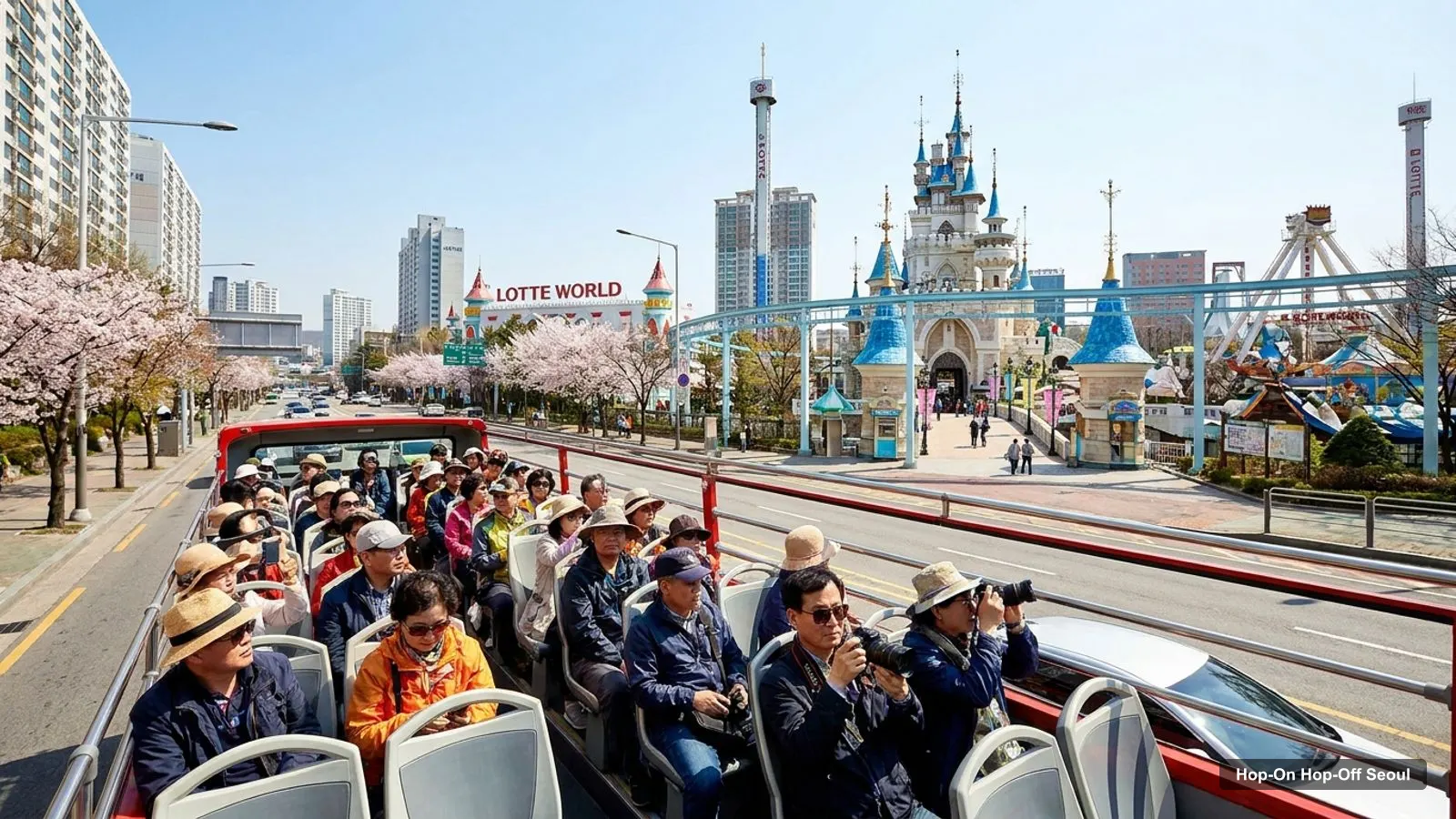
This is my Seoul tourist map: the bus corridor, the top 20 attractions with coordinates, and the three clusters that make the city easy to plan. If you want the bus itself, my guide to hop-on hop-off Seoul explains the Seoul City Tour Bus courses, the night loop and the prices on the operator’s site.
Everything here is built from Google Maps data for Seoul: names, ratings, review counts and coordinates. The stop table is my own route map and not the operator’s official list, which has 15 stops that I could not read in full. Use the map links to check each one.
Seoul Tour Map: The Bus Corridor
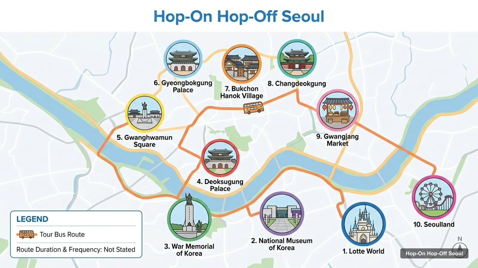
Stops on the route
- 1Lotte World
- 2National Museum of Korea
- 3War Memorial of Korea
- 4Deoksugung Palace
- 5Gwanghwamun Square
- 6Gyeongbokgung Palace
- 7Bukchon Hanok Village
- 8Changdeokgung
- 9Gwangjang Market
- 10Seoulland
The picture above shows the ten sights I put along the daytime corridor. They run from Lotte World in the south-east, through the Yongsan museums and the palaces, to Gwangjang Market. The table lists them in the same order, with a Google Maps search link for each. Seoulland is in Gwacheon, outside the city, so I list it for completeness but would treat it as a separate trip.
Sights on the Route Map
| # | Stop | Rating | Google Maps |
|---|---|---|---|
| 1 | Lotte World | 4.3 | Open map |
| 2 | National Museum of Korea | 4.7 | Open map |
| 3 | War Memorial of Korea | 4.6 | Open map |
| 4 | Deoksugung Palace | 4.6 | Open map |
| 5 | Gwanghwamun Square | 4.5 | Open map |
| 6 | Gyeongbokgung Palace | 4.6 | Open map |
| 7 | Bukchon Hanok Village | 4.4 | Open map |
| 8 | Changdeokgung | 4.6 | Open map |
| 9 | Gwangjang Market | 4.2 | Open map |
| 10 | Seoulland | 4.3 | Open map |
Seoul Tourist Attractions: Top 20 With Coordinates
These are the 20 most-reviewed attractions in my data, ranked by Google reviews. I removed bus stops, tour operators and Seoulland, which is outside the city. Coordinates are as Google Maps gives them, rounded to four places, and every row links to its map entry.
| # | Attraction | Rating | Reviews | Lat, Lng | Map |
|---|---|---|---|---|---|
| 1 | N Seoul Tower | 4.5 | 68,402 | 37.5512, 126.9882 | Map |
| 2 | Lotte World | 4.3 | 52,876 | 37.5111, 127.0982 | Map |
| 3 | Gyeongbokgung Palace | 4.6 | 46,918 | 37.5796, 126.9770 | Map |
| 4 | Gwangjang Market | 4.2 | 44,375 | 37.5700, 126.9996 | Map |
| 5 | National Museum of Korea | 4.7 | 29,274 | 37.5239, 126.9805 | Map |
| 6 | Bukchon Hanok Village | 4.4 | 24,651 | 37.5815, 126.9850 | Map |
| 7 | Deoksugung Palace | 4.6 | 20,474 | 37.5659, 126.9749 | Map |
| 8 | War Memorial of Korea | 4.6 | 18,222 | 37.5366, 126.9771 | Map |
| 9 | Gwanghwamun Square | 4.5 | 14,322 | 37.5724, 126.9769 | Map |
| 10 | Changdeokgung | 4.6 | 13,999 | 37.5794, 126.9910 | Map |
| 11 | Insa-dong Culture Street | 4.3 | 13,792 | 37.5722, 126.9868 | Map |
| 12 | Cheonggyecheon | 4.6 | 11,124 | 37.5691, 126.9787 | Map |
| 13 | Namsangol Hanok Village | 4.4 | 10,462 | 37.5593, 126.9945 | Map |
| 14 | National Palace Museum of Korea | 4.6 | 7,404 | 37.5766, 126.9750 | Map |
| 15 | Seoullo 7017 | 4.2 | 6,802 | 37.5567, 126.9696 | Map |
| 16 | Seoul Museum of History | 4.5 | 5,409 | 37.5703, 126.9705 | Map |
| 17 | Ihwa-dong Mural Village | 4.1 | 4,821 | 37.5780, 127.0072 | Map |
| 18 | Changgyeonggung Palace | 4.7 | 4,782 | 37.5788, 126.9949 | Map |
| 19 | National Museum of Modern and Contemporary Art, Seoul | 4.6 | 4,324 | 37.5788, 126.9804 | Map |
| 20 | Gwanghwamun Gate | 4.7 | 4,141 | 37.5760, 126.9769 | Map |
The top three are N Seoul Tower, Lotte World and Gyeongbokgung Palace. For what to do at each, see my guide to the best things to do in Seoul.
Seoul Sightseeing Map: The Three Clusters
Looking at the coordinates, the sights fall into three clusters.
Palace district (north). Gyeongbokgung Palace, Gwanghwamun Gate and Square, the National Palace Museum of Korea, Changdeokgung, Changgyeonggung, Bukchon Hanok Village, Insa-dong and the modern art museum all sit between about 37.565 and 37.582 north and 126.97 and 127.01 east. That is the walkable heart of the tourist map. Deoksugung and Cheonggyecheon are on its southern edge.
Yongsan and Namsan (middle). The National Museum of Korea (37.5239) and the War Memorial of Korea (37.5366) are in Yongsan District, and N Seoul Tower (37.5512) and Namsangol Hanok Village (37.5593) are on and below Namsan. This is where I’d use a bus or the subway, because the sights are spread out and the slope is steep.
Market and stream (centre-east). Gwangjang Market (37.5700, 126.9996) and the Cheonggyecheon stream link the old city to the east. The Ihwa-dong Mural Village (37.5780, 127.0072) is the furthest sight in this group.
The outlier. Lotte World sits at 37.5111, 127.0982, well south-east of everything else on the list. I would plan it as its own day or half day.
Seoul Tourist Map for First-Timers: My Order of Visits
If this is your first time, the Seoul tourist map reads best from north to south. Start in the palace district, because it holds the most-visited sights per square kilometre: Gyeongbokgung Palace has 46,918 reviews at 4.6, and Bukchon Hanok Village has 24,651 at 4.4. Move on to the market and stream, with Gwangjang Market at 44,375 reviews, then cross to Yongsan for the National Museum of Korea, rated 4.7 from 29,274 reviews, which is the best-rated big sight on the list.
The highest rating in the top 20 is shared by Changgyeonggung Palace and Gwanghwamun Gate, both at 4.7, though with fewer reviews than the headline sights. If you value a quiet visit over a famous one, those two are my tip. The lowest-rated in the table is Ihwa-dong Mural Village at 4.1, with Gwangjang Market and Seoullo 7017 at 4.2, which tells me the ratings spread is narrow: nearly everything on this map is well liked.
Seoul Tour Map Mistakes to Avoid
- Do not assume that two places close on the map are quick to reach. Namsan is steep, and the walk up is not a casual stroll.
- Do not plan Lotte World and the palaces on the same day. They are at opposite ends of the tourist map.
- Do not rely on my route map as the operator’s timetable. It is a guide to the corridor, and the official 15 stops are what count.
- Do not skip the opening hours. N Seoul Tower, for example, is listed as open 10 AM to 10:30 PM on weekdays, and other sights have different days off.
Seoul Travel Map: Which Stop for Which Sight
If you ride the bus, match the stop to the sight. For the palaces, get off nearest to Gwanghwamun Square and walk, since Gyeongbokgung, Gwanghwamun Gate and the National Palace Museum are within a few minutes of each other on the map. For the museums, get off at the National Museum of Korea or the War Memorial of Korea. For the views, ride up to N Seoul Tower. For food, go to Gwangjang Market.
The nighttime course is different. It is a non-stop loop of about 90 minutes with a 25-minute photo stop at N Seoul Tower, so there is nothing to match, only a ride to enjoy. Prices on the operator’s site were 27,000 won for the daytime adult ticket and 25,000 won for the night one when I checked on 7 October 2026.
Seoul Tourist Map PDF and Offline Use
I do not offer a PDF, and I would not trust one that is out of date. What works better is to open the map links in the table and save the places you want to a list in Google Maps, which then works offline on your phone. If you want the bus map, look at the operator’s own site, seoulcitybus.com, for its current route material.
Korea Tourist Map: Beyond Seoul
My data includes one nearby city with a page on this site: Busan, 329 kilometres away. It is far enough that it needs its own plan, and you can read about it at hop-on hop-off Busan. Inside Seoul, this map covers the places that matter on a first visit.
Subway and Walking Tips
Seoul has a dense subway system, and I would use it between clusters and walk within them. I have not put line numbers or station names in this page, because my data does not hold them, so check a live map before you go. A few habits help: save the map links offline, start the palace district early, and keep your bus ticket with you each time you board.
Using This Map
Pick one cluster per half day. Start with the palaces, then a museum, then a view. For a day-by-day plan, open my Seoul itinerary, and for the bus details go back to the main Seoul hop-on hop-off bus guide. You can find other cities from the home page.
Frequently asked questions
Where are the main tourist attractions in Seoul?
Most of them sit in three clusters: palaces and old lanes in Jongno District, museums in Yongsan District with Namsan beside them, and the market and stream area in between. Lotte World is the outlier in the south-east. The table on this page lists the top 20 with coordinates and map links.
Is there a Seoul tourist map PDF?
I do not host a PDF. Each attraction on this page has a Google Maps link, which you can save to a list on your phone and use offline. The operator of the Seoul City Tour Bus also publishes its own route material on its website, so check there for a printable bus map.
Which Seoul attractions are on the hop-on hop-off bus route?
The operator lists 15 stops on its daytime course, but I could not read the full stop list. My own route map shows ten sights along the corridor, from Lotte World to Gwangjang Market. Treat that as a guide and confirm the live stops before you plan around them.
How do I get around the Seoul tourist map without a car?
Walk inside each cluster and use the subway between them. The palace district is walkable, and a sightseeing bus is useful for the longer jumps such as Yongsan to Namsan. I only give distances I can compute from coordinates, and I have kept those to a minimum.