Seattle Tourist Map: Top Attractions & Bus Stops
By Jake Dawson · Updated · Affiliate links, explained in my disclosure

City Sightseeing Worldwide
Seattle: City Sightseeing Hop-On Hop-Off Bus Tour
3.9 (564) · from $65
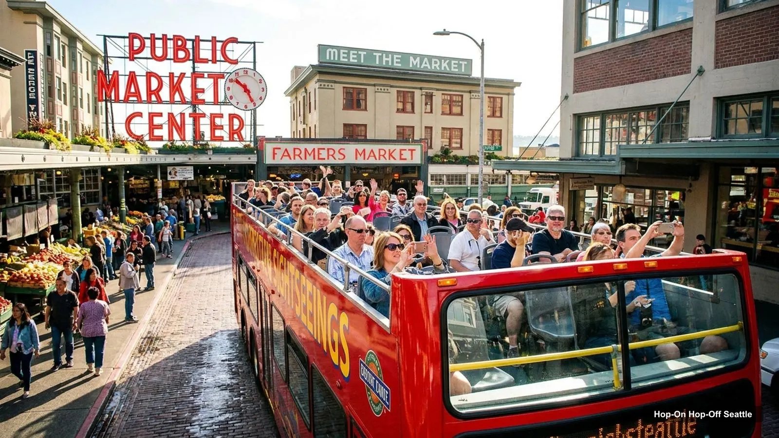
A Seattle tourist map makes more sense once you see downtown as three clusters on a hillside above Elliott Bay. I’ve put the top 20 attractions, ranked by Google Maps reviews, and the sightseeing bus stops on one page, with coordinates and a Google Maps link for each. The route image follows City Sightseeing’s loop. To pick the ticket that rides it, see my guide to hop on hop off in Seattle.
Distances below are straight-line figures computed from the coordinates, so real walking routes are longer, and Seattle’s hills make them slower. Ratings and review counts are Google Maps data, checked October 2026.
Seattle Sites Map: The Bus Route
The Seattle sites map below shows the sightseeing loop: 20 stops listed on GetYourGuide, from the Space Needle through the waterfront and Pioneer Square to Chinatown, downtown and Pike Place. The loop takes about 80 minutes without getting off. In autumn it runs every 30 minutes, 10am to 4pm, according to the listing.
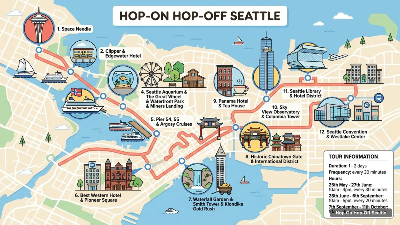
Stops on the route
- 1Space Needle
- 2Clipper & Edgewater Hotel
- 3Pier 66 Norwegian Cruise Lines
- 4Seattle Aquarium & The Great Wheel & Waterfront Park & Miners Landing
- 5Pier 54, 55 & Argosy Cruises
- 6Best Western Hotel & Pioneer Square
- 7Waterfall Garden & Smith Tower & Klondike Gold Rush
- 8Historic Chinatown Gate & International District
- 9Panama Hotel & Tea House
- 10Sky View Observatory & Columbia Tower
- 11Seattle Library & Hotel District
- 12Seattle Convention & Westlake Center
Bus stops on the main loop
These are the first 12 stops of the loop, in order. Stops 13 to 20 continue through Pike Place, the Gum Wall, the two Starbucks stops, Westlake Square and the Amazon Spheres.
| # | Stop | Map |
|---|---|---|
| 1 | Space Needle | Find on Google Maps |
| 2 | Clipper & Edgewater Hotel | Find on Google Maps |
| 3 | Pier 66 Norwegian Cruise Lines | Find on Google Maps |
| 4 | Seattle Aquarium & The Great Wheel & Waterfront Park & Miners Landing | Find on Google Maps |
| 5 | Pier 54, 55 & Argosy Cruises | Find on Google Maps |
| 6 | Best Western Hotel & Pioneer Square | Find on Google Maps |
| 7 | Waterfall Garden & Smith Tower & Klondike Gold Rush | Find on Google Maps |
| 8 | Historic Chinatown Gate & International District | Find on Google Maps |
| 9 | Panama Hotel & Tea House | Find on Google Maps |
| 10 | Sky View Observatory & Columbia Tower | Find on Google Maps |
| 11 | Seattle Library & Hotel District | Find on Google Maps |
| 12 | Seattle Convention & Westlake Center | Find on Google Maps |
Stop 18 relocates every Saturday from 6 June to 11 October because of road closures, to the front of the Via 6 building at the west corner of 6th and Lenora. The operator’s own site mentions 17 stops where the GetYourGuide listing says 20, so I follow the listing.
Seattle Tourist Attractions Map: Top 20 Sights with Coordinates
This is the Seattle tourist attractions map in table form, ranked by Google Maps reviews, with exact coordinates. Each link opens the place in Google Maps, where you can save it to a list before you travel.
| # | Sight | Rating | Reviews | Lat, Lng | Map |
|---|---|---|---|---|---|
| 1 | Pike Place Market | 4.6 | 80,142 | 47.6094, -122.3418 | Open in Google Maps |
| 2 | Space Needle | 4.6 | 59,730 | 47.6205, -122.3493 | Open in Google Maps |
| 3 | Seattle Center | 4.6 | 48,054 | 47.6206, -122.3505 | Open in Google Maps |
| 4 | Chihuly Garden and Glass | 4.7 | 25,305 | 47.6206, -122.3504 | Open in Google Maps |
| 5 | Seattle Aquarium | 4.3 | 23,926 | 47.6074, -122.3430 | Open in Google Maps |
| 6 | Kerry Park | 4.8 | 19,809 | 47.6295, -122.3599 | Open in Google Maps |
| 7 | Museum of Pop Culture | 4.5 | 19,456 | 47.6215, -122.3481 | Open in Google Maps |
| 8 | The Museum of Flight | 4.8 | 18,708 | 47.5185, -122.2969 | Open in Google Maps |
| 9 | The Gum Wall | 4.2 | 14,047 | 47.6084, -122.3403 | Open in Google Maps |
| 10 | The Seattle Great Wheel | 4.6 | 12,652 | 47.6061, -122.3425 | Open in Google Maps |
| 11 | Gas Works Park | 4.7 | 11,764 | 47.6456, -122.3344 | Open in Google Maps |
| 12 | Fremont Troll | 4.5 | 11,164 | 47.6511, -122.3475 | Open in Google Maps |
| 13 | Ballard (Hiram M. Chittenden) Locks | 4.7 | 10,345 | 47.6655, -122.3972 | Open in Google Maps |
| 14 | Olympic Sculpture Park | 4.5 | 9,569 | 47.6166, -122.3553 | Open in Google Maps |
| 15 | Discovery Park | 4.8 | 8,448 | 47.6613, -122.4171 | Open in Google Maps |
| 16 | Washington Park Arboretum | 4.8 | 8,299 | 47.6364, -122.2958 | Open in Google Maps |
| 17 | Pacific Science Center | 4.5 | 7,688 | 47.6200, -122.3516 | Open in Google Maps |
| 18 | Seattle Art Museum | 4.6 | 7,489 | 47.6075, -122.3380 | Open in Google Maps |
| 19 | Volunteer Park | 4.8 | 5,645 | 47.6311, -122.3164 | Open in Google Maps |
| 20 | International Fountain | 4.6 | 5,611 | 47.6225, -122.3520 | Open in Google Maps |
Seattle Center and the Space Needle are separate entries in the table, because Google lists them separately, but they are about 100 metres apart.
Seattle Landmarks Map: The Three Clusters
The Seattle landmarks map is easiest to read as clusters, because within each one you can walk between sights.
- Seattle Center: the Space Needle, Chihuly Garden and Glass, the Museum of Pop Culture, the Pacific Science Center and the International Fountain are all within about 200 metres of the Needle. Bus Stop 1 serves it.
- Waterfront and Pike Place: Pike Place Market, the Aquarium, the Great Wheel and the Gum Wall. The market is 240 metres from the Aquarium and 160 metres from the Gum Wall. Stops 4, 13 and 14 serve it.
- Pioneer Square: Smith Tower and the Klondike Gold Rush National Historical Park, about 280 metres apart. Stop 7 serves both. The Seattle Art Museum is about 360 metres from Pike Place.
Outside the clusters, Kerry Park is about 1.3 km from the Space Needle, Gas Works Park about 3 km, the Fremont Troll about 3.4 km, the Ballard Locks about 6 km and the Museum of Flight about 12 km. None are on the bus route.
Which Stop for Which Sight on the Seattle Tourism Map
On this Seattle tourism map, the sights that sit on a named stop are the Space Needle (Stop 1), the Aquarium, Great Wheel and Waterfront Park (Stop 4), Smith Tower and the Klondike Gold Rush museum (Stop 7), Chinatown (Stop 8), Pike Place (Stop 13) and the Gum Wall (Stop 14). Chihuly and MoPOP are a short walk from Stop 1.
| Sight | Stop | Note |
|---|---|---|
| Space Needle | 1 | Stop is named for it |
| Chihuly Garden and Glass | 1 | About 90 metres on foot |
| Museum of Pop Culture | 1 | About 140 metres on foot |
| Seattle Aquarium | 4 | Named on the stop |
| Seattle Great Wheel | 4 | Named on the stop |
| Smith Tower | 7 | Named on the stop |
| Pike Place Market | 13 | Also Stops 16 and 17 for the original Starbucks |
| The Gum Wall | 14 | Shares the stop with Pike Brewing |
Seattle Tour Map: One Route to Learn
Both tickets I found use the same City Sightseeing route, so there is one Seattle tour map to learn. The operator has a live bus map on its own site, and the app that comes with the ticket shows real-time bus tracking and when the next bus arrives. Use it, because some reviewers said it was not always clear where to get back on.
Seattle Tourist Map Printable and PDF
For a printable Seattle tourist map, print this page, or save the Google Maps links above to a list. I don’t host the operator’s PDF, and I’d rather send you to the current version than risk an out-of-date copy. The operator’s site and the ticket voucher have the official one.
Seattle Tourist Map with Light Rail
The Seattle tourist map with transit is simple downtown: Sound Transit’s Link light rail lists an adult fare of $3.00 one-way, and riders aged 18 and under ride free on Sound Transit services. Official details are on Sound Transit’s fares page. I don’t have station coordinates in my data, so I can’t tell you which station is closest to each sight. Use the Google Maps links above to check.
Seattle Tourist Map Walking Tips
Walk the clusters and ride between them. Seattle Center to Pike Place is about 1.35 km in a straight line, and the streets between climb and fall. The waterfront cluster is flat by comparison. If you have limited mobility, the bus is useful for the hilly links, though one reviewer using a mobility scooter said the wheelchair-accessible label did not match their experience.
Seattle Tourist Guide: Parks and Viewpoints on the Map
Several of the highest-rated places in the table are green spaces rather than museums. Kerry Park (4.8), Discovery Park (4.8), Washington Park Arboretum (4.8), Volunteer Park (4.8) and Gas Works Park (4.7) all score at or above the big downtown names. Discovery Park lies about 6.8 km from the Space Needle, the Arboretum about 4.4 km and Volunteer Park about 2.7 km. They are outside the bus loop, so on this map they are the places where you plan your own transit and give them a half day each.
Seattle Visitor Map: Museums Worth Adding
If you have time beyond the top 20, my data also lists the Seattle Art Museum (4.6 from 7,489 reviews), the Museum of History and Industry (4.6 from 2,021), the Frye Art Museum (4.6 from 1,864), the Wing Luke Museum (4.6 from 800) and the Burke Museum (4.5 from 1,190). The Seattle Art Museum and the Klondike Gold Rush museum are the two that sit nearest the bus stops. For the rest, use the Google Maps links in the table style above and check each museum’s own site for hours and tickets, which I don’t have.
Which Ticket Covers This Map
The $65 bus ticket covers the whole loop, and the $109 ticket adds one cruise. For ideas on how to use the map across several days, see my Seattle itinerary, and for what to do at each place, my guide to the best things to do in Seattle. For a full comparison of the two tickets, go back to my Seattle bus tour guide, or the homepage.
Frequently asked questions
Is there a printable Seattle tourist map?
This page works as one. The route image shows the sightseeing bus loop with numbered stops, and the tables below list 12 bus stops and the top 20 attractions with coordinates. Print the page, or open any Google Maps link and save the places to a list on your phone for offline use.
Where are most Seattle attractions on the map?
In three clusters. Seattle Center has the Space Needle, Chihuly Garden and Glass and the Museum of Pop Culture. The waterfront and Pike Place has the Aquarium, the Great Wheel and the market. Pioneer Square has Smith Tower and the Klondike Gold Rush museum. Parks like Kerry Park and Gas Works Park lie outside them.
How far apart are the main Seattle sights?
The Space Needle is about 1.35 km from Pike Place Market in a straight line. Pike Place to the Aquarium is about 240 metres, and the Aquarium to the Great Wheel about 140 metres. Pike Place to Smith Tower is about 1.1 km. Distances are computed from the coordinates in the table below.
Tours I compared in Seattle
My full review of each one, in the order I rank them:
- Seattle: City Sightseeing Hop-On Hop-Off Bus Tour★ 3.9 · from $65
- City Sightseeing Seattle Hop-On Hop-Off Bus Tour + Cruise★ 3.4 · from $109