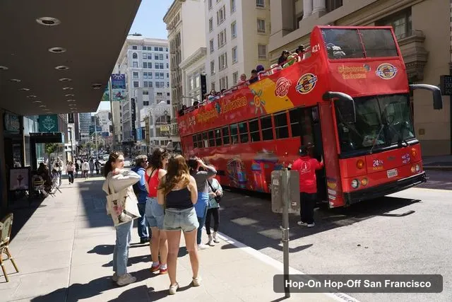
San Francisco Deluxe Sightseeing Tours
San Francisco’s only Full city Hop on Hop off Bus tour
- 4.0 (931 reviews)
- 2-day ticket
My pick: Covers the most stops on this map: 20, from Fisherman's Wharf to Golden Gate Park, for $49.
By Jake Dawson · Updated · Affiliate links, explained in my disclosure
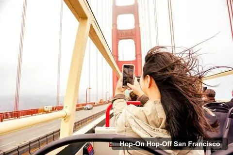
Big Bus Sightseeing - San Francisco
San Francisco: Hop-On Hop-Off Sightseeing Tour with 17 Stops
4.6 (4,121) · from $56.10
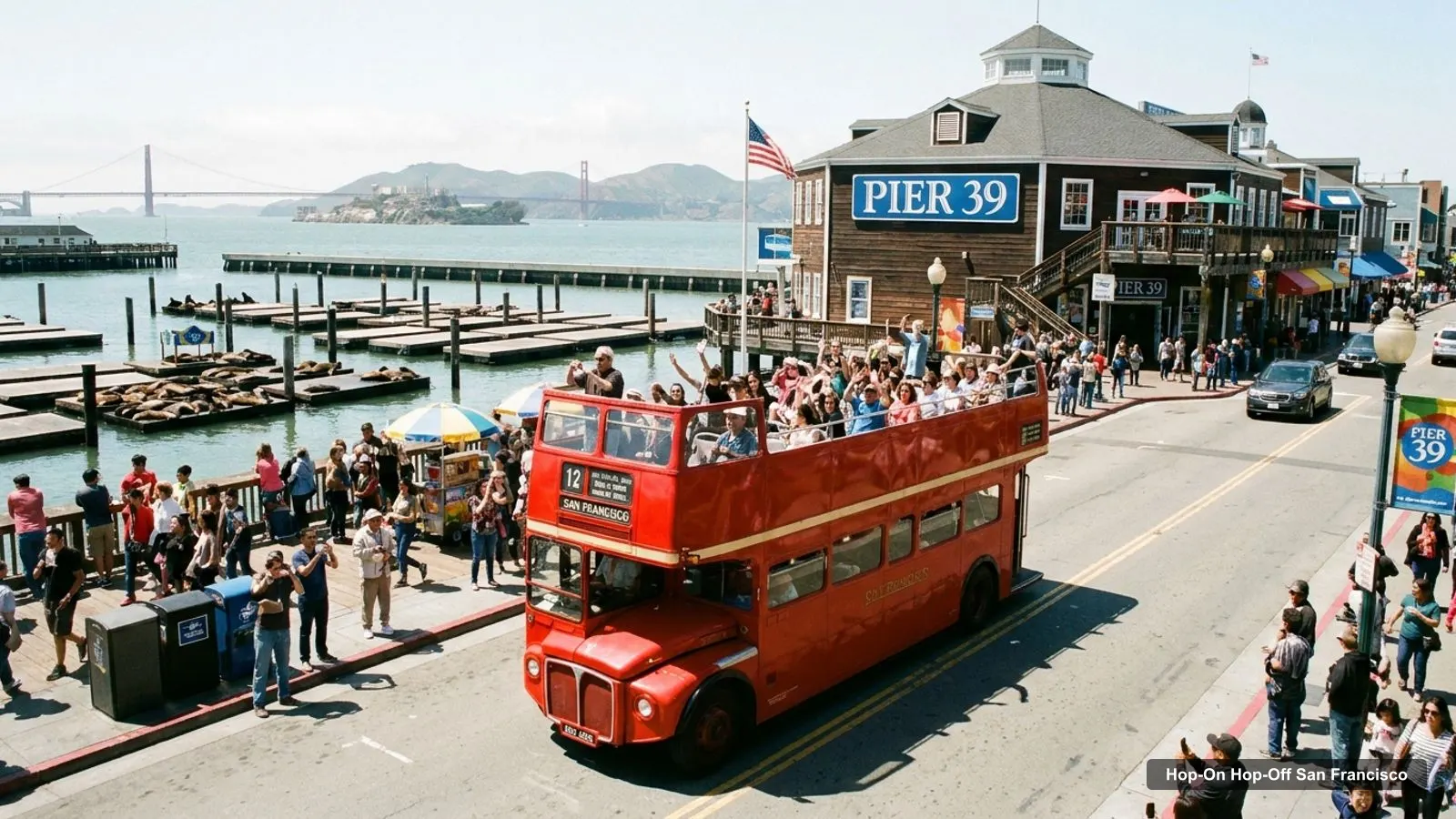
A San Francisco tourist map makes more sense once you see the city as a few clusters around the bay. I’ve put the top 20 attractions (ranked by Google Maps reviews) and the main sightseeing bus stops on one page, with coordinates and a Google Maps link for each. The route image follows Big Bus’s main loop. To pick the ticket that rides it, see my comparison of hop-on hop-off in San Francisco.
The San Francisco tour map below shows the first 12 stops of Big Bus’s main loop, from the visitors center at 99 Jefferson Street through North Beach, Chinatown and downtown to the Golden Gate Bridge and the Marina. After the Marina, the loop continues to Lombard Street, Pier 35 and Pier 39 before returning to the start. Buses run every 15 minutes, the first tour leaves at 10am and the last at 5pm.
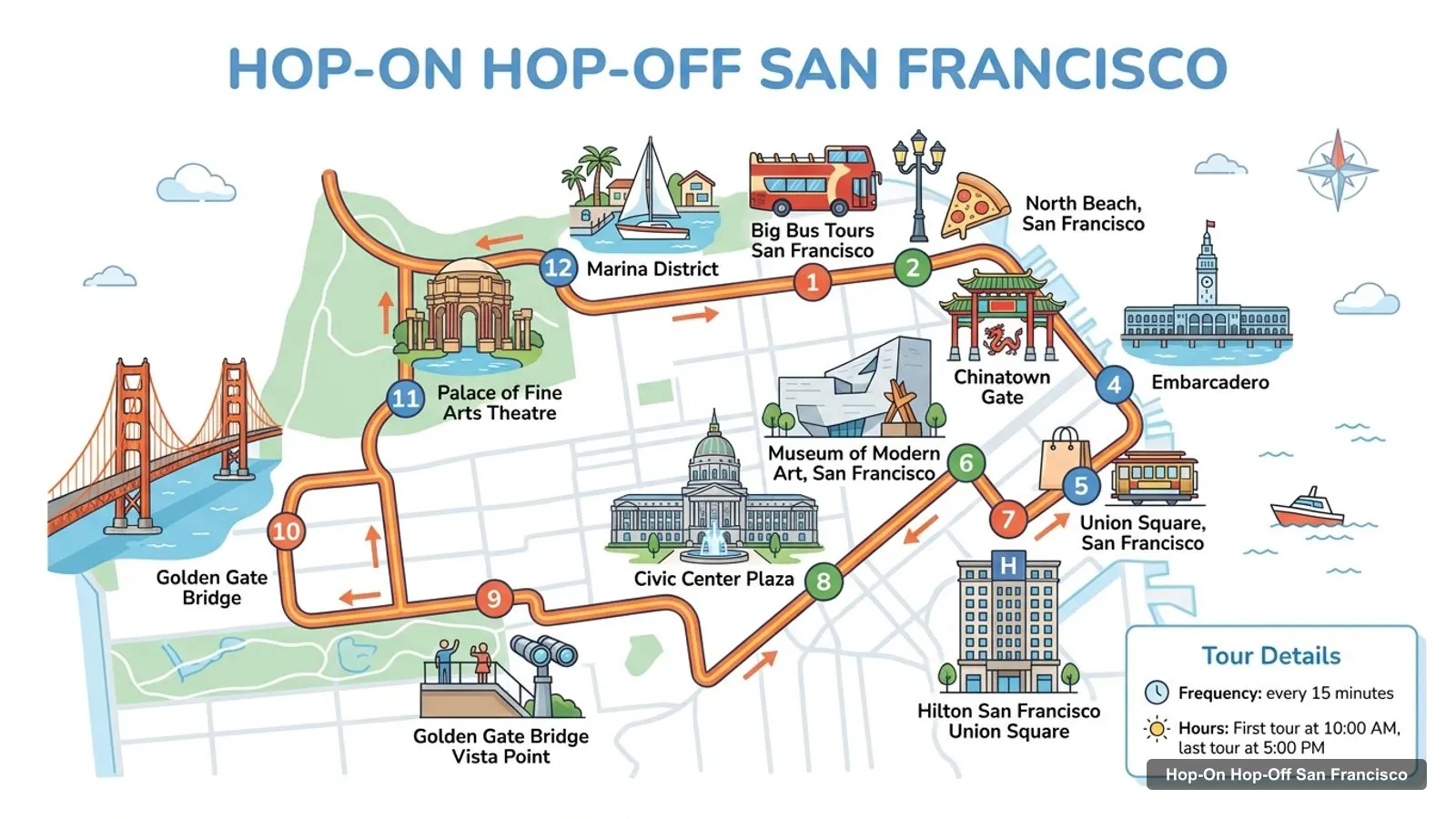
Stops on the route
| # | Stop | Map |
|---|---|---|
| 1 | Big Bus Tours San Francisco | Find on Google Maps |
| 2 | North Beach, San Francisco | Find on Google Maps |
| 3 | Chinatown Gate | Find on Google Maps |
| 4 | Embarcadero | Find on Google Maps |
| 5 | Union Square, San Francisco | Find on Google Maps |
| 6 | Museum of Modern Art, San Francisco | Find on Google Maps |
| 7 | Hilton San Francisco Union Square | Find on Google Maps |
| 8 | Civic Center Plaza | Find on Google Maps |
| 9 | Golden Gate Bridge Vista Point | Find on Google Maps |
| 10 | Golden Gate Bridge | Find on Google Maps |
| 11 | Palace of Fine Arts Theatre | Find on Google Maps |
| 12 | Marina District | Find on Google Maps |
The other operators draw longer maps. San Francisco Deluxe Sightseeing lists 20 stops, City Sightseeing 18 and Big Bus’s bundle loops 17, adding Alamo Square, Haight-Ashbury and Golden Gate Park. The table above is the core loop most visitors ride first.
These are the San Francisco tourist attractions in table form, ranked by Google Maps reviews, with exact coordinates. Each link opens the place in Google Maps, where you can save it to a list before you travel. I’ve left out tour company offices.
| # | Attraction | Coordinates | Google rating | Map |
|---|---|---|---|---|
| 1 | PIER 39 | 37.80867, -122.40982 | 4.6 (138,928) | Open in Google Maps |
| 2 | Golden Gate Bridge | 37.81991, -122.47856 | 4.8 (85,395) | Open in Google Maps |
| 3 | Alcatraz Island | 37.82698, -122.42296 | 4.7 (45,313) | Open in Google Maps |
| 4 | Golden Gate Park | 37.76892, -122.48298 | 4.8 (44,782) | Open in Google Maps |
| 5 | Union Square | 37.78794, -122.40751 | 4.4 (37,508) | Open in Google Maps |
| 6 | The Painted Ladies | 37.77625, -122.43276 | 4.4 (28,435) | Open in Google Maps |
| 7 | San Francisco Museum of Modern Art | 37.78572, -122.40105 | 4.6 (16,740) | Open in Google Maps |
| 8 | Coit Tower | 37.80239, -122.40582 | 4.6 (16,055) | Open in Google Maps |
| 9 | San Francisco Zoo | 37.73294, -122.50283 | 4.4 (14,439) | Open in Google Maps |
| 10 | Fisherman’s Wharf | 37.80844, -122.41575 | 4.6 (13,386) | Open in Google Maps |
| 11 | Chinatown San Francisco | 37.79398, -122.40808 | 4.3 (11,266) | Open in Google Maps |
| 12 | de Young Museum | 37.77147, -122.46868 | 4.6 (9,885) | Open in Google Maps |
| 13 | Exploratorium | 37.80166, -122.39735 | 4.7 (8,767) | Open in Google Maps |
| 14 | Musée Mécanique | 37.80930, -122.41597 | 4.7 (8,531) | Open in Google Maps |
| 15 | San Francisco Botanical Garden | 37.76771, -122.46931 | 4.8 (8,130) | Open in Google Maps |
| 16 | Cable Car Museum | 37.79464, -122.41151 | 4.7 (7,187) | Open in Google Maps |
| 17 | California Academy of Sciences | 37.76986, -122.46609 | 4.6 (6,456) | Open in Google Maps |
| 18 | Crissy Field | 37.80403, -122.46502 | 4.7 (6,224) | Open in Google Maps |
| 19 | USS San Francisco Memorial | 37.78284, -122.51162 | 4.7 (5,694) | Open in Google Maps |
| 20 | Legion of Honor | 37.78447, -122.50084 | 4.8 (5,288) | Open in Google Maps |
Read the coordinates above and you’ll see four groups on the San Francisco tourism map:
The Legion of Honor, the USS San Francisco Memorial and the zoo are further out on the western edge. Plan one cluster per half day and you won’t waste time crossing the city. My best things to do in San Francisco guide covers each place in detail.
The San Francisco travel map gets easier once you know which stop serves which sight. Here’s how the main attractions line up with the bus stops in the operators’ listings:
Each sightseeing bus company draws its own San Francisco tourist map, and the routes differ more than the brochures suggest. Big Bus’s 17-stop ticket runs the loop plotted above and crosses the bridge. Its bundles add Red and Yellow loops through Alamo Square, Haight-Ashbury and Golden Gate Park. San Francisco Deluxe Sightseeing has the longest stop list in my data at 20, adding Ghirardelli, Fort Mason and three stops in Golden Gate Park, every 25 minutes from 10am to 5:30pm. City Sightseeing lists 18 stops starting at Union Square, with three in the park, every 30 to 45 minutes. Skyline lists its stops more loosely, from Fisherman’s Wharf and Union Square to Haight-Ashbury and Golden Gate Park. If one sight on this map is a must for you, check that your operator stops there before you book.
For San Francisco tourist information, there are two useful kinds of desk. The bus companies run their own: the Big Bus Visitors Center at 99 Jefferson Street, on the corner of Mason Street, is where you exchange vouchers and where Skyline’s tours start too. San Francisco Deluxe Sightseeing has a booking office at 2735 Taylor Street. For official city information, events and the San Francisco tourist information center, the city’s tourism board is San Francisco Travel. For Alcatraz, the official source is the National Park Service.
If you want a printable San Francisco tourist map, print this page: the route image and the two tables fit on a few sheets and keep the stop numbers next to the sights. For a PDF, use your browser’s “Print to PDF” option, which keeps the Google Maps links clickable on a phone or tablet. I’d also save the 20 attractions to a starred list in Google Maps. It takes two minutes with the links above, and the list works offline once the area is downloaded.
Between bus stops, the city’s own transport fills the gaps. The historic cable cars climb the hills between Union Square, Chinatown and the wharf, and the Cable Car Museum on Mason Street (4.7, 7,187 reviews) sits on the line. Muni buses and streetcars reach places no sightseeing route covers, like the zoo. Routes and fares are on the San Francisco Municipal Transportation Agency site. If you’re walking, the Embarcadero along the waterfront is flat. Most of the rest of the city isn’t, which is worth knowing before you plan a walk from North Beach up to Coit Tower.
San Francisco Deluxe Sightseeing covers the most of this San Francisco tourist map in my data, with 20 stops including Golden Gate Park, Alamo Square and Ghirardelli, and a live guide on board. Big Bus has fewer stops on its plain ticket but the most reviews and the most frequent buses. To fit the stops into days, see my San Francisco itinerary for 1, 2 and 3 days. For the bus tour I’d book in San Francisco on this route, see my San Francisco sightseeing bus comparison, and the rest of my city maps start from the homepage.
San Francisco Deluxe Sightseeing Tours
My pick: Covers the most stops on this map: 20, from Fisherman's Wharf to Golden Gate Park, for $49.
This page works as one: the route map image shows the sightseeing bus loop with numbered stops, and the tables below list the top 20 attractions and 12 bus stops with coordinates. Print the page, or open any Google Maps link to save the places to your phone for offline use.
In four areas. The waterfront has PIER 39, Fisherman's Wharf and Coit Tower, with Alcatraz offshore. Downtown has Union Square, Chinatown and SFMOMA. The Presidio has the Golden Gate Bridge, Crissy Field and Fort Point. Golden Gate Park, on the west side, has the de Young, the California Academy of Sciences and the Botanical Garden.
By my calculation from the coordinates, PIER 39 to Union Square is about 2.3 km in a straight line, and PIER 39 to the Golden Gate Bridge about 6.2 km. Union Square to the Golden Gate Bridge is about 7.2 km. Those long western legs, plus the hills, are where a bus saves the most time.
My full review of each one, in the order I rank them: