San Diego Tourist Map: Top Attractions & Bus Stops
By Jake Dawson · Updated · Affiliate links, explained in my disclosure
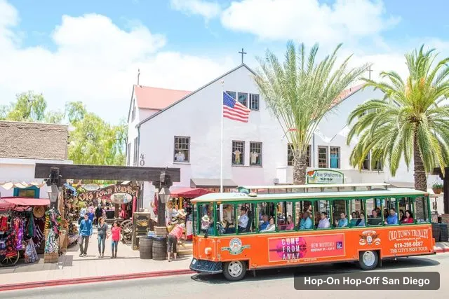
Historic Tours of America - San Diego
San Diego: Hop-on Hop-off Narrated Trolley Tour
4.7 (1,549) · from $57
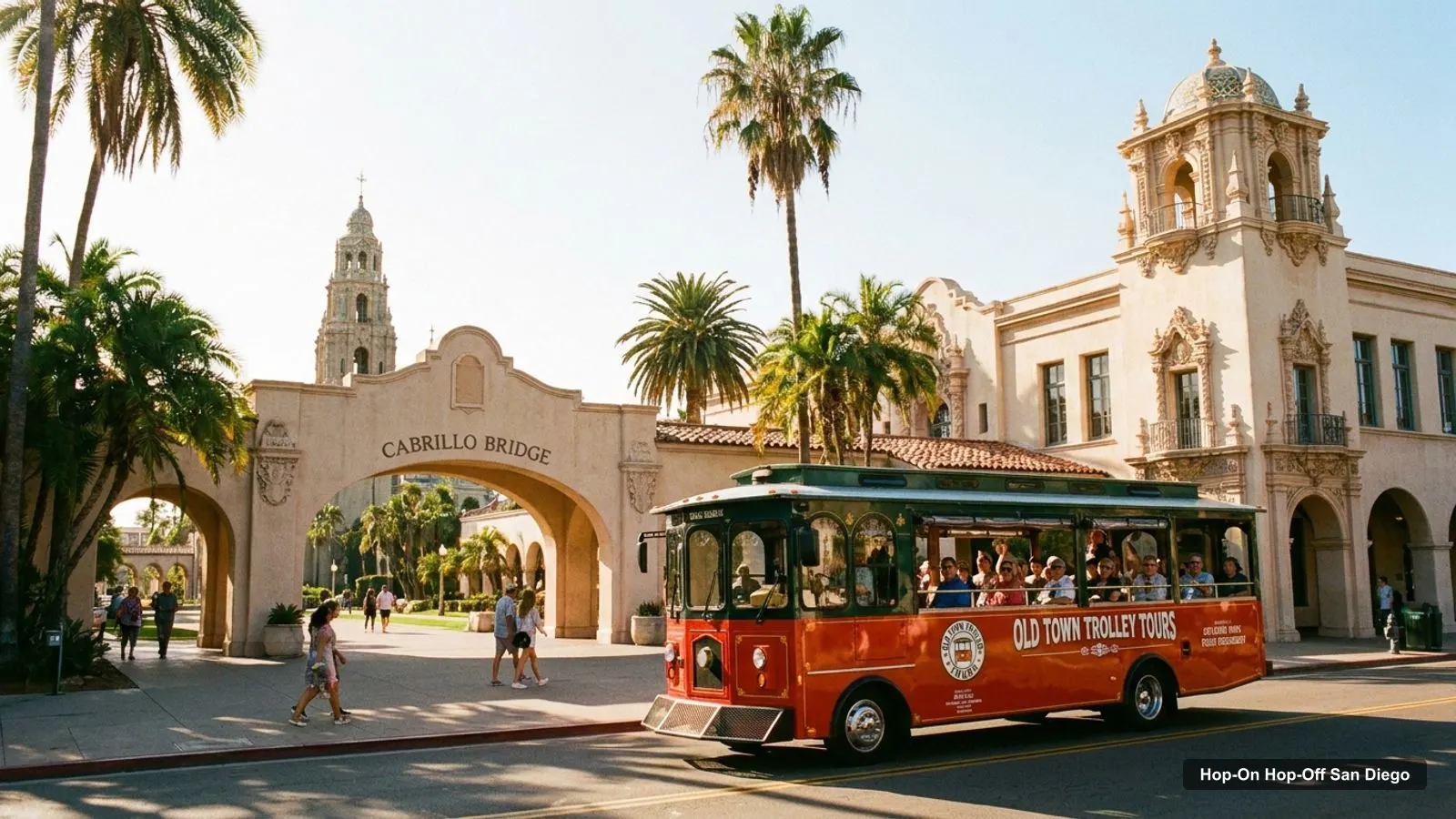
A San Diego tourist map makes more sense once you see the city as five areas. I’ve put the top 20 attractions, ranked by Google Maps reviews, and the 12 trolley stops on one page, with coordinates and a Google Maps link for each. The route image follows the Old Town Trolley loop. To pick the ticket that rides it, see my review of hop-on hop-off in San Diego.
San Diego Sightseeing Map: The Trolley Route
The San Diego sightseeing map below shows the loop: 12 stops lettered A to L, from Old Town State Historic Park through the harbor and downtown to Coronado, Balboa Park and Little Italy. Trolleys leave Old Town every 20 minutes from 9:00 AM. The last departure from Old Town is 4:00 PM from March 13 to October 29 and 3:00 PM from October 30 to March 12.
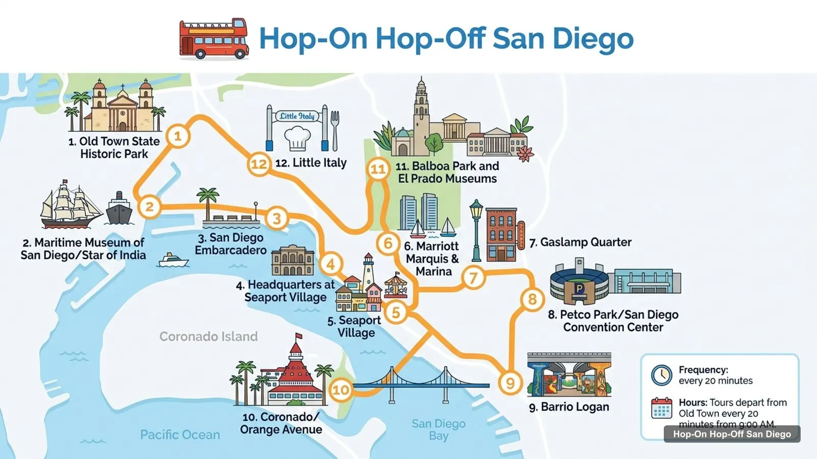
Stops on the route
- 1Old Town State Historic Park
- 2Maritime Museum of San Diego/Star of India
- 3San Diego Embarcadero
- 4Headquarters at Seaport Village
- 5Seaport Village
- 6Marriott Marquis & Marina
- 7Gaslamp Quarter
- 8Petco Park/San Diego Convention Center
- 9Barrio Logan
- 10Coronado/Orange Avenue
- 11Balboa Park and El Prado Museums
- 12Little Italy
Trolley stops on the loop
| Stop | Name | Address on the listing | Map |
|---|---|---|---|
| A | Old Town State Historic Park | 4010 Twiggs St & San Diego Ave. | Find on Google Maps |
| B | Maritime Museum of San Diego/Star of India | 1492 N Harbor Dr | Find on Google Maps |
| C | San Diego Embarcadero | 1004 N. Harbor Dr | Find on Google Maps |
| D | Headquarters at Seaport Village | 789 W Harbor Dr | Find on Google Maps |
| E | Seaport Village | 825 W Harbor Dr | Find on Google Maps |
| F | Marriott Marquis & Marina | 333 W Harbor Dr | Find on Google Maps |
| G | Gaslamp Quarter | 480 4th Ave | Find on Google Maps |
| H | Petco Park/San Diego Convention Center | 855 E Harbor Dr | Find on Google Maps |
| I | Barrio Logan | 1113 E. Cesar Chavez Pkwy | Find on Google Maps |
| J | Coronado/Orange Avenue | 1107 Orange Ave | Find on Google Maps |
| K | Balboa Park and El Prado Museums | 2175 Presidents Way | Find on Google Maps |
| L | Little Italy | 1605 India St | Find on Google Maps |
Stops D and E are both at Seaport Village, which is why some descriptions of this route count 11 stops. The listing counts 12 boarding points, and I follow the listing. The operator also publishes a real-time tracking map, which I’d open on your phone.
San Diego Tourist Attractions: Top 20 Sights with Coordinates
This is the San Diego tourist attractions list, ranked by number of Google Maps reviews. I’ve left out the trolley operator’s own entries and anything that is not a sight. The coordinates and links come from the Google Maps data I collected for this site, and the table was generated by a script, not typed by hand.
| # | Attraction | Coordinates | Google rating | Map |
|---|---|---|---|---|
| 1 | Balboa Park | 32.73415, -117.14455 | 4.8 (79,510) | Open in Google Maps |
| 2 | San Diego Zoo | 32.73604, -117.15098 | 4.7 (67,465) | Open in Google Maps |
| 3 | SeaWorld San Diego | 32.76430, -117.22644 | 4.4 (54,875) | Open in Google Maps |
| 4 | USS Midway Museum | 32.71374, -117.17513 | 4.8 (53,328) | Open in Google Maps |
| 5 | Seaport Village | 32.70906, -117.17094 | 4.6 (32,561) | Open in Google Maps |
| 6 | Old Town San Diego State Historic Park | 32.75491, -117.19764 | 4.7 (31,889) | Open in Google Maps |
| 7 | Mission Bay Park | 32.76411, -117.22626 | 4.6 (25,175) | Open in Google Maps |
| 8 | Belmont Park | 32.77067, -117.25162 | 4.6 (18,086) | Open in Google Maps |
| 9 | Cabrillo National Monument | 32.67226, -117.24161 | 4.8 (12,842) | Open in Google Maps |
| 10 | Japanese Friendship Garden & Museum | 32.73009, -117.15006 | 4.6 (10,451) | Open in Google Maps |
| 11 | Waterfront Park | 32.72228, -117.17276 | 4.7 (10,004) | Open in Google Maps |
| 12 | Mission Beach Park | 32.76812, -117.25205 | 4.7 (7,525) | Open in Google Maps |
| 13 | San Diego Air & Space Museum | 32.72623, -117.15437 | 4.6 (6,160) | Open in Google Maps |
| 14 | Maritime Museum of San Diego | 32.72094, -117.17399 | 4.7 (5,486) | Open in Google Maps |
| 15 | Fleet Science Center | 32.73080, -117.14696 | 4.5 (4,493) | Open in Google Maps |
| 16 | Old Town San Diego | 32.75583, -117.19726 | 4.7 (3,674) | Open in Google Maps |
| 17 | San Diego Natural History Museum | 32.73232, -117.14736 | 4.6 (3,538) | Open in Google Maps |
| 18 | The New Children’s Museum | 32.71067, -117.16519 | 4.4 (3,465) | Open in Google Maps |
| 19 | Spruce Street Suspension Bridge | 32.73877, -117.16602 | 4.7 (3,062) | Open in Google Maps |
| 20 | Old Point Loma Lighthouse | 32.67202, -117.24098 | 4.8 (2,996) | Open in Google Maps |
Of the 20 places, the trolley stops at or beside Balboa Park, Seaport Village, Old Town State Historic Park, Old Town San Diego, the Maritime Museum and the Gaslamp Quarter. The El Prado museums in Balboa Park (the Fleet Science Center, the Natural History Museum and the San Diego Museum of Art) share stop K with the park. The USS Midway Museum is a short walk from the Embarcadero stop (C), which is at 1004 N. Harbor Dr.
San Diego Tourist Attractions Map: The Five Areas
The San Diego tourist attractions map is easier to read as five clusters. Distances below are straight lines between map pins, so real walking and driving distances are longer.
- Old Town (north): Old Town State Historic Park, the Whaley House Museum (0.4 km away), the Mormon Battalion Historic Site (0.3 km) and Presidio Park (0.5 km). Trolley stop A.
- Harbor and downtown (southwest): the USS Midway, the Maritime Museum, Seaport Village, Waterfront Park, Tuna Harbor Park and the Gaslamp Quarter. The Midway to Seaport Village is 0.7 km and Seaport Village to the Gaslamp Quarter 1.0 km. Stops B to H.
- Balboa Park (inland): the park, the zoo (0.6 km from the Balboa Park pin), the Japanese Friendship Garden (0.3 km from the Fleet Science Center) and the museums on El Prado. Trolley stop K.
- Mission Bay and the beaches (northwest): SeaWorld, Mission Bay Park, Belmont Park and Mission Beach. SeaWorld to Belmont Park is 2.5 km. None are on the trolley route.
- Point Loma (southwest): Cabrillo National Monument and the Old Point Loma Lighthouse, 11.4 km from Balboa Park and 7.7 km from the USS Midway. Not on the route.
Which Trolley Stop for Which Sight
If you want to plan from the map, match the sight to the stop. For Old Town, use A. For the Maritime Museum and the Star of India, use B. For the USS Midway, get off at the Embarcadero, C. For Seaport Village, use D or E. For the Gaslamp Quarter, use G. For Petco Park and the Convention Center, use H. For Coronado, use J, and for Balboa Park and the El Prado museums, use K. Little Italy is L.
Barrio Logan (stop I, 1113 E. Cesar Chavez Pkwy) is the one stop with no attraction in my top 20. If you want a break from the main sights, it is the easiest way to see a different part of the city.
San Diego Tourist Guide: How I’d Read This Map
My tourist guide to the map is short. Pick one cluster per half day. The harbor cluster is walkable, Balboa Park is a half day in itself, and Coronado needs the trolley across the bridge. The mismatch between the clusters is why a trolley pass helps: the harbor and Balboa Park are 3.7 km apart, and Old Town and Balboa Park about 5.5 km. For sight details, my guide to the best things to do in San Diego ranks them. For a day-by-day plan, use my San Diego itinerary.
San Diego Tourist Information
For official information, the San Diego Tourism Authority lists its office at 401 B Street, Suite 1700, San Diego, CA 92101, with a separate page for visitor centers and their hours. For Old Town, the California State Parks page has the park’s details, and the National Park Service page for Cabrillo covers the monument. For public transport, San Diego MTS publishes its own maps and fares.
San Diego Tourist Information Center: What to Ask
If you stop at a visitor center, ask two things: whether any trolley stops are closed for events, and what the latest departure is that day. The trolley listing says there are no tours on Thanksgiving Day or Christmas Day. In October, kids 12 and under ride free with a paying adult.
San Diego Map Walking Tips
A San Diego tourist map flatters walking, because the pins look close. Use the numbers instead. Walk when the gap is under about 1 km: the USS Midway to Seaport Village (0.7 km), Seaport Village to the Gaslamp Quarter (1.0 km), the Gaslamp Quarter to the Museum of Illusions (0.1 km), and Old Town State Historic Park to the Whaley House (0.4 km). Ride when the gap is over 3 km: the harbor to Balboa Park (3.7 km) and Old Town to the Gaslamp Quarter (5.9 km).
These are straight-line figures from the coordinates in the table, so a real route will be longer, especially where the harbor and freeways force detours. I haven’t timed any walk, so open the Google Maps link for the exact walking time on the day.
Using This San Diego Map Offline
The Google Maps links in both tables open a search for the place, which you can save to a list on your phone. If you have patchy data, save the 12 trolley stops first, then the five or six sights you care about. The operator’s tracking map needs a connection, so download a Google Maps offline area for downtown, Balboa Park and Old Town before you start.
Which Ticket Covers This Map?
Only one product in my data covers the loop, and it covers every stop listed above. The pass is $57 on GetYourGuide, valid for 1 or 2 days, with 4.71 stars from 1,549 reviews. Read my full page on the Old Town Trolley pass for the rules, or go back to the homepage for other cities.
Frequently asked questions
Is there a printable San Diego tourist map?
This page works as one. The route image shows the 12-stop trolley loop with letters A to L, and the tables list the stops and the top 20 attractions with coordinates. Print the page, or open any Google Maps link and save the place to your phone for offline use.
Where are most San Diego attractions on the map?
They fall into five areas: Old Town in the north, the harbor and Gaslamp downtown, Balboa Park inland, the Mission Bay and beach area to the northwest, and Point Loma to the southwest. Balboa Park and the harbor are about 3.7 km apart, which is where the trolley saves the most time.
How far apart are the main San Diego sights?
Seaport Village to the Gaslamp Quarter is about 1.0 km, Balboa Park to the Gaslamp Quarter about 2.9 km, and Old Town to Balboa Park about 5.5 km, all in a straight line. Cabrillo National Monument is 11.4 km from Balboa Park, and SeaWorld is 8.4 km.
Where is the San Diego tourist information center?
The San Diego Tourism Authority lists its office at 401 B Street, Suite 1700, San Diego, CA 92101, phone 619.232.3101. That is an office address, and its site has a separate page for visitor centers and their hours, so check the hours there before you go.
Tours I compared in San Diego
My full review of each one, in the order I rank them:
- San Diego: Hop-on Hop-off Narrated Trolley Tour★ 4.7 · from $57