HopOn HopOff Holland
From Rotterdam: Luxury Bus Tour with Keukenhof Ticket
- 4.4 (158 reviews)
- 6 hours
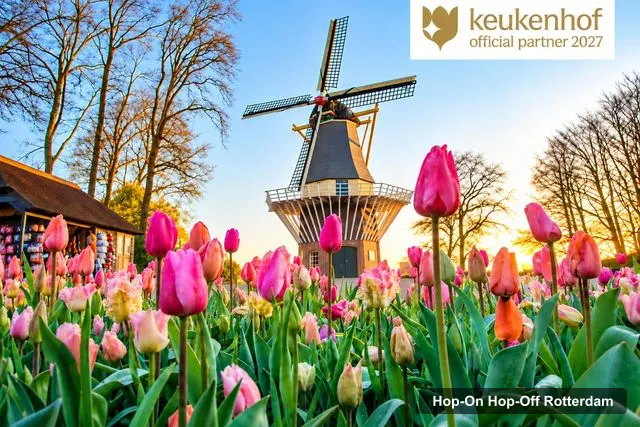
My pick: Not a city loop: a six-hour coach to Keukenhof from the cruise terminal or Central Station, $66.98 with entry included.
By Jake Dawson · Updated · Affiliate links, explained in my disclosure
HopOn HopOff Holland
From Rotterdam: Luxury Bus Tour with Keukenhof Ticket
4.4 (158) · from $66.98
A Rotterdam tourist map is easier to use when it shows where the sights cluster and where you get on a bus. This page does both as far as my data allows. There is no confirmed hop-on hop-off loop, so the “bus stops” in the title are the three points of the only coach I can offer, the Keukenhof tour from my hop-on hop-off Rotterdam page.
Distances in the top-20 table are straight lines from Rotterdam Central Station, taken at 51.9240, 4.4697 from OpenStreetMap geocoding. Ratings and review counts come from Google Maps, fetched in October 2026. Walking times, where I give them, come from OpenStreetMap foot routing fetched 8 October 2026.
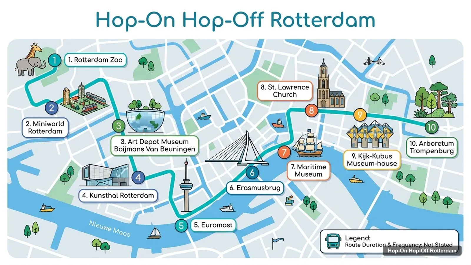
The Rotterdam tourist attractions map below numbers ten of the best-reviewed sights, from Rotterdam Zoo in the north-west to Trompenburg Arboretum in the east. It is a sightseeing map, not an official route.
Stops on the route
| # | Sight | Map |
|---|---|---|
| 1 | Rotterdam Zoo | Find on Google Maps |
| 2 | Miniworld Rotterdam | Find on Google Maps |
| 3 | Art Depot Museum Boijmans Van Beuningen | Find on Google Maps |
| 4 | Kunsthal Rotterdam | Find on Google Maps |
| 5 | Euromast | Find on Google Maps |
| 6 | Erasmusbrug | Find on Google Maps |
| 7 | Maritime Museum | Find on Google Maps |
| 8 | St. Lawrence Church | Find on Google Maps |
| 9 | Kijk-Kubus Museum-house | Find on Google Maps |
| 10 | Arboretum Trompenburg | Find on Google Maps |
The coach in my data has three points. Rotterdam Central Station departures at 9:00 and 12:00 are listed at Conradstraat, though reviewers describe a bus loop and one was told the stop was GG, so read the voucher email carefully. The cruise terminal departures are 8:30 and 11:30.
| Point | Role | Map |
|---|---|---|
| Rotterdam Cruise Terminal | Pickup and drop-off | Find on Google Maps |
| Rotterdam Central Station, Conradstraat | Pickup and drop-off | Find on Google Maps |
| Keukenhof, Stationsweg 166a, Lisse | Destination | Find on Google Maps |
The 20 most-reviewed sights in Rotterdam, from Google Maps, are below. I left out the Rivièrahal, which is part of the Zoo, and a tour operator that appeared in the places search. The coordinates are those Google returns for each place, and the last column links straight to it.
| # | Sight | Rating | Reviews | Lat, Lng | From Central Station (straight line) | Map |
|---|---|---|---|---|---|---|
| 1 | Rotterdam Zoo | 4.6 | 40,517 | 51.92816, 4.44403 | 1.8 km | Open in Google Maps |
| 2 | Kijk-Kubus Museum-house | 4.4 | 23,306 | 51.92019, 4.49057 | 1.5 km | Open in Google Maps |
| 3 | Euromast | 4.4 | 21,460 | 51.90544, 4.46664 | 2.1 km | Open in Google Maps |
| 4 | Erasmusbrug | 4.7 | 16,721 | 51.90900, 4.48712 | 2.1 km | Open in Google Maps |
| 5 | Kunsthal Rotterdam | 4.4 | 8,473 | 51.91082, 4.47369 | 1.5 km | Open in Google Maps |
| 6 | Maritime Museum | 4.3 | 7,338 | 51.91756, 4.48223 | 1.1 km | Open in Google Maps |
| 7 | Art Depot Museum Boijmans Van Beuningen | 4.4 | 5,998 | 51.91381, 4.47106 | 1.1 km | Open in Google Maps |
| 8 | Miniworld Rotterdam | 4.4 | 4,292 | 51.92282, 4.46516 | 0.3 km | Open in Google Maps |
| 9 | St. Lawrence Church | 4.5 | 3,493 | 51.92147, 4.48488 | 1.1 km | Open in Google Maps |
| 10 | Arboretum trompenburg | 4.6 | 3,123 | 51.91909, 4.51865 | 3.4 km | Open in Google Maps |
| 11 | Nederlands Fotomuseum, the Dutch National Museum of Photography | 4.2 | 2,717 | 51.90280, 4.49513 | 2.9 km | Open in Google Maps |
| 12 | FENIX | 4.7 | 2,353 | 51.90215, 4.48419 | 2.6 km | Open in Google Maps |
| 13 | Wereldmuseum Rotterdam | 4.3 | 2,042 | 51.90791, 4.48040 | 1.9 km | Open in Google Maps |
| 14 | Dutch Pinball Museum | 4.8 | 2,029 | 51.90803, 4.44886 | 2.3 km | Open in Google Maps |
| 15 | The Rotterdam | 4.6 | 1,965 | 51.90672, 4.48817 | 2.3 km | Open in Google Maps |
| 16 | Natural History Museum Rotterdam | 4.3 | 1,818 | 51.91079, 4.47255 | 1.5 km | Open in Google Maps |
| 17 | Museumpark | 4.5 | 1,163 | 51.91217, 4.47249 | 1.3 km | Open in Google Maps |
| 18 | Schouwburgplein | 4.3 | 976 | 51.92092, 4.47387 | 0.4 km | Open in Google Maps |
| 19 | City Hall Rotterdam | 4.4 | 962 | 51.92283, 4.47932 | 0.7 km | Open in Google Maps |
| 20 | Marines Museum | 4.4 | 959 | 51.91871, 4.49156 | 1.6 km | Open in Google Maps |
I ranked by Google review count, because it is the one number I have for all 20 places. It favours famous places over the best ones, and I’d treat the ratings as the tie-breaker. The Dutch Pinball Museum, with 4.8 from 2,029 reviews, outscores everything above it, and the Erasmus Bridge at 4.7 from 16,721 is the best-rated sight with a big review count.
I removed places that are not sights: a tour operator, the Rivièrahal inside the Zoo, and places outside the city such as the Low Light of the Hook of Holland, which is a different town. Bus stops are not in the places data at all.
Rotterdam on a map falls into four clusters, and a day plan is easier if you pick one per half day. These are my groupings from the coordinates, not official districts.
None of the three coach points serves a city sight. The coach goes from the cruise terminal and the station to Keukenhof and back. For the sights, Central Station is the base. By OpenStreetMap foot routing it is 1,405 metres, 19 minutes, to the Depot Boijmans; 1,441 metres, 19 minutes, to St. Lawrence Church; 1,965 metres, 26 minutes, to the Cube Houses; 2,365 metres, 32 minutes, to the Erasmus Bridge; 2,398 metres, 32 minutes, to the Zoo; and 2,546 metres, 34 minutes, to the Euromast.
| From Central Station to | Metres | Minutes |
|---|---|---|
| Depot Boijmans Van Beuningen | 1,405 | 19 |
| St. Lawrence Church | 1,441 | 19 |
| Cube Houses | 1,965 | 26 |
| Erasmus Bridge | 2,365 | 32 |
| Rotterdam Zoo | 2,398 | 32 |
| Euromast | 2,546 | 34 |
I could not route the cruise terminal to any sight, so I give no times for it. Paste the terminal link above into Google Maps and ask for walking directions to your first stop.
The map is wide, so you will use public transport for at least one leg. RET runs the metro, trams and buses, and its Tourist Day Ticket costs 17.00 euros for one day, counted from your first check-in until the end of that day’s timetable. It also covers the Water Bus in Zuid-Holland, which is another way to see the river without a sightseeing ticket. I did not fetch the single-ride fare, so I give no figure for it.
For the old-vehicle option, a Tripadvisor result in my search data describes the Historische Tramlijn 10 with a day ticket of 15 euros. I could not open the page, so treat that as a lead to check, not a price. The practical rule I use on this map is to walk inside a cluster and ride between clusters. Walking inside Museumpark is 8 minutes. Walking from the station to the Euromast is 34 minutes, which is why I’d ride.
The straight-line column in the top-20 table is a planning number, not a walking time. Roads, bridges and the river make real walks longer. Compare the table with the routed figures above: the Cube Houses are listed at about 1.5 kilometres in a straight line from Central Station but 1,965 metres, 26 minutes, on foot, and the Euromast sits at about 2.1 kilometres in a straight line but 2,546 metres on foot.
Use the Google Maps link in the last column when you want a live route, because it will include the metro and tram options that I have not checked. If a sight is more than 2 kilometres away in a straight line, I’d plan on a ride.
Is Rotterdam worth visiting? The map suggests a spread-out, modern city, not a compact old one. Wikipedia says the centre was destroyed on 14 May 1940, with about 900 killed and some 80,000 made homeless, and the skyline you see is the rebuilt one. Its municipality had 674,485 residents in 2026, and Wikipedia calls it Europe’s largest seaport.
For me the answer is yes if architecture and the harbour appeal. My best things to do in Rotterdam ranks 15 sights with opening days, and my Rotterdam itinerary turns the clusters into one, two and three day plans.
I do not have an official printable Rotterdam tourist map to link, so I will not link one. The simplest printable map is a saved Google Maps list: open each Google Maps link in the top-20 table, save it to a list, and print or download the offline map before you leave. For walking times, the figures in my itinerary come from OpenStreetMap routing.
On this map, the public transport day ticket covers the most. The RET Tourist Day Ticket costs 17.00 euros and is valid from first check-in until the end of that day’s timetable, on buses, trams, metros and the Water Bus in Zuid-Holland. It does not cover trains. That is the pass I’d use for the clusters above, and it is cheaper than any sightseeing ticket I found.
The coach is the exception. It is the one ticket in my data, and it goes to Keukenhof, outside the map.
HopOn HopOff Holland
My pick: Not a city loop: a six-hour coach to Keukenhof from the cruise terminal or Central Station, $66.98 with entry included.
For other cities, head back to the homepage. And for the full explanation of why I found no hop-on hop-off loop here, read my hop-on hop-off Rotterdam guide.
Not for a current bus that I can verify. The map on this page numbers ten top sights, and the only bus route in my data is the Keukenhof coach, which has three points: Rotterdam Cruise Terminal, Rotterdam Central Station and Keukenhof. Search results mention older City Sightseeing buses, so check the operator before relying on a printed map.
Rotterdam is in the province of South Holland, the second-largest city in the Netherlands by population, with 674,485 residents in the municipality in 2026 according to Wikipedia. Amsterdam is 58 km away in a straight line, Brussels 119 km and Dusseldorf 176 km. The Google Maps link for each sight is in the tables below.
I think so for architecture, the harbour and museums. The centre was destroyed on 14 May 1940 and rebuilt, so it looks modern. Nine of the ten best-reviewed sights score 4.4 or more on Google Maps, and the Erasmus Bridge scores 4.7 from 16,721 reviews. If you want old canals and gabled houses, I'd pick another city.
By review count: Rotterdam Zoo, the Cube Houses, the Euromast, the Erasmus Bridge, Kunsthal Rotterdam, the Maritime Museum, the Depot Boijmans Van Beuningen, Miniworld, St. Lawrence Church and Trompenburg Arboretum. The top-20 table on this page gives coordinates and a Google Maps link for each.
I don't have a verified address for it in my data, so I won't state one. Rotterdam's official visitor site is rotterdam.info, which I did not open, and Google Maps will show the current location of the nearest tourist information desk. Use the Central Station link in the table below as your starting point.
My full review of each one, in the order I rank them: