Porto Tourist Map: Top Attractions & Bus Stops
By Jake Dawson · Updated · Affiliate links, explained in my disclosure
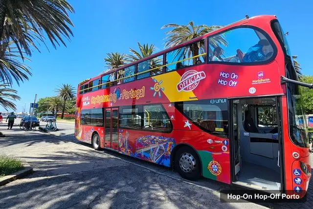
City Sightseeing Europe
City Sightseeing Porto Hop-On Hop-Off Bus & Bookable Extras
4.0 (3,670) · from $31.53
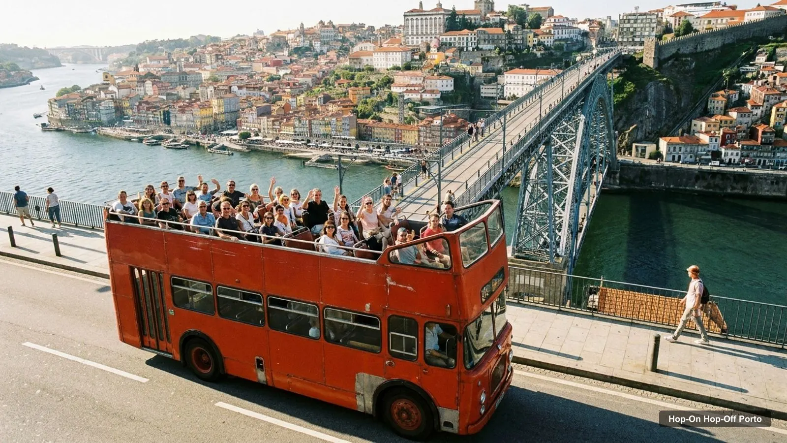
A Porto tourist map makes more sense once you see the city as three clusters: the old centre on the north bank, the Gaia wine cellars across the river, and the coast and Serralves to the west. I’ve put the main hop-on hop-off stops and the top 20 attractions, ranked by Google Maps reviews, on one page, with coordinates and links. If you’re choosing a ticket, my hop-on hop-off Porto guide compares both.
Porto Sightseeing Map: The Bus Route
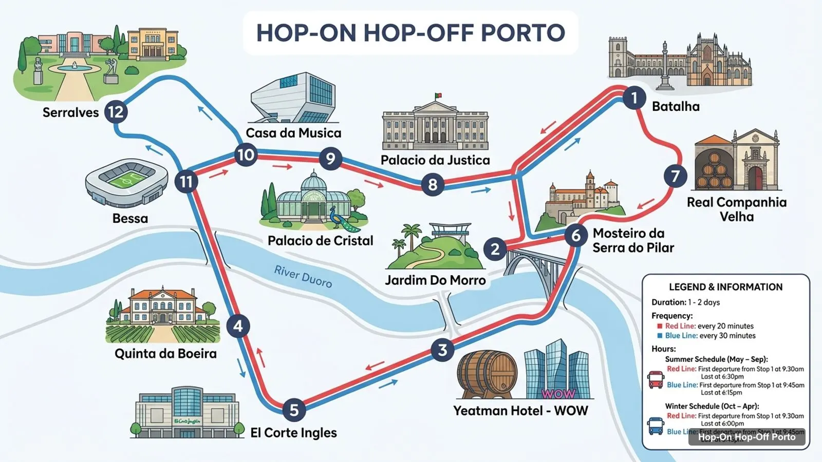
The Porto sightseeing map below shows the first 12 stops of the City Sightseeing route, from Batalha to Serralves. Buses run every 20 minutes on the Red Line in summer and every 25 minutes in winter, with a first departure from Stop 1 at 9:30am, and every 30 minutes on the Blue Line.
Stops on the route
- 1Batalha
- 2Jardim Do Morro
- 3Yeatman Hotel - WOW
- 4Quinta da Boeira
- 5El Corte Ingles
- 6Mosteiro da Serra do Pilar
- 7Real Companhia Velha
- 8Palacio da Justica
- 9Palacio de Cristal
- 10Casa da Musica
- 11Bessa
- 12Serralves
Bus stops on the route
| # | Stop | Map |
|---|---|---|
| 1 | Batalha | Open in Google Maps |
| 2 | Jardim Do Morro | Open in Google Maps |
| 3 | Yeatman Hotel - WOW | Open in Google Maps |
| 4 | Quinta da Boeira | Open in Google Maps |
| 5 | El Corte Ingles | Open in Google Maps |
| 6 | Mosteiro da Serra do Pilar | Open in Google Maps |
| 7 | Real Companhia Velha | Open in Google Maps |
| 8 | Palacio da Justica | Open in Google Maps |
| 9 | Palacio de Cristal | Open in Google Maps |
| 10 | Casa da Musica | Open in Google Maps |
| 11 | Bessa | Open in Google Maps |
| 12 | Serralves | Open in Google Maps |
The full City Sightseeing network has 18 stops: the Red Line adds Parque da Cidade (temporarily closed), Castelo do Queijo, Foz, Cais do Ouro, Massarelos and Ribeira, and the Blue Line crosses to Gaia. Gray Line lists 26 stops across three lines, including Matosinhos.
Porto Tourist Attractions Map: Top 20 Sights with Coordinates
This is the Porto tourist attractions map in table form, ranked by Google Maps reviews, with exact coordinates. Each link opens the place in Google Maps, where you can save it to a list before you travel. I left out bus stops and tour operators.
| # | Attraction | Coordinates | Rating | Map |
|---|---|---|---|---|
| 1 | Luís I Bridge | 41.1400, -8.6094 | 4.8 (98,654) | Map |
| 2 | Livraria Lello | 41.1469, -8.6148 | 4 (88,333) | Map |
| 3 | Porto Cathedral | 41.1429, -8.6111 | 4.6 (39,408) | Map |
| 4 | Torre dos Clérigos | 41.1457, -8.6146 | 4.6 (22,516) | Map |
| 5 | Palácio da Bolsa | 41.1414, -8.6157 | 4.5 (14,616) | Map |
| 6 | Clérigos Church | 41.1459, -8.6139 | 4.6 (13,621) | Map |
| 7 | Chapel of Souls | 41.1499, -8.6057 | 4.6 (11,934) | Map |
| 8 | Church of Saint Francis | 41.1410, -8.6160 | 4.4 (10,035) | Map |
| 9 | Fundação Serralves | 41.1598, -8.6598 | 4.6 (9,774) | Map |
| 10 | FC Porto Museum | 41.1608, -8.5827 | 4.7 (7,868) | Map |
| 11 | World of Discoveries | 41.1435, -8.6208 | 4.4 (7,403) | Map |
| 12 | Serralves Museum of Contemporary Art | 41.1598, -8.6596 | 4.4 (7,158) | Map |
| 13 | Porto São Bento | 41.1455, -8.6095 | 4.7 (6,556) | Map |
| 14 | Soares dos Reis | 41.1477, -8.6216 | 4.4 (3,635) | Map |
| 15 | Porto Tram Museum | 41.1476, -8.6329 | 4.4 (3,566) | Map |
| 16 | Portuguese Centre of Photography | 41.1446, -8.6158 | 4.4 (2,035) | Map |
| 17 | Neonia Porto | 41.1484, -8.6145 | 4.7 (1,796) | Map |
| 18 | Fonte dos Leões | 41.1471, -8.6156 | 4.6 (1,670) | Map |
| 19 | Galeria da Biodiversidade | 41.1537, -8.6426 | 4.7 (1,571) | Map |
| 20 | Muralhas Fernandinas do Porto | 41.1415, -8.6095 | 4.4 (1,406) | Map |
Porto Tourist Map by Type of Sight
The top 20 table mixes very different places, so here is how I’d sort it. For churches and monuments: the Cathedral (4.6), the Clerigos Tower and Church (4.6 each), the Chapel of Souls (4.6), the Church of Saint Francis (4.4) and the Episcopal Palace (4.4). For museums: the FC Porto Museum (4.7), World of Discoveries (4.4), Serralves (4.4 for the museum) and the Soares dos Reis museum (4.4). For views and the river: the Luis I Bridge (4.8) and the Fernandine Walls (4.4).
Smaller places score well too. Neonia Porto (4.7 from 1,796 reviews), the 3D Fun Art Museum (4.8 from 1,265) and the Wondersense Museum (4.8 from 748) are all rated higher than Livraria Lello, which sits at 4.0. If a queue puts you off, those are my first alternatives from the data.
Porto City Map: The Three Clusters
Read the coordinates above and the Porto city map falls into three groups:
- The old centre (around 41.14, -8.61): the Luis I Bridge, the Cathedral, Palacio da Bolsa, the Church of Saint Francis, Sao Bento, the Clerigos Tower and Livraria Lello. The bridge to Livraria Lello is about 0.9 km, so you can walk all of it in a morning.
- Serralves and the west (around 41.16, -8.66): the Serralves Foundation and Museum of Contemporary Art, about 4 km from the Clerigos Tower. This is where the bus earns its fare.
- The east (around 41.16, -8.58): the FC Porto Museum at the Estadio do Dragao, about 3 km from the Clerigos Tower and not on any stop list.
Plan one cluster per half day. My best things to do in Porto guide explains what to see at each place, and my Porto itinerary turns the clusters into a day plan.
Porto Tourist Map with Metro and Trains
Porto’s Sao Bento station is the one rail landmark on the tourist map: it has 6,556 Google reviews averaging 4.7 and sits about 420 metres from the Clerigos Tower and 320 metres from the Cathedral. It’s also the centre of the old town, which makes it a useful anchor when you read the coordinates above. For metro, tram and bus fares and timetables, use the official STCP site, because I haven’t loaded fares into my data.
Porto Tourist Map by Walking Distance
These are the straight-line distances between the sights people ask about most, computed from the coordinates in the table. Add 20 to 30 percent for the hills and the bends.
| From | To | Distance |
|---|---|---|
| Luis I Bridge | Porto Cathedral | 0.35 km |
| Luis I Bridge | Palacio da Bolsa | 0.54 km |
| Luis I Bridge | Clerigos Tower | 0.77 km |
| Luis I Bridge | Livraria Lello | 0.89 km |
| Sao Bento | Clerigos Tower | 0.42 km |
| Clerigos Tower | Serralves | 4.1 km |
| Clerigos Tower | FC Porto Museum | 3.15 km |
The pattern is clear. Everything on the first four rows is under a kilometre, and the last two rows are why the bus exists.
Reading the Route Map Stop by Stop
The first three stops of the City Sightseeing route are Batalha, Jardim do Morro and the Yeatman hotel (listed as WOW). They belong to the Blue Line, which crosses to Gaia and passes the port wine houses. Stops four to seven on the infographic, Quinta da Boeira, El Corte Ingles, the Serra do Pilar monastery and Real Companhia Velha, are also Blue Line stops. The rest of the infographic belongs to the Red Line, from the Palacio da Justica to Serralves.
I’ve kept the infographic’s numbering, so it doesn’t match the operator’s own stop numbers on each line. If you board, use the operator’s map for the stop number and mine for the Google Maps links.
Which Stop for Which Sight on the Porto Tourist Map
The stop names tell you more than you’d think. Here is how the main attractions line up with the stops in the two operators’ listings:
- Serralves: Serralves on City Sightseeing’s Red Line and Fundacao Serralves on Gray Line’s Blue Line.
- Church of Saint Francis and Palacio da Bolsa: Igreja S. Francisco, stop 13 on the Gray Line Blue Line. The two sights are about 50 metres apart.
- Clerigos Tower and Livraria Lello: the nearest listed Gray Line stop is Cordoaria. The two sights are about 140 metres apart.
- The river and the Luis I Bridge: Ribeira (City Sightseeing Red Line) and Cais de Gaia (Gray Line Orange Line).
- World of Discoveries: the Massarelos stop on both operators’ lists is the nearest name.
- Palacio de Cristal: its own stop on both operators’ routes.
- The coast: Castelo do Queijo, Foz and, for Matosinhos, the Gray Line Green Line.
Porto Tourist Map PDF and Printable Version
If you want a Porto tourist map PDF, use your browser’s Print to PDF on this page. The route image and the two tables fit on a few sheets and keep the stop numbers next to the sights. The operators also hand out paper maps with their audio guides, but the listings don’t say where, so ask at Batalha, the first stop.
Porto Tourist Map Walking Tips
If you’re walking rather than riding, follow the river down from the Cathedral to the bridge and then climb back up to Sao Bento. The centre is hilly, and the straight-line distances above understate the climbs. I’d put Serralves on a bus day, not a walking day.
Which Bus Covers the Most of This Map?
Gray Line covers the most of this Porto tourist map, with 26 stops across Orange, Blue and Green lines and a stop at Igreja S. Francisco. City Sightseeing has 18 stops, the larger review base (3,670 reviews at 4.0) and two included walking tours. Both start at $31.53. Check my hop-on hop-off Porto page for the cards, or go back to the homepage for other cities.
Frequently asked questions
Where can I find a Porto tourist map?
Use the route map and the two tables on this page. The stop table links every City Sightseeing stop to Google Maps, and the attraction table gives coordinates for the top 20 sights. For a printable version, use your browser's Print to PDF on this page.
How far apart are the main sights in Porto?
The old centre is compact. The Luis I Bridge is about 0.35 km from the Cathedral, 0.77 km from the Clerigos Tower and 0.89 km from Livraria Lello, by straight line. Serralves is the outlier, about 4 km west of the Clerigos Tower.
Does the Porto bus stop at the main attractions?
Only some of them. Serralves is a named stop on both operators' lists, and Igreja S. Francisco is a Gray Line stop. Most of the old centre, including Livraria Lello, the Cathedral and the Clerigos Tower, is a walk from the nearest listed stop.
Tours I compared in Porto
My full review of each one, in the order I rank them:
- City Sightseeing Porto Hop-On Hop-Off Bus & Bookable Extras★ 4.0 · from $31.53
- Porto: Hop-on Hop-off Bus with Optional Cruise & Wine Cellar★ 4.1 · from $31.53