Pittsburgh Tourist Map: Top Attractions & Bus Stops
By Jake Dawson · Updated · Affiliate links, explained in my disclosure
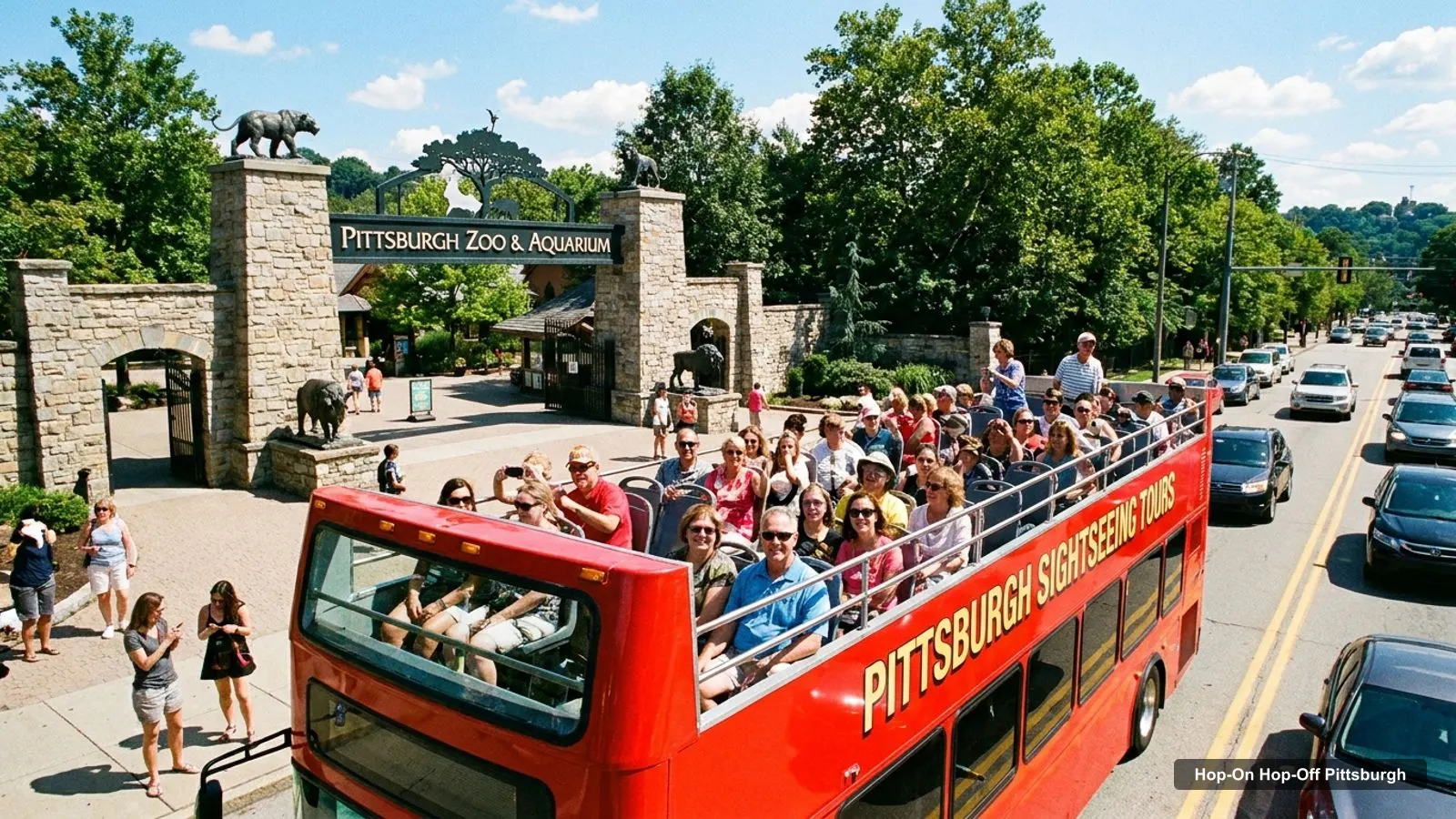
A Pittsburgh tourist map makes more sense once you see the city as clusters: downtown and the Point, the North Side, Oakland, the Strip, the lookouts and the zoo. I’ve put the top 20 attractions, ranked by Google Maps reviews, and ten sightseeing stops on one page, with coordinates and a Google Maps link for every place. If you are planning how to move between them, my guide to hop-on hop-off Pittsburgh covers the double-decker.
An honest note on the word stops. The operator says it has 21 stops, but I could not find a numbered list of them. So the ten stops below are sights on my route map, drawn from Google Maps data, and not official boarding points. Check the operator’s current stop list before you plan around any of them.
Pittsburgh Sightseeing Map: The Route
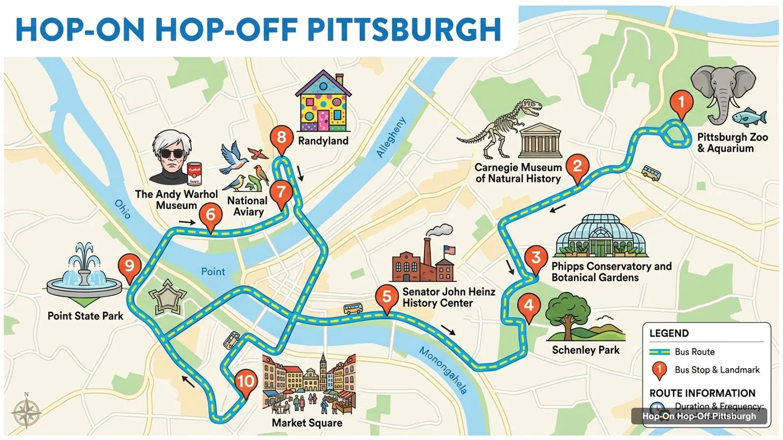
The Pittsburgh sightseeing map below shows ten numbered stops: the zoo, the Carnegie Museum of Natural History, Phipps Conservatory, Schenley Park, the Heinz History Center, the Andy Warhol Museum, the National Aviary, Randyland, Point State Park and Market Square. They run from east to west and then across the river to the North Side.
Stops on the route
- 1Pittsburgh Zoo & Aquarium
- 2Carnegie Museum of Natural History
- 3Phipps Conservatory and Botanical Gardens
- 4Schenley Park
- 5Senator John Heinz History Center
- 6The Andy Warhol Museum
- 7National Aviary
- 8Randyland
- 9Point State Park
- 10Market Square
The ten stops on the route
| # | Stop | Map |
|---|---|---|
| 1 | Pittsburgh Zoo & Aquarium | Find on Google Maps |
| 2 | Carnegie Museum of Natural History | Find on Google Maps |
| 3 | Phipps Conservatory and Botanical Gardens | Find on Google Maps |
| 4 | Schenley Park | Find on Google Maps |
| 5 | Senator John Heinz History Center | Find on Google Maps |
| 6 | The Andy Warhol Museum | Find on Google Maps |
| 7 | National Aviary | Find on Google Maps |
| 8 | Randyland | Find on Google Maps |
| 9 | Point State Park | Find on Google Maps |
| 10 | Market Square | Find on Google Maps |
Use these links to check each place’s current hours and access before you travel. Stops 1 to 4 are in the east, around Oakland and the zoo, stop 5 is in the Strip, stops 6 to 8 are on the North Side, and stops 9 and 10 are downtown.
Pittsburgh Tourist Attractions: Top 20 with Coordinates
This is the Pittsburgh tourist attractions list in table form, ranked by Google Maps reviews, with exact coordinates. I left out tour operators, a bike shop, a haunted tour company and duplicate listings. Each link opens the place in Google Maps, where you can save it before you travel.
| # | Attraction | Coordinates | Google rating | Map |
|---|---|---|---|---|
| 1 | Pittsburgh Zoo & Aquarium | 40.48425, -79.92220 | 4.5 (18,054) | Open in Google Maps |
| 2 | Phipps Conservatory and Botanical Gardens | 40.43902, -79.94795 | 4.8 (10,716) | Open in Google Maps |
| 3 | Point State Park | 40.44157, -80.00785 | 4.7 (9,774) | Open in Google Maps |
| 4 | Schenley Park | 40.43506, -79.94175 | 4.7 (8,733) | Open in Google Maps |
| 5 | Market Square | 40.44078, -80.00248 | 4.6 (8,464) | Open in Google Maps |
| 6 | National Aviary | 40.45333, -80.00961 | 4.7 (7,924) | Open in Google Maps |
| 7 | The Andy Warhol Museum | 40.44838, -80.00249 | 4.6 (5,955) | Open in Google Maps |
| 8 | Carnegie Museum of Natural History | 40.44332, -79.94997 | 4.8 (4,722) | Open in Google Maps |
| 9 | Randyland | 40.45793, -80.00974 | 4.7 (3,806) | Open in Google Maps |
| 10 | Senator John Heinz History Center | 40.44684, -79.99207 | 4.7 (3,516) | Open in Google Maps |
| 11 | Kamin Science Center | 40.44568, -80.01819 | 4.4 (2,409) | Open in Google Maps |
| 12 | Mattress Factory Contemporary Art Museum | 40.45722, -80.01242 | 4.3 (2,189) | Open in Google Maps |
| 13 | Carnegie Museum of Art | 40.44371, -79.94897 | 4.7 (2,076) | Open in Google Maps |
| 14 | Point State Park Fountain | 40.44181, -80.01277 | 4.8 (1,922) | Open in Google Maps |
| 15 | West End Overlook Park | 40.44566, -80.03375 | 4.8 (1,790) | Open in Google Maps |
| 16 | Schenley Farms Historic District | 40.44763, -79.95577 | 4.5 (1,692) | Open in Google Maps |
| 17 | The Frick Pittsburgh Museums & Gardens | 40.44748, -79.90176 | 4.6 (1,635) | Open in Google Maps |
| 18 | Points of View | 40.43927, -80.02131 | 4.8 (1,140) | Open in Google Maps |
| 19 | Fort Pitt Museum | 40.44064, -80.00969 | 4.6 (1,050) | Open in Google Maps |
| 20 | Mellon Square | 40.44096, -79.99749 | 4.3 (831) | Open in Google Maps |
Pittsburgh Tourism Map: Five Clusters
Downtown and the Point. Market Square, Point State Park, the fountain, the Fort Pitt Museum, the Fort Pitt Block House, Mellon Square and the Fourth Avenue Historic District are all within about 1 km of each other. This is the easiest walking day.
North Side. The Andy Warhol Museum, the National Aviary, Randyland, the Kamin Science Center, the Mattress Factory and the Children’s Museum are 0.8 to 2 km from Market Square. The operator’s route describes a North Shore leg.
Oakland. The Carnegie Museum of Natural History, the Carnegie Museum of Art, Phipps Conservatory, Schenley Park and the Cathedral of Learning are within about 1.2 km of each other, and about 4.5 km from Market Square.
The Strip and Lawrenceville. The Heinz History Center is at 1212 Smallman St, 1.1 km from Market Square. The Clemente Museum is further out on Penn Avenue.
Out on their own. The zoo is 8.3 km from Market Square and the Frick Pittsburgh is 8.6 km. Points of View on Grandview Avenue and West End Overlook Park are the two lookouts.
Pittsburgh Tourism Guide: What the Official Site Offers
For a wider guide, the official VisitPITTSBURGH site lists neighbourhood guides, an accessibility guide and a transportation section. Its office is at 120 Fifth Avenue, Suite 14300. I use it for events and for anything my data does not cover, such as restaurants and shows, which I have not attempted here.
Pittsburgh Attractions Tripadvisor
People often search for Pittsburgh attractions on Tripadvisor, so here is what I use instead. Every rating on this page is a Google Maps rating with its review count, and I do not mix in other platforms. The Tripadvisor page for The Pittsburgh Tour Company appears in search results, but I have not copied a rating from it. If you compare sites, remember that review counts differ and ratings are not directly comparable.
Pittsburgh Attractions Near Me
If you are searching for attractions near you, use the coordinates in the table to drop pins in your own map app. As a rough guide, anything downtown is within walking distance of Market Square, while Oakland is a bus or car ride away. Here are the nearest high-rated sights to Market Square in a straight line: Mellon Square (0.4 km, 4.3), the Fort Pitt Block House (0.6 km, 4.7), Point State Park (0.5 km, 4.7) and the Warhol Museum (0.8 km, 4.6).
Pittsburgh Tourist Map Tips for Getting Around
Before you head out with this Pittsburgh tourist map, a few planning habits help. First, check opening days: Google Maps showed several museums as closed on Tuesday, and the double-decker is closed that day too. Second, count the gaps between clusters, not just the stops. A straight line from Market Square to the zoo is 8.3 km and the road is longer. Third, remember the hills and bridges, which make short distances feel longer.
Fourth, use the coordinates if you want to drop pins into your own map. They come straight from Google Maps data and I have not adjusted them. Finally, remember that the bus tour runs April to October, so outside those months you are walking or driving. Wherever you go, a map only tells you where things are, so give yourself time to enjoy them.
Reading the Distances
All the distances on this page are straight-line figures calculated from the Google Maps coordinates in the table, measured from Market Square unless I say otherwise. Point State Park is 0.5 km away, the Andy Warhol Museum 0.8 km, the Heinz History Center 1.1 km, the National Aviary 1.5 km, Randyland 2 km, the Carnegie Museum of Natural History 4.5 km, Phipps Conservatory 4.6 km, Schenley Park 5.2 km, the zoo 8.3 km and the Frick 8.6 km. Treat them as a ranking of closeness, not a walking time. Rivers and bridges mean the real route is often longer, and the hills make a short walk feel slower.
Which Clusters Suit Which Traveller
Families should look at the zoo, the Aviary and the Kamin Science Center, but give the zoo its own half day. Art lovers have the Warhol, the Carnegie Museum of Art and the Mattress Factory. History fans have the Heinz History Center, the Fort Pitt Museum and the Fort Pitt Block House, the last two inside Point State Park. People who want gardens and parks have Phipps and Schenley Park side by side. If you have only a few hours, stay downtown, where the most sights sit close together.
Using This Map
Save the Google Maps links for the places you care about, pick the cluster for each day, and decide whether the bus fits. For the double-decker and its Tuesday closure, go back to hop on hop off Pittsburgh. For a day-by-day plan see my Pittsburgh itinerary, and for ranked write-ups see the best things to do in Pittsburgh. More city maps are on my home page.
Frequently asked questions
What are the top tourist attractions in Pittsburgh?
By Google Maps reviews: the Pittsburgh Zoo and Aquarium (18,054), Phipps Conservatory (10,716), Point State Park (9,774), Schenley Park (8,733) and Market Square (8,464). The National Aviary, the Andy Warhol Museum and the Carnegie Museum of Natural History follow. The table on this page lists the top 20 with coordinates.
Is there a tourist information center in Pittsburgh?
VisitPITTSBURGH, the official tourism organisation, lists an office at 120 Fifth Avenue, Fifth Avenue Place, Suite 14300, Pittsburgh, PA 15222, and a phone number of 412 281 7711 on its website. I have not confirmed walk-in hours, so call or check the site before you go.
Is there a hop-on hop-off bus map for Pittsburgh?
I could not find an official numbered stop list. The Pittsburgh Tour Company says it has 21 stops and describes a route from the Southside along the river to the North Shore, the Strip, downtown and Oakland. My map shows ten sights along that arc, not official boarding points.
How far apart are the main sights?
Downtown sights are close: Point State Park is about 0.5 km from Market Square. The Andy Warhol Museum is 0.8 km, the Carnegie Museum of Natural History 4.5 km and the zoo 8.3 km, all in a straight line. Road distances are longer, so allow for the hills and the bridges.
Are the museums open on Tuesday?
Google Maps showed the Carnegie Museum of Natural History, the Carnegie Museum of Art, the Andy Warhol Museum, the National Aviary and the Kamin Science Center as closed on Tuesday. The double-decker bus is also closed on Tuesdays, per its website. Plan outdoor sights for that day and check each site's own calendar.
Which attractions are near the North Side?
The Andy Warhol Museum, the National Aviary, Randyland, the Kamin Science Center, the Mattress Factory and the Children's Museum are all on the North Side. They sit between 0.8 and 2 km from Market Square in a straight line, which makes them a good walking cluster.