Philadelphia Tourist Map: Top Attractions & Bus Stops
By Jake Dawson · Updated · Affiliate links, explained in my disclosure
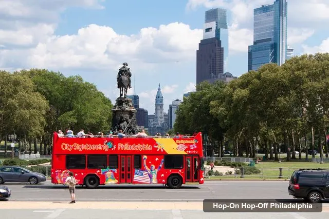
Philadelphia City Sightseeing
Philadelphia: Double-Decker Hop-on Hop-off Sightseeing Tour
4.4 (960) · from $54
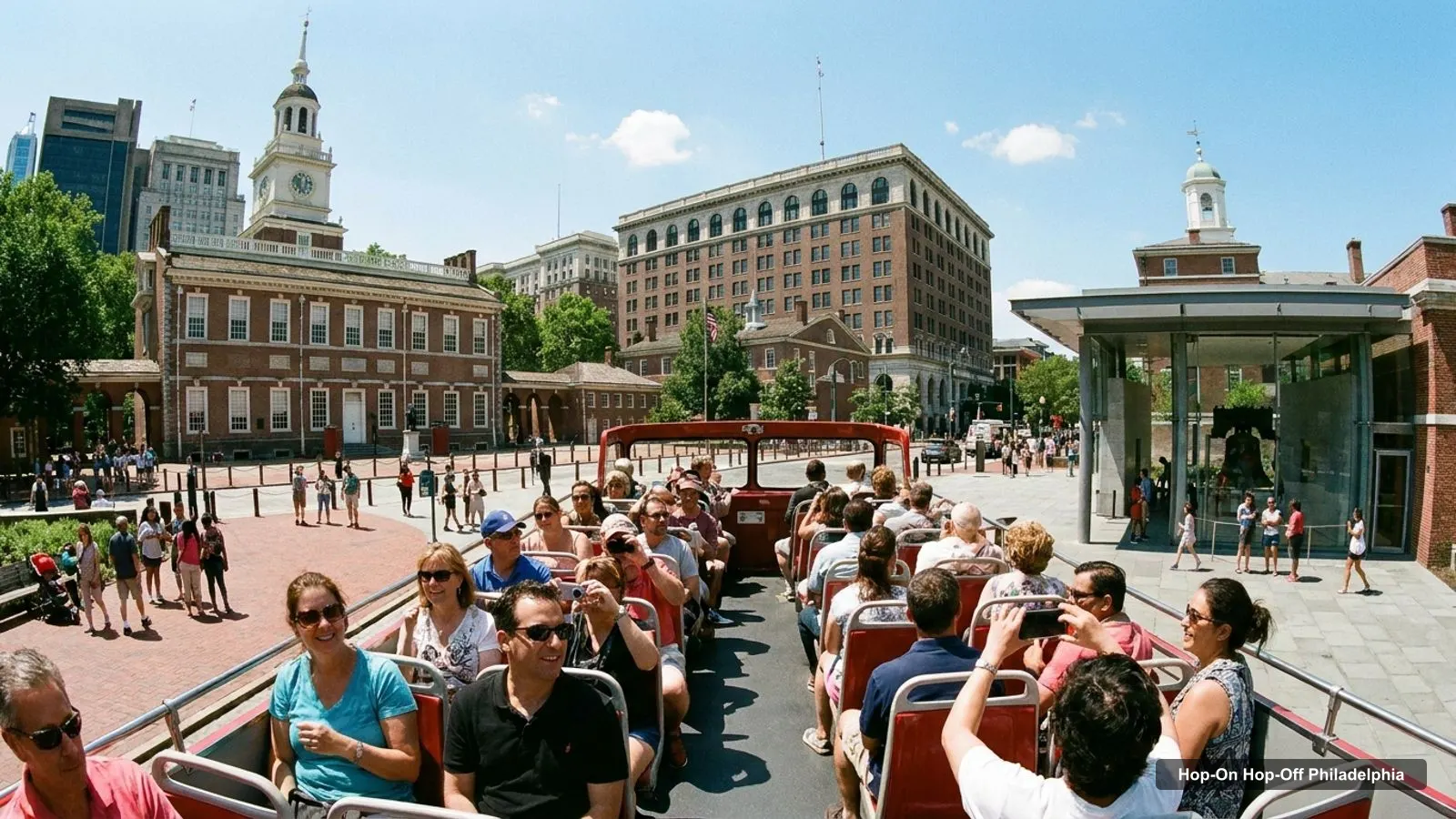
A Philadelphia tourist map is easiest to read as two clusters on one long street. The first is Old City, around Independence Mall. The second is the museum district, along Benjamin Franklin Parkway. Between them sit City Hall, Love Park and Reading Terminal Market. I’ve put the top 20 attractions, ranked by Google Maps reviews, and the main sightseeing bus stops on this page, each with coordinates and a Google Maps link. The route graphic follows the City Sightseeing bus. For prices and tickets, see my guide to hop-on hop-off in Philadelphia.
Philadelphia Sites Map: The Bus Route
The Philadelphia sites map below shows the first 12 stops of the City Sightseeing route, from the Bourse Building in Old City to the Rocky Statue at the Art Museum. The listing names 27 stops in all, and a bus every 30 minutes between 10:00 AM and 4:30 PM. The official site describes the route as a 16-mile loop with 26 stops, so the number of stops depends on the source and the season.
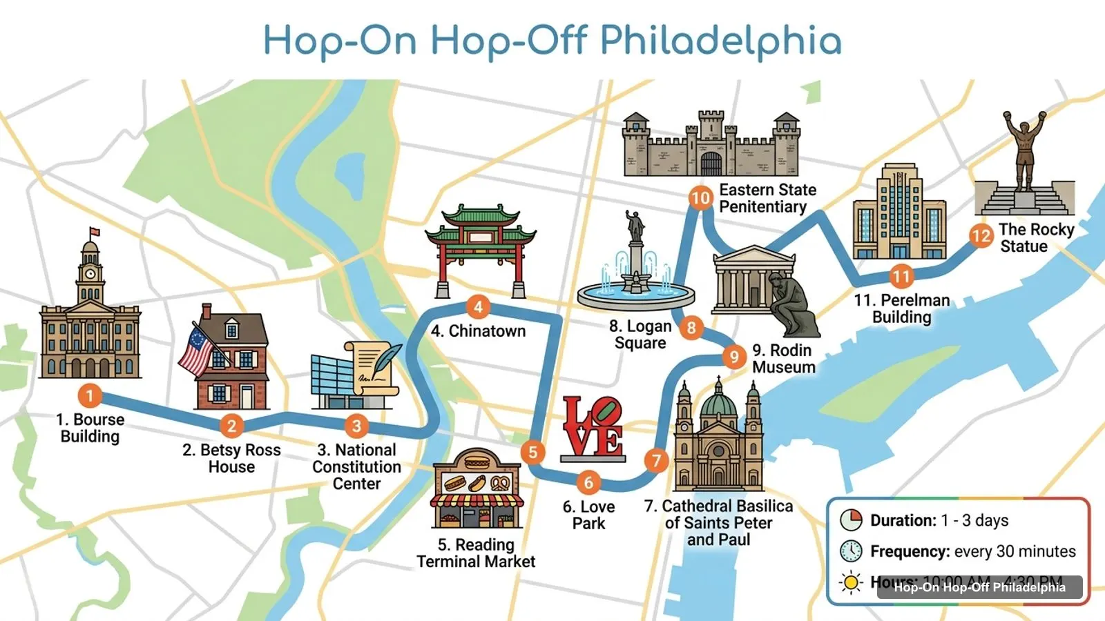
Stops on the route
- 1Bourse Building
- 2Betsy Ross House
- 3National Constitution Center
- 4Chinatown
- 5Reading Terminal Market
- 6Love Park
- 7Cathedral Basilica of Saints Peter and Paul
- 8Logan Square
- 9Rodin Museum
- 10Eastern State Penitentiary
- 11Perelman Building
- 12The Rocky Statue
Bus stops on the main loop
| Stop | Map |
|---|---|
| Bourse Building | Find on Google Maps |
| Betsy Ross House | Find on Google Maps |
| National Constitution Center | Find on Google Maps |
| Chinatown | Find on Google Maps |
| Reading Terminal Market | Find on Google Maps |
| Love Park | Find on Google Maps |
| Cathedral Basilica of Saints Peter and Paul | Find on Google Maps |
| Logan Square | Find on Google Maps |
| Rodin Museum | Find on Google Maps |
| Eastern State Penitentiary | Find on Google Maps |
| Perelman Building | Find on Google Maps |
| The Rocky Statue | Find on Google Maps |
Philadelphia Tourist Attractions: Top 20 With Coordinates
These are the 20 most-reviewed Philadelphia tourist attractions on Google Maps, excluding tour offices, visitor centers and sights outside the city centre. The bus column shows whether the sight is a named stop on at least one of the two daytime bus lists. Independence National Historical Park and Independence Hall are not named stops, but the Liberty Bell stop and the Bourse Building start are right beside them.
| # | Attraction | Rating | Reviews | Coordinates | On a bus list | Map |
|---|---|---|---|---|---|---|
| 1 | Independence National Historical Park | 4.6 | 26,799 | 39.9495, -75.1497 | No | Open map |
| 2 | Liberty Bell | 4.6 | 23,744 | 39.9496, -75.1503 | Yes | Open map |
| 3 | Philadelphia Museum of Art | 4.8 | 23,682 | 39.9656, -75.1810 | Yes | Open map |
| 4 | Philadelphia Zoo | 4.5 | 22,837 | 39.9715, -75.1955 | Yes | Open map |
| 5 | JFK Plaza (Love Park) | 4.5 | 16,066 | 39.9541, -75.1656 | Yes | Open map |
| 6 | Philadelphia Museum of Art Steps | 4.7 | 15,070 | 39.9648, -75.1799 | Yes | Open map |
| 7 | The Franklin Institute | 4.6 | 14,058 | 39.9582, -75.1731 | Yes | Open map |
| 8 | Independence Hall | 4.7 | 8,261 | 39.9489, -75.1500 | No | Open map |
| 9 | Please Touch Museum | 4.6 | 7,377 | 39.9795, -75.2091 | Yes | Open map |
| 10 | Mütter Museum | 4.6 | 6,696 | 39.9532, -75.1764 | Yes | Open map |
| 11 | Philadelphia’s Magic Gardens | 4.6 | 5,840 | 39.9426, -75.1594 | No | Open map |
| 12 | Franklin Square | 4.6 | 5,336 | 39.9557, -75.1505 | No | Open map |
| 13 | Rocky Statue | 4.7 | 4,788 | 39.9651, -75.1803 | Yes | Open map |
| 14 | Barnes Foundation | 4.7 | 4,735 | 39.9606, -75.1728 | Yes | Open map |
| 15 | Elfreth’s Alley Museum | 4.6 | 4,599 | 39.9527, -75.1424 | No | Open map |
| 16 | The Wanamaker Building | 4.6 | 4,154 | 39.9514, -75.1626 | No | Open map |
| 17 | Museum of Illusions Philadelphia | 4.5 | 4,055 | 39.9505, -75.1474 | No | Open map |
| 18 | Betsy Ross House | 4.5 | 4,048 | 39.9522, -75.1447 | Yes | Open map |
| 19 | Museum of the American Revolution | 4.7 | 3,801 | 39.9483, -75.1458 | Yes | Open map |
| 20 | National Constitution Center | 4.6 | 2,737 | 39.9537, -75.1491 | Yes | Open map |
Philadelphia Visitors Map: The Three Clusters
The easiest Philadelphia visitors map is a set of three clusters. Each one is walkable on its own, and the bus joins them.
- Old City and Independence Mall. The Liberty Bell, Independence Hall, Independence National Historical Park, the National Constitution Center, Betsy Ross House, Elfreth’s Alley Museum and the Museum of the American Revolution. The Liberty Bell and Independence Hall are about 80 metres apart in a straight line, and Franklin Square is about 250 metres from the National Constitution Center.
- Center City. City Hall, Love Park, Reading Terminal Market, the Wanamaker Building and Chinatown. Love Park is on both bus tickets, and it is about 1.8 km in a straight line from the Art Museum.
- The Parkway and Fairmount. The Philadelphia Museum of Art with the Rocky Steps, the Barnes Foundation, the Rodin Museum, the Franklin Institute and Eastern State Penitentiary. The Barnes Foundation and the Rodin Museum are about 170 metres apart, and Eastern State is about 0.8 km from the Art Museum. The zoo and Please Touch Museum sit further out in West Fairmount Park, about 1.4 to 1.5 km from the Art Museum.
Philadelphia Travel Map: Which Stop for Which Sight
If you use a Philadelphia travel map to decide where to hop off, this is how I’d match sights to stops. For Independence Hall and the Liberty Bell, use the Liberty Bell stop or ride from the Bourse Building. For the Art Museum and Rocky Steps, use The Rocky Statue stop on the City Sightseeing list, or Rocky Steps on the Big Bus list. For the Franklin Institute, use the Franklin Institute stop on either ticket. For the Barnes Foundation, use the Big Bus ticket, and for the Mütter Museum, use the City Sightseeing ticket.
The two lists name the same places differently. City Sightseeing says Love Park and Big Bus says City Hall and Love Park. City Sightseeing says Please Touch Museum and Big Bus adds Memorial Hall and Fairmount Park. I’d go by the Google Maps link in the table above and not by the stop name.
Philadelphia Tourist Information Center
The Philadelphia tourist information center most visitors want is the Independence Visitor Center at 599 Market St. It has 4,228 Google reviews averaging 4.6, and Google Maps lists Monday hours of 9 AM to 6 PM. It is about 200 metres from the Liberty Bell in a straight line, and on the Big Bus list it is a named stop. The other option is the City Hall Visitor Center at 1400 John F Kennedy Blvd, Room 121, which has 1,997 reviews averaging 4.8 and lists Monday hours of 9 AM to 4 PM.
For events, trip planning and official maps, Visit Philadelphia is the city’s tourism site, and the National Park Service has the details for the historic park.
How to Use This Philadelphia Tourist Map
I built this Philadelphia tourist map to answer three questions. Where is each sight, which bus stop is nearest, and how far is it from the next one. Start with the cluster section above to choose an area, then use the attraction table for coordinates and a Google Maps link, and the stop table for the bus. Tap a link on your phone and Google Maps opens straight to the place.
The route graphic and the stop table follow the City Sightseeing bus because it has the longest stop list in my data. If you ride the Big Bus ticket instead, the first half of the route is nearly the same, and the stop names differ only in wording. For the ranked list of what to see, use the guide to the best things to do. For a day-by-day plan, use the itinerary. This page is the map that both of them rely on.
Philadelphia Visitor Map: Walking Tips
A Philadelphia visitor map is only useful if you know which distances to walk. Within Old City, I’d walk everything. Between Old City and the Parkway, I’d take the bus, because the Liberty Bell and the Art Museum are about 3.2 km apart in a straight line. All distances here are straight-line figures from the coordinates in the table, so real walking routes are a little longer.
Mondays matter. Google Maps lists Monday as closed for the National Constitution Center, Elfreth’s Alley Museum and Penn Museum, so don’t plan them for that day. Outdoor sights such as the Rocky Statue and the Chinatown Friendship Arch are listed as open 24 hours.
Which Bus Covers the Most of This Map?
On the numbers in the listings, City Sightseeing covers the most of this map: 27 listed stops against 26 for Big Bus, and 960 reviews against 340. The Big Bus ticket adds the Barnes Foundation and the Independence Visitor Center. Both cost $54 and are valid for up to 72 hours. For the full comparison, see my best things to do in Philadelphia, which ranks what to see at each stop, and my Philadelphia itinerary, which turns the map into 1, 2 and 3 days. When you’re ready to book, the hub page has both tickets: compare the Philadelphia bus tickets. The homepage lists my other cities.
Frequently asked questions
Where is the Philadelphia tourist information center?
The Independence Visitor Center is at 599 Market St, about 200 metres from the Liberty Bell in a straight line, with 4,228 Google reviews averaging 4.6. The City Hall Visitor Center is at 1400 John F Kennedy Blvd, Room 121, and is rated 4.8 from 1,997 reviews. Both are free to walk into.
What are the main tourist attractions in Philadelphia?
By Google Maps reviews, the top five are Independence National Historical Park (26,799 reviews), the Liberty Bell (23,744), the Philadelphia Museum of Art (23,682), Philadelphia Zoo (22,837) and Love Park (16,066). Most of them are stops on the hop-on hop-off bus routes.
Is there a Philadelphia map with the bus stops?
Yes. The table on this page lists the first 12 stops of the City Sightseeing route, from the Bourse Building to the Rocky Statue, each with a Google Maps link. The City Sightseeing listing names 27 stops, and the Big Bus listing names 26, so the full route is longer than the graphic.
How far apart are the two main areas of Philadelphia?
The Liberty Bell and the Philadelphia Museum of Art are about 3.2 km apart in a straight line. That is why I'd use the sightseeing bus between the historic district and the Parkway museums, and walk within each area. Distances here are straight-line, calculated from Google Maps coordinates.
Tours I compared in Philadelphia
My full review of each one, in the order I rank them:
- Philadelphia: Double-Decker Hop-on Hop-off Sightseeing Tour★ 4.4 · from $54
- Philadelphia: Double-Decker Sightseeing Bus Tour★ 4.3 · from $54
- Philadelphia: Open-Top Nighttime Bus Tour★ 4.1 · from $47