The Perth tourist map below puts the bus stops and the top attractions on one page, with coordinates and a Google Maps link for each. I built it from my Google Maps data for Perth, Western Australia, not Perth in Scotland. If you are choosing a ticket first, my hop-on hop-off Perth guide compares the two products I found.
I can’t embed an interactive map here, so the tables do the job. Open a link on your phone, and Google Maps shows the place with directions from where you are.
Stops on the route
1Kings Park and Botanic Gardens
2Northbridge
3Crown Perth
4Elizabeth Quay
5The WACA
6The Bell Tower
7The Perth Mint
8The Swan River
9Museum & Art Gallery of WA
10Perth Town Hall
11Water Town Discount Shopping Complex
12Perth City Shopping Malls
Perth Tourist Map: The Bus Route
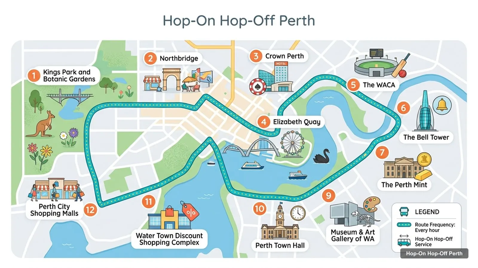
The Perth tourist map for the bus is one circuit of 12 stops on the GetYourGuide listing, which says a full loop takes 2 hours with buses every hour. The operator’s own site now says 15 stops, so the list below may be shorter than the live route. I have kept the listing’s order, which is not proof of the driving order.
The graphic above shows the Perth Explorer city bus stops in order; the table lists the same stops with map links.
The listing gives one stop’s departures as 9:15am, 10:15am, 11:15am, 12:15pm, 1:15pm, 2:15pm and 3:15pm. It does not say which stop that is. In my Perth data, the Perth Explorer office is placed at Barrack Street Jetty, 0.2 km from Elizabeth Quay, which is why I treat the riverfront as the start.
Perth Tour Map: The Rottnest Island Route
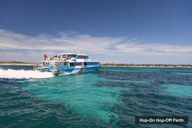
The Perth tour map for the island day trip has four stops on the SeaLink listing. You pick your departure when you book: Perth from Barrack Street Jetty, or Fremantle from O’Connor Landing. The trip includes a guided island bus tour, which the listing gives as about 105 minutes.
The island is about 18 km west of Fremantle, covers roughly 19 square kilometres and has no private cars, according to Wikipedia. The ticket costs $104.06 and the listing rates it 4.61 from 1,515 reviews.
Perth Tourist Attractions: Top 20 With Coordinates
The top Perth tourist attractions by Google review count are in the table below. I left out the Perth Explorer, which is a tour operator, and the Elizabeth Quay Bridge, which is part of the quay. I kept the far-away museums so you can see how far they sit from the centre. You can paste the coordinates straight into any map app.
Distances are straight lines from Elizabeth Quay, so the real distance is longer. Kings Park and the State War Memorial are both on or beside the first bus stop, while the Fremantle sights are 14.6 to 15.5 km away and need a train or a ferry.
Perth Tourist Attractions Australia: What the Ratings Tell Me
The ratings on the Perth tourist attractions list are high, and that is a reason to read them carefully. Nineteen of the top 20 score 4.3 or better, and only the Museum of Perth drops to 3.7 from 376 reviews. Review counts matter more than the stars here: Kings Park has 28,555 reviews, while Perth Town Hall has 498 and a 4.9 rating. A small sample can produce a perfect score, so I rank by volume first.
I’d also read the distance column before the rating column. The Aviation Heritage Museum scores 4.8 but is 10.2 km from Elizabeth Quay, and the Motor Museum of Western Australia scores 4.8 at 16.1 km. They are worth a trip only if you have a car or a free day.
Perth Travel Map: Reading the Coordinates
Each coordinate pair is latitude then longitude in decimal degrees. Perth sits at about minus 31.95 degrees latitude and 115.86 degrees longitude, so every number in the table starts the same way for city sights. The Fremantle sights drop to about minus 32.05, and the island is further west still. If you paste a pair into Google Maps, it drops a pin at that spot.
What Is Perth Famous For
Perth is famous for its parks, its river and its isolation, and the map shows all three. Kings Park and Botanic Garden is the most-reviewed place in my data, with 28,555 reviews at 4.8 stars, and it is open 24 hours. Elizabeth Quay follows with 22,089 reviews at 4.6. The river frames both.
Fremantle, about 15 km south-west of Elizabeth Quay, carries the convict history: Fremantle Prison has 4,311 reviews at 4.7, the WA Shipwrecks Museum has 2,686 at 4.7 and the WA Maritime Museum has 3,618 at 4.5. Offshore, Rottnest Island draws roughly 780,000 visitors a year, according to Wikipedia.
Perth Sights by Area
Group the map into four areas and the day plans itself.
Riverfront: Elizabeth Quay, the Bell Tower, Old Perth Port and the Perth Explorer jetty, all within 0.3 km of each other.
Cultural Centre and Northbridge side: WA Museum Boola Bardip, the Art Gallery of Western Australia, Yagan Square and the Museum of Perth, between 0.8 and 1.0 km from the quay.
Kings Park: the garden, the State War Memorial, the DNA Tower and the Blue Boat House, between 1.2 and 3.4 km from the quay.
Fremantle: the prison and the two maritime museums, 14.6 to 15.5 km from the quay.
How to Use This Perth Tourist Map on a Bus Day
Use the table to pick two or three stops, not twelve. I’d choose Kings Park, the Bell Tower and one museum. The Perth Explorer ticket starts at $38.41, which is about A$55 at 1.436 Australian dollars to the US dollar on 8 October 2026, and the operator’s own 24 hour adult price is A$55.
Ride one full loop first, then use the map to decide where to get off. Check the last departure with the driver, because the only afternoon time I can confirm is 3:15pm at one stop.
I could not find an official Perth tourist map PDF to link, so I won’t send you to an unchecked file. The operator publishes its own interactive map and a live-tracking timetable on its website, which is the best source for the current route. Transperth also publishes a Free Transit Zone map as a PDF, but I did not read it and can’t describe the zone.
Getting Between the Stops With Transperth
Transperth is the cheap way to connect the dots. Its fares page, effective 1 January 2026, lists a three-hour Go Anywhere fare of A$3.50 cash or A$2.80 with a SmartRider, and a DayRider cap of A$7.00. Every Sunday, SmartRider and contactless users travel free on buses, trains and ferries.
That makes a Sunday on the Perth tourist map very cheap, though the open-top bus itself is still a paid ticket.
I could not find an official printable map in my data, so I built the next best thing: tables with coordinates and Google Maps links for the 12 bus stops on the listing and the top 20 attractions. Open any link on your phone, or save the places to your own map. The operator also publishes an interactive map on its site.
Where does the Perth hop-on hop-off bus start?+
You can board at any stop. The Google Maps data places the Perth Explorer at Barrack Street Jetty, beside the Bell Tower and 0.2 km from Elizabeth Quay, which is the easiest place to start. The listing gives hourly departures from 9:15am to 3:15pm at one stop and says to check the operator's timetable for the others.
What is Perth famous for?+
Perth is known for Kings Park and Botanic Garden, the Swan River waterfront at Elizabeth Quay and the Bell Tower, and for Fremantle's convict-era prison. Nearby Rottnest Island is the other big draw. Kings Park leads my data with 4.8 stars from 28,555 reviews, and Elizabeth Quay follows at 4.6 from 22,089.
How far is Kings Park from Elizabeth Quay?+
Kings Park is 2.4 km from Elizabeth Quay in a straight line, by the coordinates in my data. The real route is longer and uphill, which is why many visitors take the bus. Kings Park and Botanic Gardens is the first stop on the Perth Explorer listing, and the park is open 24 hours.
Is Perth easy to get around without a car?+
Yes for the centre. Elizabeth Quay, the Bell Tower, Perth Town Hall and Yagan Square sit within 0.8 km of each other. Transperth fares are capped at a DayRider rate of A$7.00 a day for SmartRider and contactless users, and Sunday travel is free for them. Fremantle and Rottnest need a train or ferry.
Tours I compared in Perth
My full review of each one, in the order I rank them: