Oxford Tourist Map: Top Attractions & Bus Stops
By Jake Dawson · Updated · Affiliate links, explained in my disclosure
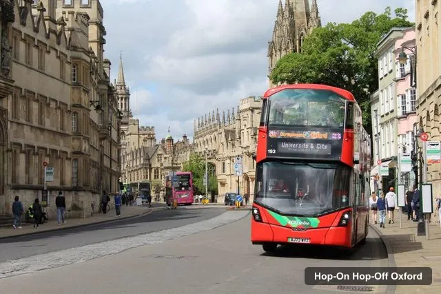
City Sightseeing UK
Oxford: City Sightseeing Hop-On Hop-Off Bus Tour
4.5 (811) · from $25.22
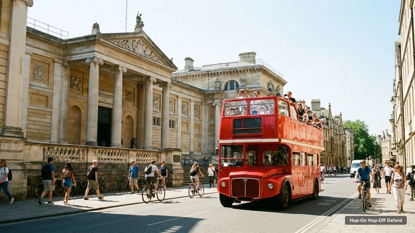
An Oxford tourist map is easier to use when you know the shape of the city. Almost everything worth seeing sits in an area of roughly two kilometres around the centre, and the sightseeing bus makes a loop through it. This page gives you the bus stops, the top 20 attractions with coordinates, and a way to group them so you’re not zigzagging. If you want to know whether the bus itself is worth buying, my hop-on hop-off Oxford comparison has the prices and ratings.
All coordinates, ratings and addresses on this page come from Google Maps place data collected in October 2026. Distances are straight-line figures I calculated from those coordinates, and I measured them from the Railway Station, which is Stop 1. Real walking routes are longer, so treat them as a guide.
Oxford Tourist Map: The Bus Route
The Oxford tourist map below follows the City Sightseeing route. It starts at the Railway Station, passes the castle and the shopping centre, loops south to Christ Church, then goes north through the college district and back along St Giles. The infographic numbers the first 12 stops. The table after it lists all 18.
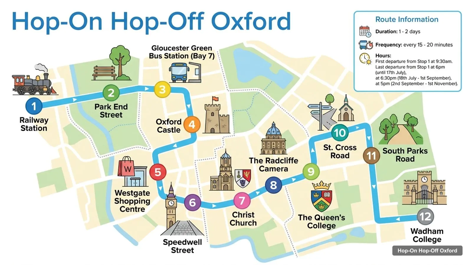
Stops on the route
- 1Railway Station
- 2Park End Street
- 3Gloucester Green Bus Station (Bay 7)
- 4Oxford Castle
- 5Westgate Shopping Centre
- 6Speedwell Street
- 7Christ Church
- 8The Radcliffe Camera
- 9The Queen's College
- 10St. Cross Road
- 11South Parks Road
- 12Wadham College
Bus stops on the main loop
The route has 18 stops and you can join at any of them, not only at Stop 1. A bus runs every 15 to 20 minutes, and the first departure from Stop 1 is at 9:30am. Each stop below has a Google Maps search link so you can see where to stand.
| # | Stop | Map |
|---|---|---|
| 1 | Railway Station | Find on Google Maps |
| 2 | Park End Street | Find on Google Maps |
| 3 | Gloucester Green Bus Station (Bay 7) | Find on Google Maps |
| 4 | Oxford Castle | Find on Google Maps |
| 5 | Westgate Shopping Centre | Find on Google Maps |
| 6 | Speedwell Street | Find on Google Maps |
| 7 | Christ Church | Find on Google Maps |
| 8 | The Radcliffe Camera | Find on Google Maps |
| 9 | The Queen’s College | Find on Google Maps |
| 10 | St. Cross Road | Find on Google Maps |
| 11 | South Parks Road | Find on Google Maps |
| 12 | Wadham College | Find on Google Maps |
| 13 | Trinity College | Find on Google Maps |
| 14 | Parks Road | Find on Google Maps |
| 15 | Banbury Road | Find on Google Maps |
| 16 | Woodstock Road | Find on Google Maps |
| 17 | St. Giles Church | Find on Google Maps |
| 18 | Martyr’s Memorial | Find on Google Maps |
A note on the data: one of the three GetYourGuide listings, the TouringBee walking audio guide, gives a shorter list of nine names and starts its walk at Castle Mound. I use the longer 18-stop list from City Sightseeing UK because both City Sightseeing listings agree on it. Stop names are as printed in the listings, so the signs in the street may read slightly differently.
Oxford Tourist Attractions: The Top 20 on a Map
Oxford tourist attractions are easiest to compare by review count, because the same few places dominate. The table ranks the top 20 in my Google Maps data, skipping the bus operator itself and the sights outside the city such as Kelmscott Manor, which is about 26 km from the station. The last column shows how far each one is from the Railway Station in a straight line.
| # | Attraction | Coordinates | Google rating | Straight-line from station | Map |
|---|---|---|---|---|---|
| 1 | Ashmolean Museum | 51.75543, -1.26007 | 4.7 (12,204) | 700 m | Open in Google Maps |
| 2 | Oxford University Museum of Natural History | 51.75870, -1.25547 | 4.8 (11,519) | 1.1 km | Open in Google Maps |
| 3 | Oxford Castle Prison | 51.75167, -1.26320 | 4.4 (7,641) | 460 m | Open in Google Maps |
| 4 | Oxford Botanic Garden | 51.75098, -1.24767 | 4.5 (5,769) | 1.5 km | Open in Google Maps |
| 5 | Pitt Rivers Museum | 51.75887, -1.25511 | 4.7 (3,499) | 1.2 km | Open in Google Maps |
| 6 | Christ Church Meadow | 51.74800, -1.25200 | 4.6 (3,266) | 1.3 km | Open in Google Maps |
| 7 | Carfax Tower | 51.75198, -1.25813 | 4.4 (3,004) | 790 m | Open in Google Maps |
| 8 | History of Science Museum | 51.75429, -1.25541 | 4.4 (2,621) | 980 m | Open in Google Maps |
| 9 | Port Meadow | 51.77175, -1.28509 | 4.7 (2,561) | 2.3 km | Open in Google Maps |
| 10 | South Park | 51.75136, -1.23121 | 4.6 (2,024) | 2.6 km | Open in Google Maps |
| 11 | Cutteslowe and Sunnymead Park | 51.79120, -1.25757 | 4.6 (1,789) | 4.3 km | Open in Google Maps |
| 12 | The Sheldonian Theatre | 51.75430, -1.25500 | 4.7 (1,409) | 1.0 km | Open in Google Maps |
| 13 | Bodleian Library | 51.75407, -1.25404 | 4.6 (1,355) | 1.1 km | Open in Google Maps |
| 14 | Oxford Castle Quarter | 51.75167, -1.26264 | 4.5 (1,197) | 500 m | Open in Google Maps |
| 15 | The Story Museum | 51.75067, -1.25784 | 4.6 (980) | 840 m | Open in Google Maps |
| 16 | Radcliffe Camera | 51.75343, -1.25405 | 4.7 (935) | 1.1 km | Open in Google Maps |
| 17 | Martyrs’ Memorial | 51.75509, -1.25897 | 4.3 (678) | 750 m | Open in Google Maps |
| 18 | The Headington Shark | 51.75895, -1.21326 | 4.5 (645) | 3.9 km | Open in Google Maps |
| 19 | Folly Bridge | 51.74639, -1.25631 | 4.5 (562) | 1.2 km | Open in Google Maps |
| 20 | Museum of Oxford | 51.75155, -1.25720 | 4.3 (400) | 860 m | Open in Google Maps |
The ratings are Google ratings and reflect many different kinds of visitor, not only people on a bus tour. A few entries are the same site seen twice: Oxford Castle Prison and Oxford Castle Quarter are about 38 m apart, so I treat them as one area.
Oxford Sightseeing Map: Five Clusters
An Oxford sightseeing map is most useful when you group the sights into clusters, because the walking between clusters is where the time goes. These are the five I use, with the bus stop that serves each one.
- Castle and station (west). Oxford Castle Prison and the Castle Quarter are about 460 to 500 m from the station. Bus stops: Oxford Castle, Westgate Shopping Centre and Park End Street.
- Carfax and the centre. Carfax Tower, the Museum of Oxford, the Story Museum and the Illusion Museum are all within roughly 100 to 350 m of each other. There’s no stop called Carfax, so you’d walk from Christ Church or the Radcliffe Camera, about 324 m from the camera to the tower.
- Radcliffe Camera and Broad Street. The Radcliffe Camera, the Bodleian Library (about 71 m away), the Sheldonian Theatre (about 117 m) and the History of Science Museum (about 134 m) make the densest cluster in the city. Bus stop: The Radcliffe Camera.
- Parks Road museums. The Natural History Museum and the Pitt Rivers Museum are only about 31 m apart, and they are about 483 m from the Ashmolean. Bus stops: Parks Road and South Parks Road.
- Christ Church and the river (south). Christ Church Meadow, Folly Bridge (about 347 m away) and the Botanic Garden (about 445 m from the meadow). Bus stop: Christ Church.
Outside those clusters, Port Meadow (2.3 km), South Park (2.6 km) and the Headington Shark (3.9 km) are not on the bus route. I’d reach them on foot or by local bus.
Oxford Tourist Information: Where to Get Help
Oxford tourist information is split between a few places. The City Sightseeing listing names a Visitor Information Point at 44-45 High Street, where its Oxford Uncovered walking tour leaves every hour from 11am to 4pm, and Google Maps lists the same address as City Sightseeing Oxford. That is the operator’s own desk, so it’s the right place for bus questions and walking tour tickets. For wider planning around the city and county, the tourism board’s site, Experience Oxfordshire, is the official place to start.
If you’re searching for an Oxford tourist information centre or an Oxford tourist information office, check the opening hours on the day before you walk across town. I don’t have opening hours for the High Street desk in my data, so I can’t tell you when it closes.
How to Read the Distances on This Oxford Tourist Map
The distance column in the top 20 table is measured from the Railway Station in a straight line, so it is a floor, not a walking time. Oxford’s lanes, one-way streets and college walls add detours, especially around the Radcliffe Camera, where you cannot cut through. As a rule of thumb, I’d add about a quarter to any figure under 1 km and expect a little more to the Botanic Garden and the Parks Road museums.
Two clusters are close enough to treat as one stop. The Natural History Museum and Pitt Rivers are about 31 m apart, and Oxford Castle Prison and the Castle Quarter are about 38 m apart. The Ashmolean and Martyr’s Memorial are about 85 m apart, which is why the last bus stop doubles as the first stop for a museum morning.
Which Stops Matter Most on the Oxford Sightseeing Map
Of the 18 stops, five do most of the work. Oxford Castle (Stop 4) serves the castle area. Christ Church (Stop 7) serves the meadow and the river. The Radcliffe Camera (Stop 8) serves the densest college cluster. South Parks Road (Stop 11) and Parks Road (Stop 14) serve the museums. Martyr’s Memorial (Stop 18) serves the Ashmolean.
The other stops are useful for specific jobs. Westgate Shopping Centre (Stop 5) is for food and shopping, Gloucester Green Bus Station (Stop 3) is for coach arrivals, and Wadham and Trinity Colleges (Stops 12 and 13) are for looking at college architecture from the top deck. I wouldn’t plan a visit around Speedwell Street, St. Cross Road, Banbury Road or Woodstock Road, which are mostly stops that link the loop.
Using the Map with the Bus
Pick a cluster, ride to its stop and walk. That’s the whole method. On a first visit I’d ride a full loop from the Railway Station to get a feel for the layout, then use my best things to do in Oxford guide to decide which clusters deserve time. If you need a plan by day, my Oxford itinerary for 1, 2 and 3 days is built around the same stops.
For the ticket itself, City Sightseeing is the one I’d book: a 24 or 48-hour pass from $25.22, with a seasonal walking tour included. The detailed comparison, including a river cruise combo, is on the hop-on hop-off Oxford page, and the rest of my city guides start on the homepage.
Frequently asked questions
Is there a tourist information centre in Oxford?
The City Sightseeing listing names a Visitor Information Point at 44-45 High Street, where its Oxford Uncovered walking tour starts. Google Maps lists it as City Sightseeing Oxford, rated 4.4 from 221 reviews. It is the operator's point, so for county-wide advice I'd also use the Experience Oxfordshire website.
How many bus stops are on the Oxford sightseeing route?
The City Sightseeing route lists 18 stops, from Stop 1 at the Railway Station to Martyr's Memorial. You can join at any of them, and buses run every 15 to 20 minutes. The map below numbers all 18 and gives a Google Maps link for each.
Which Oxford attractions are closest to the railway station?
Oxford Castle Prison is the closest big sight, about 460 m in a straight line from the station. Carfax Tower is about 790 m, the Ashmolean about 700 m and Martyrs' Memorial about 750 m. These distances come from Google Maps coordinates, so real walking routes are a little longer.
Where is the best place to start a walk around Oxford?
I'd start at the Radcliffe Camera. The Bodleian Library is about 71 m away and the Sheldonian Theatre about 117 m, and Carfax Tower is about 324 m south. It's also a bus stop on the City Sightseeing route, so you can arrive by bus and leave on foot.
Tours I compared in Oxford
My full review of each one, in the order I rank them:
- Oxford: City Sightseeing Hop-On Hop-Off Bus Tour★ 4.5 · from $25.22
- City Sightseeing Oxford HOHO Bus Tour + River Cruise★ 4.6 · from $45.80
- Oxford Walking Tour with Audioguide & HO-HO Bus Tour Optionfrom $11.26