An Ottawa tourist map is most useful when it answers two questions: where are the sights, and where does the bus stop? This page gives you both in table form. Every row has Google Maps coordinates or a search link you can open and save. For the bus itself, my main guide is hop-on hop-off Ottawa.
The data comes from Google Maps listings for Ottawa. Ratings are Google ratings, and review counts weren’t in my data, so I rank by rating. Distances are straight-line figures from Parliament Hill, so allow more on foot. The operator’s GetYourGuide listing does not publish a numbered stop list, so the stop table below uses the places named by the tourism site Visit Ottawa and the route infographic.
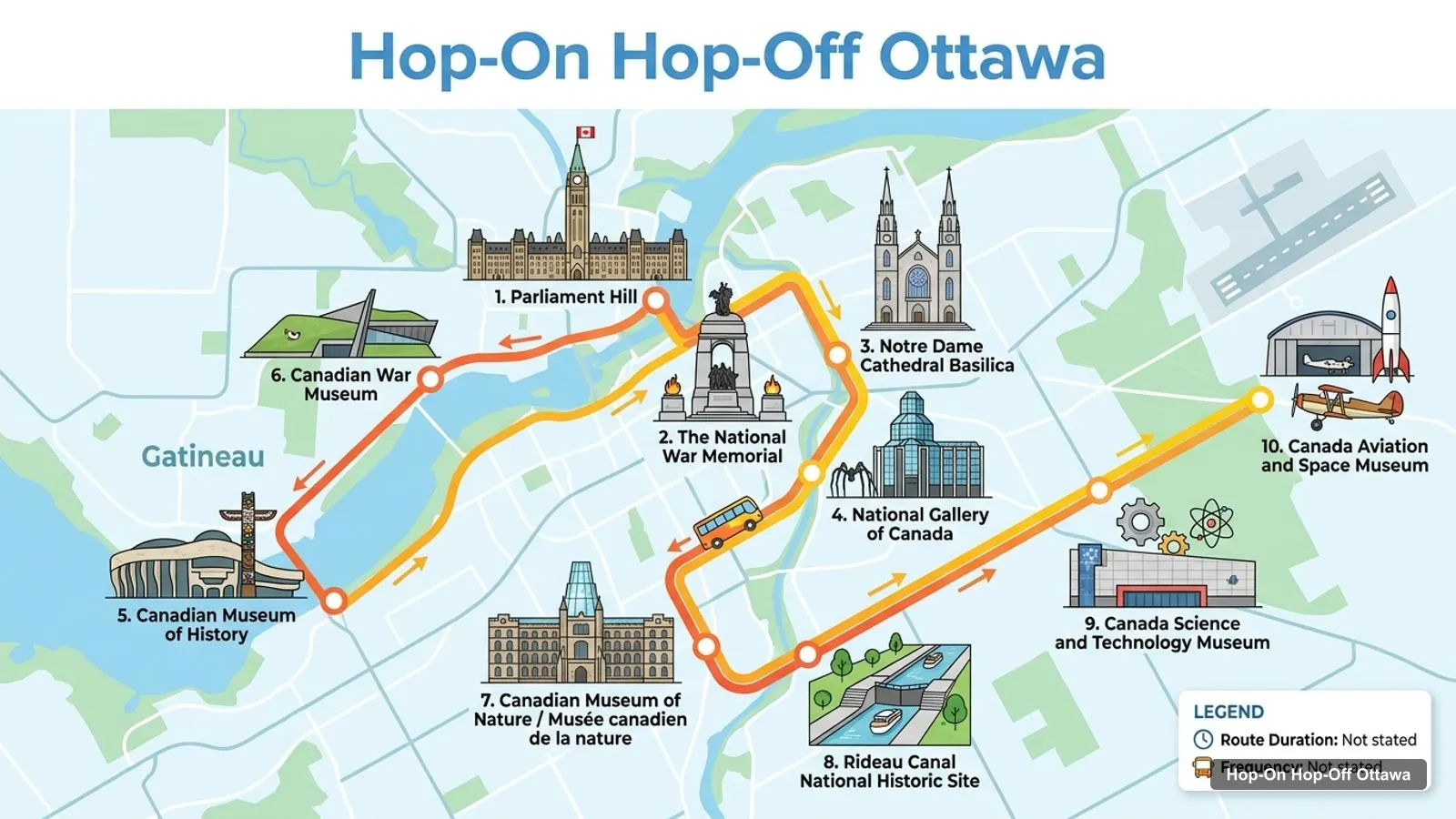
7Canadian Museum of Nature / Musée canadien de la nature
8Rideau Canal National Historic Site
9Canada Science and Technology Museum
10Canada Aviation and Space Museum
Ottawa Tourist Attractions
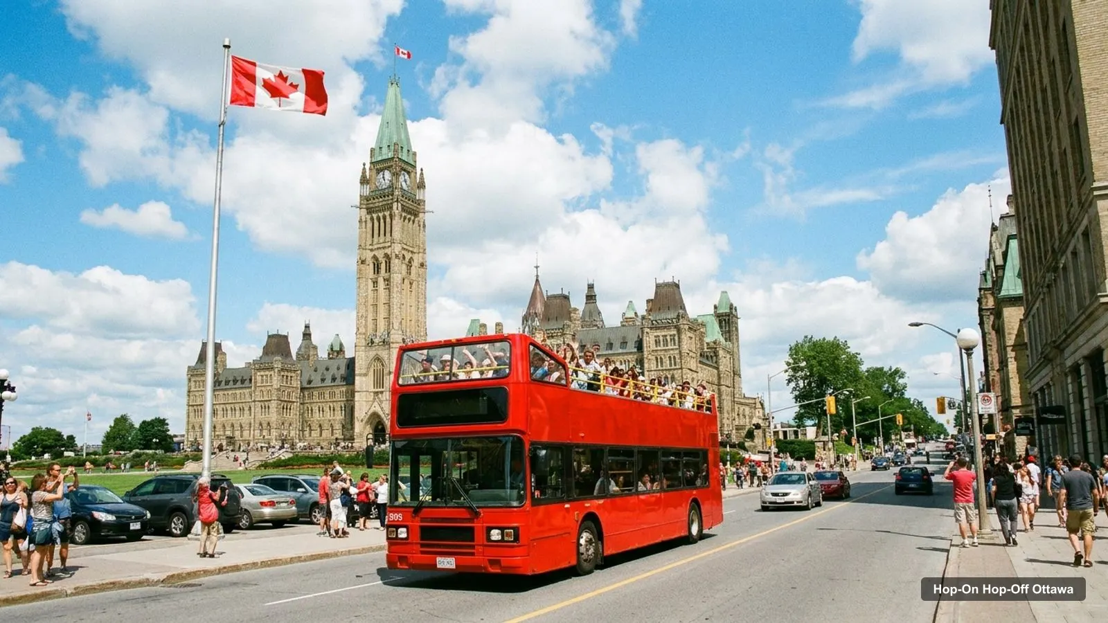
Ottawa tourist attractions group into three areas. The first is the Parliament area: Parliament Hill, the Peace Tower, the Centennial Flame, the National War Memorial and the Tomb of the Unknown Soldier. All of them are within about 0.4 km of the Hill in the coordinates.
The second is the river and market area: Notre Dame Cathedral Basilica, the National Gallery of Canada, Major’s Hill Park and Byward Market, between 0.5 and 0.8 km from the Hill. The third is the museum district, with the Canadian Museum of History across the river and the Canadian War Museum and Museum of Nature to the west and south.
Ottawa Locations: Where the Bus Stops
The locations I can tie to the hop-on hop-off bus come from the Visit Ottawa page, which names stops near these six places. The Grayline listing gives the meeting point as 44 Sparks Street.
The ten sights on my route infographic are the big names near the bus corridor, in the order they appear on the image. They are sights, not an official stop list, so use them to plan and confirm the bus calls there.
The Grayline pass is a loop of about 1.5 hours, from $31.81, and the 1-day ticket lasts 24 hours from first activation. The pass has 1,391 reviews averaging 4.48 on GetYourGuide.
What Is Ottawa Known for: Top 20 Attractions With Coordinates
This is the Ottawa tourist map in table form, ranked by Google Maps rating, with exact coordinates. I left out tour operators and anything more than about 12 km from Parliament Hill. Each link opens the place in Google Maps, where you can save it to a list before you travel.
The Ottawa tourism map is easiest to read as clusters. Within each one you can walk, and between them you ride. These are the groups I use when I plan a day.
Parliament cluster: Parliament Hill, Peace Tower, Centennial Flame, Victoria Tower Bell Monument, Confederation Building, the National War Memorial, the Tomb of the Unknown Soldier and Confederation Square. All within about 0.5 km of each other.
River and market cluster: Major’s Hill Park, Notre Dame Cathedral Basilica, the National Gallery of Canada, Alexandra Bridge Lookout and the Rideau Canal locks. Between 0.5 and 0.8 km from the Hill.
Across the river: The Canadian Museum of History in Gatineau, Quebec, about 0.9 km from the Hill.
West and south museums: The Canadian War Museum (1.4 km), the Canadian Museum of Nature (1.5 km) and the Rideau Canal National Historic Site (about 2.4 km).
Outer museums: The Aviation and Space Museum (about 5.9 km) and the Science and Technology Museum (about 6.8 km).
For clusters 4 and 5 the bus saves the most time, but I couldn’t confirm which of these the Grayline loop reaches, so check the route on the booking page.
Ottawa Tourist Map PDF and Offline Use
I don’t offer an Ottawa tourist map PDF, because a static file goes out of date and can’t link to live opening hours. A better way is to open the links in the tables above and save the places to a Google Maps list, then download the Ottawa area for offline use.
Before you go, check opening hours on each museum’s official site, since my data doesn’t include them for every place. For transit, I couldn’t open the OC Transpo fares page, so I can’t quote fares or routes. The National Capital Commission says the Rideau Canal Skateway is 7.8 km long and opens between January and early March when the weather allows, which matters if you visit in winter.
Walking Distances From Parliament Hill
Walking distances from Parliament Hill tell you quickly whether a sight needs the bus. These are straight-line distances calculated from the coordinates in the table above, so real walking routes are longer, especially where the river or the canal is in the way.
Sight
Straight-line distance from the Hill
Peace Tower
about 0.2 km
National War Memorial
about 0.4 km
Major’s Hill Park
about 0.5 km
National Gallery of Canada
about 0.7 km
Notre Dame Cathedral Basilica
about 0.8 km
Canadian Museum of History
about 0.9 km
Canadian War Museum
about 1.4 km
Canadian Museum of Nature
about 1.5 km
Canada Aviation and Space Museum
about 5.9 km
Canada Science and Technology Museum
about 6.8 km
The pattern is clear. Everything in the first six rows is a short walk, and I would not ride a bus between them unless the weather is bad or someone in your group finds walking hard. The last two rows are the reason to carry a pass or a transit ticket.
One more tip for reading this map: the Canadian Museum of History has a Gatineau address, so Google Maps will show a Quebec postal code and a different municipality. It is still only 0.9 km from Parliament Hill in a straight line, with the river in between, so check the walking route in Google Maps before you set off.
Planning a Route Across the Map
When I plan a route on the Ottawa tourist map, I start with the cluster that has the most sights and work outward. That means beginning at Parliament Hill, doing the memorials on foot, and leaving the museum district until the afternoon, when your legs are tired and a bus is most welcome.
If you only have a morning, pick one cluster and do it properly. Two clusters in a morning usually means rushing. If you have a full day, pair the Parliament cluster with one museum and keep the other museums for another day. Save every place you plan to visit to a Google Maps list, so the route updates as you add stops, and check opening days for the museums, since some close one day a week.
How to Use This Map With the Bus
Use the cluster list to decide where to hop off. If you only want the Parliament cluster, you can walk it and skip the bus. If you want the museums, ride the Grayline loop once for the overview, which takes about 1.5 hours, then hop off at the museum you care about most.
The pass is from $31.81 per person, with a live guide in English and French and free cancellation up to 24 hours before. Read the full hop-on hop-off Ottawa guide for tickets, accessibility and languages before you book.
Frequently asked questions
Is there a printable Ottawa tourist map?+
I don't host a PDF, but the tables on this page give coordinates and a Google Maps link for each of the top 20 sights and the main bus stops. Open the links, save the places to a Google Maps list and download the offline area for Ottawa. That works like a printable map and updates itself.
What is Ottawa known for?+
Ottawa is known as Canada's capital, with Parliament Hill, the National War Memorial and the Rideau Canal at its centre. It's also known for its national museums, including the Canadian War Museum and the Canadian Museum of History, and for the Rideau Canal Skateway, which the National Capital Commission calls the world's largest skating rink.
Where are the main tourist attractions in Ottawa?+
Most are downtown, within about 1 km of Parliament Hill: the National War Memorial, Notre Dame Cathedral Basilica, Major's Hill Park and the Rideau Canal locks. The museum district lies a little farther out, with the Canadian War Museum about 1.4 km west and the Museum of Nature about 1.5 km south.
Where does the Ottawa hop-on hop-off bus start?+
The Grayline Ottawa listing gives the meeting point as 44 Sparks Street, Ottawa, K1P 5K6, near Parliament Hill. Because it is hop-on hop-off, you can board at other stops once you have your ticket. I'd confirm the exact boarding points on the booking page, since the listing doesn't number its stops.
Which Ottawa sights are close enough to walk between?+
Parliament Hill, the National War Memorial, the Centennial Flame and Confederation Square are within about 0.4 km of one another. Notre Dame Basilica and the National Gallery are around 0.7 to 0.8 km from the Hill. The museums beyond that, such as the Aviation and Space Museum at about 5.9 km, are better reached by bus.
Is Ottawa easy to get around without a car?+
In the centre, yes. The core sights are walkable, and the Grayline hop-on hop-off bus, from $31.81, links the farther museums. I couldn't open the OC Transpo fares page, so I can't quote local bus or train prices. Check the current fares before you travel.
Tours I compared in Ottawa
My full review of each one, in the order I rank them: