Nice Tourist Map: Top Attractions & Bus Stops
By Jake Dawson · Updated · Affiliate links, explained in my disclosure

NiceCar
Nice: Panoramic Riviera guided Tour by Open-Top Electric Car
4.9 (1,576) · from $67.56
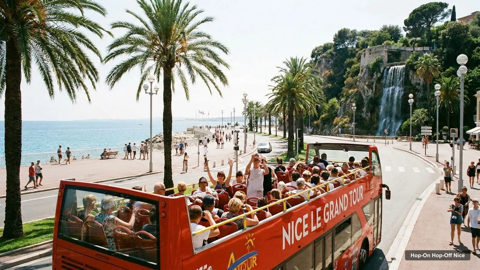
If you want one Nice tourist map that shows where the sights are and where the sightseeing bus stops, this page is it. I’ve combined the 11 stops of the open-top bus with the 20 most-reviewed attractions on Google Maps, so you can see at a glance which sight is on the route and which is not. The bus itself is covered on my hop-on hop-off in Nice page, and everything below is built from the listing data and Google Maps coordinates.
Nice Tourist Map: The Bus Route
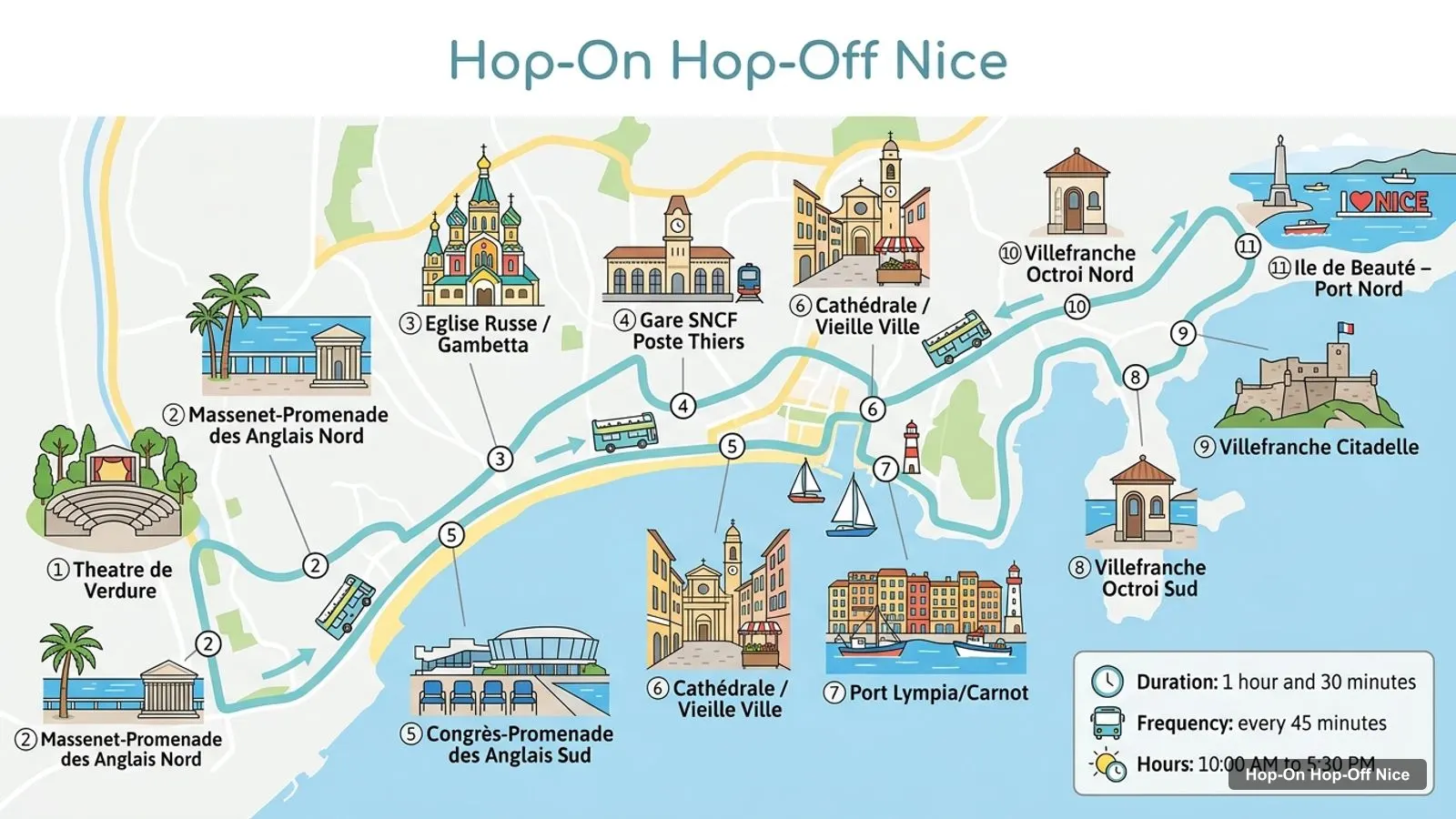
The route graphic below numbers the 11 stops in the order the operator lists them, starting at the Theatre de Verdure on the Promenade des Anglais and finishing at Ile de Beaute - Port Nord in Villefranche-sur-Mer. It is a schematic rather than a street map, which is why I add Google Maps links for every stop in the table underneath.
Stops on the route
- 1Theatre de Verdure
- 2Massenet-Promenade des Anglais Nord
- 3Eglise Russe / Gambetta
- 4Gare SNCF Poste Thiers
- 5Congrès-Promenade des Anglais Sud
- 6Cathédrale / Vieille Ville
- 7Port Lympia/Carnot
- 8Villefranche Octroi Sud
- 9Villefranche Citadelle
- 10Villefranche Octroi Nord
- 11Ile de Beauté – Port Nord
The loop takes 1 hour 30 minutes without getting off, and the bus runs every 45 minutes from 10:00 AM to 5:30 PM, according to the listing. That timetable is the thing to hold in your head when you read any tourist map of Nice: the distance between sights is short, the gap between buses is not.
Bus stops on the main loop
Each stop below links to a Google Maps search. I searched by the stop name plus Nice, so if a pin lands a street away from where you stand, trust the address column and the sign at the stop.
| # | Stop | Address (from the listing) | Map |
|---|---|---|---|
| 1 | Theatre de Verdure | 1 promenade des Anglais, 06000 Nice | Open in Google Maps |
| 2 | Massenet-Promenade des Anglais Nord | 7, Promenade des Anglais | Open in Google Maps |
| 3 | Eglise Russe / Gambetta | 47, Avenue Thiers | Open in Google Maps |
| 4 | Gare SNCF Poste Thiers | 23, Avenue Thiers | Open in Google Maps |
| 5 | Congrès-Promenade des Anglais Sud | Opposite 15, Promenade des Anglais (sea side) | Open in Google Maps |
| 6 | Cathédrale / Vieille Ville | 22, Boulevard Jean Jaurès, Nice | Open in Google Maps |
| 7 | Port Lympia/Carnot | 10, Boulevard Carnot, Nice | Open in Google Maps |
| 8 | Villefranche Octroi Sud | 10, Avenue Maréchal Foch | Open in Google Maps |
| 9 | Villefranche Citadelle | Place Emmanuelle Philibert | Open in Google Maps |
| 10 | Villefranche Octroi Nord | 2, Avenue Maréchal Foch | Open in Google Maps |
| 11 | Ile de Beauté – Port Nord | 5, Place Ile de Beauté | Open in Google Maps |
Stops 1 to 7 are in the city. Stops 8 to 11 are in Villefranche-sur-Mer, a separate town east of Nice, and the last stop is a port stop on Place Ile de Beaute. The listing does not give coordinates for the stops, so I haven’t invented any.
Nice Tourist Attractions: Top 20 With Coordinates
These are the 20 most-reviewed attractions in my Google Maps data for Nice, ranked by review count. I left out tour operators and the tourist train, because they are not sights. The coordinates come straight from Google Maps and each row opens the place card.
| # | Place | Rating (Google reviews) | Coordinates | Map |
|---|---|---|---|---|
| 1 | Colline du Château | 4.7 (25,848) | 43.6959, 7.2797 | Google Maps |
| 2 | Place Masséna | 4.6 (12,141) | 43.6972, 7.2702 | Google Maps |
| 3 | Cathédrale Saint-Nicolas de Nice | 4.6 (10,833) | 43.7039, 7.2539 | Google Maps |
| 4 | Marc Chagall National Museum | 4.4 (8,184) | 43.7095, 7.2702 | Google Maps |
| 5 | Musée Picasso | 4.3 (7,339) | 43.5808, 7.1283 | Google Maps |
| 6 | Cathédrale Sainte-Réparate de Nice | 4.6 (5,271) | 43.6972, 7.2760 | Google Maps |
| 7 | Fontaine du Soleil | 4.7 (5,243) | 43.6965, 7.2706 | Google Maps |
| 8 | Promenade du Paillon | 4.6 (4,830) | 43.6974, 7.2715 | Google Maps |
| 9 | illusion Nice - Musée de l’illusion | 4.9 (4,473) | 43.6978, 7.2687 | Google Maps |
| 10 | Fondation Maeght | 4.6 (4,042) | 43.7007, 7.1149 | Google Maps |
| 11 | Villa Masséna, musée d’art et d’histoire | 4.5 (3,479) | 43.6954, 7.2589 | Google Maps |
| 12 | #ILoveNICE | 4.7 (3,137) | 43.6936, 7.2790 | Google Maps |
| 13 | Cascade du Château | 4.7 (2,504) | 43.6958, 7.2795 | Google Maps |
| 14 | Musée du Palais Lascaris | 4.4 (2,144) | 43.6977, 7.2772 | Google Maps |
| 15 | Asian Arts Museum | 4.5 (1,839) | 43.6681, 7.2161 | Google Maps |
| 16 | Musée des Beaux-Arts de Nice | 4.3 (1,783) | 43.6945, 7.2488 | Google Maps |
| 17 | Parc Castel des Deux Rois | 4.3 (1,714) | 43.7003, 7.2913 | Google Maps |
| 18 | Musée de la Photographie Charles Nègre | 4.4 (1,424) | 43.6959, 7.2746 | Google Maps |
| 19 | Parc Honoré d’Estienne d’Orves | 4.4 (1,125) | 43.6988, 7.2446 | Google Maps |
| 20 | National Sports Museum | 4.3 (986) | 43.7063, 7.1923 | Google Maps |
Two things stand out. Castle Hill has more than twice the reviews of the next place, 25,848 against 12,141 for Place Massena, so it is the one sight I would not skip. And two of the top ten, the Picasso museum and the Fondation Maeght, are not in Nice at all: the first is in Antibes and the second in Saint-Paul-de-Vence, so they need their own half day.
Nice Tourism Map: Four Clusters
Almost every sight in the table falls into one of four clusters, and walking one cluster per half day is the easiest way to use a Nice tourism map. The distances below are straight lines computed from the coordinates, not walking routes, so allow extra for streets and hills.
Place Massena and the Paillon. Place Massena (4.6), the Fontaine du Soleil (4.7), the Promenade du Paillon (4.6) and the Musee de l’illusion (4.9 from 4,473 reviews) are all within about 350 metres of Stop 1. This is the flattest cluster, and it is where I’d start.
Castle Hill and the port. Castle Hill (4.7), the Cascade du Chateau (4.7), the Point de vue Colline du Chateau (4.7) and the #ILoveNICE letters (4.7) sit within about 1 km of Stop 1 and about 0.5 km of Port Lympia, where stop 7 is. The park is listed as open from 8:30 AM to 8 PM, and the city’s Castle Hill page is the official source for the park.
The Old Town. The Cathedrale Sainte-Reparate (4.6), the Musee du Palais Lascaris (4.4) and the Musee de la Photographie Charles Negre (4.4) are 0.5 to 0.8 km from Stop 1. Stop 6 is named Cathedrale / Vieille Ville, so I’d use it for this cluster. Several of these close one day a week.
The west and north. The Russian cathedral Saint-Nicolas (4.6 from 10,833 reviews), the Villa Massena and the Musee des Beaux-Arts are 0.7 to 1.5 km west of Stop 1, and the Marc Chagall museum is 1.5 km to the north. The Eglise Russe stop is the one to use for the cathedral.
If I were laying out one day on this Nice tourist map, I’d take the Massena cluster in the morning, ride to stop 7 for Castle Hill after lunch and finish in the Old Town, because those three clusters are all on the first half of the route. The west and north sights are better as a second day, and Villefranche-sur-Mer is the natural last stop of a two-day pass. None of this needs more than a few hundred metres of walking between neighbouring sights, which is the real advantage of a compact city.
Nice France Tourist Map: Which Stop for Which Sight
If you are standing at a stop and wondering what is near, this is my pairing, based on stop names and straight-line distances rather than a walked route.
- Stop 1, Theatre de Verdure: Place Massena, Fontaine du Soleil, Promenade du Paillon, Musee de l’illusion.
- Stop 3, Eglise Russe / Gambetta: the Russian cathedral Saint-Nicolas, though I haven’t measured the walk from the stop.
- Stop 6, Cathedrale / Vieille Ville: the Old Town cluster and the Cathedrale Sainte-Reparate.
- Stop 7, Port Lympia / Carnot: the port, and a walk to Castle Hill of roughly 0.5 km.
- Stops 8 to 10, Villefranche-sur-Mer: the Citadelle stop is named for the fortress, and the other two are on Avenue Marechal Foch.
I have no data on whether a stop sits at a sight’s entrance, so check the sign on the day. If you want to compare stops with times, my Nice itinerary puts them in a day plan.
Nice Tourist Attractions Near Me
If you are searching for Nice tourist attractions near me, start with distance from where you are. The central cluster around Place Massena is the densest: four of the top ten sights are within 350 metres of one another. If you’re on the seafront near the Promenade des Anglais, the bus stops 1, 2 and 5 are on your side of the city.
The practical test I use is whether the sight is open. The listings in my data show Place Massena, the Fontaine du Soleil and the #ILoveNICE letters as open 24 hours, and Castle Hill as 8:30 AM to 8 PM. Most museums have a closing day, so open the website from the table before you walk across town.
Nice Tourist Map Printable and Offline
I don’t offer a printable PDF, but there are two simple ways to take this map with you. Open the Google Maps links from the tables and save the places to a list on your phone, or screenshot the route graphic. The stop table has addresses for all 11 stops, so you can find a stop even without a pin.
Free cancellation up to 24 hours before travel applies to the bus pass, which means you can check the forecast first and book later. The pass is from $27.02 and is described in detail, with a booking button, on my Nice hop-on hop-off bus guide. If you’d rather see the other things I rank in Nice, the best things to do in Nice page covers the same sights with opening hours, and the homepage lists the other cities.
Frequently asked questions
Is there a tourist map of Nice with the sightseeing bus stops?
Yes, the route graphic on this page numbers all 11 stops of the Nice Le Grand Tour bus, from the Theatre de Verdure on the Promenade des Anglais to Ile de Beaute - Port Nord. The stop table below gives each address and a Google Maps link, so you can open any stop on your phone.
Which Nice tourist attractions are closest to the first bus stop?
Measured in a straight line from Stop 1, the Theatre de Verdure, the closest are the Musee de l'illusion and the Fontaine du Soleil at about 0.24 km, Place Massena at 0.26 km and the Promenade du Paillon at 0.35 km. Castle Hill is about 0.95 km away.
How big is the tourist area of Nice on the map?
The central sights fit inside about 2 km. Stop 1 to Castle Hill is 0.95 km in a straight line and Stop 1 to the Marc Chagall museum is 1.5 km. The big outliers are Antibes and Saint-Paul-de-Vence, 17 km and 12 km from Stop 1, which need a car, train or tour.
Are all the sights on the Nice tourist map open every day?
No. Castle Hill (8:30 AM to 8 PM), Place Massena and the Fontaine du Soleil (open 24 hours) are listed as open every day, but several museums, including the Chagall museum, Villa Massena and the Musee des Beaux-Arts, show one closed day a week. Check each website before you go.
Tours I compared in Nice
My full review of each one, in the order I rank them:
- Nice: Panoramic Riviera guided Tour by Open-Top Electric Car★ 4.9 · from $67.56
- Nice: 1 or 2-Day Hop-On Hop-Off Bus Tour★ 4.2 · from $27.02