Mumbai Tourist Map: Top Attractions & Bus Stops
By Jake Dawson · Updated · Affiliate links, explained in my disclosure
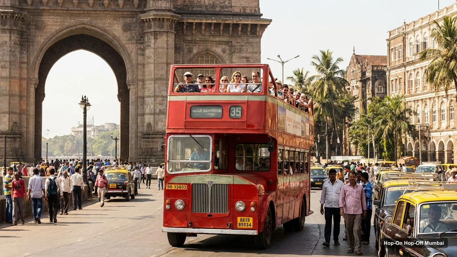
This Mumbai tourist map is a set of tables and links that work together with Google Maps. You get the ten sights from my route graphic, the top 20 attractions with exact coordinates, and the clusters I use to decide which sights to combine. If you want to know what I found about buses, my guide to hop on hop off Mumbai covers it.
One caution first. I could not verify a hop-on hop-off bus in Mumbai, so I have no bus stop coordinates to pin. What I did instead was map the sights and measure how far each is from the Gateway of India, the natural starting point for a visit.
Mumbai Tourist Attractions
The graphic below shows ten sights in the order I would link them on a day with a taxi. It’s my own sequence, built from Google Maps coordinates, not an operator’s stop list.
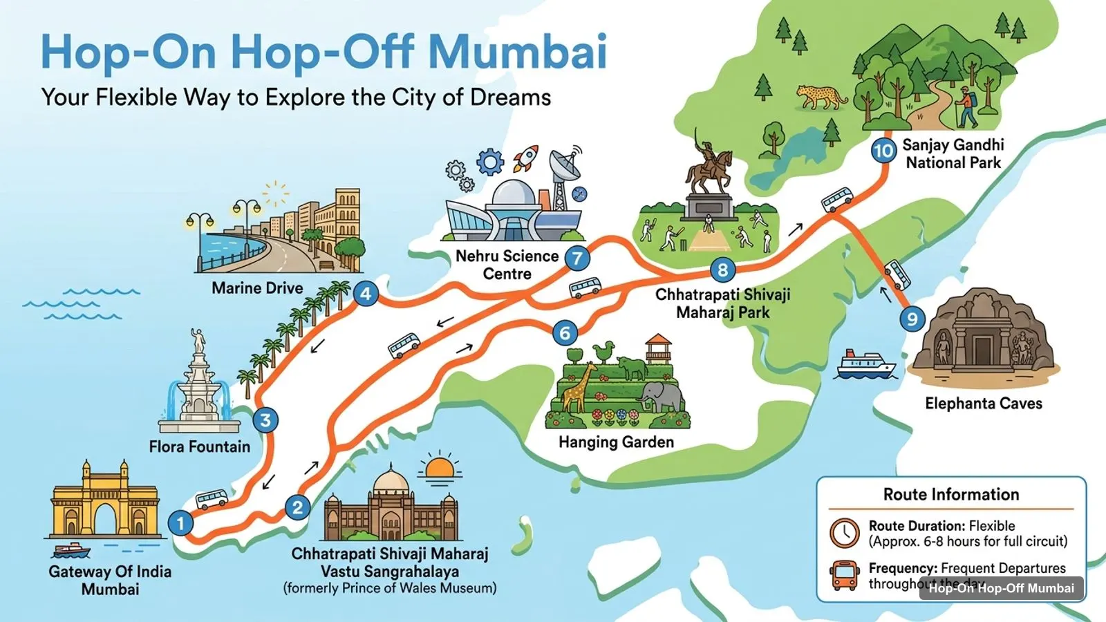
Stops on the route
- 1Gateway Of India Mumbai
- 2Chhatrapati Shivaji Maharaj Vastu Sangrahalaya
- 3Flora Fountain
- 4Marine Drive
- 5Nariman Point, Mumbai
- 6Hanging Garden
- 7Chhatrapati Shivaji Maharaj Park
- 8Elephanta Caves
- 9Sanjay Gandhi National Park
- 10Water Kingdom by EsselWorld
The ten sights on the route graphic
| # | Stop | Map |
|---|---|---|
| 1 | Gateway Of India Mumbai | Find on Google Maps |
| 2 | Chhatrapati Shivaji Maharaj Vastu Sangrahalaya | Find on Google Maps |
| 3 | Flora Fountain | Find on Google Maps |
| 4 | Marine Drive | Find on Google Maps |
| 5 | Nariman Point, Mumbai | Find on Google Maps |
| 6 | Hanging Garden | Find on Google Maps |
| 7 | Chhatrapati Shivaji Maharaj Park | Find on Google Maps |
| 8 | Elephanta Caves | Find on Google Maps |
| 9 | Sanjay Gandhi National Park | Find on Google Maps |
| 10 | Water Kingdom by EsselWorld | Find on Google Maps |
Each link opens a Google Maps search, so you can save a sight to a list. For what to see inside each one, read my best things to do in Mumbai.
Mumbai Tourist Attractions Places
Here are the top 20 attractions in my data, ranked by Google reviews, with coordinates and a map link for each. I left out an amusement park and a boat club on the far outskirts, and a few photo-point listings, so the table is about sights worth a visit. The table was generated from the places data, not typed by hand.
| # | Attraction | Coordinates | Google rating | Reviews | Map |
|---|---|---|---|---|---|
| 1 | Gateway Of India Mumbai | 18.9220, 72.8347 | 4.6 | 388,618 | Open map |
| 2 | Marine Drive | 18.9302, 72.8219 | 4.7 | 72,529 | Open map |
| 3 | Sanjay Gandhi National Park | 19.2205, 72.9128 | 4.3 | 64,819 | Open map |
| 4 | Chhatrapati Shivaji Maharaj Park | 19.0268, 72.8382 | 4.5 | 41,647 | Open map |
| 5 | Elephanta Caves | 18.9633, 72.9315 | 4.3 | 41,077 | Open map |
| 6 | Chhatrapati Shivaji Maharaj Vastu Sangrahalaya | 18.9269, 72.8327 | 4.6 | 39,993 | Open map |
| 7 | Hanging Garden | 18.9566, 72.8050 | 4.2 | 37,977 | Open map |
| 8 | Nariman Point, Mumbai | 18.9257, 72.8186 | 4.7 | 29,954 | Open map |
| 9 | Flora Fountain | 18.9325, 72.8315 | 4.5 | 24,619 | Open map |
| 10 | Nehru Science Centre | 18.9918, 72.8207 | 4.3 | 19,671 | Open map |
| 11 | Priyadarshini Park | 18.9571, 72.7989 | 4.5 | 19,100 | Open map |
| 12 | Paradox Museum Mumbai | 18.9364, 72.8316 | 4.7 | 17,960 | Open map |
| 13 | Basilica of Our Lady of the Mount (Bandra, Mumbai) | 19.0466, 72.8225 | 4.7 | 17,228 | Open map |
| 14 | Jehangir Art Gallery | 18.9274, 72.8317 | 4.5 | 12,699 | Open map |
| 15 | Kanheri Caves | 19.2079, 72.9048 | 4.5 | 9,049 | Open map |
| 16 | Mahakali Caves | 19.1301, 72.8732 | 4.1 | 6,846 | Open map |
| 17 | Dr. Bhau Daji Lad Museum | 18.9790, 72.8348 | 4.4 | 5,990 | Open map |
| 18 | Sion Hillock Fort | 19.0466, 72.8677 | 4.2 | 4,114 | Open map |
| 19 | Worli Fort | 19.0237, 72.8168 | 4.2 | 4,096 | Open map |
| 20 | RBI Monetary Museum | 18.9338, 72.8361 | 4.6 | 2,718 | Open map |
Mumbai Tourist Guide: The Clusters
A map is only useful if you know what to combine. In Mumbai the clusters are clear.
The Fort and Colaba cluster is the densest. The Gateway of India, the Vastu Sangrahalaya museum, Jehangir Art Gallery, Flora Fountain, St. Thomas Cathedral and Rajabai Clock Tower all sit within about 1.2 km of one another and of the Gateway. You can do the whole cluster on foot in a morning.
The seafront cluster is Marine Drive and Nariman Point, 1.6 and 1.7 km from the Gateway. They join into one evening walk along the Arabian Sea, and a short taxi connects them to Fort.
The Malabar Hill cluster is Hanging Garden, Priyadarshini Park and Shri Walkeshwar Temple, about 5 km from the Gateway. Mani Bhavan Gandhi Sangrahalaya is just beyond, at 4.9 km, so one taxi can serve the lot.
Then there are the outliers: Shivaji Park at 11.7 km, Elephanta Caves at 11.2 km across the harbour, and Sanjay Gandhi National Park at 34.2 km. I’d give each of them a half day or leave them out of a short trip.
Mumbai Travel Map: Distances
This table shows how far each key sight is from the Gateway of India in a straight line. Treat it as a ranking of nearness, not a travel-time guide, because Mumbai roads and water crossings add a lot.
| Sight | Straight-line distance from the Gateway of India |
|---|---|
| Chhatrapati Shivaji Maharaj Vastu Sangrahalaya | 0.6 km |
| Jehangir Art Gallery | 0.7 km |
| Flora Fountain | 1.2 km |
| Marine Drive | 1.6 km |
| Nariman Point, Mumbai | 1.7 km |
| Hanging Garden | 5.0 km |
| Nehru Science Centre | 7.9 km |
| Elephanta Caves | 11.2 km |
| Chhatrapati Shivaji Maharaj Park | 11.7 km |
| Sanjay Gandhi National Park | 34.2 km |
A good rule from this table: anything under 2 km can be walked or covered by a short ride, and anything over 5 km deserves its own slot in the day. My Mumbai itinerary uses that rule to build the one, two and three-day plans.
Mumbai Sightseeing Map: Where a Bus Would Fit
The Mumbai Darshan Bus site describes a guided full-day tour with 10 halting points, plus more than 35 landmarks you pass, and says it lasts 8 to 10 hours. It does not describe itself as hop-on hop-off, and I did not find its halts named, so I can’t place them on this map. What the clusters above show is that a bus loop would logically run through Fort, the seafront and Malabar Hill, which are the three densest areas.
If you’d rather control your own stops, the tables above give you the same loop by taxi. For the details of what I verified and what I could not, read my hop-on hop-off guide for Mumbai.
Mumbai Tourist Map for a Rainy Day
Mumbai’s museums make the map work in wet weather too. The Fort cluster has the Vastu Sangrahalaya museum (rated 4.6, listed 10:15 AM to 6 PM on Monday and Tuesday), the Paradox Museum (4.7), the RBI Monetary Museum (4.6, 1.3 km from the Gateway, closed on Mondays) and Jehangir Art Gallery (4.5, listed 11 AM to 7 PM). All four are within about 1.6 km of the Gateway, so you can hop between them by a short taxi or an umbrella walk. Further out, the Nehru Science Centre in Worli (7.9 km) and the Dr. Bhau Daji Lad Museum in Byculla (6.3 km) are the best indoor options in my data.
What Mumbai Is Famous For
From the places data, Mumbai stands out for three things. The waterfront comes first: the Gateway of India and Marine Drive are the two most reviewed places by a wide margin outside the national park. Heritage comes second, with the Fort buildings, the caves at Elephanta, Kanheri and Mahakali, and a long list of museums. Green space comes third, led by Sanjay Gandhi National Park, with Hanging Garden and Priyadarshini Park on Malabar Hill.
I find that grouping more useful than a flat ranking, because it tells you which sights compete for the same afternoon. Use it with the top-20 table above and you will not spend the day crossing the city twice.
How to Use This Mumbai Tourist Map
Open the top-20 table on your phone and tap the map links for the sights you like. Google Maps lets you save each one to a list, and the list then shows as a set of pins you can compare against your hotel. That is the closest thing to a custom Mumbai tourist map you can get for free.
Then use the clusters. Pick one cluster per half day, not one sight per area. Fort in the morning, the seafront in the evening, and a separate day for Malabar Hill or the outliers is a sensible shape. Last, check each sight’s own site for hours. The places data shows that several sights close on Mondays, so a pin on a map is not a promise that the door is open.
Mumbai Tourist Map PDF Free Download
I don’t offer a PDF, and I’d rather not hand you a file that goes out of date. The Google Maps lists above do the same job with live data. For the sights themselves, my things to do guide ranks them with hours and ratings, and the site home page lists other cities.
If you only remember one thing from this map, make it the Fort and Colaba cluster. It’s the part of the city where history, museums and the waterfront fit into one morning. For the next step, go back to the Mumbai sightseeing bus guide or plan your days in the itinerary.
Frequently asked questions
What are the main tourist attractions in Mumbai?
By Google review volume the leaders are the Gateway of India with 388,618 reviews, Marine Drive with 72,529, Sanjay Gandhi National Park with 64,819, Shivaji Park with 41,647 and Elephanta Caves with 41,077. The table below ranks the top 20 with coordinates and a map link for each.
Where are the hop-on hop-off bus stops in Mumbai?
I could not verify a hop-on hop-off route, so I have no official stop list to map. The Mumbai Darshan Bus site lists 10 halting points for a guided full-day tour but I didn't find their names printed there. The table below maps the sights instead of bus stops.
Which Mumbai attractions are close together?
The Vastu Sangrahalaya museum, Jehangir Art Gallery, Flora Fountain, St. Thomas Cathedral and Rajabai Clock Tower are all within about 1.2 km of the Gateway of India in a straight line. Marine Drive and Nariman Point are 1.6 and 1.7 km away, so one walking cluster covers most of South Mumbai.
Is there a printable Mumbai tourist map?
I don't publish a printable file. Every row in the tables links to Google Maps, where you can save places to a list and use it offline. Download the area map in the Google Maps app before you travel if you expect patchy signal.
How far is Elephanta Caves from the Gateway of India?
About 11.2 km in a straight line, based on the Google Maps coordinates, across the harbour. You travel by boat, so the real journey takes longer and depends on the crossing. I'd treat Elephanta as a half-day to full-day trip, not a quick add-on.