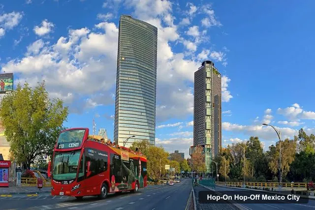
Turibus CDMX
Mexico City: Hop-on Hop-off City Tour by Turibus 1-Day Pass
- 4.2 (888 reviews)
- 24-hour ticket
- Free cancellation
My pick: Four circuits (Centro, Basilica, Polanco and Sur) cover all four clusters on this map, 4.16 from 888 reviews.
By Jake Dawson · Updated · Affiliate links, explained in my disclosure
Turibus CDMX
Mexico City: Hop-on Hop-off City Tour by Turibus 1-Day Pass
4.2 (888) · from $22.25
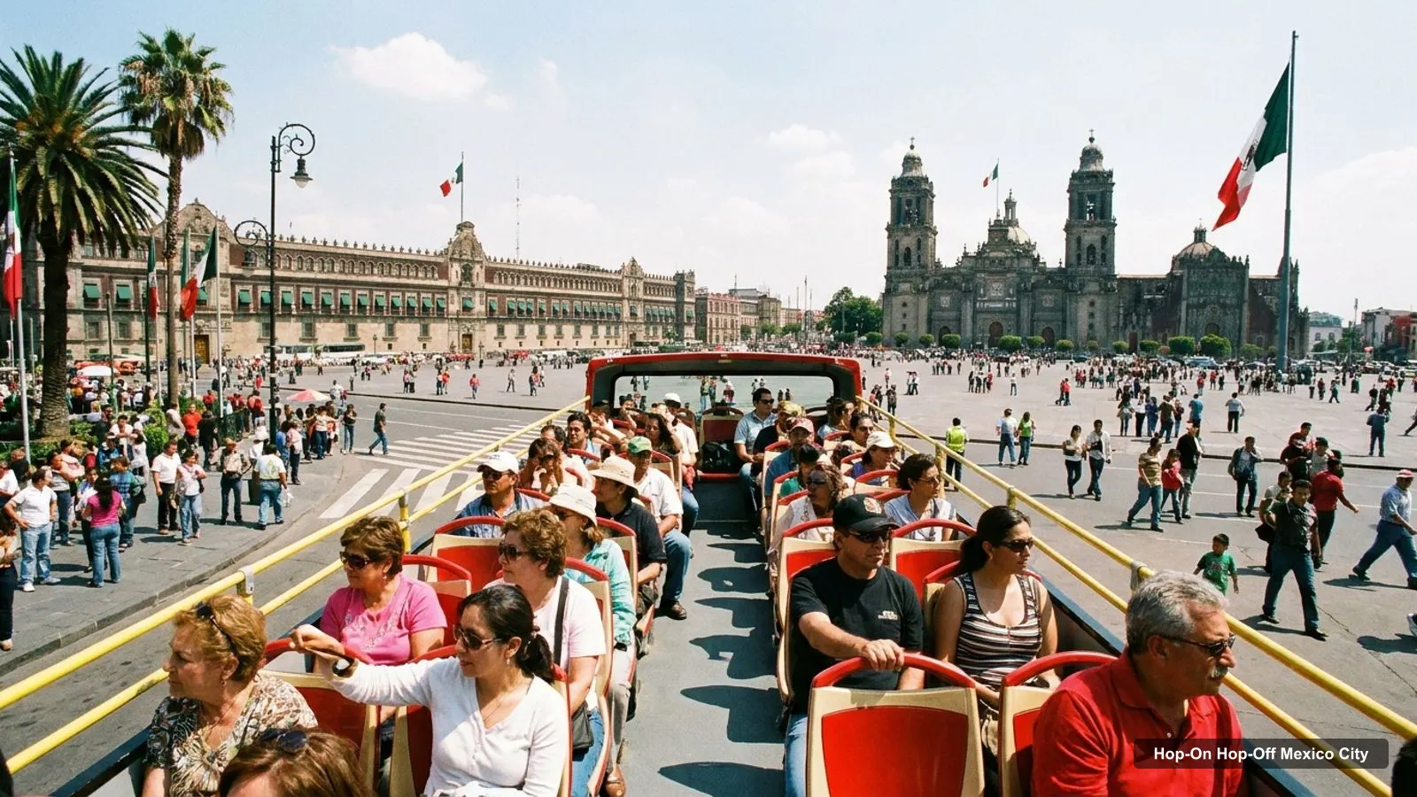
A Mexico City tourist map makes more sense once you see the city as four clusters. I’ve put the 20 most-reviewed attractions on Google Maps and the main hop-on hop-off bus stops on one page, with coordinates and a Google Maps link for each. The route graphic follows the Julia Travel Centro circuit, the most detailed stop list in my data. To compare tickets for that route, see my guide to hop-on hop-off Mexico City.
The route graphic below shows 12 of the 19 stops on the Julia Travel Centro route, numbered in the order the listing gives them. The listing says buses run about every 30 minutes, daily from 9am to 7pm.
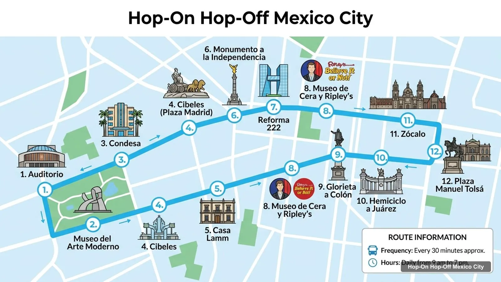
Stops on the route
| # | Stop | Map |
|---|---|---|
| 1 | Auditorio | Find on Google Maps |
| 2 | Museo del Arte Moderno | Find on Google Maps |
| 3 | Condesa | Find on Google Maps |
| 4 | Cibeles (Plaza Madrid) | Find on Google Maps |
| 5 | Casa Lamm | Find on Google Maps |
| 6 | Monumento a la Independencia | Find on Google Maps |
| 7 | Reforma 222 | Find on Google Maps |
| 8 | Museo de Cera y Ripley’s | Find on Google Maps |
| 9 | Glorieta a Colón | Find on Google Maps |
| 10 | Hemiciclo a Juárez | Find on Google Maps |
| 11 | Zócalo | Find on Google Maps |
| 12 | Plaza Manuel Tolsá | Find on Google Maps |
The listing adds seven more stops that the graphic leaves out: Museo Franz Mayer, Monumento a la Revolución, Museo de San Carlos, Reforma-Insurgentes, Monumento a la Independencia (a second time), Reforma Rio de la Plata and Museo de Antropología. The Turibus tickets add three more circuits: Basilica, Polanco and Sur. Those listings don’t name individual stops, so use the map at the stop for those.
Here is the Mexico City tourist attractions map in table form. I ranked the sights by Google review count and skipped bus stops, tour operators and anything too far out. The coordinates come from Google Maps, and each link opens the exact place.
| # | Attraction | Coordinates | Google rating | Map |
|---|---|---|---|---|
| 1 | Constitution Plaza | 19.43264, -99.13332 | 4.7 (324,900) | Open in Google Maps |
| 2 | Bosque de Chapultepec | 19.41948, -99.18946 | 4.7 (268,256) | Open in Google Maps |
| 3 | Palacio de Bellas Artes | 19.43520, -99.14120 | 4.8 (195,819) | Open in Google Maps |
| 4 | The Angel of Independence | 19.42700, -99.16766 | 4.7 (165,349) | Open in Google Maps |
| 5 | Alameda Central | 19.43594, -99.14393 | 4.6 (122,308) | Open in Google Maps |
| 6 | Museo Nacional de Antropología | 19.42600, -99.18628 | 4.8 (92,372) | Open in Google Maps |
| 7 | Chapultepec Castle | 19.42044, -99.18193 | 4.8 (89,090) | Open in Google Maps |
| 8 | Monument to the Revolution | 19.43613, -99.15466 | 4.7 (80,694) | Open in Google Maps |
| 9 | Museo Soumaya | 19.44069, -99.20470 | 4.8 (71,737) | Open in Google Maps |
| 10 | Latin American Tower Viewpoint | 19.43394, -99.14064 | 4.6 (58,493) | Open in Google Maps |
| 11 | Casa de los Azulejos | 19.43422, -99.14018 | 4.4 (52,873) | Open in Google Maps |
| 12 | Frida Kahlo Museum | 19.35518, -99.16246 | 4.5 (45,380) | Open in Google Maps |
| 13 | Templo Mayor Museum | 19.43460, -99.13188 | 4.8 (35,110) | Open in Google Maps |
| 14 | Plaza de Santo Domingo | 19.43729, -99.13380 | 4.2 (29,706) | Open in Google Maps |
| 15 | Papalote Museo del Niño | 19.41170, -99.19502 | 4.5 (29,332) | Open in Google Maps |
| 16 | Museo Nacional De Arte (MUNAL) | 19.43620, -99.13940 | 4.8 (28,392) | Open in Google Maps |
| 17 | Mexico City Metropolitan Cathedral | 19.43439, -99.13308 | 4.7 (24,276) | Open in Google Maps |
| 18 | Memory and Tolerance Museum | 19.43461, -99.14453 | 4.7 (20,797) | Open in Google Maps |
| 19 | Museo Franz Mayer | 19.43687, -99.14319 | 4.7 (19,902) | Open in Google Maps |
| 20 | Museo de Arte Moderno | 19.42300, -99.17969 | 4.7 (17,687) | Open in Google Maps |
Read the coordinates above, and you’ll see four groups on the Mexico City travel map:
Plan one cluster per half day. My best things to do in Mexico City guide says what to see at each place, and my Mexico City itinerary turns the clusters into one, two and three day plans.
A few notes will save you time with this map. First, the distances are straight lines, so budget extra for traffic and for walking around the big squares and parks. Second, the Zócalo and Chapultepec Park are large, and a place that looks close on the map can be a long walk inside the grounds. Third, bus timetables differ by listing: Julia Travel says daily from 9am to 7pm, Experiences Mexico says 9:00am to 8:00pm, and the Turibus attraction ticket has a voucher time that one reviewer found wrong, so confirm the first bus on your own voucher. Finally, many museums close one day a week, so check the day before you build a day around one.
If you only want a short list, my three-sight shortcut is the Zócalo, the Anthropology museum and the Angel of Independence, because all three sit on the Centro route. The Frida Kahlo Museum is the one big sight that needs a different circuit.
The Mexico City tourist spots are easier to reach once you know which stop serves which sight. This is how the main ones line up with the listings:
In my data, the Julia Travel Centro route covers the most of this map, with 19 named stops, including 6 of the top 8 sights. The Turibus 1-day pass names four circuits, so it reaches Coyoacán too. It is rated 4.16 from 888 reviews, at $22.25. If you want one ticket for the whole map, that’s the one I’d book.
Turibus CDMX
My pick: Four circuits (Centro, Basilica, Polanco and Sur) cover all four clusters on this map, 4.16 from 888 reviews.
Over five days, I’d give each cluster its own day and keep the fifth for the one you liked best. Day one is the historic center, day two is Reforma and the Monument to the Revolution, day three is Chapultepec and Polanco, day four is Coyoacán, and day five is flexible. The Basilica circuit adds the sanctuary in the north if you want it. The route lengths are long, so I wouldn’t try two clusters in one day.
If you want a plan and not just a map, here is the order I’d follow. Start at the Zócalo and walk to Templo Mayor and the cathedral. Continue to Bellas Artes and the Alameda, then take the bus west along Reforma to the Angel of Independence. Get off again at the Anthropology museum and spend the afternoon in Chapultepec. Keep Coyoacán and the Frida Kahlo Museum for a separate morning, because the 9.1 km trip south is long enough to deserve its own half day.
If you want a printable Mexico City tourist map, print this page: the route graphic and the two tables fit on a few sheets and keep the stop numbers next to the sights. For a PDF, use your browser’s Print to PDF option. Each Google Maps link also lets you save the place to a list on your phone, which works well offline.
The bus covers the long straight line along Reforma and the center, and the Metro is the cheap way to reach anything off it. You can see the network on the official Mexico City Metro site, and the city’s visitor site has events and opening times. Use my map to decide which cluster you want, and then pick the transport. For other cities I’ve mapped, head back to the homepage, or return to the hop-on hop-off Mexico City tickets page when you’re ready to book.
This page works as one: the route graphic shows 12 numbered bus stops, and the tables list the top 20 attractions with coordinates and Google Maps links. Print the page, or save any link to your phone for offline use. For the official maps and events, the Mexico City tourism site is also worth checking.
In four areas. The historic center has the Zócalo, Templo Mayor, Bellas Artes and the Alameda. Reforma has the Angel of Independence and the Monument to the Revolution. Chapultepec and Polanco have the Anthropology museum, the castle and the Soumaya. Coyoacán in the south has the Frida Kahlo Museum, about 9 km from the Zócalo.
From the Zócalo it's 0.9 km to Bellas Artes, 3.7 km to the Angel of Independence and 5.6 km to the Museo de Antropología, in straight lines. The Frida Kahlo Museum is about 9.1 km away. That's why a bus or the Metro matters more here than in a compact city.
My full review of each one, in the order I rank them: