
Julia Travel Gray Line Spain
Madrid City Tour – Hop-On Hop-Off Bus
- 4.1 (13,533 reviews)
- 2-day ticket
- Free cancellation
My pick: Covers the most stops on this map: 28 across three routes, including Palacio Real and Plaza Mayor.
By Jake Dawson · Updated · Affiliate links, explained in my disclosure
Julia Travel Gray Line Spain
Madrid City Tour – Hop-On Hop-Off Bus
4.1 (13,533) · from $33.44
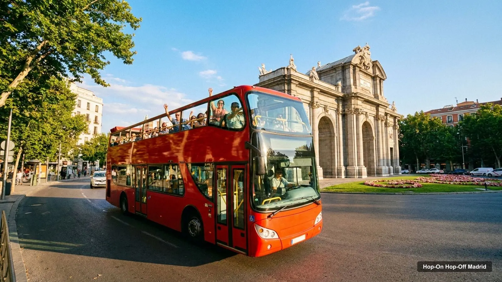
A Madrid tourist map makes more sense once you see the city as a historic core with a museum boulevard to its east. I’ve put the top 20 attractions (ranked by Google Maps reviews) and the main sightseeing bus stops on one page, with coordinates and a Google Maps link for each. The route image follows Madrid City Tour’s historic Route 1. To pick the ticket that rides it, see my comparison of hop-on hop-off in Madrid.
The Madrid tourist map below shows the historic loop: 12 stops from Neptuno on the Paseo del Prado, out through Gran Vía and Plaza de España to the Temple of Debod, down to Puerta de Toledo and back via the Royal Palace and Plaza Mayor. On Madrid City Tour the full loop takes about 85 minutes, with a bus roughly every 35 minutes depending on the season. City Sightseeing runs the same loop every 25 minutes, from 10am to 6:20pm.
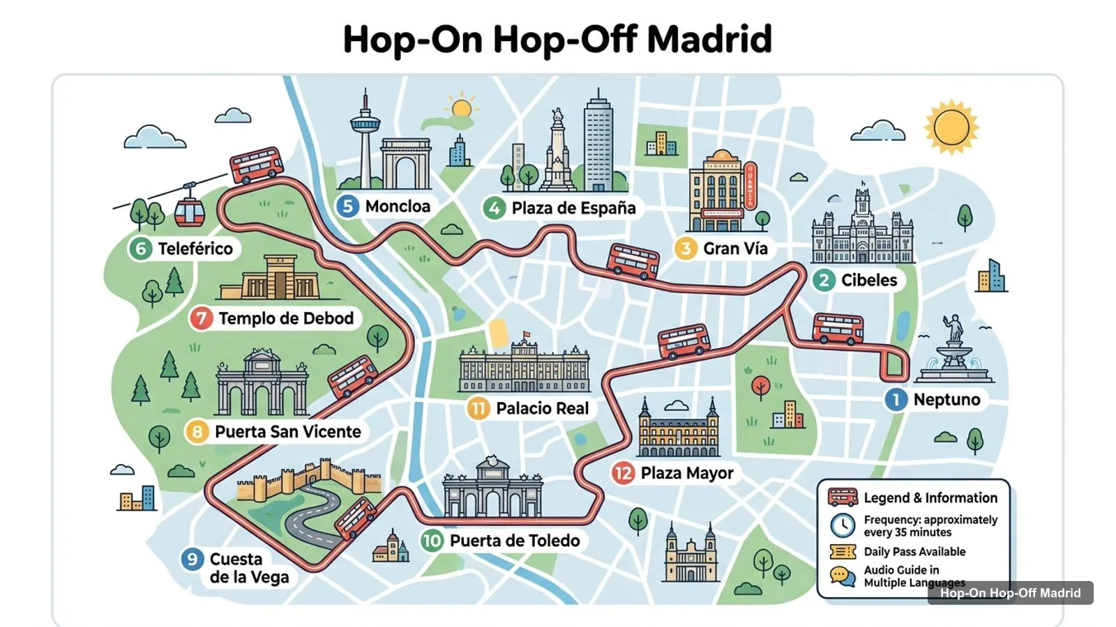
Stops on the route
| # | Stop | Map |
|---|---|---|
| 1 | Neptuno | Find on Google Maps |
| 2 | Cibeles | Find on Google Maps |
| 3 | Gran Vía | Find on Google Maps |
| 4 | Plaza de España | Find on Google Maps |
| 5 | Moncloa | Find on Google Maps |
| 6 | Teleférico | Find on Google Maps |
| 7 | Templo de Debod | Find on Google Maps |
| 8 | Puerta San Vicente | Find on Google Maps |
| 9 | Cuesta de la Vega | Find on Google Maps |
| 10 | Puerta de Toledo | Find on Google Maps |
| 11 | Palacio Real | Find on Google Maps |
| 12 | Plaza Mayor | Find on Google Maps |
The full network is bigger than this. Madrid City Tour lists 28 stops across three routes, City Sightseeing 25 and the TouringBee bundle 27. The other two loops add Colón, Museo de Ciencias Naturales, Santiago Bernabéu, Nuevos Ministerios, Museo Sorolla, Serrano, Puerta de Alcalá, Goya, Plaza de Toros, Bilbao, Malasaña and Callao. The table above is the loop most visitors ride first.
These are the top Madrid tourist attractions in table form, ranked by Google Maps reviews, with exact coordinates. I’ve left out bus operators’ offices. Each link opens the place in Google Maps, where you can save it to a list before you travel.
| # | Attraction | Coordinates | Google rating | Map |
|---|---|---|---|---|
| 1 | El Retiro Park | 40.41526, -3.68347 | 4.8 (216,348) | Open in Google Maps |
| 2 | Plaza Mayor | 40.41551, -3.70740 | 4.6 (204,837) | Open in Google Maps |
| 3 | Mercado de San Miguel | 40.41538, -3.70897 | 4.4 (165,253) | Open in Google Maps |
| 4 | Museo Nacional del Prado | 40.41378, -3.69213 | 4.7 (157,052) | Open in Google Maps |
| 5 | Royal Palace of Madrid | 40.41795, -3.71431 | 4.7 (134,156) | Open in Google Maps |
| 6 | Museo Nacional Centro de Arte Reina Sofía | 40.40791, -3.69456 | 4.5 (72,119) | Open in Google Maps |
| 7 | Temple of Debod | 40.42402, -3.71777 | 4.4 (70,293) | Open in Google Maps |
| 8 | Puerta de Alcalá | 40.41999, -3.68874 | 4.7 (63,852) | Open in Google Maps |
| 9 | Thyssen-Bornemisza National Museum | 40.41604, -3.69493 | 4.7 (48,382) | Open in Google Maps |
| 10 | Catedral de Santa María la Real de la Almudena | 40.41565, -3.71455 | 4.6 (33,255) | Open in Google Maps |
| 11 | Parque del Oeste | 40.43077, -3.72622 | 4.5 (30,718) | Open in Google Maps |
| 12 | National Museum of Archaeology | 40.42333, -3.68882 | 4.7 (28,929) | Open in Google Maps |
| 13 | CaixaForum Madrid | 40.41111, -3.69357 | 4.5 (24,574) | Open in Google Maps |
| 14 | Museo del Ferrocarril de Madrid | 40.39942, -3.69203 | 4.5 (19,026) | Open in Google Maps |
| 15 | Teatro Real | 40.41813, -3.71030 | 4.6 (15,096) | Open in Google Maps |
| 16 | Museo Nacional de Ciencias Naturales | 40.44124, -3.69019 | 4.5 (13,764) | Open in Google Maps |
| 17 | Naval Museum | 40.41776, -3.69273 | 4.6 (12,246) | Open in Google Maps |
| 18 | Madrid History Museum | 40.42574, -3.70067 | 4.5 (11,101) | Open in Google Maps |
| 19 | Museo de Cera | 40.42507, -3.69151 | 4.1 (10,965) | Open in Google Maps |
| 20 | Sweet Space Museum | 40.43191, -3.68744 | 4.4 (10,803) | Open in Google Maps |
Read the coordinates above and you’ll see the same few groups on any Madrid tourist guide:
The historic centre and the Paseo del Prado are about 1.3 km apart, Plaza Mayor to the Prado, and you can walk it in under half an hour. Plan one cluster per half day and you won’t waste time crossing the city. My best things to do in Madrid guide has what to see at each place, and my Madrid itinerary turns the clusters into 1, 2 and 3-day plans.
The Madrid tourist map gets easier once you know which stop serves which sight. Here’s how the main attractions line up with the bus stops in the operators’ listings:
Most Madrid street signs and stop names are in Spanish, so a Madrid tourist map in English helps to have both names side by side. The ones that confuse people most: Palacio Real is the Royal Palace, Templo de Debod is the Temple of Debod, Neptuno is the Neptune Fountain, and Plaza de Toros is the Las Ventas bullring. Teleférico is the cable car, and Cibeles is the fountain and square at the top of the Paseo del Prado. On the bus itself, every operator in my data offers commentary in 10 languages, English included. The TouringBee Retiro audio guide is in English, Spanish or Russian.
If you want a Madrid tourist map PDF, use your browser’s “Print to PDF” option on this page. The route image and the two tables fit on a few sheets, and the Google Maps links stay clickable on a phone or tablet. I’d also save the 20 attractions to a starred list in Google Maps. It takes a couple of minutes with the links above, and the list works offline once you’ve downloaded the area.
For Madrid tourist information, the official source is esMadrid, the city’s tourism site, which has events and opening times. The city’s main tourist information office is on Plaza Mayor, so you can combine it with the Plaza Mayor bus stop. If your question is about the bus itself, go to the operators. On Google Maps, the Big Bus visitor centre at Calle de San Bernardo 5 has 21,459 reviews averaging 4.9 and is open from 8am to 8:30pm. City Sightseeing’s office is at Gran Vía 6. Madrid City Tour’s desk is normally at Plaza de Cánovas del Castillo, but from 30 September to 19 October its buses start from Calle Felipe IV.
Many sightseeing bus stops share a name with a Metro station, which helps if you switch between the two. Moncloa, Plaza de España, Gran Vía, Callao, Bilbao, Colón, Serrano, Goya, Nuevos Ministerios, Puerta de Toledo and Santiago Bernabéu are all station names as well as bus stops. Those are the easiest places to change from the open-top bus to the Metro. For city bus routes and fares, check EMT Madrid.
If you’re walking rather than riding, the Madrid tourist map has one easy spine: the line from the Royal Palace through Plaza Mayor and Puerta del Sol to the Paseo del Prado. It’s about 2 km from the palace to the Prado, and you pass six of the top ten on the way or just off it. Save El Retiro for the end, since the Puerta de Alcalá is about 750 metres from the Prado. In summer, walk early and late, and use the museums or the bus for the hottest part of the day.
Madrid City Tour covers the most of this Madrid tourist map in my data, with 28 stops across three routes, including Palacio Real, which the City Sightseeing list doesn’t name. Big Bus has the best rating, and its three routes pass the Royal Palace, El Retiro, the Bernabéu and Las Ventas. If you want the bus tour I’d book in Madrid for this route, it’s on my Madrid sightseeing bus comparison, and the rest of my city maps start from the homepage.
Julia Travel Gray Line Spain
My pick: Covers the most stops on this map: 28 across three routes, including Palacio Real and Plaza Mayor.
This page works as one: the route map image shows the historic sightseeing bus loop with 12 numbered stops, and the tables below list the top 20 attractions with coordinates. Print the page or save it as a PDF, or open the Google Maps links to save the places to your phone for offline use.
In two clusters about 1.3 km apart. The historic centre has the Royal Palace, the Almudena Cathedral, Plaza Mayor and the Mercado de San Miguel. The Paseo del Prado has the Prado, Thyssen-Bornemisza, Reina Sofía and CaixaForum, with El Retiro and the Puerta de Alcalá just east. The Temple of Debod and Parque del Oeste sit to the north-west.
Plaza Mayor and the Prado are about 1.3 km apart, and the Royal Palace and El Retiro about 2.6 km. The three Art Triangle museums are within about 700 metres of each other. The Museo Nacional de Ciencias Naturales is the outlier, about 3 km north of the Prado, which is where the bus saves the most time.
The city's main tourist information centre is on Plaza Mayor, which is also a sightseeing bus stop. The bus operators run their own desks too: Big Bus has a visitor centre at Calle de San Bernardo 5, open 8am to 8:30pm on Google Maps, and City Sightseeing has an office at Gran Vía 6.
My full review of each one, in the order I rank them: