Leipzig Tourist Map: Top Attractions & Bus Stops
By Jake Dawson · Updated · Affiliate links, explained in my disclosure
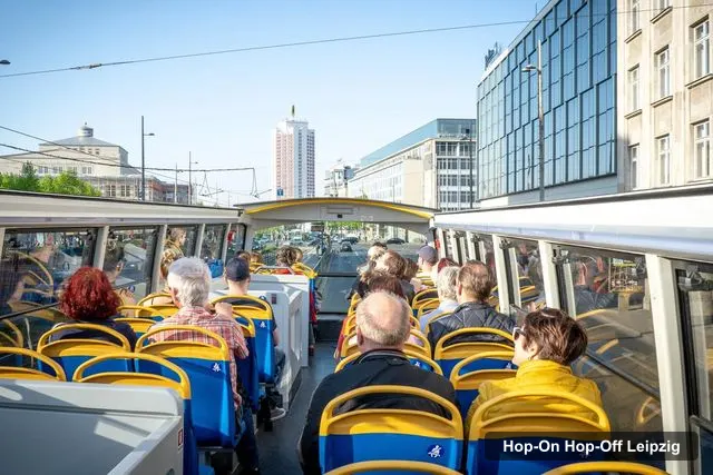
Stadtrundfahrt Leipzig
Leipzig: 13-Stop Hop-on/Hop-off Bus Ticket
4.6 (1,687) · from $27.02
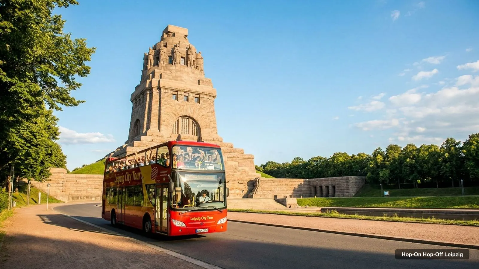
A Leipzig tourist map makes more sense once you see the city as a compact old town with a few big sights to the south. I’ve put the top 20 attractions, ranked by Google Maps reviews, and the bus stops on one page, with coordinates and a Google Maps link for each. The route image shows how the bus connects them, and my guide to hop-on hop-off Leipzig compares the tickets.
Coordinates and review counts come from Google Maps, and the stop names come from the Stadtrundfahrt Leipzig listing, checked October 2026.
Leipzig Sightseeing Map: The Bus Route
The Leipzig sightseeing map below shows the Stadtrundfahrt Leipzig loop, which takes about 1.5 hours and runs every 30 minutes. It starts at Goethestraße by the main station, runs north to the zoo and Gohlis Castle, then south to the Panometer and the Battle of the Nations Monument before returning. The listing names 13 entries, but Goethestraße appears three times, so there are 11 different places.
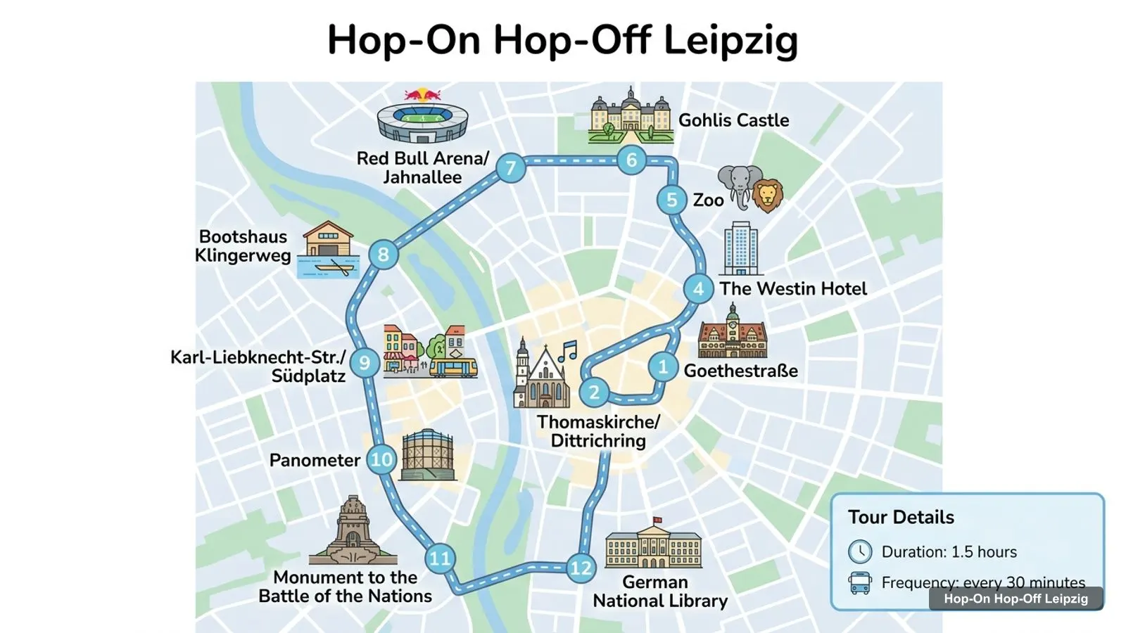
Stops on the route
- 1Goethestraße
- 2Thomaskirche/Dittrichring
- 3Goethestraße
- 4The Westin Hotel
- 5Zoo
- 6Gohlis Castle
- 7Red Bull Arena/Jahnallee
- 8Bootshaus Klingerweg
- 9Karl-Liebknecht-Str./Südplatz
- 10Panometer
- 11Monument to the Battle of the Nations
- 12German National Library
Bus stops on the loop
| # | Stop | Map |
|---|---|---|
| 1 | Goethestraße | Find on Google Maps |
| 2 | Thomaskirche/Dittrichring | Find on Google Maps |
| 3 | Goethestraße | Find on Google Maps |
| 4 | The Westin Hotel | Find on Google Maps |
| 5 | Zoo | Find on Google Maps |
| 6 | Gohlis Castle | Find on Google Maps |
| 7 | Red Bull Arena/Jahnallee | Find on Google Maps |
| 8 | Bootshaus Klingerweg | Find on Google Maps |
| 9 | Karl-Liebknecht-Str./Südplatz | Find on Google Maps |
| 10 | Panometer | Find on Google Maps |
| 11 | Monument to the Battle of the Nations | Find on Google Maps |
| 12 | German National Library | Find on Google Maps |
The Bootshaus Klingerweg stop has been relocated because of construction. The operator says to use the LVB stop Nonnenstraße near the Klingerbrücke, then walk about 10 minutes to Klingerweg 2. The Original Leipziger Stadtrundfahrten route is different: it starts at Richard-Wagner-Straße 2 and also stops at Schiller House, the City Harbour, the Federal Administrative Court, the Bavarian Station and Augustusplatz.
Leipzig Tourist Attractions: Top 20 With Coordinates
This is the Leipzig attractions map in table form, ranked by Google Maps reviews. I left out the two sightseeing tour offices. Each link opens the place in Google Maps, where you can save it before you travel.
| # | Attraction | Coordinates | Google rating | Map |
|---|---|---|---|---|
| 1 | Völkerschlachtdenkmal | 51.31237, 12.41327 | 4.7 (30,785) | Open in Google Maps |
| 2 | Marktplatz Leipzig | 51.34062, 12.37470 | 4.6 (22,878) | Open in Google Maps |
| 3 | Clara-Zetkin-Park | 51.33039, 12.35906 | 4.7 (10,029) | Open in Google Maps |
| 4 | Leipzig Panometer | 51.31430, 12.38679 | 4.5 (9,816) | Open in Google Maps |
| 5 | St. Nicholas Church | 51.34032, 12.37849 | 4.7 (6,084) | Open in Google Maps |
| 6 | St. Thomas Church | 51.33932, 12.37268 | 4.7 (5,706) | Open in Google Maps |
| 7 | Mädler-Passage | 51.33940, 12.37558 | 4.7 (4,398) | Open in Google Maps |
| 8 | Leipzig Museum of Fine Arts | 51.34234, 12.37560 | 4.6 (3,389) | Open in Google Maps |
| 9 | Botanical Garden Leipzig | 51.32916, 12.39175 | 4.5 (2,580) | Open in Google Maps |
| 10 | Grassi Museum of Applied Arts | 51.33734, 12.38821 | 4.6 (2,311) | Open in Google Maps |
| 11 | Forum of Contemporary History Leipzig | 51.33977, 12.37572 | 4.7 (2,132) | Open in Google Maps |
| 12 | Memorial Museum in the “Round Corner” | 51.34173, 12.36986 | 4.5 (1,865) | Open in Google Maps |
| 13 | Stadtgeschichtliches Museum Leipzig, Altes Rathaus | 51.34042, 12.37535 | 4.7 (1,791) | Open in Google Maps |
| 14 | Natural History Museum, Leipzig | 51.34501, 12.37087 | 4.4 (1,641) | Open in Google Maps |
| 15 | Mendelssohn-Haus | 51.33626, 12.38325 | 4.7 (1,057) | Open in Google Maps |
| 16 | Grassi Museum of Ethnology in Leipzig | 51.33737, 12.38836 | 4.5 (1,046) | Open in Google Maps |
| 17 | UNIKATUM Children’s Museum Leipzig | 51.33144, 12.33796 | 4.3 (1,043) | Open in Google Maps |
| 18 | Mendebrunnen | 51.33848, 12.38079 | 4.7 (862) | Open in Google Maps |
| 19 | Torhaus Dölitz Zinnfigurenmuseum | 51.28745, 12.38773 | 4.6 (719) | Open in Google Maps |
| 20 | Bach-Museum Leipzig | 51.33883, 12.37221 | 4.5 (708) | Open in Google Maps |
Leipzig Germany Attractions: Four Clusters
Read the coordinates above and you will see four groups on the Leipzig map in Germany.
- The old town (around 51.340, 12.375): the Marktplatz, the Altes Rathaus, St. Thomas Church, St. Nicholas Church, the Mädler-Passage, the Museum of Fine Arts, the Forum of Contemporary History and the Bach-Museum. St. Thomas Church to St. Nicholas Church is only 0.42 km. You can walk all of it in a morning.
- Augustusplatz and the Grassi quarter (around 51.337, 12.385): the Grassi museums, the Mendelssohn-Haus and the Mendebrunnen, about 0.6 to 1.1 km from St. Thomas Church.
- The parks (around 51.330, 12.36 to 12.39): Clara-Zetkin-Park to the west, 1.4 km from the church, and the Botanical Garden to the south-east, 1.7 km away.
- The south (around 51.31, 12.40): the Panometer and the Battle of the Nations Monument, 1.85 km apart, and the Napoleonstein nearby. The Torhaus Dölitz Zinnfigurenmuseum is further south still.
Plan one cluster per half day and you will not waste time crossing the city. My best things to do in Leipzig guide says what to see at each place, and my Leipzig itinerary turns the clusters into 1, 2 and 3-day plans.
Leipzig Map in Germany: Where the City Sits
Leipzig is in Saxony, in the east of Germany, and the old town is a ring of streets around the Marktplatz at 51.34062, 12.37470. The main station is on the northern edge of that ring, which is why the Stadtrundfahrt Leipzig office at Goethestraße and the Original tour’s meeting point at Richard-Wagner-Straße 2 are both there. The straight line from the Goethestraße office to the Marktplatz is about 0.52 km.
For the city-wide public transport network, the Leipziger Verkehrsbetriebe publishes the maps and timetables at lvb.de. I did not check fares for this page.
Leipzig Walking Distances Between the Main Sights
Distances decide how you use the map. I calculated these as straight lines from the Google Maps coordinates in the table above, so a real street route is longer. Allow extra time, and check the route in Google Maps on the day.
- St. Thomas Church to the Marktplatz: 0.2 km. The Mädler-Passage and the Forum of Contemporary History are also about 0.2 km from the church.
- St. Thomas Church to St. Nicholas Church: 0.42 km, and to the Museum of Fine Arts 0.39 km.
- St. Thomas Church to the Grassi Museum of Applied Arts: 1.1 km. To Clara-Zetkin-Park it is 1.37 km, and to the Botanical Garden 1.74 km.
- Marktplatz to the Panometer: 3.04 km. To the Battle of the Nations Monument it is 4.13 km.
- Panometer to the monument: 1.85 km, and from the German National Library to the monument 1.7 km.
The pattern is clear. Everything in the old town is under half a kilometre apart, and everything in the south is around 2 km from its neighbour. That is why I’d walk the first cluster and ride to the second. The bus covers the 3 to 4 km gap with a live guide, and a day ticket costs $27.02.
Which Stop for Which Sight on the Leipzig Sightseeing Map
The map gets easier once you know which stop serves which sight. This is how the main attractions line up with the stop lists in the operators’ listings:
- Battle of the Nations Monument: the stop named Monument to the Battle of the Nations, on both operators’ routes. It is open 10 am to 6 pm daily.
- Panometer: the Panometer stop on the Stadtrundfahrt Leipzig route. The Original route lists Eisfichte Coffee on Fichtestraße for the Panometer and the MDR premises.
- St. Thomas Church, the Bach-Museum and the Round Corner memorial: Thomaskirche/Dittrichring. The Bach-Museum is 60 metres from the church and the Round Corner is at Dittrichring 24.
- Marktplatz, Altes Rathaus, Mädler-Passage, St. Nicholas Church: no stop of their own. Get off at Thomaskirche/Dittrichring and walk 200 to 420 metres.
- Leipzig Zoo: the Zoo stop on both routes. The Original route calls it Zoo/Gondwanaland.
- Gohlis Castle: the Gohlis Castle stop on both routes. Schiller House (Menckestraße 42) is a stop on the Original route.
- Augustusplatz, with the Mendebrunnen and the Gewandhaus: the Augustusplatz stop on the Original route. The Stadtrundfahrt Leipzig commentary passes it without a stop.
- German National Library and the Deutsches Buch- und Schriftmuseum: the German National Library stop, 1.7 km from the monument.
A last tip for reading the Leipzig tourist map: the two operators draw the loop differently. The Stadtrundfahrt Leipzig route lists 13 entries and runs about 1.5 hours. The Original Leipziger Stadtrundfahrten route lists 12 stops and takes roughly 90 minutes. Both pass the monument, the zoo and Gohlis Castle, so you can switch operators without losing a sight.
Leipzig Germany Tourism: Official Sources
For events, opening times and visitor information I’d start with the city’s tourism board at leipzig.travel. The monument has its own foundation site at stiftung-voelkerschlachtdenkmal-leipzig.de, and the Panometer at panometer.de.
Opening hours in my tables come from Google Maps, so check the official site on the day. Museums list Monday as closed, and the Mädler-Passage is closed on Sunday.
Leipzig on a Map: Printable Notes
Print this page or save the Google Maps links to a list. If you want one map of the route, the image above is the one I’d use, and the stop table gives a search link for each stop. When you are ready to book, compare the three tickets in my Leipzig bus tour comparison, and for other cities go back to the homepage.
Frequently asked questions
Is there a printable Leipzig tourist map?
This page works as one. The route image shows the bus loop with numbered stops, and the tables list the top 20 attractions and the bus stops with coordinates. Print the page, or open any Google Maps link to save the place to your own list before you travel.
Where are most Leipzig attractions on the map?
In the old town. The Marktplatz, St. Thomas Church, St. Nicholas Church, the Mädler-Passage and the Altes Rathaus sit within about 400 metres of each other. The two big outliers are the Battle of the Nations Monument and the Panometer, both in the south-east of the city.
How far apart are the main Leipzig sights?
St. Thomas Church to St. Nicholas Church is 0.42 km. The Marktplatz to the Panometer is about 3.0 km and to the Battle of the Nations Monument about 4.1 km, as straight lines from Google Maps coordinates. The Panometer and the monument are 1.85 km apart. Real walking routes are longer.
Where is Leipzig in Germany?
Leipzig is in the state of Saxony, in eastern Germany. On this map the Marktplatz sits at 51.34062 north, 12.37470 east. The main train station is at the northern edge of the old town, which is why both bus operators start there.
Which bus stop is closest to the old town?
Thomaskirche/Dittrichring, on the Stadtrundfahrt Leipzig route. It serves St. Thomas Church, and the Marktplatz, the Mädler-Passage and the Altes Rathaus are about 200 metres away in a straight line. Walk the rest, because no bus stops on the square itself.
Tours I compared in Leipzig
My full review of each one, in the order I rank them:
- Leipzig: 13-Stop Hop-on/Hop-off Bus Ticket★ 4.6 · from $27.02
- Leipzig: Bus Tour★ 4.5 · from $27.02
- Leipzig: 1-Day Hop-On Hop-Off Bus and Leipzig Zoo Ticket★ 4.5 · from $56.30