Key West Tourist Map: Top Attractions & Bus Stops
By Jake Dawson · Updated · Affiliate links, explained in my disclosure
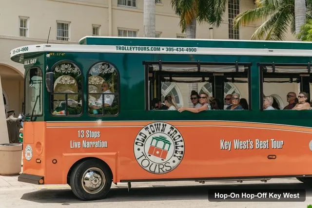
Historic Tours of America** - Key West
Key West: Old Town Trolley 13-Stop Hop-On Hop-Off Tour
4.6 (484) · from $55.60
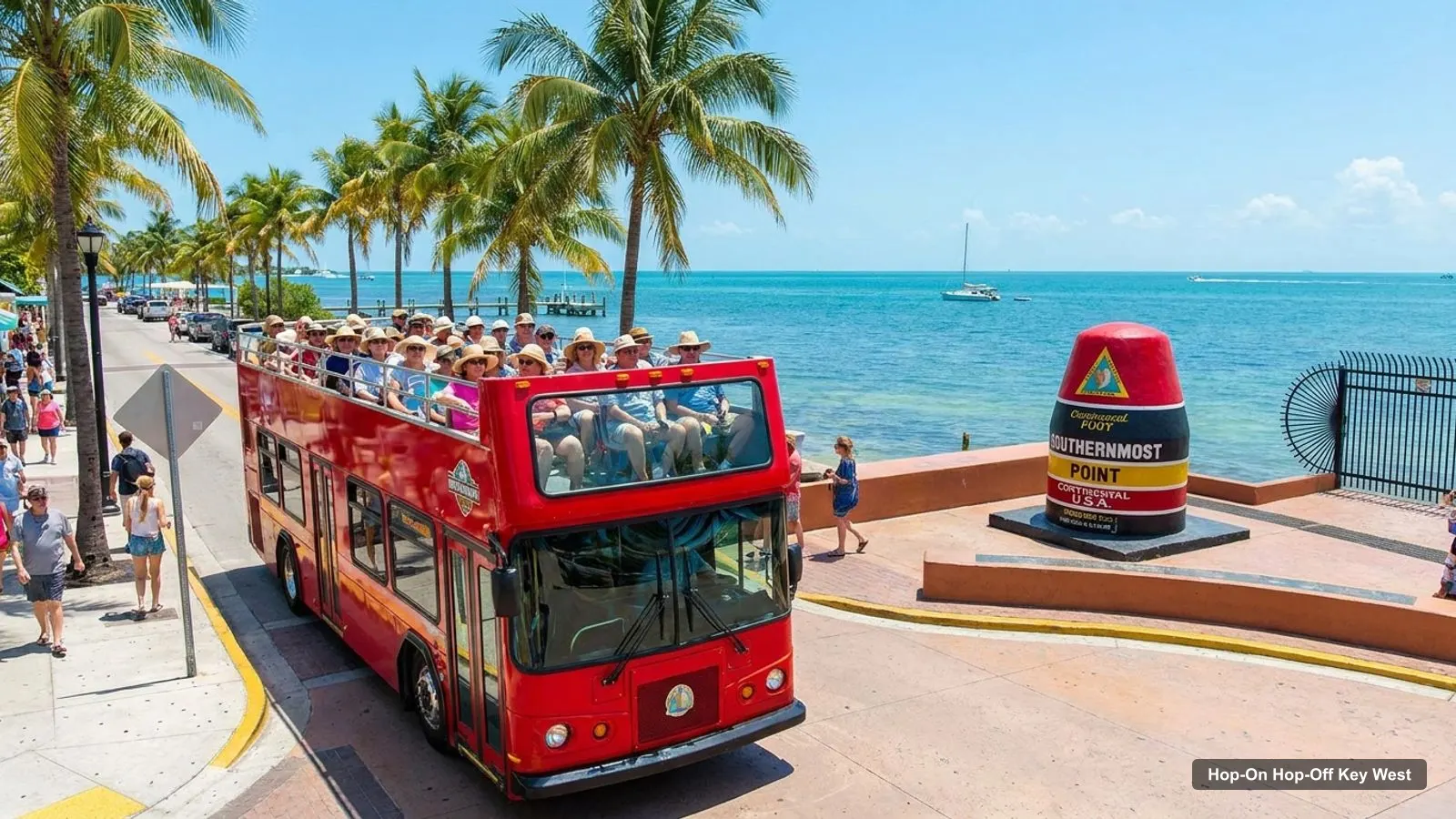
A Key West tourist map makes more sense once you see the island as three clusters. I’ve put the top 20 attractions, ranked by Google Maps reviews, and the 13 trolley stops on one page, with coordinates and a Google Maps link for each. To pick the ticket that rides the loop, see my review of hop-on hop-off in Key West.
Key West Sightseeing Map: The Trolley Route
The Key West sightseeing map below shows the loop: 13 numbered stops from Mallory Square through Old Town, along Roosevelt Boulevard to East Martello, and back through Casa Marina and the Southernmost Trolley Stop. The first tour starts at 9:00 AM, a trolley leaves about every 30 minutes, and the last tour departs Mallory Square at 4:30 PM, according to the operator.
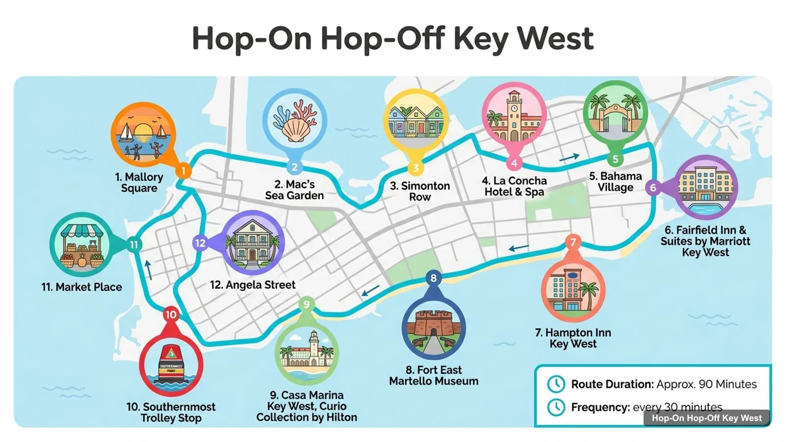
Stops on the route
- 1Mallory Square
- 2Mac's Sea Garden
- 3Simonton Row
- 4La Concha Hotel & Spa
- 5Bahama Village
- 6Fairfield Inn & Suites by Marriott Key West
- 7Hampton Inn Key West
- 8Fort East Martello Museum
- 9Casa Marina Key West, Curio Collection by Hilton
- 10Southernmost Trolley Stop
- 11Market Place
- 12Angela Street
Trolley stops on the loop
| Stop | Name | Address on the listing | Map |
|---|---|---|---|
| 1 | Mallory Square | 400 Wall St | Find on Google Maps |
| 1a | Presidential Gates | Whitehead St & Caroline St | Find on Google Maps |
| 2 | Mac’s Sea Garden | 280 Margaret St | Find on Google Maps |
| 3 | Simonton Row | Greene St & Simonton St | Find on Google Maps |
| 4 | La Concha Hotel | 430 Duval St | Find on Google Maps |
| 5 | Bahama Village | Whitehead St & Petronia St | Find on Google Maps |
| 6 | Fairfield Inn | 2400 N Roosevelt Blvd | Find on Google Maps |
| 7 | Roosevelt Station | 3840 N Roosevelt Blvd | Find on Google Maps |
| 8 | Hampton Inn | 3755 S Roosevelt Blvd | Find on Google Maps |
| 9 | East Martello | 3501 S Roosevelt Blvd | Find on Google Maps |
| 10 | Casa Marina | 1500 Reynolds St | Find on Google Maps |
| 11 | Southernmost Trolley Stop | South St & Simonton St | Find on Google Maps |
| 12 | Truval Village | Truman Ave & Duval St | Find on Google Maps |
| 13 | Angela Street Depot | Angela St & Duval St | Find on Google Maps |
The route image shows 12 names, because the GetYourGuide itinerary block lists 12 places, while the description lists 13 numbered stops plus a sub-stop at the Presidential Gates. I follow the numbered list with street addresses, and I’d check the printed map you receive for the current stops.
Key West Tourist Attractions: Top 20 Sights with Coordinates
This is the Key West tourist attractions list, ranked by number of Google Maps reviews. I’ve left out the trolley operator’s own entry, the Sand Key Lighthouse, which sits at sea, and the Dry Tortugas ferry office, because they are not sights you can walk up to. The coordinates and links come from the Google Maps data I collected for this site, and the table was generated by a script, not typed by hand.
| # | Attraction | Coordinates | Google rating | Map |
|---|---|---|---|---|
| 1 | Southernmost Point of the Continental U.S.A. | 24.54651, -81.79751 | 4.5 (43,560) | Open in Google Maps |
| 2 | The Hemingway Home and Museum | 24.55119, -81.80062 | 4.6 (18,808) | Open in Google Maps |
| 3 | Fort Zachary Taylor Historic State Park Beach | 24.54655, -81.81056 | 4.6 (16,273) | Open in Google Maps |
| 4 | Smathers Beach | 24.55198, -81.76873 | 4.3 (9,817) | Open in Google Maps |
| 5 | The Key West Butterfly and Nature Conservatory | 24.54756, -81.79682 | 4.8 (9,667) | Open in Google Maps |
| 6 | Clarence S.Higgs Memorial Beach | 24.54717, -81.78725 | 4.3 (5,883) | Open in Google Maps |
| 7 | Truman Little White House | 24.55627, -81.80686 | 4.6 (4,216) | Open in Google Maps |
| 8 | Key West Aquarium | 24.55907, -81.80733 | 4.1 (3,134) | Open in Google Maps |
| 9 | Key West Lighthouse | 24.55061, -81.80087 | 4.6 (2,882) | Open in Google Maps |
| 10 | Mel Fisher Maritime Museum | 24.55806, -81.80648 | 4.5 (2,080) | Open in Google Maps |
| 11 | USCGC Ingham Maritime Museum | 24.55222, -81.80779 | 4.8 (1,444) | Open in Google Maps |
| 12 | Mallory Square | 24.55987, -81.80768 | 4.7 (1,433) | Open in Google Maps |
| 13 | Key West Shipwreck Museum | 24.55905, -81.80694 | 4.4 (1,397) | Open in Google Maps |
| 14 | Fort East Martello Museum | 24.55209, -81.75520 | 4.6 (1,278) | Open in Google Maps |
| 15 | Edward B. Knight Pier | 24.54644, -81.78393 | 4.7 (1,131) | Open in Google Maps |
| 16 | Key West Museum of Art & History at the Custom House | 24.55834, -81.80695 | 4.6 (509) | Open in Google Maps |
| 17 | Audubon House & Tropical Gardens | 24.55832, -81.80608 | 4.6 (431) | Open in Google Maps |
| 18 | Key West Ghost and Mysteries Tour | 24.55775, -81.80450 | 4.7 (208) | Open in Google Maps |
| 19 | Oldest House Museum & Gardens Key West | 24.55734, -81.80406 | 4.5 (207) | Open in Google Maps |
| 20 | Alex Vega Key West Firehouse Museum | 24.55373, -81.79296 | 4.9 (153) | Open in Google Maps |
Key West Tourist Attractions Map: The Three Areas
The Key West tourist attractions map falls into three areas. The first is the Mallory Square end: Mallory Square, the Truman Little White House, the aquarium, the shipwreck museum and the Mel Fisher Maritime Museum are all within about 0.5 km of each other. The second is Whitehead Street, where the Hemingway Home, the lighthouse and the Southernmost Point run 0.6 km from end to end. The third is the east side with Fort East Martello and Smathers Beach, 1.4 km apart.
Fort Zachary Taylor and Higgs Beach are the two outliers on the south coast. Fort Zachary Taylor is 1.3 km from the Southernmost Point and Higgs Beach 1.0 km.
Which Trolley Stop for Which Sight
The Key West tour map only helps if you can match sights to stops. This is what the data lets me say:
| Sight | Trolley stop | Note |
|---|---|---|
| Mallory Square | 1, Mallory Square | At the stop |
| Truman Little White House | 1, Mallory Square | 0.4 km |
| Hemingway Home, lighthouse | 1a and 5 (Whitehead Street) | Same street, check the printed map |
| Southernmost Point | 11, Southernmost Trolley Stop | Near, not at, the stop |
| Fort East Martello | 9, East Martello | At the stop |
Key West Tourism Map: How I’d Read It
On a Key West tourism map I’d always start with the distances. Mallory Square to Fort East Martello is 5.4 km, which is a long walk in the Florida heat, and that is the stretch where the trolley pays for itself at $55.60. Between the Mallory Square sights and Whitehead Street, walking is easy.
I’d also check the weather before choosing. In 2025 data, September had 20 days with at least 1 mm of rain and February had 2, so a dry-season trip means fewer detours to indoor sights.
Key West Tourist Information Center
The Florida Keys tourism site lists the Greater Key West Chamber of Commerce at 510 Greene Street, 1st Floor, with the phone number 1-800-527-8539. That is the contact for visitor information that I could verify in October 2026, and I recommend the Florida Keys tourism page for Key West for current details.
For the trolley, the operator’s own site, trolleytours.com/key-west, says the tour is about 13 miles long and averages 90 minutes. You collect a map and schedule when you redeem your voucher at the depot.
Key West Tour Map: Reading the Route
The Key West tour map has a simple logic once you know the three legs. Stops 1 to 5 are the Old Town leg: Mallory Square, the Presidential Gates, Mac’s Sea Garden, Simonton Row, La Concha Hotel and Bahama Village. Stops 6 to 9 run along Roosevelt Boulevard, past the Fairfield Inn, Roosevelt Station and the Hampton Inn, and end at East Martello. Stops 10 to 13 bring you back through Casa Marina, the Southernmost Trolley Stop, Truval Village and the Angela Street Depot.
Because the trolley takes about 90 minutes without stops, you can use the first loop as a map lesson. Listen to the conductor, then decide where to spend your time. A reviewer on the listing says the guide’s information helped their group decide where to spend the day, and that is exactly how I’d use it.
Key West Walking Tips
Walking is how most people see the old town. Keep to the shade in summer: average highs in 2025 were 29.0 C in June and 30.3 C in August. The short hops, such as the Hemingway Home to the lighthouse, take almost no time, while the stretch from Mallory Square to the Southernmost Point is 1.8 km. When the distance passes about 1.5 km, I’d take the trolley.
Using This Key West Map Offline
Open any Google Maps link in the tables and save the place to your phone before you go, so it works without a signal. Save the trolley stops you plan to use, plus the depot address on your voucher. The listing gives 501 Front St as the meeting point, while Google Maps lists the operator at 1 Whitehead St, so save both and check which one your voucher names.
Parking and Getting Around
The listing says parking is available at Mallory Square, at the Westin parking garage and at the Key West Welcome Center on N. Roosevelt Blvd. Seating on the trolley is first come, first served, and the listing does not allow pets or large bags, so travel light. If you drive in, leave the car at one of those places and let the trolley do the rest, which is what the operator suggests when it describes the ticket as a way to forget your car.
Key Largo Tourist Map
People also search for a Key Largo tourist map, but Key Largo is a different island and not part of this trolley route. I have no map data for it, so this page covers Key West only. Use the Florida Keys tourism site for Key Largo.
Which Ticket Covers This Map?
The Old Town Trolley ticket on GetYourGuide covers the whole loop for one day, at $55.60, rated 4.56 from 484 reviews. My full review is on the hop-on hop-off Key West page. To decide what to visit at each stop, see my guide to the best things to do in Key West, and to plan your days, use my Key West itinerary for 1, 2 and 3 days. The homepage lists every city I cover.
Frequently asked questions
Is there a printable Key West tourist map?
This page works as one. The route image shows the trolley loop with numbered stops, and the tables list every stop and the top 20 attractions with coordinates. You also get a printed map and schedule when you redeem your trolley voucher at the depot, or from the conductor if you board at a stop with no booth.
Where is the Key West tourist information center?
The Florida Keys tourism site lists the Greater Key West Chamber of Commerce at 510 Greene Street, 1st Floor, Key West, FL 33040, phone 1-800-527-8539. That is the contact it publishes, checked October 2026. Check the chamber's own site for opening hours before you go.
How far apart are the main Key West sights?
In a straight line, Mallory Square to the Truman Little White House is about 0.4 km, to the Hemingway Home 1.2 km, to the Southernmost Point 1.8 km and to Fort East Martello 5.4 km. The Hemingway Home and the lighthouse are only 0.07 km apart. Smathers Beach is 4.0 km from Mallory Square.
Where are most Key West attractions on the map?
They cluster in two places: the Mallory Square and Front Street end, and Whitehead Street running south to the Southernmost Point. A third group, East Martello and Smathers Beach, sits 4 to 5 km east. The trolley loop connects all three, with 13 stops and a tour about every 30 minutes.
Tours I compared in Key West
My full review of each one, in the order I rank them:
- Key West: Old Town Trolley 13-Stop Hop-On Hop-Off Tour★ 4.6 · from $55.60