Jakarta Tourist Map: Top Attractions & Bus Stops
By Jake Dawson · Updated · Affiliate links, explained in my disclosure
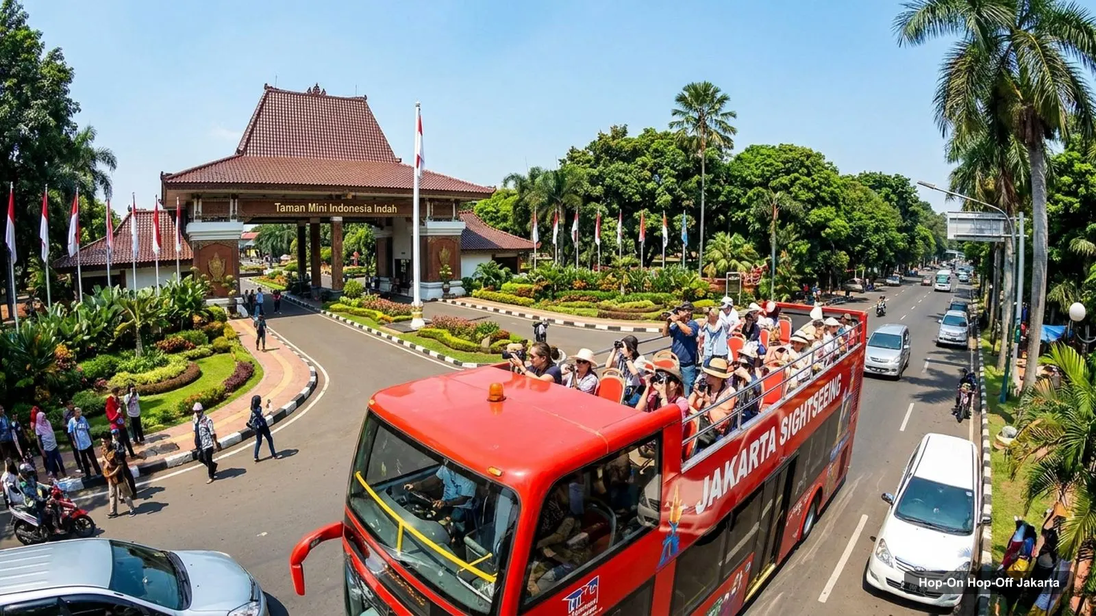
A Jakarta tourist map is easier to read once you see the city as three clusters and one outlier. I put the top 20 attractions, ranked by Google Maps reviews, on one page with coordinates and a map link for each, and added the ten stops of my suggested route. To understand why those stops are not a real bus line, read my guide to hop-on hop-off in Jakarta.
Jakarta Tourist Map: My Suggested Route
The image below shows the ten stops I would use for a self-guided Jakarta day, from Taman Mini Indonesia Indah in the south-east to Sea World Ancol in the north. It is a route I drew from the data, not the path of a bus. I would not do all ten in one day.
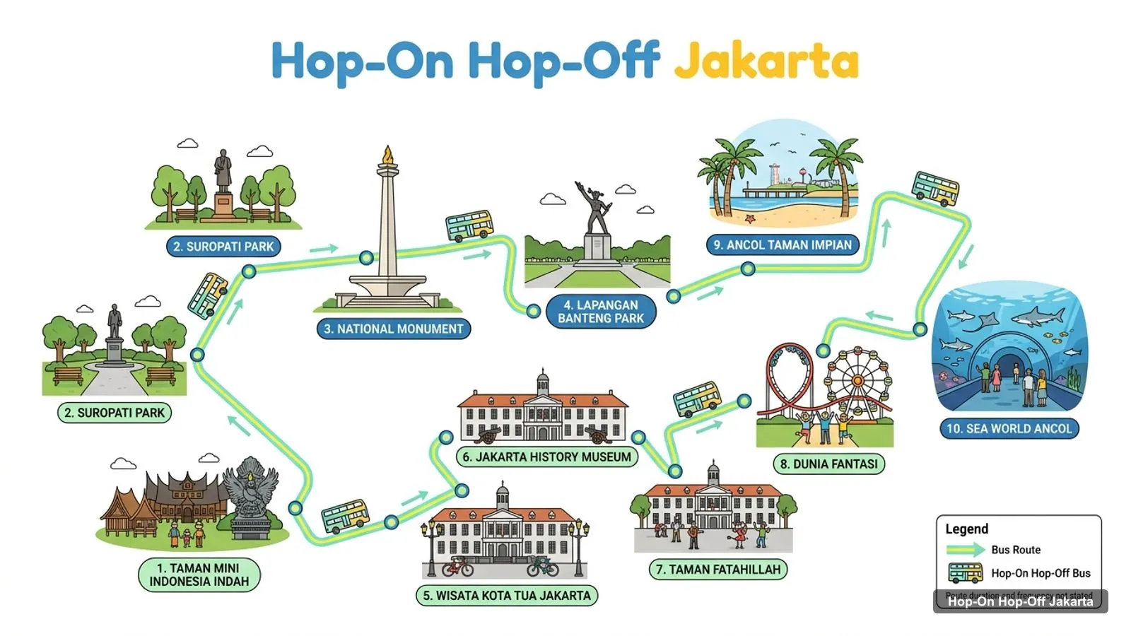
Stops on the route
- 1Taman Mini Indonesia Indah
- 2Suropati Park
- 3National Monument
- 4Lapangan Banteng Park
- 5Wisata Kota Tua Jakarta
- 6Jakarta History Museum
- 7Taman Fatahillah
- 8Dunia Fantasi
- 9Ancol Taman Impian
- 10Sea World Ancol
Route stops with Google Maps links
| # | Stop | Map |
|---|---|---|
| 1 | Taman Mini Indonesia Indah | Find on Google Maps |
| 2 | Suropati Park | Find on Google Maps |
| 3 | National Monument | Find on Google Maps |
| 4 | Lapangan Banteng Park | Find on Google Maps |
| 5 | Wisata Kota Tua Jakarta | Find on Google Maps |
| 6 | Jakarta History Museum | Find on Google Maps |
| 7 | Taman Fatahillah | Find on Google Maps |
| 8 | Dunia Fantasi | Find on Google Maps |
| 9 | Ancol Taman Impian | Find on Google Maps |
| 10 | Sea World Ancol | Find on Google Maps |
Jakarta Tourist Attractions: Top 20 by Reviews
These are the 20 most-reviewed places in my Google Maps data for Jakarta. The coordinates are from the same data, and each link opens the place on Google Maps.
| # | Attraction | Rating | Reviews | Coordinates | Map |
|---|---|---|---|---|---|
| 1 | Taman Mini Indonesia Indah | 4.6 | 174,975 | -6.3045, 106.8893 | Open map |
| 2 | National Monument | 4.6 | 122,641 | -6.1753, 106.8271 | Open map |
| 3 | Dunia Fantasi | 4.6 | 80,110 | -6.1275, 106.8343 | Open map |
| 4 | Ancol Taman Impian | 4.6 | 48,272 | -6.1253, 106.8335 | Open map |
| 5 | Sea World Ancol | 4.5 | 47,402 | -6.1259, 106.8428 | Open map |
| 6 | Lapangan Banteng Park | 4.7 | 30,678 | -6.1706, 106.8350 | Open map |
| 7 | Taman Fatahillah | 4.6 | 29,962 | -6.1347, 106.8132 | Open map |
| 8 | Wisata Kota Tua Jakarta | 4.6 | 27,226 | -6.1351, 106.8137 | Open map |
| 9 | Jakarta History Museum | 4.6 | 22,904 | -6.1352, 106.8133 | Open map |
| 10 | Suropati Park | 4.6 | 22,460 | -6.1994, 106.8326 | Open map |
| 11 | National Museum of Indonesia | 4.7 | 20,881 | -6.1765, 106.8218 | Open map |
| 12 | Cathedral of Our Lady of the Assumption | 4.8 | 15,457 | -6.1692, 106.8334 | Open map |
| 13 | Museum MACAN | 4.5 | 11,879 | -6.1910, 106.7679 | Open map |
| 14 | Museum Bank Indonesia | 4.7 | 11,588 | -6.1372, 106.8129 | Open map |
| 15 | National Gallery of Indonesia | 4.7 | 10,934 | -6.1783, 106.8320 | Open map |
| 16 | Satriamandala Museum | 4.6 | 8,773 | -6.2318, 106.8189 | Open map |
| 17 | Selamat Datang Monument | 4.7 | 8,649 | -6.1950, 106.8230 | Open map |
| 18 | Taman Proklamator | 4.7 | 7,410 | -6.2032, 106.8468 | Open map |
| 19 | Tugu Tani | 4.5 | 6,718 | -6.1827, 106.8348 | Open map |
| 20 | Wayang Museum | 4.5 | 5,213 | -6.1349, 106.8123 | Open map |
Jakarta Things to Do by Cluster
Group the map into clusters and the city gets simpler. Merdeka Square is the central cluster: Monas, the National Museum, the National Gallery, Lapangan Banteng Park and the cathedral are all within a short walk or ride of each other. Kota Tua is the old-town cluster around Fatahillah Square, about 4.8 km north-west of Monas by straight line. Ancol is the coastal cluster, about 5.6 km north of Monas. Taman Mini Indonesia Indah is the outlier, about 15.9 km to the south-east.
Within the clusters everything is walkable. Between them you need a taxi, a ride-hailing car or the TransJakarta network. Wikipedia says Corridors 1 and 2 serve the National Monument and Corridor 1 ends at Kota, so one corridor links the first two clusters. I do not have a timetable, so check on the day.
Jakarta Must See: My Short List
If I had to reduce the map to five pins, I would choose Monas, the cathedral, Fatahillah Square, Lapangan Banteng Park and one of the Ancol parks. The cathedral has the best rating among the big sights, 4.8 from 15,457 reviews. Lapangan Banteng Park scores 4.7 and is open around the clock.
Is Jakarta Worth Visiting
Yes, if you like history, museums and food more than beaches. Five of the museums on this map score 4.7 on Google Maps, and the old town and Merdeka Square give you colonial Batavia and national monuments within a short ride of each other. It is a big, busy city, so I’d keep to two areas per day. See my Jakarta itinerary for how I would order them.
Jakarta Indonesia Attractions: Opening Hours to Check
Hours vary a lot. In my data Taman Mini Indonesia Indah is listed from 6 AM to 8 PM, Dunia Fantasi from 10 AM to 6 PM, Sea World Ancol from 9 AM to 5 PM and Ancol Taman Impian from 6 AM to 11 PM. Lapangan Banteng Park and Taman Fatahillah are listed as open 24 hours. Several museums showed as closed on the day the data was captured, so check opening days before you set out.
Distances Between the Main Jakarta Sights
I worked these out from the coordinates in the tables above, as straight lines, so roads will be longer. Inside Merdeka Square the National Museum of Indonesia and the National Gallery are each about 0.6 km from Monas, and the cathedral is about 1.0 km. Suropati Park in Menteng is about 2.7 km from Monas, and the Selamat Datang Monument is about 2.2 km away.
In Kota Tua the distances are tiny. The Wayang Museum is about 0.1 km from Fatahillah Square, Museum Bank Indonesia about 0.3 km and Museum Mandiri about 0.4 km. That is why I tell people to base themselves on the square and walk. At Ancol, Ancol Taman Impian and Dunia Fantasi are about 0.3 km apart, and Sea World Ancol is about 1.0 km from Dunia Fantasi.
The long legs are the ones that decide your day. Museum MACAN is about 6.8 km from Monas, and Taman Mini Indonesia Indah is about 20.9 km from Ancol Taman Impian. Add a generous buffer for traffic on any of them.
How to Read the Coordinates and Links
The coordinates in the attraction table are latitude and longitude in decimal degrees, taken from the Google Maps listing. The Map link opens the same place, so you can get directions from wherever you are. The stop table uses a Google Maps search link by name instead, because the stops are my own suggested route and not official bus stops. If a link opens the wrong place, search the name together with Jakarta.
Opening days change, and the data I use is a snapshot. Treat the hours I give as a guide, and check the place’s own page on the day.
Getting Between the Map Clusters
I have no timetable or route data for the free Bus Wisata, so I cannot tell you which clusters it links. What Wikipedia does say is that it is a free double-decker bus that circles major roads and needs no card tap. For the public network, Wikipedia gives the TransJakarta fare as Rp3,500 and says Corridors 1 and 2 serve Monas, with Corridor 1 ending at Kota. That is the cheapest link between the first two clusters on this map.
For Ancol and Taman Mini I’d use a taxi or a ride-hailing car, or a guided tour. In my GetYourGuide data the guided half-day city tours start at $46.62 per person, and the best-reviewed private half-day tour is $47.20 at 4.84 from 367 reviews. I explain the options on my main page.
Planning a Day With This Jakarta Tourist Map
Here is how I would use the Jakarta tourist map in practice. Pick one cluster for the morning and a second for the afternoon, and keep the third for another day. Open the route table, tap the first stop, and let Google Maps build the walking or driving directions. If you are travelling with children, the Ancol cluster is the easiest, because the main parks are within about a kilometre of each other. If you prefer history, stay in Merdeka Square and Kota Tua.
Whatever you choose, leave room in the plan. A Jakarta tourist map shows distances, but it cannot show traffic, and traffic is what makes the city slow. Start early, take water, and keep a museum and a park on your list for each area, so a closed door does not spoil the day.
Using This Map
Open any link on your phone and save the place to a Google Maps list, then plan the order by area. For ratings, addresses and whether a bus stops at each place, see my best things to do in Jakarta. For the full comparison of ways to get around, return to my Jakarta hop-on hop-off guide, or go to the homepage for other cities.
Frequently asked questions
Is there a printable Jakarta tourist map?
This page works as one. The route image shows ten numbered stops I suggest for a self-guided day, and the tables list the top 20 attractions with coordinates and a Google Maps link for each. Print the page, or open the links to save the places on your phone for offline use.
Where are most Jakarta attractions on the map?
In three clusters plus one outlier. Merdeka Square holds Monas and the National Museum. Kota Tua, about 4.8 km north of Monas, holds Fatahillah Square and the History Museum. Ancol is on the north coast, and Taman Mini Indonesia Indah is about 15.9 km south-east of Monas.
Are there real bus stops on this map?
No. I found no ticketed hop-on hop-off bus in Jakarta, so the ten numbered stops are my suggested sightseeing route, not an operator's stops. Wikipedia lists a free Bus Wisata city tour bus and the TransJakarta network, so check the current routes and stops locally.