Inverness Tourist Map: Top Attractions & Bus Stops
By Jake Dawson · Updated · Affiliate links, explained in my disclosure
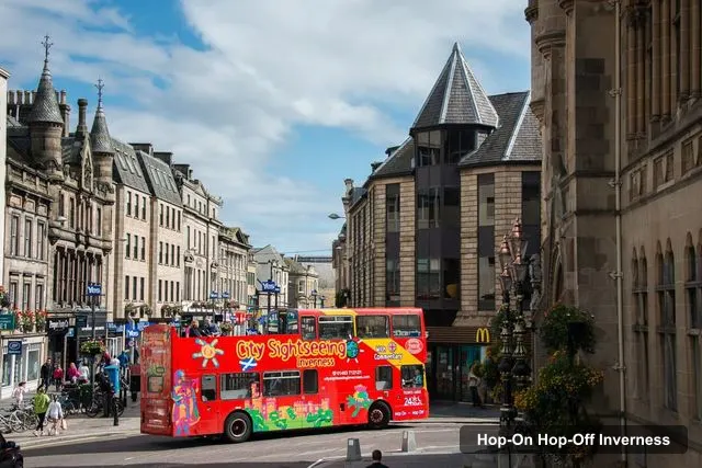
City Sightseeing UK
Inverness: City Sightseeing Hop-On Hop-Off Bus Tour
4.1 (500) · from $15.93
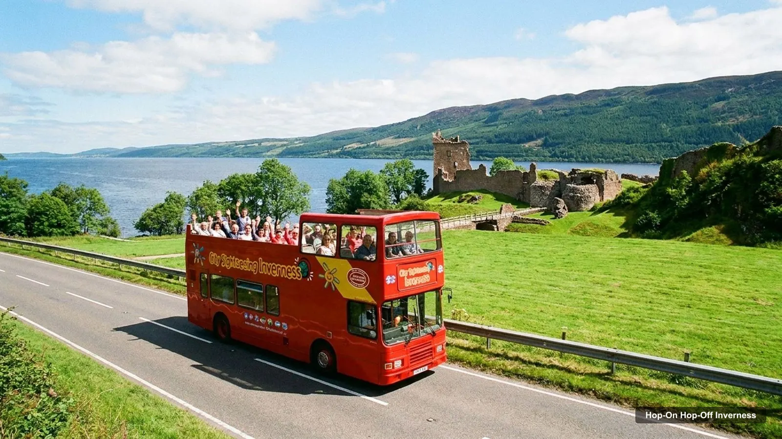
An Inverness tourist map makes more sense once you see the city as three layers: a compact centre, a river and park zone to the west, and a ring of big historic sights out of town. I’ve put the top 20 attractions, ranked by Google Maps reviews, and the sightseeing bus stops on one page, with coordinates and a Google Maps link for each. For the ticket itself, see my hop-on hop-off Inverness page.
The tables are built from the Google Maps data for each place and from the stop list in the City Sightseeing listing, checked on 8 October 2026. Distances are straight-line figures worked out from the coordinates, so walking and driving routes are longer.
Inverness Tour Map: The Bus Route
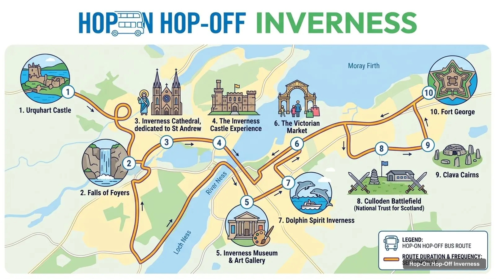
The Inverness tour map below shows the main sights around the city, numbered. It is a map of places, not a copy of the bus route: Urquhart Castle, Culloden Battlefield and Fort George are on it, and none of them is a bus stop. The bus itself is a loop of 7 stops that takes 55 minutes, with one departure an hour from 10:15am to 4:15pm.
Stops on the route
- 1Bus Station, Stance 6
- 2Bridge Street
- 3Bellfield Park War Memorial
- 4Bishops Road, St. Andrew's Cathedral
- 5Bught Drive, Inverness Ice Rink
- 6Dochgarroch Loch
- 7Telford Street
Bus stops on the route
Here are the 7 stops in route order, with a Google Maps search link for each. The listing’s highlights mention the castle, but none of the 7 stops has the castle’s name, so Bridge Street is the nearest listed stop to the castle area.
| # | Stop | Map |
|---|---|---|
| 1 | Bus Station, Stance 6 | Find on Google Maps |
| 2 | Bridge Street | Find on Google Maps |
| 3 | Bellfield Park War Memorial | Find on Google Maps |
| 4 | Bishops Road, St. Andrew’s Cathedral | Find on Google Maps |
| 5 | Bught Drive, Inverness Ice Rink | Find on Google Maps |
| 6 | Dochgarroch Loch | Find on Google Maps |
| 7 | Telford Street | Find on Google Maps |
Inverness Scotland Attractions Map: Top 20 Sights with Coordinates
This is the Inverness Scotland attractions map in table form, ranked by Google Maps reviews. I left out the bus station, a walking-tour operator, a boat cruise, The Steeple (21 reviews) and three places over 10 km from the city that have fewer than 100 reviews. Each link opens the place in Google Maps, where you can save it to a list before you travel.
| # | Attraction | Coordinates | Google rating | Map |
|---|---|---|---|---|
| 1 | Urquhart Castle | 57.32414, -4.44200 | 4.5 (29,289) | Open in Google Maps |
| 2 | Culloden Battlefield (National Trust for Scotland) | 57.47779, -4.09571 | 4.6 (15,991) | Open in Google Maps |
| 3 | The Inverness Castle Experience | 57.47616, -4.22542 | 4.1 (5,777) | Open in Google Maps |
| 4 | Clava Cairns | 57.47350, -4.07317 | 4.6 (5,262) | Open in Google Maps |
| 5 | The Victorian Market | 57.47920, -4.22466 | 4.1 (4,720) | Open in Google Maps |
| 6 | Fort George | 57.58411, -4.06873 | 4.6 (4,715) | Open in Google Maps |
| 7 | Falls of Foyers | 57.24907, -4.49162 | 4.5 (4,041) | Open in Google Maps |
| 8 | Inverness Cathedral, dedicated to St Andrew | 57.47450, -4.22915 | 4.4 (2,603) | Open in Google Maps |
| 9 | Inverness Museum & Art Gallery | 57.47700, -4.22526 | 4.5 (1,362) | Open in Google Maps |
| 10 | Whin Park | 57.46054, -4.23960 | 4.5 (1,334) | Open in Google Maps |
| 11 | Ness Islands | 57.46450, -4.22987 | 4.8 (1,305) | Open in Google Maps |
| 12 | Inverness Botanic Gardens and Café | 57.46320, -4.24033 | 4.6 (794) | Open in Google Maps |
| 13 | Merkinch Local Nature Reserve (North end) | 57.49492, -4.24623 | 4.5 (685) | Open in Google Maps |
| 14 | Craig Phadrig | 57.47692, -4.27026 | 4.6 (277) | Open in Google Maps |
| 15 | Bruce’s roundabout | 57.48173, -4.22577 | 4.9 (164) | Open in Google Maps |
| 16 | Kessock Bridge | 57.49873, -4.22865 | 4.6 (157) | Open in Google Maps |
| 17 | Flora Macdonald Statue | 57.47583, -4.22546 | 4.4 (149) | Open in Google Maps |
| 18 | Abertarff House (National Trust for Scotland) | 57.47912, -4.22764 | 3.9 (59) | Open in Google Maps |
| 19 | Balnain House | 57.47880, -4.23126 | 4.3 (24) | Open in Google Maps |
| 20 | Circle of Wise | 57.46377, -4.23086 | 4.4 (22) | Open in Google Maps |
Inverness Tourist Attractions Map: The Three Clusters
The Inverness tourist attractions fall into three clusters, and knowing them saves more time than any single stop.
- City centre. The Victorian Market, the Castle Experience, the Museum and Art Gallery, the Flora MacDonald statue and the cathedral. The Castle Experience to the museum is about 0.09 km, and to the cathedral about 0.29 km. The bus station to the market is about 0.14 km.
- River and Bught. Ness Islands, the Botanic Gardens and Whin Park. Botanic Gardens to Whin Park is about 0.3 km, and to Ness Islands about 0.64 km. The cathedral to Ness Islands is about 1.11 km.
- Out of town. Culloden Battlefield, Clava Cairns, Fort George and Urquhart Castle. Culloden to Clava Cairns is about 1.43 km, Culloden to Fort George about 11.93 km, and Urquhart Castle to the Falls of Foyers about 8.86 km.
The bus covers cluster one and most of cluster two. It doesn’t reach cluster three.
Is Inverness Worth Visiting
Inverness is worth visiting if you want a base for the Highlands more than a big-city itinerary. Wikipedia describes it as the long-regarded de facto capital of the Scottish Highlands, serving a Highlands and Islands region of about half a million people, in its Inverness article. The map shows why a short trip works: the city centre is small, and the three most-reviewed sights are one day-trip away.
What Is Inverness Famous For
Inverness is famous for its position on the River Ness at the gateway to Loch Ness, and for the battles and castles of Highland history. The bus listing says Inverness has had 5 castles over the centuries, with Macbeth, Robert the Bruce, Mary Queen of Scots and Bonnie Prince Charlie among its visitors. Culloden Battlefield, 7.74 km from the bus station, is the best-reviewed historic site close to the city, with 15,991 reviews at 4.6.
Inverness Tourist Information
For Inverness tourist information, I don’t have a verified visitor centre address in my data, so I won’t give you one. The City Sightseeing place card on Google Maps shows the address Bus Station, Inverness IV1 1LT, with hours of 10am to 5pm, and the bus listing’s meeting point is Bus Station Stance 6, Inverness IV1 1LS.
For official visiting details, use the venue sites in the places data. The Historic Environment Scotland page for Urquhart Castle and the Historic Environment Scotland page for Clava Cairns are the two I’d check first.
Which Stop for Which Sight on the Inverness Tourist Map
Here is which stop to use for the sights in the top 20, from the route list. Only the cathedral and the market sit at a named stop; the rest are walks from the nearest one.
| Sight | Stop to use | Distance |
|---|---|---|
| Victorian Market | Stop 1, Bus Station | About 0.14 km from the bus station |
| Inverness Castle Experience | Stop 2, Bridge Street | The Steeple on Bridge Street is about 0.15 km away |
| Museum and Art Gallery | Stop 2, Bridge Street | About 0.09 km beyond the castle |
| Inverness Cathedral | Stop 4, Bishops Road | At the stop |
| Botanic Gardens and Whin Park | Stop 5, Bught Drive | Nearest listed stop by name |
| Loch Ness boat trip | Stop 6, Dochgarroch | Reviewers use this stop |
Culloden Battlefield, Clava Cairns, Fort George, Urquhart Castle and the Falls of Foyers have no stop.
Inverness Tourist Map Opening Hours
The Inverness tourist map looks different at 4pm than at 10am, because the last bus leaves Stop 1 at 4:15pm and several sights close soon after. Google Maps lists the Botanic Gardens until 4pm, Fort George until 4pm, Urquhart Castle until 4:30pm, the museum until 5pm and the cathedral until 5:30pm. The Castle Experience closes at 6pm. Ness Islands, Culloden Battlefield, Clava Cairns and Whin Park show as open 24 hours. The museum is closed on Mondays and Sundays.
Inverness Tourist Map Walking Tips
Walking inside the clusters is easy, and walking between them is a decision. The market, the castle area and the cathedral are all within about 0.7 km of the bus station. The cathedral to Ness Islands is about 1.11 km, which is a pleasant riverside walk. With one bus an hour, I’d walk the short stretches and ride only to Bught or Dochgarroch.
Getting Around the Inverness Tourist Map
The Inverness tourist map is easiest to use in two modes: on foot in the centre, and on wheels for everything else. The bus gives you the west side without a car, and a short taxi or tour covers Culloden, Clava Cairns and Fort George. I haven’t verified local bus fares or timetables, so check those with the operator before you plan a day around them.
For the Loch Ness end of the map, the Dochgarroch stop is the one the bus offers. Two GetYourGuide reviewers used it to reach a Loch Ness boat trip without driving. Urquhart Castle itself is about 21.7 km from the bus station in a straight line, and the Falls of Foyers are about 30.29 km away, so treat them as a separate day.
Which Bus Covers the Most of This Map?
In my data one bus covers it: the City Sightseeing Red Route, with 7 stops and a 55-minute loop. It reaches the cathedral and the market directly and puts you within walking distance of the castle-area sights. The listing is one ticket, valid for 24 hours, from $15.93 and rated 4.09 from 500 reviews on GetYourGuide.
If you want to plan days around this map, my Inverness itinerary does that for 1, 2 and 3 days, and my best things to do in Inverness ranks the sights in detail. For the ticket, go back to the Inverness bus tour page. For other cities, head to the homepage.
Frequently asked questions
Is there a printable Inverness tourist map?
This page works as one. The map image numbers the main sights around Inverness, and the tables list the 7 bus stops and the top 20 attractions with coordinates and Google Maps links. Print the page, or open any link and save the place to a Google Maps list. I don't host a separate PDF.
Where are most Inverness attractions on the map?
They sit in three areas. The city centre has the Castle Experience, the museum, the market and the cathedral. The river and Bught area has Ness Islands, the Botanic Gardens and Whin Park. The big sights, Culloden, Clava Cairns, Fort George and Urquhart Castle, are 7 to 22 km out and are not bus stops.
Is Inverness worth visiting?
Yes, if you want Highland history and Loch Ness within reach. Urquhart Castle has 29,289 Google reviews at 4.5 and Culloden Battlefield 15,991 at 4.6. The city itself is small, so I'd allow two days: one for the centre and the bus, and one for Culloden and Clava Cairns.
Where is the tourist information centre in Inverness?
I don't have a verified visitor-centre address in my data, so I won't give one. The City Sightseeing office is on the Google Maps listing at Bus Station, Inverness IV1 1LT, open 10am to 5pm, but it is rated only 3.2 from 69 reviews. For official details, use the venue sites linked on this page.
Tours I compared in Inverness
My full review of each one, in the order I rank them:
- Inverness: City Sightseeing Hop-On Hop-Off Bus Tour★ 4.1 · from $15.93