Houston Tourist Map: Top Attractions & Bus Stops
By Jake Dawson · Updated · Affiliate links, explained in my disclosure
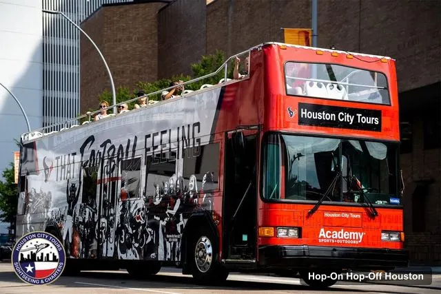
Houston City Tours LLC
Houston: Guided City Tour by an Open-Top Double Decker Bus
4.5 (574) · from $39.95
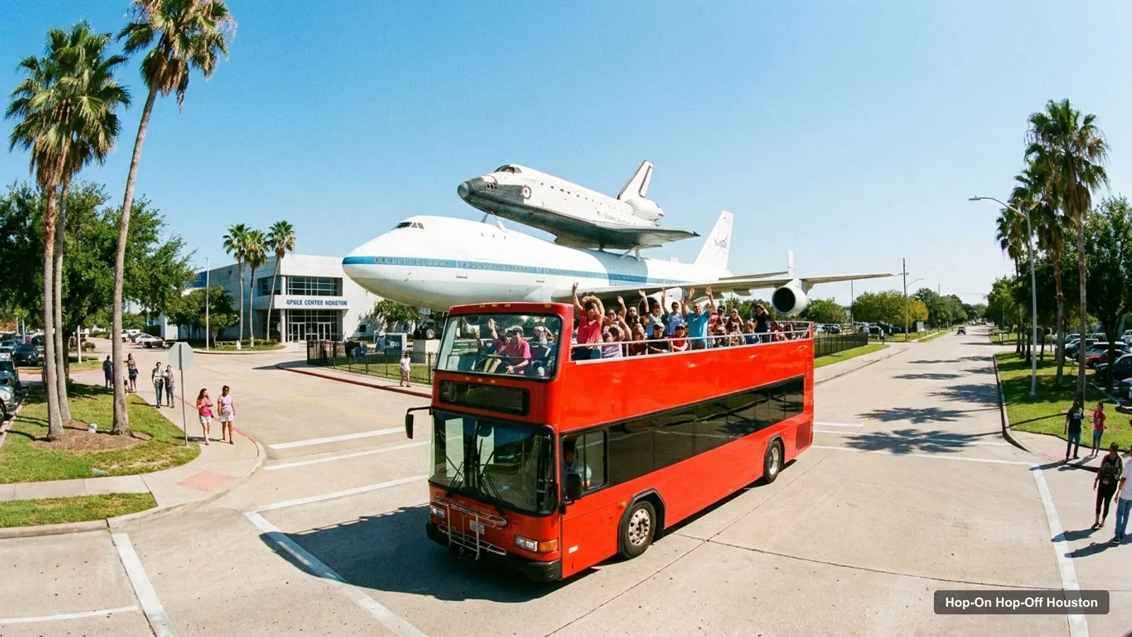
A Houston tourist map is easier to use once you know the city has three groups of sights. I’ve put the top 20 attractions, ranked by Google Maps reviews, and the 13 points on the double-decker bus route on one page, with coordinates and a Google Maps link for each. For the bus itself, see my hop-on hop-off Houston guide.
Ratings and coordinates are from Google Maps, and the bus route points are from the GetYourGuide booking page. All were checked on 8 October 2026.
Houston Tourist Attractions Map: The Bus Route
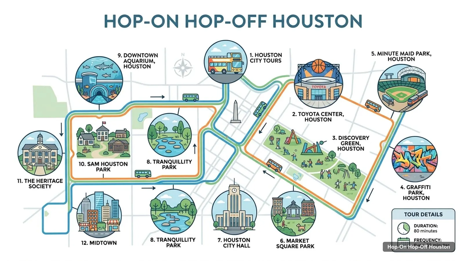
The Houston tourist attractions map below is a sketch of the double-decker’s named points, drawn from place names. It is not the operator’s route, so use their map for exact streets. The loop starts at Houston City Tours, 1302 Dallas Street, and returns there after 80 minutes. The booking page marks every point as a pass-by, so you ride past these places and do not get off.
Stops on the route
- 1Houston City Tours
- 2Toyota Center, Houston
- 3Discovery Green, Houston
- 4Graffiti Park, Houston
- 5Minute Maid Park, Houston
- 6Market Square Park
- 7Houston City Hall
- 8Tranquillity Park
- 9Downtown Aquarium, Houston
- 10Sam Houston Park
- 11The Heritage Society
- 12Midtown
Double-decker route points
| # | Point | Type | Map |
|---|---|---|---|
| 1 | Houston City Tours | Start and finish | Find on Google Maps |
| 2 | Toyota Center, Houston | Pass-by | Find on Google Maps |
| 3 | Discovery Green, Houston | Pass-by | Find on Google Maps |
| 4 | Graffiti Park, Houston | Pass-by | Find on Google Maps |
| 5 | Minute Maid Park, Houston | Pass-by | Find on Google Maps |
| 6 | Market Square Park | Pass-by | Find on Google Maps |
| 7 | Houston City Hall | Pass-by | Find on Google Maps |
| 8 | Tranquillity Park | Pass-by | Find on Google Maps |
| 9 | Downtown Aquarium, Houston | Pass-by | Find on Google Maps |
| 10 | Sam Houston Park | Pass-by | Find on Google Maps |
| 11 | The Heritage Society | Pass-by | Find on Google Maps |
| 12 | Midtown | Pass-by | Find on Google Maps |
| 13 | Houston Museum District | Pass-by, about 15 minutes | Find on Google Maps |
The listing says the itinerary is for reference only and subject to change. Of the points above, Midtown and the Museum District are the only two with a time attached, at about 10 and 15 minutes. The first leg runs through downtown, past the Toyota Center, Discovery Green and the ballpark, before turning toward City Hall and the west side.
Landmarks You Will See From the Top Deck
Reading the route points as a landmarks map helps you decide what to revisit on foot. The Toyota Center is the arena of the NBA’s Houston Rockets, and Minute Maid Park is the ballpark of the Astros, whom the listing credits with the 2022 World Series title. Discovery Green is the urban park in the Convention Center area, and Graffiti Park is the street art stop with changing murals.
Market Square Park sits in the Downtown Historic District, and the listing points to the Old Union train station building there. Houston City Hall is described as Art Deco and faces Hermann Square, and Tranquillity Park was built to mark the Apollo 11 moon landing in July 1969. The route then passes the Downtown Aquarium, Sam Houston Park and the Heritage Society, a museum and park about the city’s past. For a first visit, I’d photograph the City Hall and Tranquillity Park stretch from the top deck, because both are easy to reach on foot afterwards.
Houston Attractions for Adults
Houston attractions for adults sit mostly in the Museum District and Montrose, and the map below puts them in order. The Menil Collection is about 3.8 km from the bus start, and Rothko Chapel is only 0.2 km from the Menil, so you can walk between them. Both are closed on Monday, and the Menil is closed on Tuesday too.
The Museum of Fine Arts, Houston is about 4.1 km from the start and rated 4.8 from 12,302 reviews. The Holocaust Museum Houston is rated 4.7 from 2,174. For a lighter evening, the Waugh Drive Bat Colony is listed as open 24 hours and about 3.5 km from the start. I would not plan an evening around the bat colony without checking the season, because I do not have flight times in my data.
Places on my route sketch
| # | Place | Map |
|---|---|---|
| 1 | Downtown Aquarium | Open in Google Maps |
| 2 | Discovery Green | Open in Google Maps |
| 3 | Market Square Park | Open in Google Maps |
| 4 | Tranquillity Park | Open in Google Maps |
| 5 | Sam Houston Park | Open in Google Maps |
| 6 | Hermann Park | Open in Google Maps |
| 7 | Houston Museum of Natural Science | Open in Google Maps |
| 8 | Space Center Houston | Open in Google Maps |
| 9 | Houston Zoo | Open in Google Maps |
| 10 | The Museum of Fine Arts, Houston | Open in Google Maps |
Houston Landmarks Map: Top 20 with Coordinates
This Houston landmarks map lists the top 20 attractions by review count. I left out bus stations, tour operators, a second pin for the same fountain and the National Museum of Funeral History, which is about 27 km from the start. Distances are straight lines from the bus start, taken from the coordinates in the table, so a taxi or a bus ride will be longer.
| # | Place | Rating (reviews) | Coordinates | From start | Map |
|---|---|---|---|---|---|
| 1 | Space Center Houston | 4.6 (54,813) | 29.5518, -95.0981 | 34 km | Open in Google Maps |
| 2 | Houston Zoo | 4.6 (44,254) | 29.7158, -95.3903 | 4.9 km | Open in Google Maps |
| 3 | Houston Museum of Natural Science | 4.8 (31,205) | 29.7221, -95.3896 | 4.3 km | Open in Google Maps |
| 4 | Hermann Park | 4.7 (30,458) | 29.7138, -95.3894 | 5.1 km | Open in Google Maps |
| 5 | Downtown Aquarium | 4.1 (25,564) | 29.7643, -95.3674 | 1.2 km | Open in Google Maps |
| 6 | Discovery Green | 4.7 (22,531) | 29.7531, -95.3596 | 0.4 km | Open in Google Maps |
| 7 | The Museum of Fine Arts, Houston | 4.8 (12,302) | 29.7256, -95.3905 | 4.1 km | Open in Google Maps |
| 8 | Memorial Park | 4.8 (10,930) | 29.7671, -95.4478 | 8.3 km | Open in Google Maps |
| 9 | Gerald D. Hines Waterwall Park | 4.7 (10,117) | 29.7359, -95.4613 | 9.7 km | Open in Google Maps |
| 10 | Children’s Museum Houston | 4.6 (6,970) | 29.7229, -95.3853 | 4.0 km | Open in Google Maps |
| 11 | Eleanor Tinsley Park | 4.7 (6,471) | 29.7623, -95.3792 | 1.8 km | Open in Google Maps |
| 12 | Buffalo Bayou Park | 4.7 (6,425) | 29.7631, -95.3761 | 1.6 km | Open in Google Maps |
| 13 | The Menil Collection | 4.6 (4,414) | 29.7374, -95.3984 | 3.8 km | Open in Google Maps |
| 14 | Market Square Park | 4.5 (3,180) | 29.7626, -95.3624 | 1.0 km | Open in Google Maps |
| 15 | Color Factory Houston | 4.6 (3,010) | 29.7354, -95.4183 | 5.7 km | Open in Google Maps |
| 16 | The Health Museum | 4.3 (2,627) | 29.7217, -95.3860 | 4.2 km | Open in Google Maps |
| 17 | Holocaust Museum Houston | 4.7 (2,174) | 29.7252, -95.3857 | 3.8 km | Open in Google Maps |
| 18 | Smither Park | 4.7 (1,990) | 29.7168, -95.3246 | 5.5 km | Open in Google Maps |
| 19 | Sam Houston Park | 4.6 (1,829) | 29.7601, -95.3716 | 1.1 km | Open in Google Maps |
| 20 | Tranquillity Park | 4.3 (1,247) | 29.7606, -95.3683 | 0.9 km | Open in Google Maps |
Houston Things to Do Map: Clusters
The Houston things to do map falls into four clusters, and planning by cluster saves hours on the road.
- Downtown, 0 to 2 km from the start. Discovery Green (0.4 km), Tranquillity Park (0.9 km), Market Square Park (1.0 km), Sam Houston Park (1.1 km) and Downtown Aquarium (1.2 km). The double-decker passes all of them, and you can walk between them.
- Buffalo Bayou, 1.5 to 2 km. Buffalo Bayou Park (1.6 km) and Eleanor Tinsley Park (1.8 km) run along the water west of downtown, and both are open daily or around the clock.
- Museum District and Hermann Park, 4 to 5 km. The Houston Museum of Natural Science (4.3 km), the Museum of Fine Arts (4.1 km), the Houston Zoo (4.9 km), Hermann Park (5.1 km) and Children’s Museum Houston (4.0 km).
- Further out. Memorial Park (8.3 km), the Waterwall (9.7 km) and Space Center Houston (34 km).
The Museum District cluster is the densest. Hermann Park and the Museum of Fine Arts are only 1.3 km apart, and the natural science museum and the zoo share the same park edge. If you have one afternoon for it, pick two venues and walk.
How to Use This Map on the Day
Use the route table to decide what you want to see from the bus, and the attraction table to decide where to spend your free time. I’d open the Google Maps link for the start point first, because the tour begins and ends at the same address, and a late arrival means a missed departure. Then save two or three attractions from the top 20 to your own list, so the day has a plan beyond the ride.
Remember that the straight-line distance is the minimum. Houston’s freeways and bayous mean the road distance can be noticeably longer, so I leave a buffer between a morning booking and a lunch reservation.
Houston Tourist Map Pdf
There is no separate PDF for this Houston tourist map, and I would rather you use the live links than a file that goes out of date. Every row above has a Google Maps link, and you can save the places to a list on your phone for offline use. If you want paper, use your browser’s print option on this page.
The tables are built from Google Maps coordinates, so they work as a quick checklist on the day. I’d screenshot the bus route table and the top 20 table the evening before. The booking page also gives a map of the pickup point, which is the 1302 Dallas Street address.
Getting Between the Clusters
The Houston tourist map shows how spread out the city is, so the connections matter. Downtown is walkable. For the Museum District, METRO lists a regular fare of $1.25 on both local buses and METRORail, with a discounted fare of $0.60, and children aged five or younger ride free with an adult. A physical RideMETRO Fare Card costs $2, and the virtual card is free.
Space Center Houston is the outlier at about 34 km from the bus start, and no METRO fare covers it. For that day, see my Houston itinerary for 1, 2 and 3 days. For the ranked list with hours, see the best things to do in Houston. The home page lists the other cities I cover, and if you want the open-top ride, my Houston double-decker tour page has the full details. Back to the Houston hop on hop off bus guide for tickets and how I’d choose.
Frequently asked questions
Is there a printable Houston tourist map?
This page works as one. The route sketch shows the main stops, and the tables list the 13 points on the double-decker route and the top 20 attractions with coordinates. Print the page or open any Google Maps link to save the places to your own map. I do not host a separate PDF.
Where are most Houston attractions on the map?
In three groups. Downtown holds Discovery Green, Market Square Park and the Downtown Aquarium, all within about 1.2 km of the bus start. The Museum District holds the zoo, Hermann Park and the museums, 4 to 5 km away. Space Center Houston is about 34 km to the south-east.
How far apart are the main Houston sights?
Discovery Green and the Downtown Aquarium are about 1.5 km apart in a straight line. Hermann Park and the Museum of Fine Arts are about 1.3 km apart. Downtown to the Museum District is roughly 4 km, and Space Center Houston is about 34 km from the bus start.
Are there free tourist attractions in Houston?
Several. Discovery Green, Hermann Park, Market Square Park and Buffalo Bayou Park are open daily from 6 AM to 11 PM on Google Maps, and Memorial Park, Eleanor Tinsley Park and Tranquillity Park are listed open 24 hours. Check each for parking fees, and note that museums and the zoo charge admission.
Tours I compared in Houston
My full review of each one, in the order I rank them:
- Houston: Guided City Tour by an Open-Top Double Decker Bus★ 4.5 · from $39.95