Hong Kong Tourist Map: Top Attractions & Bus Stops
By Jake Dawson · Updated · Affiliate links, explained in my disclosure
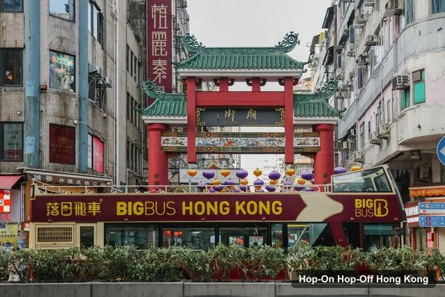
Big Bus Tours - Hong Kong
Hong Kong: Big Bus Hop-On Hop-Off Tour & Optional Peak Tram
4.4 (1,181) · from $55
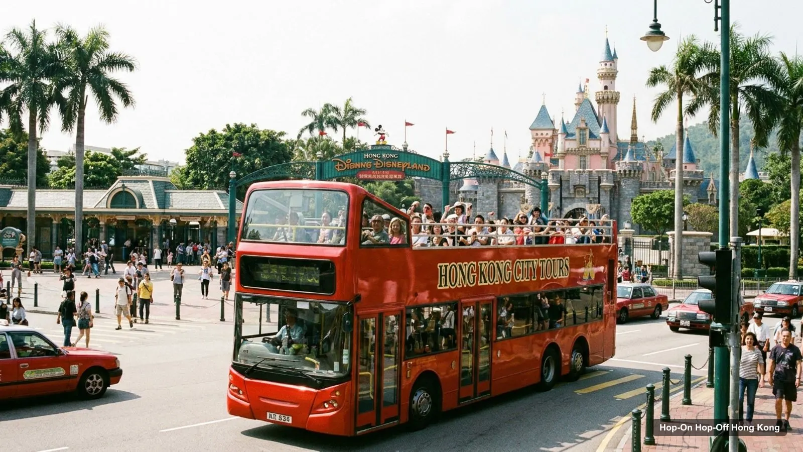
A Hong Kong tourist map is most useful when it shows where the buses go, so I built mine around the hop-on hop-off Hong Kong routes. It has the 12 main stops in order, then the top 20 attractions ranked by Google reviews, with coordinates and a map link for each. Ratings are from Google Maps and the stops from the Big Bus listing on GetYourGuide, checked in October 2026.
Hong Kong Tourist Attractions Map: The Bus Route
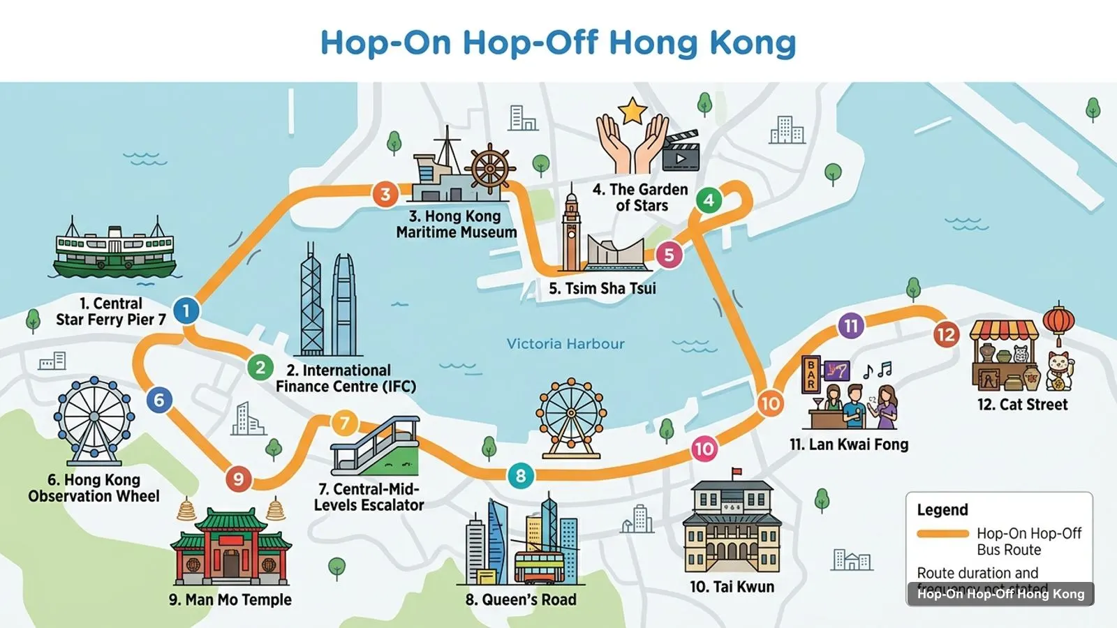
The graphic below shows the main route as 12 numbered stops, starting at Central Star Ferry Pier 7 and running through the IFC, the Maritime Museum, the Garden of Stars and Tsim Sha Tsui, to the Observation Wheel, the Escalator, Man Mo Temple, Tai Kwun, Lan Kwai Fong and Cat Street. The full Big Bus listing goes well beyond this, with 41 stops and sights across three routes. The Red Route buses run every 45 minutes.
Stops on the route
- 1Central Star Ferry Pier 7
- 2International Finance Centre (IFC)
- 3Hong Kong Maritime Museum
- 4The Garden of Stars
- 5Tsim Sha Tsui
- 6Hong Kong Observation Wheel
- 7Central-Mid-Levels Escalator
- 8Queen's Road
- 9Man Mo Temple
- 10Tai Kwun
- 11Lan Kwai Fong
- 12Cat Street
Bus stops on the main route
Each link opens the stop in Google Maps, so you can save it before you travel.
| # | Stop | Map |
|---|---|---|
| 1 | Central Star Ferry Pier 7 | Open map |
| 2 | International Finance Centre (IFC) | Open map |
| 3 | Hong Kong Maritime Museum | Open map |
| 4 | The Garden of Stars | Open map |
| 5 | Tsim Sha Tsui | Open map |
| 6 | Hong Kong Observation Wheel | Open map |
| 7 | Central-Mid-Levels Escalator | Open map |
| 8 | Queen’s Road | Open map |
| 9 | Man Mo Temple | Open map |
| 10 | Tai Kwun | Open map |
| 11 | Lan Kwai Fong | Open map |
| 12 | Cat Street | Open map |
Hong Kong Tourism Map: Top 20 Sights with Coordinates
This is the Hong Kong tourism map in table form, ranked by Google Maps reviews, with exact coordinates. I left out bus companies and tour agencies. The last column shows whether the place is on a Big Bus route.
| # | Attraction | Coordinates | Google rating | On a bus route | Map |
|---|---|---|---|---|---|
| 1 | Hong Kong Disneyland | 22.3130, 114.0413 | 4.5 (66,380) | No | Open map |
| 2 | Ocean Park | 22.2467, 114.1757 | 4.3 (33,885) | Yes | Open map |
| 3 | Temple Street Night Market | 22.3065, 114.1700 | 3.8 (23,306) | Yes | Open map |
| 4 | Tian Tan Buddha | 22.2540, 113.9050 | 4.6 (19,708) | No | Open map |
| 5 | Ngong Ping 360 | 22.2563, 113.9014 | 4.5 (18,744) | No | Open map |
| 6 | Avenue of Stars HK | 22.2930, 114.1742 | 4.3 (17,452) | Yes (Garden of Stars) | Open map |
| 7 | Hong Kong Observation Wheel | 22.2853, 114.1617 | 4.3 (14,491) | Yes | Open map |
| 8 | Central-Mid-Levels Escalators | 22.2838, 114.1550 | 4.1 (10,541) | Yes | Open map |
| 9 | Hong Kong Museum of History | 22.3019, 114.1773 | 4.3 (9,184) | No | Open map |
| 10 | Hong Kong Heritage Museum | 22.3766, 114.1856 | 4.3 (7,897) | No | Open map |
| 11 | Hong Kong Space Museum | 22.2943, 114.1719 | 4.2 (7,002) | No | Open map |
| 12 | Victoria Harbour | 22.2933, 114.1726 | 4.6 (5,811) | Star Ferry | Open map |
| 13 | Hong Kong Palace Museum | 22.3018, 114.1560 | 4.4 (5,179) | Yes | Open map |
| 14 | Hong Kong Museum of Art | 22.2936, 114.1721 | 4.5 (4,777) | No | Open map |
| 15 | Madame Tussauds Hong Kong | 22.2712, 114.1497 | 4.3 (4,267) | Near Peak stop | Open map |
| 16 | Sky Terrace 428 | 22.2712, 114.1503 | 4.5 (4,170) | Yes (Victoria Peak) | Open map |
| 17 | Hong Kong Railway Museum | 22.4476, 114.1643 | 4.1 (3,690) | No | Open map |
| 18 | Hong Kong Science Museum | 22.3010, 114.1777 | 4.4 (3,572) | No | Open map |
| 19 | Nan Lian Garden | 22.3396, 114.2045 | 4.6 (2,755) | No | Open map |
| 20 | Hong Kong Park | 22.2769, 114.1608 | 4.5 (2,352) | Near Central stops | Open map |
Hong Kong Map Tourist Spots: The Four Clusters
The top sights are not spread evenly, and the map breaks into four areas.
Central and the Peak (Hong Kong Island). The Observation Wheel, the Maritime Museum and the Star Ferry pier are within about 0.15 km of each other. The Central-Mid-Levels Escalators are about 0.7 km from the Wheel, and the Dr Sun Yat-sen Museum is about 0.47 km from the Escalators. The Peak, with Sky Terrace 428 and Madame Tussauds about 0.05 km apart, is about 2 km from the Wheel in a straight line.
Tsim Sha Tsui (Kowloon). The Avenue of Stars, the Space Museum and the Museum of Art are all within about 0.3 km of each other. The Museum of History is about 1 km away, and Temple Street is about 1.56 km away. The Palace Museum in West Kowloon is about 2.1 km from the Avenue of Stars.
The south coast. Ocean Park, Aberdeen, Stanley and Repulse Bay are on the Stanley route. Ocean Park is about 4.5 km from the Observation Wheel in a straight line.
Lantau Island. Hong Kong Disneyland, the Tian Tan Buddha and Ngong Ping 360 are here, and no bus route reaches them. The Buddha and the cable car are 0.45 km apart, and Disneyland is about 15.5 km from the Buddha. For what to do at each, see my best things to do in Hong Kong.
Which Stop for Which Sight on the Hong Kong Tourist Map
Use this as a quick guide for where to hop off.
- Observation Wheel and Maritime Museum: Central Star Ferry Pier 7 and the Maritime Museum stop.
- Avenue of Stars: The Garden of Stars and Tsim Sha Tsui Promenade stops.
- Escalators, Man Mo Temple and Cat Street: The Central-Mid-Levels Escalator, Man Mo Temple and Cat Street stops.
- Sky Terrace 428: the Peak Tram lower terminus and Victoria Peak.
- Ocean Park: a stop on the Stanley route.
- Temple Street Night Market: the Temple Street stop on the Kowloon route.
- Palace Museum: a Kowloon route stop.
Hong Kong Street Map and MTR Tips
For a street map, I use Google Maps with the links above. The MTR is the fastest way to get to the places the bus doesn’t reach, such as Lantau, and the MTR site has the network map. An Octopus card also works on the MTR, trams and the Star Ferry. Check the Octopus site before you buy one.
Hong Kong Tourist Map PDF and Printable
I don’t publish a PDF of this Hong Kong tourist map, because the tables and links above are easier to keep up to date. If you want a printable one, copy the table into a note, or save the places to a Google Maps list and download the area for offline use. The Hong Kong Tourism Board also has visitor information.
Hong Kong Tourist Map Walking Tips
Treat this Hong Kong tourist map as a planning tool first and a navigation tool second. Open the Google Maps links on your phone, star the places you care about, and you’ll see at a glance which stars sit close together and which are an island away. That’s how I’d decide whether a sight is worth a hop-off.
The distances above are straight lines computed from the coordinates in the table, so real walking routes are longer, and Hong Kong Island is steep. The Central-Mid-Levels Escalators exist for that reason, and I’d use them to climb toward Soho and Man Mo Temple and not walk the hill. In Kowloon the waterfront is flat, so the walk from the Avenue of Stars to the Space Museum and the Museum of Art is easy. Between clusters I’d always ride, either the bus, the MTR or the Star Ferry.
Hong Kong is hot for much of the year and reviewers of the Big Bus say a hat helps on the top deck, so I’d plan the outdoor clusters for the morning and keep the museums for the middle of the day. If it rains, the Kowloon museum group is the most compact indoor plan on the map: the Space Museum, the Museum of Art and the Museum of History are all within about 1 km of the Avenue of Stars.
How to Use This Map With the Bus Routes
I’d start with the Red Route, because it’s the one with a listed frequency of every 45 minutes, and the Central cluster is on it. Mark the Wheel, the Escalators, Man Mo Temple and Lan Kwai Fong, then the Peak. On day two, take the Kowloon route and mark the Garden of Stars, the Palace Museum and Temple Street. If you also want the south coast, the Stanley route is the third line on the map, with Repulse Bay, Stanley, Ocean Park and Aberdeen. My Hong Kong hop-on hop-off guide explains which ticket covers which route, and I’d save every place you plan to visit into one Google Maps list before you leave your hotel.
Which Ticket Covers the Most of This Map?
The Big Bus ticket at $55 covers the most of this map: three routes across Hong Kong Island, Stanley and Kowloon, plus the Star Ferry. It has 4.43 from 1,181 reviews. The $76 Red Route combo adds the Peak Tram and Sky Terrace 428 but only covers the island. My Hong Kong itinerary shows how to use them day by day, and my page on Hong Kong hop-on hop-off bus tickets has all four in one place. For other cities, head back to the homepage.
Frequently asked questions
Is there a tourist map of the hop-on hop-off bus in Hong Kong?
Yes. The route graphic on this page numbers the 12 main Big Bus stops from Central Star Ferry Pier 7 to Cat Street, and the table below links each one to Google Maps. The full Big Bus listing names 41 stops and sights across the Hong Kong Island, Stanley and Kowloon routes.
Where are the main tourist attractions in Hong Kong on a map?
They fall in three clusters: Central and the Peak on Hong Kong Island, Tsim Sha Tsui and West Kowloon across the harbour, and Lantau Island to the west. Ocean Park is on the south coast. The top 20 table below gives exact coordinates and a map link for each.
Can I print or download a Hong Kong tourist map?
I don't publish a PDF. Instead, each Google Maps link in my tables opens the place so you can save it to a list or download that area for offline use. If you want a printed map, the Hong Kong Tourism Board site is a good place to start.
Tours I compared in Hong Kong
My full review of each one, in the order I rank them:
- Hong Kong: Big Bus Hop-On Hop-Off Tour & Optional Peak Tram★ 4.4 · from $55
- Hong Kong: Peak Tram & Big Bus Hop-On, Hop-Off★ 4.3 · from $76
- Hong Kong: Sampan Houseboat & Stanley Hop-on, Hop-off Tour★ 2.8 · from $74
- Hong Kong: Star Ferry, Open-Top Bus & Temple Guided Tourfrom $128