Glasgow Tourist Map: Top Attractions & Bus Stops
By Jake Dawson · Updated · Affiliate links, explained in my disclosure
City Sightseeing UK
Glasgow: City Sightseeing Hop-On Hop-Off Bus Tour
4.5 (3,612) · from $26.55
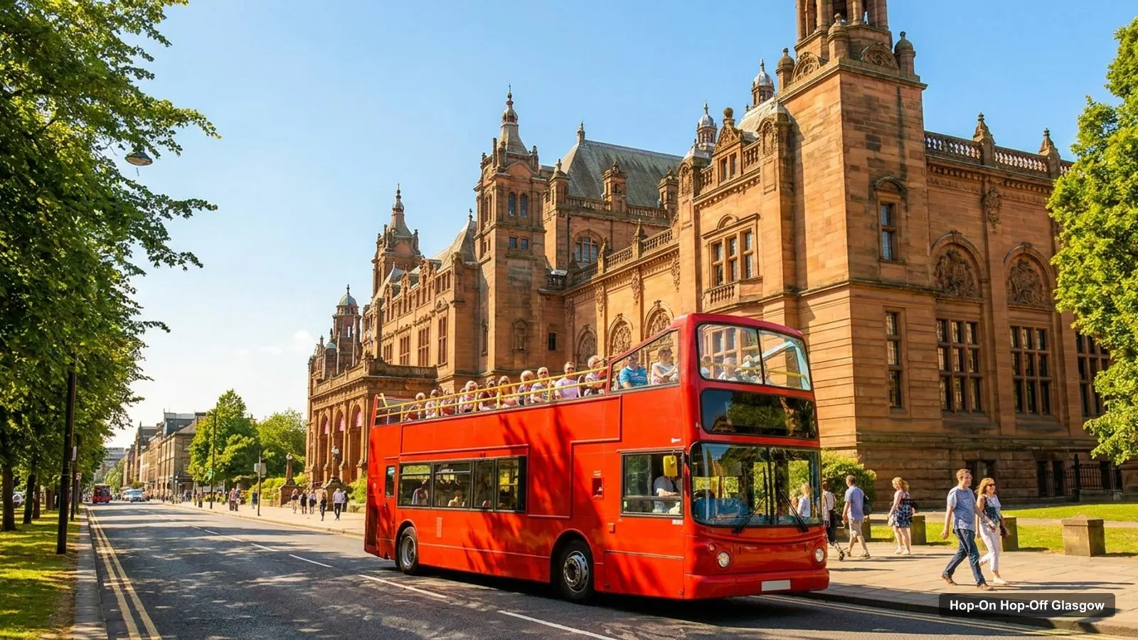
A Glasgow tourist map makes more sense once you see the city as four clusters: the West End, the old city around the Cathedral, the Clyde riverside and the south side. I’ve put the top 20 attractions, ranked by Google Maps reviews, and the sightseeing bus stops on one page, with coordinates and a Google Maps link for each. For the ticket itself, see my hop-on hop-off Glasgow page.
The tables are built from the Google Maps data for each place and from the stop list in the City Sightseeing listing, checked on 7 October 2026. Distances are straight-line figures worked out from the coordinates, so walking routes are a little longer.
Glasgow Tour Map: The Bus Route
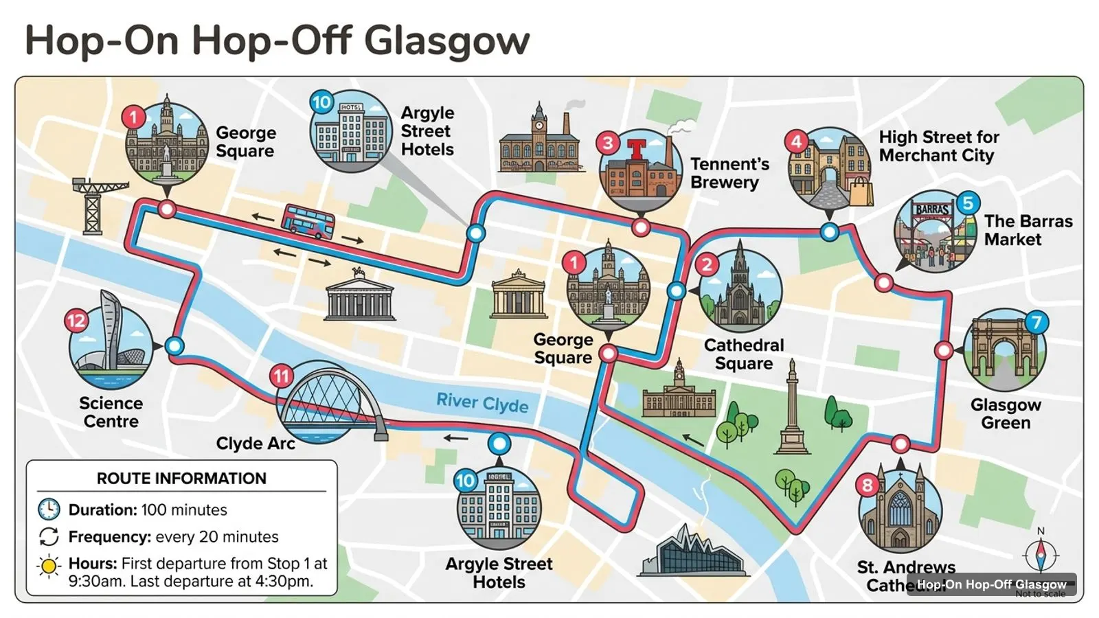
The Glasgow tour map below shows the Red Route: 24 numbered stops, from George Square east to the Cathedral and Glasgow Green, across the Clyde to the Science Centre and Riverside Museum, and up to Kelvingrove. The loop takes about 100 minutes. This map shows the first 12 stops, and the table underneath lists them with a Google Maps link for each.
Stops on the route
- 1George Square
- 2Cathedral Square
- 3Tennent's Brewery
- 4High Street for Merchant City
- 5The Barras Market
- 6Glasgow Green
- 7McLennan Arc
- 8St. Andrews Cathedral
- 9Central Station
- 10Argyle Street Hotels
- 11Clyde Arc
- 12Science Centre
Bus stops on the main loop
From 29 September the first bus leaves Stop 1 at 10am and the last at 4pm, every 30 minutes. In summer, from 26 June to 30 August, it runs 9am to 5:30pm every 15 minutes. Stop 3, Tennent’s Brewery, is temporarily unavailable because of roadworks, so use Stop 2, Cathedral Square, instead.
| # | Stop | Map |
|---|---|---|
| 1 | George Square | Find on Google Maps |
| 2 | Cathedral Square | Find on Google Maps |
| 3 | Tennent’s Brewery | Find on Google Maps |
| 4 | High Street for Merchant City | Find on Google Maps |
| 5 | The Barras Market | Find on Google Maps |
| 6 | Glasgow Green | Find on Google Maps |
| 7 | McLennan Arc | Find on Google Maps |
| 8 | St. Andrews Cathedral | Find on Google Maps |
| 9 | Central Station | Find on Google Maps |
| 10 | Argyle Street Hotels | Find on Google Maps |
| 11 | Clyde Arc | Find on Google Maps |
| 12 | Science Centre | Find on Google Maps |
The route continues past Stop 12 with Govan Stones, Fairfield, Village Hotel, Hilton Garden Inn, Scottish Events Campus, The Clydeside Distillery, Riverside Museum (Stop 19), Byres Road, Kelvingrove Art Gallery and Museum (Stop 21), Hidden Lane, Blythswood Square and Nelson Mandela Place (Stop 24).
Glasgow Scotland Attractions Map: Top 20 Sights with Coordinates
This is the Glasgow attractions map in table form, ranked by Google Maps reviews. I left out bus stops, a tour operator and a statue. Each link opens the place in Google Maps, where you can save it to a list before you travel.
| # | Attraction | Coordinates | Google rating | Map |
|---|---|---|---|---|
| 1 | Kelvingrove Art Gallery and Museum | 55.86859, -4.29060 | 4.7 (25,944) | Open in Google Maps |
| 2 | Riverside Museum | 55.86510, -4.30621 | 4.7 (21,227) | Open in Google Maps |
| 3 | Glasgow Botanic Gardens | 55.87970, -4.29118 | 4.7 (15,365) | Open in Google Maps |
| 4 | Kelvingrove Park | 55.86917, -4.28339 | 4.7 (14,190) | Open in Google Maps |
| 5 | Glasgow Green | 55.84911, -4.23532 | 4.6 (11,904) | Open in Google Maps |
| 6 | Glasgow Cathedral | 55.86300, -4.23458 | 4.6 (10,482) | Open in Google Maps |
| 7 | Pollok Country Park | 55.83101, -4.31252 | 4.7 (8,686) | Open in Google Maps |
| 8 | Glasgow Science Centre | 55.85854, -4.29380 | 4.6 (8,524) | Open in Google Maps |
| 9 | The Burrell Collection | 55.83089, -4.30763 | 4.7 (3,133) | Open in Google Maps |
| 10 | Hunterian Art Gallery | 55.87302, -4.28895 | 4.6 (2,314) | Open in Google Maps |
| 11 | The Tall Ship Glenlee | 55.86461, -4.30748 | 4.6 (1,900) | Open in Google Maps |
| 12 | House for an Art Lover | 55.84739, -4.31402 | 4.6 (1,596) | Open in Google Maps |
| 13 | Gallery of Modern Art | 55.86017, -4.25255 | 4 (1,507) | Open in Google Maps |
| 14 | The Glasgow Necropolis | 55.86269, -4.23112 | 4.7 (1,329) | Open in Google Maps |
| 15 | Pollok House | 55.82793, -4.31818 | 4.5 (1,259) | Open in Google Maps |
| 16 | The Tenement House (National Trust for Scotland) | 55.86808, -4.26833 | 4.6 (1,204) | Open in Google Maps |
| 17 | Kibble Palace | 55.87883, -4.28823 | 4.8 (873) | Open in Google Maps |
| 18 | Metropolitan Cathedral of St Andrew | 55.85547, -4.25296 | 4.7 (795) | Open in Google Maps |
| 19 | Glasgow Police Museum | 55.85798, -4.24491 | 4.7 (789) | Open in Google Maps |
| 20 | St. Mungo Museum Of Religious Life & Art | 55.86247, -4.23630 | 4.4 (640) | Open in Google Maps |
Glasgow Tourist Attractions Map: The Four Clusters
The Glasgow tourist attractions fall into four clusters, and knowing them saves more time than any single stop.
- West End. Kelvingrove Art Gallery and Museum, Kelvingrove Park, the Hunterian Art Gallery and the Botanic Gardens. Kelvingrove to the park is about 0.45 km, and to the Hunterian about 0.5 km. The Botanic Gardens are about 1.24 km away.
- Old city in the east. Glasgow Cathedral, the Necropolis, Provand’s Lordship and the St Mungo Museum are all within about 0.2 km of each other. Glasgow Green is about 1.55 km from the Cathedral.
- Clyde riverside. Riverside Museum and the Tall Ship Glenlee are about 0.1 km apart, and the Science Centre is about 1.06 km from the museum, across the river.
- South side. Pollok Country Park and the Burrell Collection are about 0.31 km apart. Riverside Museum to the Burrell is about 3.81 km.
The bus covers clusters one to three. It doesn’t reach the south side.
Is Glasgow Worth Visiting
Glasgow is worth visiting if you want big free museums and a working riverside more than a castle skyline. It’s the fifth-most-visited city in the UK according to Wikipedia, and Kelvingrove alone has 25,944 reviews at 4.7. The map shows why a short trip works: the best-reviewed places fit inside three clusters the bus already serves.
Glasgow Tourist Information
For Glasgow tourist information, I don’t have a verified visitor centre address in my data, so I won’t give you one. The place card for City Sightseeing Glasgow on Google Maps shows a G2 1EH postcode, 4.3 stars from 834 reviews, and hours of 9am to 5:30pm. The bus listing’s meeting point is a plus code in the middle of the city, and George Square is Stop 1.
For official visiting details, use the venue sites in the places data. The Glasgow Life Kelvingrove page and the Historic Environment Scotland Cathedral page are the two I’d check first.
Which Stop for Which Sight on the Glasgow Tourist Map
Here is which stop to use for the sights in the top 20, from the route list:
| Sight | Stop to use | Distance from stop |
|---|---|---|
| Kelvingrove Art Gallery and Museum | Stop 21 | At the stop |
| Riverside Museum | Stop 19 | At the stop |
| Tall Ship Glenlee | Stop 19 | About 0.1 km |
| Glasgow Cathedral | Stop 2, Cathedral Square | At the stop |
| Glasgow Necropolis | Stop 2, Cathedral Square | About 0.22 km |
| Glasgow Green | Stop 6 | At the stop |
| Glasgow Science Centre | Stop 12 | At the stop |
| Metropolitan Cathedral of St Andrew | Stop 8, St. Andrews Cathedral | At the stop |
The Botanic Gardens, the Burrell Collection, Pollok Country Park, House for an Art Lover and the Tenement House have no stop named after them.
Glasgow Tourist Map with Subway Stations
The Glasgow Subway is the way to reach the sights the bus misses. The adult contactless single is 1.80 pounds and the all-day ticket 3.40 pounds, from the SPT subway ticket page. I haven’t listed station names against the sights, because my data doesn’t cover them, so check each sight on Google Maps.
Glasgow Tourist Map Printable and PDF
I don’t publish a separate PDF of this Glasgow tourist map, because a static file goes out of date the day the timetable changes. The page itself prints cleanly, and the Google Maps links in the top 20 table open the exact place card, with opening hours that update. If you want an offline copy, open each link on your phone and save the place to a list called Glasgow, then download the area in Google Maps before you go.
Glasgow Tourist Map by Opening Hours
The Glasgow tourist map looks different at 4pm than at 10am, because the last winter bus leaves at 4pm and several sights close soon after. Google Maps lists Kelvingrove and Riverside Museum as open until 5pm, Glasgow Cathedral until 3:15pm and the Necropolis until 4:30pm. Glasgow Green and Kelvingrove Park are open 24 hours, and the Botanic Gardens close at 6pm. The Hunterian is closed on Mondays, and the Science Centre is closed on Tuesdays. I’d use that order to plan a day: Cathedral first, museums second, parks last.
Glasgow Tourist Map Walking Tips
Walking between the clusters isn’t practical, and walking within them is easy. Kelvingrove to Riverside Museum is about 1.05 km, which is a pleasant walk. The Cathedral to Glasgow Green is about 1.55 km. Kelvingrove to the Cathedral is about 3.55 km, and that’s the one I’d put on the bus. In winter the last bus is at 4pm, so walk the short stretches and ride the long ones early.
Which Bus Covers the Most of This Map?
In my data one bus covers it: the City Sightseeing route, with 24 stops and about 100 minutes per loop. It reaches 8 of the 20 sights in the table at or within about 0.25 km of a stop. The listing is one ticket with 1 or 2-day validity, from $26.55, rated 4.46 from 3,612 reviews on GetYourGuide.
If you want to plan the days around this map, my Glasgow itinerary does that for 1, 2 and 3 days, and my best things to do in Glasgow ranks the sights in detail. For the ticket, go back to the Glasgow bus tour page. For other cities, head to the homepage.
Frequently asked questions
Is there a printable Glasgow tourist map?
This page works as one. The route map image shows the bus loop with numbered stops, and the tables list the first 12 stops and the top 20 attractions with coordinates and Google Maps links. Print the page, or open any link and save the places to a Google Maps list. I don't host a separate PDF.
Where are most Glasgow attractions on the map?
They sit in four areas. The West End has Kelvingrove, Kelvingrove Park, the Hunterian and the Botanic Gardens. The old city in the east has the Cathedral, the Necropolis and Glasgow Green. The Clyde riverside has Riverside Museum and the Science Centre. Pollok Country Park and the Burrell Collection are on the south side.
How far apart are the main Glasgow sights?
Kelvingrove and Riverside Museum are about 1.05 km apart in a straight line. Kelvingrove and Glasgow Cathedral are about 3.55 km apart, which is the stretch where the bus helps most. Glasgow Cathedral to Glasgow Green is about 1.55 km. These are straight-line distances from Google Maps coordinates, so walking routes are a little longer.
Is Glasgow worth visiting?
Yes, if you like museums, architecture and parks. Glasgow is the fifth-most-visited city in the United Kingdom, and its two most-reviewed sights, Kelvingrove and Riverside Museum, have 25,944 and 21,227 Google reviews at 4.7. I'd allow two days so you can fit in the bus loop and three or four of the top sights.
Tours I compared in Glasgow
My full review of each one, in the order I rank them:
- Glasgow: City Sightseeing Hop-On Hop-Off Bus Tour★ 4.5 · from $26.55