
Sightseeing Experience
Florence: Hop-on Hop-off Bus Tour: 24, 48 or 72-Hour Ticket
- 3.8 (7,398 reviews)
- 3-day ticket
My pick: The ticket that matches the stop table above: $22.01, 25 minutes between buses on Line A, 3.82 from 7,398 reviews.
By Jake Dawson · Updated · Affiliate links, explained in my disclosure
Sightseeing Experience
Florence: Hop-on Hop-off Bus Tour: 24, 48 or 72-Hour Ticket
3.8 (7,398) · from $22.01
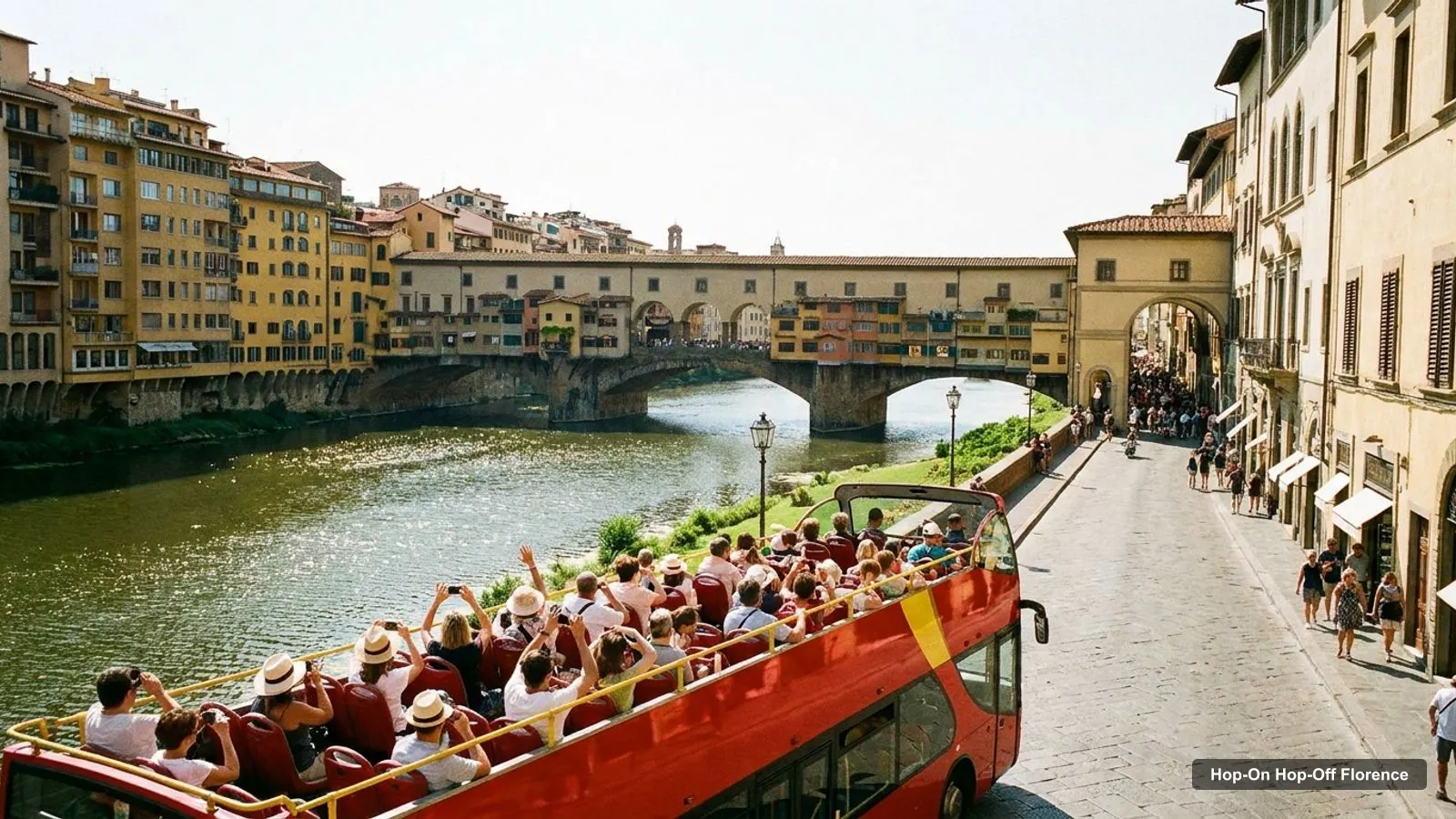
A Florence tourist map is more useful than most, because the city is small and the best sights sit in a few tight clusters. I built this page from two sources: the stop list on the main hop-on hop-off bus listing, and the Google Maps data for the 20 most-reviewed attractions. Every row links to Google Maps, so you can tap through and save it. If you are still choosing a ticket, my hop-on hop-off Florence guide compares all five.
The Florence tourist map below shows the first twelve stops on the main bus loop, in the order the listing gives them. They start at Santa Maria Novella train station and finish at Leopolda at Parco della Musica. The listing has 25 stop entries in total, some repeated, and it also reaches Piazza Indipendenza, San Domenico and Fiesole. Line A runs every 25 minutes from 9.00 am to 5.45 pm, and Line B every 60 minutes from 11.00 am to 4.00 pm.
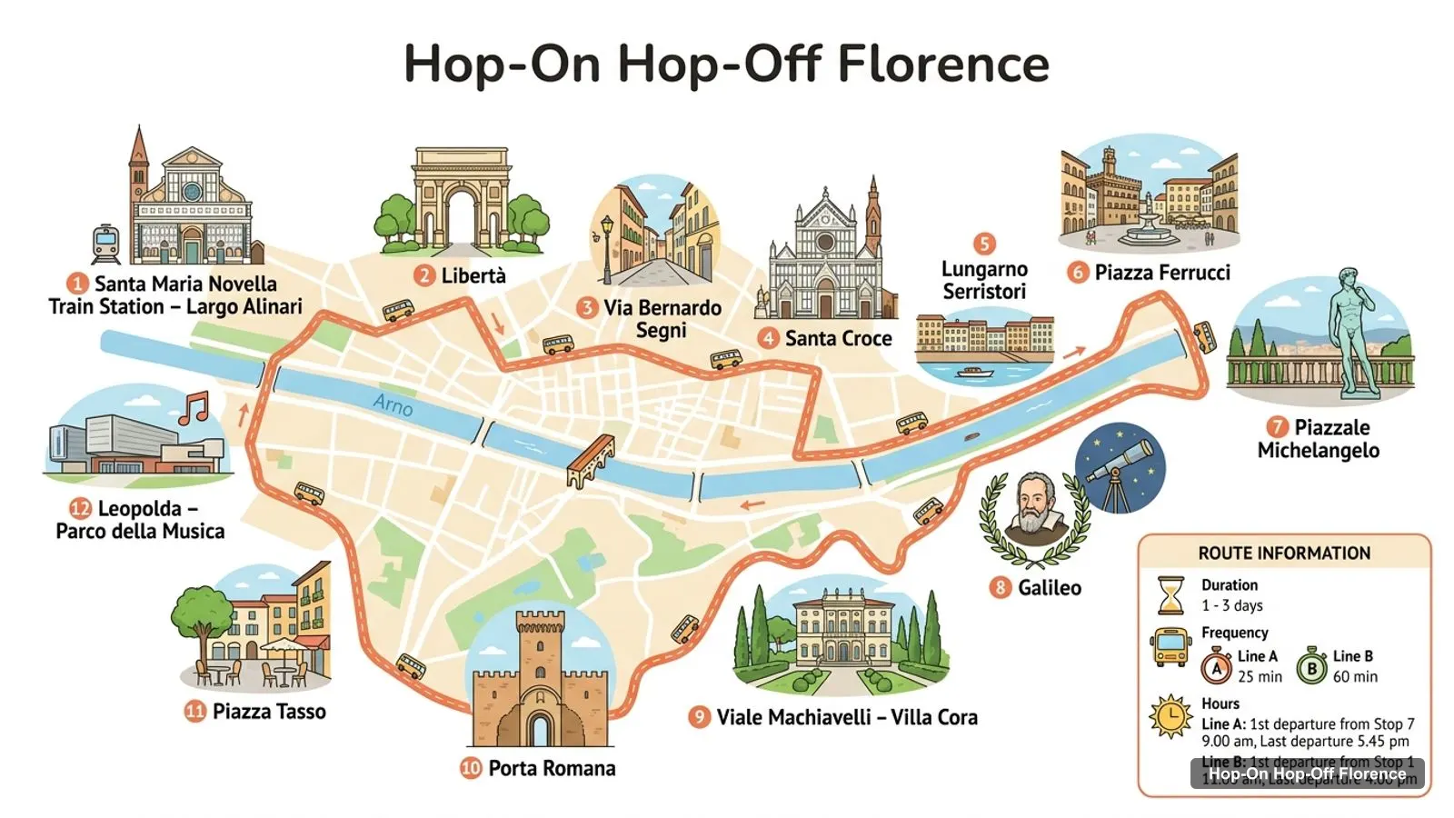
Stops on the route
| # | Stop | Map |
|---|---|---|
| 1 | Santa Maria Novella Train Station – Largo Alinari | Find on Google Maps |
| 2 | Libertà | Find on Google Maps |
| 3 | Via Bernardo Segni | Find on Google Maps |
| 4 | Santa Croce | Find on Google Maps |
| 5 | Lungarno Serristori | Find on Google Maps |
| 6 | Piazza Ferrucci | Find on Google Maps |
| 7 | Piazzale Michelangelo | Find on Google Maps |
| 8 | Galileo | Find on Google Maps |
| 9 | Viale Machiavelli – Villa Cora | Find on Google Maps |
| 10 | Porta Romana | Find on Google Maps |
| 11 | Piazza Tasso | Find on Google Maps |
| 12 | Leopolda – Parco della Musica | Find on Google Maps |
The listing does not say where Line A ends and Line B begins, so I have not tried to split the stops between the two. Use the free app that comes with the ticket for the live position of the buses.
This is the Florence tour map in table form, ranked by Google Maps review count, with coordinates. Each link opens the place in Google Maps. I left out bus stops and tour operators, so these are the sights themselves.
| # | Attraction | Rating | Reviews | Lat, Lng | Map |
|---|---|---|---|---|---|
| 1 | Ponte Vecchio | 4.7 | 154,661 | 43.7679, 11.2531 | Open |
| 2 | Piazzale Michelangelo | 4.8 | 114,365 | 43.7629, 11.2651 | Open |
| 3 | Cathedral of Santa Maria del Fiore | 4.8 | 111,878 | 43.7731, 11.2560 | Open |
| 4 | Uffizi Galleries | 4.7 | 95,196 | 43.7678, 11.2553 | Open |
| 5 | Piazza della Signoria | 4.8 | 87,667 | 43.7697, 11.2556 | Open |
| 6 | Galleria dell’Accademia di Firenze | 4.6 | 58,362 | 43.7768, 11.2586 | Open |
| 7 | Basilica of Santa Croce in Florence | 4.8 | 42,634 | 43.7686, 11.2623 | Open |
| 8 | Palazzo Pitti | 4.6 | 36,636 | 43.7652, 11.2500 | Open |
| 9 | Basilica of Santa Maria Novella | 4.7 | 32,509 | 43.7746, 11.2494 | Open |
| 10 | Boboli Gardens | 4.1 | 31,079 | 43.7625, 11.2484 | Open |
| 11 | Piazza della Repubblica | 4.6 | 27,932 | 43.7714, 11.2540 | Open |
| 12 | Palazzo Vecchio | 4.7 | 26,098 | 43.7693, 11.2562 | Open |
| 13 | Leonardo Interactive Museum | 4.7 | 21,518 | 43.7750, 11.2589 | Open |
| 14 | Fontana del Porcellino | 4.5 | 12,907 | 43.7699, 11.2542 | Open |
| 15 | Strozzi Palace | 4.6 | 12,401 | 43.7712, 11.2518 | Open |
| 16 | Brunelleschi’s dome | 4.8 | 12,097 | 43.7732, 11.2567 | Open |
| 17 | Opera del Duomo Museum | 4.6 | 11,647 | 43.7732, 11.2581 | Open |
| 18 | Baptistery of St. John | 4.6 | 9,836 | 43.7731, 11.2550 | Open |
| 19 | Museo Nazionale del Bargello | 4.7 | 9,233 | 43.7704, 11.2580 | Open |
| 20 | Museo Galileo | 4.5 | 8,650 | 43.7677, 11.2559 | Open |
Two entries overlap. Brunelleschi’s dome is part of the cathedral, and Giotto’s Bell Tower and the Baptistery stand in the same square, so the real number of separate sights is lower than the table suggests. I kept them because Google Maps lists them separately.
Plotting the coordinates, the sights fall into three groups. Treat these as the sections of your sightseeing map.
The Duomo and Signoria core. The cathedral, Baptistery, Giotto’s Bell Tower, Brunelleschi’s dome, the Opera del Duomo Museum, Piazza della Signoria, Palazzo Vecchio, the Uffizi, Piazza della Repubblica and the Fontana del Porcellino are all within about 0.65 km of the cathedral in a straight line. This is the area you walk, and the bus does not have a stop named for any of it.
The Santa Croce and east side. Santa Croce is about 0.72 km east of the Duomo and is a bus stop. Continue east and uphill to Piazzale Michelangelo, about 1.35 km from the Duomo, which is also a stop and the best view on the map.
The Oltrarno and the station. On the south bank are Palazzo Pitti (about 1.01 km from the Duomo), the Boboli Gardens (about 1.33 km) and, along the route, Porta Romana. On the north side, Santa Maria Novella sits by the station at about 0.55 km from the Duomo, and the Accademia is about 0.46 km.
Here is the way I would use the tables on a first morning. Pin the twelve bus stops and the top ten sights in a single Google Maps list, then look at where the pins bunch up. You will see one dense knot around the cathedral, a thinner line running east to Santa Croce and Piazzale Michelangelo, and a loose scatter across the river. That shape tells you how to move: walk inside the knot, ride between the clusters, and save the hill for the time of day when the light is best.
Ratings help you choose between neighbours. The cathedral, Piazza della Signoria, Santa Croce and Piazzale Michelangelo all average 4.8, while the Accademia averages 4.6 and the Boboli Gardens 4.1. A lower score on a famous place usually means queues, heat or a hilly walk, not a bad sight. The review counts, from 154,661 for Ponte Vecchio down to 8,650 for the Museo Galileo, show how crowded each one is likely to be.
Walking time is the thing a tourist map hides, so I use distance as a proxy. From the Duomo in a straight line, the Opera del Duomo Museum is about 0.17 km, Piazza della Repubblica about 0.25 km, the Bargello about 0.35 km, Piazza della Signoria about 0.39 km, the Accademia about 0.46 km, Santa Maria Novella about 0.55 km, the Uffizi about 0.6 km, Ponte Vecchio about 0.62 km and Santa Croce about 0.72 km. Only Palazzo Pitti, the Boboli Gardens and Piazzale Michelangelo are more than a kilometre away. I have not converted these to minutes, because I have no street data, but nothing in the core is far.
| Sight | Nearest stop on the listing | Note |
|---|---|---|
| Piazzale Michelangelo | Piazzale Michelangelo (Stop 7) | The stop is the viewpoint |
| Basilica of Santa Croce | Santa Croce (Stop 4) | Stop name matches |
| Basilica of Santa Maria Novella | Santa Maria Novella Train Station (Stop 1) | Across the square |
| Museo Galileo | Galileo | Stop name matches |
| Cathedral and Baptistery | None named | About 0.6 km on foot from the station |
| Uffizi, Signoria, Ponte Vecchio | None named | In the walking core |
| Boboli Gardens, Palazzo Pitti | Porta Romana, same side of the river | Check the live map for the closest stop |
Stop numbers count the stop list in the order the listing gives it. For the Uffizi bundle, the voucher exchange point is the Sightseeing Experience Visitor Center inside Santa Maria Novella station, so Stop 1 doubles as a ticket office.
Locals and Italian signs say Firenze, so the label you see on a printed Firenze tourist map will match the Google Maps links above. Three notes on walking: the core is flat and mostly pedestrian, the climb to Piazzale Michelangelo is the one steep stretch, and the river is your compass, with the Oltrarno on the south side. For official visitor information and event notices, I check the tourism board, Feel Florence.
The Turbopass Flex Pass lists public transport among its inclusions, along with a 24-hour hop-on hop-off bus option and 2 to 7 attractions, for $89.97. It has only 3 reviews, so I would not buy it for transport alone. The plain bus pass costs $22.01, is rated 3.82 from 7,398 reviews and comes with a free mobile app, Wi-Fi and audio in eight languages.
The main bus pass is the one that matches the route table above, and it is the one with the most reviews. For a day trip from a cruise port, the Livorno and La Spezia excursions bundle the same city bus with a coach. Whichever you choose, a stop-by-stop plan from the table works best if you ride once to Piazzale Michelangelo and walk the rest.
Sightseeing Experience
My pick: The ticket that matches the stop table above: $22.01, 25 minutes between buses on Line A, 3.82 from 7,398 reviews.
If you are ready to turn the map into a schedule, my Florence itinerary puts these clusters into one, two and three days, and the best things to do in Florence ranks the top 15 with the bus note for each. More cities are on the homepage, and the ticket comparison is on my Florence bus tour page.
The tables on this page work as a map: the bus stops and the top 20 attractions each have a Google Maps link, so you can save them to a list. For a paper map, the bus listing says its free app and audio map come with the ticket, and the tourism board at Feel Florence publishes visitor information.
Small. In a straight line, the Uffizi, Ponte Vecchio, the Accademia, Santa Maria Novella and Piazza della Signoria are all within about 0.6 km of the Duomo. Piazzale Michelangelo is the outlier, about 1.35 km east and uphill across the Arno, which is why it is a bus stop.
Not by name. The main listing's stops include Santa Maria Novella station, Santa Croce, Piazzale Michelangelo and Porta Romana, but none is called the Duomo. From the station the cathedral is roughly 0.6 km away in a straight line, so you walk, and the map below shows the route.
My full review of each one, in the order I rank them: