Edinburgh Tourist Map: Top Attractions & Bus Stops
By Jake Dawson · Updated · Affiliate links, explained in my disclosure
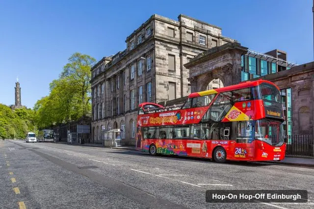
City Sightseeing UK
Edinburgh: City Sightseeing Hop-On Hop-Off Bus Tour
4.6 (7,840) · from $23.90
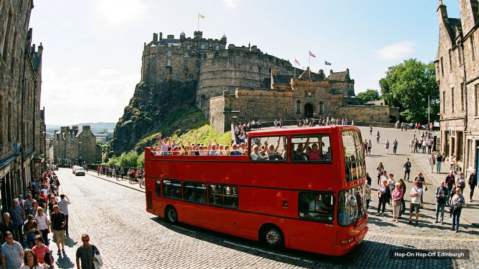
An Edinburgh tourist map works best when you can see the bus route and the sights together. The city’s big attractions fall into three clusters: the Old Town around the Castle and the Royal Mile, the New Town and its gardens, and the Holyrood end with Calton Hill. A sightseeing bus links them in a line. This page shows the route, the 12 stops from the City Sightseeing listing, and the 20 most-reviewed attractions with coordinates. For ticket prices and operators, my guide to hop-on hop-off Edinburgh compares all seven.
Edinburgh Tour Map: The Bus Route
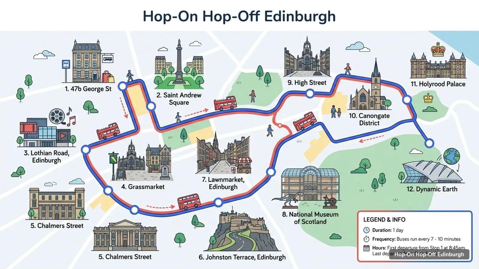
This is the route on the City Sightseeing ticket, starting at 47b George Street in the New Town and running through the Grassmarket, the Lawnmarket and the Royal Mile to Holyrood and Dynamic Earth. Other operators add Waterloo Place, The Mound, the Botanic Garden and Leith, so it’s worth checking the stop list for your ticket.
Stops on the route
- 147b George St, Edinburgh EH2 2HT, UK
- 2Saint Andrew Square
- 3Lothian Road, Edinburgh
- 4Grassmarket
- 5Chalmers Street
- 6Johnston Terrace, Edinburgh
- 7Lawnmarket, Edinburgh
- 8National Museum of Scotland
- 9High Street, Edinburgh
- 10Canongate District
- 11Holyrood Palace
- 12Dynamic Earth
Bus stops on the main loop
Every stop below links to a Google Maps search, so you can save the ones you need to your phone.
| # | Stop | Map |
|---|---|---|
| 1 | 47b George St, Edinburgh EH2 2HT, UK | Find on Google Maps |
| 2 | Saint Andrew Square | Find on Google Maps |
| 3 | Lothian Road, Edinburgh | Find on Google Maps |
| 4 | Grassmarket | Find on Google Maps |
| 5 | Chalmers Street | Find on Google Maps |
| 6 | Johnston Terrace, Edinburgh | Find on Google Maps |
| 7 | Lawnmarket, Edinburgh | Find on Google Maps |
| 8 | National Museum of Scotland | Find on Google Maps |
| 9 | High Street, Edinburgh | Find on Google Maps |
| 10 | Canongate District | Find on Google Maps |
| 11 | Holyrood Palace | Find on Google Maps |
| 12 | Dynamic Earth | Find on Google Maps |
Edinburgh Tourist Attractions: Top 20 Sights with Coordinates
These are the most-reviewed places in Edinburgh on Google Maps, ranked by review count, with coordinates so you can drop them into any map app. I’ve left out tour operators and a few places that are well outside the city. Ratings were checked October 2026.
| # | Attraction | Coordinates | Google rating | Map |
|---|---|---|---|---|
| 1 | Edinburgh Castle | 55.94859, -3.19991 | 4.6 (110,085) | Open in Google Maps |
| 2 | National Museum of Scotland | 55.94700, -3.19057 | 4.8 (60,048) | Open in Google Maps |
| 3 | Princes Street Gardens | 55.95098, -3.19855 | 4.7 (27,288) | Open in Google Maps |
| 4 | Royal Mile | 55.95011, -3.18802 | 4.7 (25,702) | Open in Google Maps |
| 5 | Royal Botanic Garden Edinburgh | 55.96501, -3.20910 | 4.7 (25,156) | Open in Google Maps |
| 6 | Palace of Holyroodhouse | 55.95271, -3.17227 | 4.6 (23,578) | Open in Google Maps |
| 7 | The Real Mary King’s Close | 55.94992, -3.19051 | 4.6 (19,862) | Open in Google Maps |
| 8 | National Galleries of Scotland: National | 55.95090, -3.19569 | 4.7 (17,487) | Open in Google Maps |
| 9 | Camera Obscura & World of Illusions | 55.94895, -3.19567 | 4.6 (16,166) | Open in Google Maps |
| 10 | The Royal Yacht Britannia | 55.98216, -3.17725 | 4.7 (14,386) | Open in Google Maps |
| 11 | St Giles’ Cathedral | 55.94948, -3.19089 | 4.6 (13,507) | Open in Google Maps |
| 12 | Holyrood Park | 55.94602, -3.15964 | 4.8 (12,870) | Open in Google Maps |
| 13 | The Scotch Whisky Experience | 55.94875, -3.19590 | 4.7 (11,614) | Open in Google Maps |
| 14 | Scott Monument | 55.95238, -3.19327 | 4.7 (7,997) | Open in Google Maps |
| 15 | Calton Hill | 55.95505, -3.18274 | 4.8 (6,959) | Open in Google Maps |
| 16 | The Edinburgh Dungeon | 55.95113, -3.19091 | 4.5 (6,815) | Open in Google Maps |
| 17 | National Galleries Scotland: Portrait | 55.95550, -3.19352 | 4.7 (5,921) | Open in Google Maps |
| 18 | National Galleries Scotland: Modern One | 55.95082, -3.22764 | 4.6 (4,965) | Open in Google Maps |
| 19 | Surgeons’ Hall Museum | 55.94665, -3.18528 | 4.7 (4,809) | Open in Google Maps |
| 20 | Museum of Edinburgh | 55.95139, -3.17944 | 4.4 (3,373) | Open in Google Maps |
Edinburgh Sites Map: The Three Clusters
The attractions group naturally, and the bus follows the same grouping.
Old Town: the Castle to Holyrood. Edinburgh Castle, the Camera Obscura, the Scotch Whisky Experience, St Giles’ Cathedral, Mary King’s Close and the National Museum of Scotland are all within about 0.6 km of the Castle or the Royal Mile. The Palace of Holyroodhouse is at the bottom, 1.8 km from the Castle in a straight line. Stops here: Grassmarket, Lawnmarket, High Street, Canongate and Holyrood Palace.
New Town and the gardens. Princes Street Gardens is only 0.3 km from the Castle, and the Scott Monument and the National Galleries on the Mound sit along its edge. Stops here: Saint Andrew Square, George Street, Hanover Street and The Mound.
Calton Hill and Holyrood Park. Calton Hill is about 0.7 km from the Palace of Holyroodhouse, and Holyrood Park starts about 1.1 km from it. These are the free, high-rated viewpoints, and Dynamic Earth is the nearest bus stop.
Outer ring: the Botanic Garden and Leith. The Royal Botanic Garden is about 1.9 km from the Castle. The Royal Yacht Britannia is about 3.3 km from Holyroodhouse. These need the longer routes.
How to Read the Edinburgh Tourist Map
The first thing to know about the map is that Edinburgh is vertical. The Castle sits on volcanic rock, the Royal Mile follows the ridge down, and the New Town lies across a valley to the north. So two sights that look close on a flat map may be a steep climb apart. That is why I trust the coordinates in the table above less for walking time and more for deciding which sights belong in the same half day.
A few pairs show it well. Edinburgh Castle and the National Museum of Scotland are about 0.6 km apart, and Edinburgh Castle and Princes Street Gardens only 0.3 km, but the path between them is uphill. The Scott Monument and Calton Hill are about 0.7 km apart, which is an easy walk. The Palace of Holyroodhouse and Calton Hill are also about 0.7 km apart, so I’d pair them on one afternoon. Distances here are straight-line figures worked out from the coordinates in my data, not walking routes.
Edinburgh Tourist Map for Phones and Printing
I’d save the stops, not the whole map. Open the Google Maps links in the stop table and the attractions table above, and star the ones you plan to use. Then save the area for offline use in Google Maps before you leave your hotel, since signal in the closes and wynds can be patchy. If you prefer paper, the bus operators hand out route maps at the first stop, and each listing says that audio commentary runs on board in several languages.
If you are travelling in a group, I’d share the starred list so everyone sees the same stops. One more tip: the first stop on the City Sightseeing route is at 47b George Street, which is a short walk from Saint Andrew Square. Other operators begin at Waterloo Place or Waverley Bridge, so check where your ticket starts before you head out.
Which Stop for Which Sight on the Edinburgh Tourist Map
| Sight | Nearest named stop in my data | Which ticket |
|---|---|---|
| Edinburgh Castle | Edinburgh Castle, Lawnmarket | Three-route pass, live guide, City Sightseeing |
| National Museum of Scotland | National Museum of Scotland | City Sightseeing, three-route pass, Big Bus Britannia combo |
| Royal Mile | Lawnmarket, High Street, Canongate | City Sightseeing |
| Palace of Holyroodhouse | Holyrood Palace | Most tickets |
| National Galleries | The Mound | Big Bus tickets, three-route pass |
| Royal Botanic Garden | Royal Botanic Garden | Three-route pass, both Big Bus tickets |
| Royal Yacht Britannia | Royal Yacht Britannia | Three-route pass, both Big Bus tickets |
Edinburgh Tourist Guide: Walking Between the Sights
Walking gives you the parts of the map that no bus can reach: the narrow closes off the High Street, the steps down to the Grassmarket and the viewpoints on Victoria Street. It also lets you stay as long as you like at each sight. I’d treat the bus as a shuttle for the long gaps and walk the short ones, which is the whole idea of a hop-on hop-off ticket.
If you walk rather than ride, begin at the Castle and go downhill. The Royal Mile is cobbled and steep, so wear grippy shoes, and take the closes between the High Street and the Cowgate for the quieter views. The Old Town cluster is easy on foot, but the climb back from Holyrood is where I’d hop on a bus. Edinburgh also has no Tube. For the local city buses, see Lothian Buses.
Edinburgh Tourist Information and Information Centre
For official tourist information, the national tourist board, VisitScotland, lists events, opening hours and passes. I haven’t confirmed a current address for the Edinburgh information centre, so check the website before you set off. Ticket staff at the bus stops are also good at answering route questions, and reviewers of the City Sightseeing tour mention them often. If you want a plan in place before you go, my Edinburgh itinerary turns this map into a 1, 2 and 3-day route, and my list of the best things to do in Edinburgh ranks the sights.
Which Bus Covers the Most of This Map?
The Edinburgh Bus Tours three-route pass lists the most stops in my data, 26, and it reaches both the Botanic Garden and the Royal Yacht Britannia. City Sightseeing covers the Old Town and Holyrood most simply, with 12 stops on the loop above. Big Bus is the one for hotel pickup and a single operator. For a first visit, I’d start with the three-route pass if you want the whole map, and City Sightseeing if you only want the centre. Both are covered in my full hop-on hop-off Edinburgh comparison, and the homepage lists the other cities I’ve mapped.
Frequently asked questions
How far is Edinburgh Castle from the Palace of Holyroodhouse?
About 1.8 km in a straight line, down the Royal Mile. On foot it's a downhill walk of roughly 25 minutes without stops, and the City Sightseeing route links the two via the Lawnmarket, High Street and Canongate stops. Most visitors walk down and ride back up.
Where is the Royal Yacht Britannia on the map?
It's moored at Ocean Terminal in Leith, EH6 6JJ, about 3.3 km from the Palace of Holyroodhouse in a straight line. No central Old Town route reaches it, so you need a ticket with the Britannia route, such as the Big Bus City and Britannia combo or the three-route pass.
Where can I get Edinburgh tourist information?
VisitScotland is the national tourist board and its website lists events, passes and opening times. I haven't verified a current visitor centre address, so check the site before you go. Staff at the bus stops also help with routes and tickets, as reviewers of the City Sightseeing tour say.
Tours I compared in Edinburgh
My full review of each one, in the order I rank them:
- Edinburgh: City Sightseeing Hop-On Hop-Off Bus Tour★ 4.6 · from $23.90
- Edinburgh: Royal Attractions with Hop-On Hop-Off Bus Tours★ 4.7 · from $107.53
- Edinburgh: Hop-On Hop-Off Bus Pass with 3 City Tours★ 4.7 · from $34.52
- Edinburgh: Big Bus Hop-On, Hop-Off Tour by Open-Top Bus★ 4.3 · from $26.28
- Edinburgh: Hop-On, Hop-Off Bus Tour City & Britannia Combo★ 4.2 · from $35.84
- Edinburgh: Hop-On Hop-Off Bus Tour with Live Guide★ 4.8 · from $23.90
- Edinburgh Royal Mile Audio Guide & HO-HO Bus Tour Optionfrom $11.26