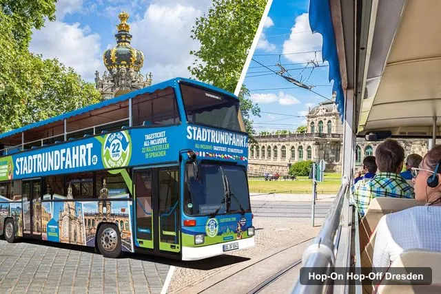
STADTRUNDFAHRT DRESDEN GmbH
Dresden: 1-Day Hop-On-Hop-Off Bus Tour
- 4.5 (3,243 reviews)
- 24-hour ticket
- Free cancellation
My pick: Lists all 22 stops, from the Zwinger to Albertplatz, at $28.15.
By Jake Dawson · Updated · Affiliate links, explained in my disclosure
STADTRUNDFAHRT DRESDEN GmbH
Dresden: 1-Day Hop-On-Hop-Off Bus Tour
4.5 (3,243) · from $28.15
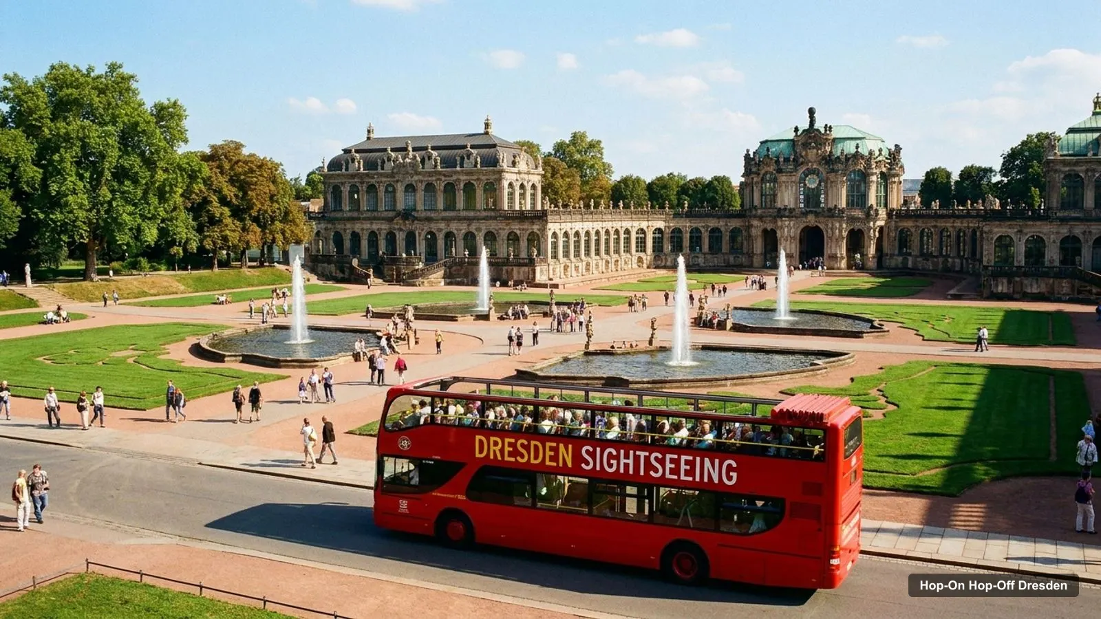
This Dresden tourist map has three layers: the route of the sightseeing bus, the top 20 attractions with coordinates, and the clusters the sights fall into. Everything links to Google Maps, so you can save places to your phone before you go. If you are still deciding on a ticket, my hop-on hop-off Dresden guide compares the two options.
The stop list is from the GetYourGuide listing for the 24-hour ticket. Attraction ratings and coordinates are from Google Maps data pulled in October 2026.
The Dresden sightseeing map below shows the loop from Postplatz and Zwinger through the old town, east to the Grosser Garten, along the Elbe to the Blue Wonder bridge and back through the Neustadt. Buses run every 15 minutes from April to October between 10:00 and 17:00, and every 30 minutes from November to March between 10:00 and 16:00.
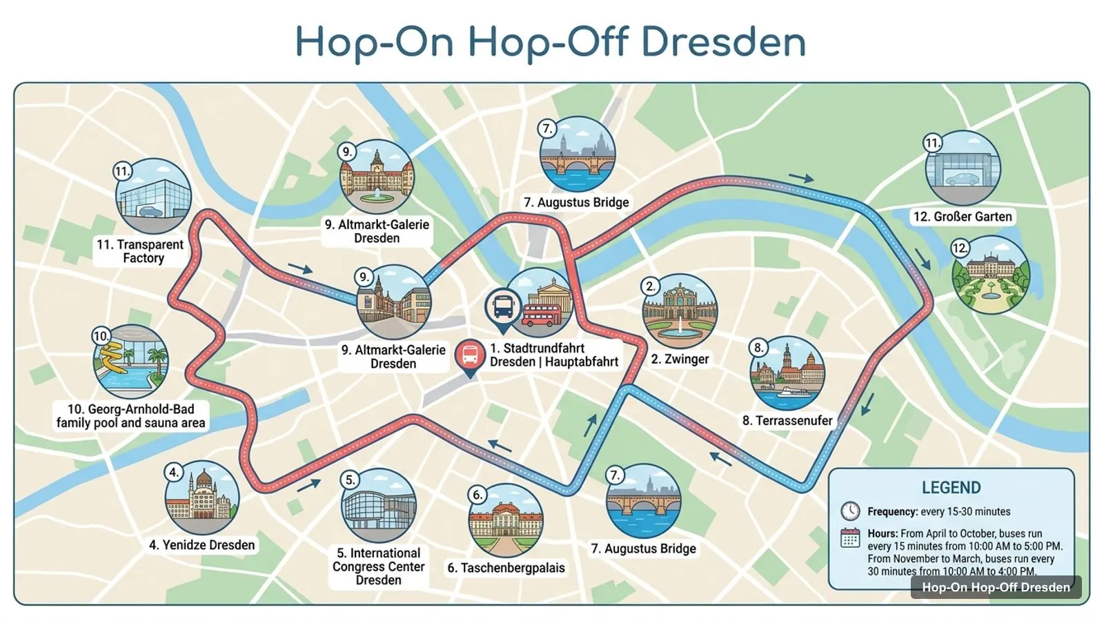
Stops on the route
The main departure point is first, followed by the 22 named stops in the order the listing prints them.
| # | Stop | Map |
|---|---|---|
| S | Main departure (Postplatz and Zwinger) | Find on Google Maps |
| 1 | Zwinger | Find on Google Maps |
| 2 | Postplatz, Dresden | Find on Google Maps |
| 3 | Yenidze Dresden | Find on Google Maps |
| 4 | International Congress Center Dresden | Find on Google Maps |
| 5 | Taschenbergpalais | Find on Google Maps |
| 6 | Augustus Bridge | Find on Google Maps |
| 7 | Terrassenufer | Find on Google Maps |
| 8 | Altmarkt-Galerie Dresden | Find on Google Maps |
| 9 | Georg-Arnhold-Bad family pool and sauna area | Find on Google Maps |
| 10 | Transparent Factory | Find on Google Maps |
| 11 | Großer Garten | Find on Google Maps |
| 12 | Elbschlösser | Find on Google Maps |
| 13 | Schillerplatz | Find on Google Maps |
| 14 | Blue Wonder Bridge | Find on Google Maps |
| 15 | Weißer Hirsch | Find on Google Maps |
| 16 | Albrechtsberg Palace | Find on Google Maps |
| 17 | Waldschlösschen Bridge | Find on Google Maps |
| 18 | Molkerei Pfund | Find on Google Maps |
| 19 | Albertinum Dresden | Find on Google Maps |
| 20 | Old Market Square, Dresden | Find on Google Maps |
| 21 | Dresden Frauenkirche | Find on Google Maps |
| 22 | Albertplatz | Find on Google Maps |
The 48-hour ticket is sold by the same operator and quotes the same 22 stops, but its listing does not print them. The stop that most visitors use first is the Zwinger, where the main departure point sits at the Kronentor gate.
These are the Dresden tourist attractions in table form, ranked by Google Maps reviews, with exact coordinates. I left out the two bus operators. Each link opens the place in Google Maps.
| # | Attraction | Coordinates | Google rating | Map |
|---|---|---|---|---|
| 1 | Dresden Zwinger | 51.05300, 13.73393 | 4.7 (57,292) | Open in Google Maps |
| 2 | Frauenkirche Dresden | 51.05187, 13.74152 | 4.8 (40,404) | Open in Google Maps |
| 3 | Semperoper Dresden | 51.05449, 13.73528 | 4.8 (17,654) | Open in Google Maps |
| 4 | Brühl’s Terrace | 51.05333, 13.74158 | 4.7 (14,632) | Open in Google Maps |
| 5 | Pillnitz Castle | 51.00843, 13.87111 | 4.6 (13,669) | Open in Google Maps |
| 6 | Golden Rider | 51.05813, 13.74133 | 4.6 (13,571) | Open in Google Maps |
| 7 | Residenzschloss | 51.05250, 13.73666 | 4.7 (13,226) | Open in Google Maps |
| 8 | German Hygiene Museum | 51.04427, 13.74730 | 4.5 (10,327) | Open in Google Maps |
| 9 | Historisches Grünes Gewölbe | 51.05263, 13.73631 | 4.7 (9,498) | Open in Google Maps |
| 10 | SKD - Old Masters Picture Gallery | 51.05339, 13.73471 | 4.8 (8,470) | Open in Google Maps |
| 11 | Museum of Military History | 51.07853, 13.75996 | 4.6 (7,942) | Open in Google Maps |
| 12 | Kunsthofpassage Dresden | 51.06801, 13.75400 | 4.6 (7,788) | Open in Google Maps |
| 13 | Dresden Transport Museum | 51.05185, 13.73956 | 4.6 (7,096) | Open in Google Maps |
| 14 | Dresden Panometer | 51.02549, 13.78845 | 4.7 (7,047) | Open in Google Maps |
| 15 | Fürstenzug | 51.05279, 13.73890 | 4.8 (4,924) | Open in Google Maps |
| 16 | Dresdner Striezelmarkt | 51.04968, 13.73798 | 4.7 (4,696) | Open in Google Maps |
| 17 | Cathedral St. Trinitatis | 51.05351, 13.73736 | 4.8 (3,653) | Open in Google Maps |
| 18 | Festung Xperience (Festung Dresden) | 51.05325, 13.74358 | 4.6 (2,750) | Open in Google Maps |
| 19 | Albertinum (1884-87; Adolph Canzler) | 51.05202, 13.74434 | 4.6 (2,569) | Open in Google Maps |
| 20 | Historical city center Dresden | 51.05416, 13.73666 | 4.9 (1,496) | Open in Google Maps |
Reading the table: the ratings run from 4.4 to 4.9, and the review counts fall from 57,292 for the Zwinger to a few hundred for the quieter courtyards. High review counts mean crowds, so for the top five I would go early, before the first bus at 10:00. The coordinates are the points Google Maps uses for each place, so a large site such as the Zwinger has entrances a few minutes’ walk from the pin.
The Dresden Germany attractions fall into three clusters, which is why the bus loop works.
The old town. The Zwinger, Semperoper, Residenzschloss, Frauenkirche, Brühl’s Terrace, Fürstenzug and Albertinum are all within about a kilometre of the Postplatz stop. Named stops here are the Zwinger, Frauenkirche and Albertinum, and the others are a short walk. From the Postplatz stop the Semperoper is 5 minutes away, the Fürstenzug 7 and the Frauenkirche 10, per OpenStreetMap routes.
The Neustadt. The Golden Rider (0.9 km from the Zwinger stop), the Canaletto-Blick viewpoint and the Kunsthofpassage (2.3 km) sit north of the river. Albertplatz is the named stop closest to them as far as I can tell.
The edges. The German Hygiene Museum is 1.4 km away, the Military History Museum 3.5 km and Pillnitz Castle 11 km, all in a straight line. The first two are tram trips, and Pillnitz is a half day.
People search for a Dresden map of Germany mostly to place the city, so here is the short version.
On a Dresden map of Germany the city is in the east, on the Elbe, about 165 km south-east of Berlin in a straight line. The coordinates I use for the bus start are 51.05237 north and 13.73243 east, at an elevation of 119 metres by Open-Meteo. Because Dresden is the Saxon capital and on the route to Czechia, it is often paired with Berlin or Prague, though I have not checked either route for this page.
This is the question I get most from readers who plan a hop-off: which stop is closest to the sight? Here is the answer for the five sights people ask about most.
| Sight | Nearest named stop | Walk |
|---|---|---|
| Zwinger | Zwinger / Postplatz | 6 minutes (432 m) to the Kronentor |
| Semperoper | Zwinger / Postplatz | 5 minutes (363 m) |
| Fürstenzug | Zwinger / Postplatz | 7 minutes (547 m) |
| Frauenkirche | Dresden Frauenkirche stop | 10 minutes from Postplatz (749 m) |
| Brühl’s Terrace | Albertinum | 4 minutes (283 m) |
Walk times are from OpenStreetMap foot routing between coordinates, so allow extra for crowds and stairs.
I treat the Dresden tourist map as two tools. The stop table tells me where the bus can drop me, and the attraction table tells me what is worth the drop. Where the two overlap, I hop off. Where they do not, I walk or take a tram.
In practice that gives three rules. First, walk the old town cluster, because its sights are 3 to 10 minutes apart and the bus would cost you more time in waiting than it saves. Second, use the bus for the stretch between the Albertinum and the Grosser Garten, where the stops are far apart and the buses run every 15 minutes in summer. Third, treat the Elbe villas as a ride-through unless you have the 48-hour ticket, because the Blue Wonder, Weisser Hirsch and Albrechtsberg stops each deserve a slow half hour.
One more detail from the listings: the stops after the departure point are marked as pass-by on the 24-hour listing. I read that as a note about the commentary rather than a ban on getting off, because the same listing promises you can hop off at any of the 22 stops. If a driver tells you otherwise, trust the driver and the printed map at the departure point.
The Dresden map looks different after dark, because the 24-hour ticket lists a night watchman tour in its includes. The listing gives no start time or meeting point for it, so I would ask at the Postplatz departure point when you collect your ticket. The old town cluster is the part of the map to use in the evening: the Frauenkirche, Brühl’s Terrace and the Zwinger are within the 10-minute walks in the table above, which keeps the route simple when the buses have finished for the day.
The Dresden weather pattern decides which part of this map to use. Here is 2025 from Open-Meteo.
| Month | Average high 2025 | Rain days (1 mm or more) |
|---|---|---|
| Jan | 5.8°C | 14 |
| Feb | 4.9°C | 5 |
| Mar | 11.3°C | 11 |
| Apr | 16.1°C | 5 |
| May | 17.6°C | 13 |
| Jun | 24.7°C | 13 |
| Jul | 23.6°C | 16 |
| Aug | 24.1°C | 7 |
| Sep | 20.4°C | 14 |
| Oct | 12.9°C | 17 |
| Nov | 8.7°C | 11 |
| Dec | 5.5°C | 6 |
The open top is best from May to September. Outside those months I would stay with the old town cluster, where you can duck into a museum.
I am a map person, so I understand wanting a file you can print. I decided against a PDF because the bus operator can change a stop at short notice, and a printed list would go out of date. The tables here are checked against the listings in October 2026.
For a Dresden tourist map PDF, the practical option is the paper route map at the departure point, and the tables above, which you can save to a phone. There is no metro in Dresden, so the trams are your fallback: a single ticket in the Dresden zone costs 3.60 euros and a day pass 9.50 euros, according to DVB, valid from April 2026.
Walking tips: the old town has cobbles, and the Neumarkt and Frauenkirche area is pedestrian. Wear shoes you can stand in, because the guided tours that come with the tickets are on foot.
Both tickets cover the same 22 stops. The 24-hour one lists the stops and adds a night watchman tour, while the 48-hour one gives a second day to use them.
STADTRUNDFAHRT DRESDEN GmbH
My pick: Lists all 22 stops, from the Zwinger to Albertplatz, at $28.15.
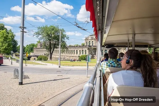
STADTRUNDFAHRT DRESDEN GmbH
My pick: The same operator and 22 stops over 48 hours, with the Procession of Princes tour included.
For a plan that uses the map, see the Dresden itinerary, and for ranked sights, the best things to do in Dresden. To buy, return to the Dresden bus tickets compared, or go to the homepage for other cities.
I do not host a PDF. The tables on this page give you every bus stop and the 20 most-reviewed sights with Google Maps links, and you can save them to a list on your phone. The bus operator hands out a route map at the departure point on Postplatz, so ask for one when you collect your ticket.
Dresden is in eastern Germany, the capital of Saxony, at about 51.05 degrees north and 13.74 degrees east. It lies about 165 km south-east of Berlin in a straight line, which I computed from the city-centre coordinates. The Elbe runs through the city, and the old town sits on its south bank.
Three of the top sights by Google reviews are named stops: the Zwinger, the Frauenkirche and the Albertinum. The Semperoper, Residenzschloss and Brühl's Terrace are within a few minutes' walk of old town stops. Pillnitz Castle, about 11 km away in a straight line, is not on the loop.
The GetYourGuide listing for the 24-hour ticket names 22 stops plus the main departure point on Postplatz and Zwinger. The loop takes about 90 minutes without hop-offs. The 48-hour listing also says 22 stops but does not print them, so I assume it follows the same route.
My full review of each one, in the order I rank them: