Cordoba Tourist Map: Top Attractions & Bus Stops
By Jake Dawson · Updated · Affiliate links, explained in my disclosure

City Sightseeing Europe
Córdoba: City Sightseeing Hop-On Hop-Off Bus Tour
4.0 (827) · from $30.40
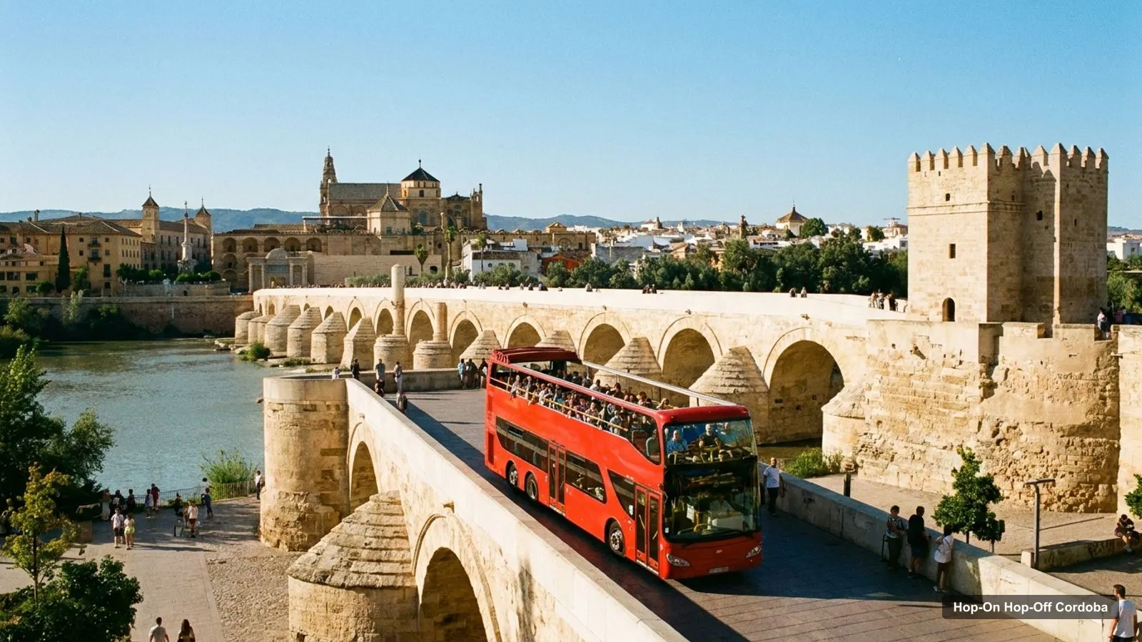
A Cordoba tourist map is easier to use when it shows two things at once: where the sights are and where the buses stop. This page does both. The first section lists the stops of the City Sightseeing bus, and the second ranks the top 20 sights with coordinates, distances and Google Maps links. For the route, the price and the timetable, start with my guide to hop-on hop-off Cordoba.
All distances on this page are straight-line figures from the Mosque-Cathedral at 37.87891, -4.77939, taken from Google Maps. Walking times, where I give them, come from OpenStreetMap foot routing fetched 8 October 2026. Ratings and review counts come from Google Maps. I left out the City Sightseeing ticket office, and I explain the biggest outlier, Medina Azahara, below.
Cordoba Things to See and Do: The Bus Route Map
The City Sightseeing ticket has 27 listed stop entries and two lines that meet at the river. The Red Line, the Panoramic Route, has 17 entries and a stated 70 minutes. The Blue Line, the Intima Route, has 10 entries and a stated 30 minutes. The first 12 red stops are on the map below, and the table after it lists all 27.
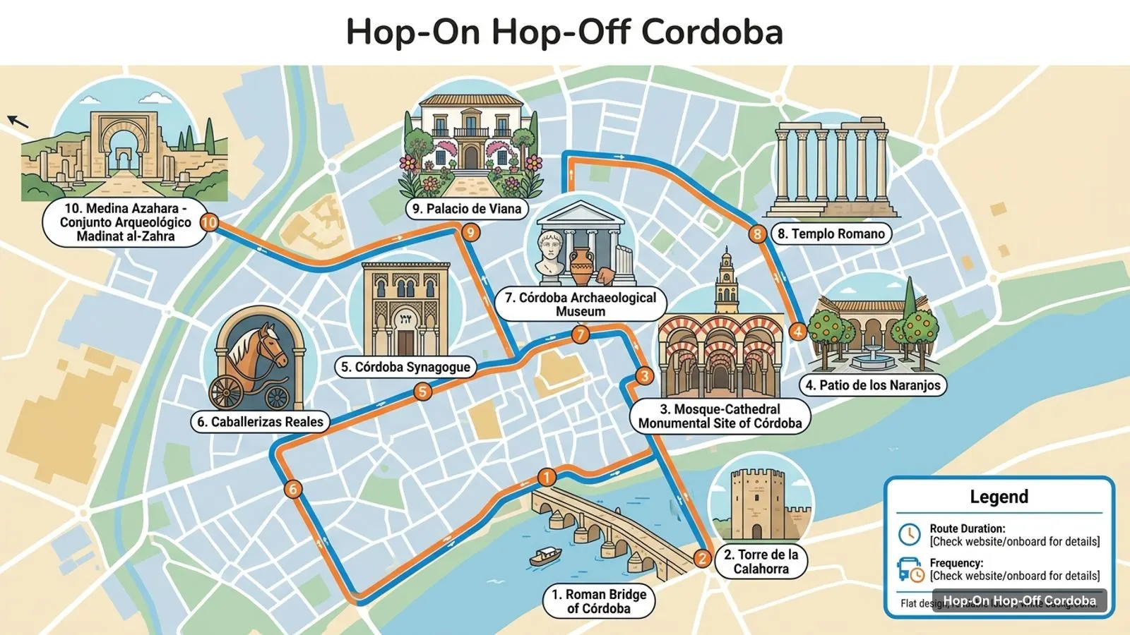
Stops on the route
- 1Panorámica del Río
- 2Jardín Botánico y Zoológico
- 3Ciudad de los Niños
- 4Barrio de San Basilio
- 5Puerta de Almodóvar
- 6Mercado de la Victoria
- 7Av. Gran Capitán
- 8Estación Central de Tren/ Autobús
- 9Palacio de la Merced
- 10Torre de la Malmuerta - Barrio de Santa Marina
- 11Plaza Corazón de María
- 12Barrio de San Lorenzo
Three red stops are listed as suspended: the river panorama (stop 1), the botanical garden and zoo (2) and the children’s park (3). The blue line stop at the river panorama is active. Treat the red line as starting at San Basilio, stop 4.
Every listed stop
| Line | # | Stop | Sight it serves | Map |
|---|---|---|---|---|
| Red | 1 | Panorámica del Río | Guadalquivir riverside | Find on Google Maps |
| Red | 2 | Jardín Botánico y Zoológico | Botanical garden and zoo (suspended) | Find on Google Maps |
| Red | 3 | Ciudad de los Niños | Children’s park (suspended) | Find on Google Maps |
| Red | 4 | Barrio de San Basilio | San Basilio patio district | Find on Google Maps |
| Red | 5 | Puerta de Almodóvar | Old town west gate | Find on Google Maps |
| Red | 6 | Mercado de la Victoria | Food market | Find on Google Maps |
| Red | 7 | Av. Gran Capitán | Main avenue | Find on Google Maps |
| Red | 8 | Estación Central de Tren/ Autobús | Railway and bus station | Find on Google Maps |
| Red | 9 | Palacio de la Merced | Palacio de la Merced | Find on Google Maps |
| Red | 10 | Torre de la Malmuerta - Barrio de Santa Marina | Torre de la Malmuerta | Find on Google Maps |
| Red | 11 | Plaza Corazón de María | Plaza and district | Find on Google Maps |
| Red | 12 | Barrio de San Lorenzo | San Lorenzo district | Find on Google Maps |
| Red | 13 | Realejo - Barrio de San Andrés | Realejo and San Andres | Find on Google Maps |
| Red | 14 | Templo Romano | Roman Temple | Find on Google Maps |
| Red | 15 | Arco del Portillo | Arco del Portillo and Casa del Agua | Find on Google Maps |
| Red | 16 | Puente Romano | Roman Bridge and Calahorra Tower | Find on Google Maps |
| Red | 17 | Alcázar de los Reyes Cristianos - Baños Califales | Alcazar and Califal Baths | Find on Google Maps |
| Blue | 1 | Alcázar de los Reyes Cristianos | Alcazar of the Christian Monarchs | Find on Google Maps |
| Blue | 2 | Mezquita - Catedral | Mosque-Cathedral | Find on Google Maps |
| Blue | 3 | San Pedro | San Pedro church area | Find on Google Maps |
| Blue | 4 | Realejo - San Andrés | Realejo and San Andres | Find on Google Maps |
| Blue | 5 | Palacio de Viana | Palacio de Viana | Find on Google Maps |
| Blue | 6 | Palacio de la Merced - Diputación | Palacio de la Merced | Find on Google Maps |
| Blue | 7 | Ayuntamiento - Templo Romano | Town Hall and Roman Temple | Find on Google Maps |
| Blue | 8 | Plaza de las Tendillas | Central square | Find on Google Maps |
| Blue | 9 | Arco del Portillo | Arco del Portillo and Casa del Agua | Find on Google Maps |
| Blue | 10 | Panorámica del Río | Guadalquivir riverside | Find on Google Maps |
The listing counts 27 entries, but several names repeat: the Arco del Portillo appears on both lines, and so do the river panorama and the Roman Temple. The operator’s site counts 20 stops, which is closer to the number of different places.
Cordoba Tourist Attractions: The Top 20 Ranked by Reviews
The Cordoba tourist attractions below are ranked by Google Maps review count. Distances are straight-line from the Mezquita, and the map links open the place card.
| # | Sight | Rating | Reviews | Latitude, longitude | From Mezquita | Map |
|---|---|---|---|---|---|---|
| 1 | Roman Bridge of Córdoba | 4.7 | 33,165 | 37.87671, -4.77797 | 274 m | Google Maps |
| 2 | Mosque-Cathedral | 4.8 | 33,111 | 37.87891, -4.77939 | 0 m | Google Maps |
| 3 | Medina Azahara | 4.5 | 19,174 | 37.88086, -4.85415 | 6,565 m | Google Maps |
| 4 | Palacio de Viana | 4.5 | 14,965 | 37.88864, -4.77405 | 1,180 m | Google Maps |
| 5 | Templo Romano | 4.2 | 9,501 | 37.88477, -4.77641 | 702 m | Google Maps |
| 6 | Caballerizas Reales | 4.4 | 5,572 | 37.87666, -4.78315 | 414 m | Google Maps |
| 7 | Córdoba Synagogue | 4.3 | 4,873 | 37.87971, -4.78334 | 358 m | Google Maps |
| 8 | Córdoba Archaeological Museum | 4.6 | 4,694 | 37.88196, -4.77814 | 357 m | Google Maps |
| 9 | Torre de la Calahorra | 4.5 | 4,624 | 37.87568, -4.77664 | 432 m | Google Maps |
| 10 | Patio de los Naranjos | 4.8 | 4,469 | 37.87946, -4.77987 | 75 m | Google Maps |
| 11 | Museum of Fine Arts of Cordoba | 4.4 | 2,734 | 37.88138, -4.77475 | 491 m | Google Maps |
| 12 | Baños del Alcázar Califal | 4.2 | 1,795 | 37.87779, -4.78240 | 292 m | Google Maps |
| 13 | Torre de la Malmuerta | 4.5 | 1,613 | 37.89180, -4.77767 | 1,441 m | Google Maps |
| 14 | Puerta del Puente | 4.6 | 1,482 | 37.87775, -4.77911 | 131 m | Google Maps |
| 15 | Casa Andalusí | 4.4 | 1,236 | 37.88011, -4.78354 | 388 m | Google Maps |
| 16 | Centro de Creación Contemporánea de Andalucía C3A | 4.4 | 1,158 | 37.87561, -4.77169 | 769 m | Google Maps |
| 17 | Bullfighting Museum of Cordoba | 4 | 1,000 | 37.87940, -4.78284 | 308 m | Google Maps |
| 18 | Casa de Sefarad | 4.5 | 861 | 37.87988, -4.78333 | 363 m | Google Maps |
| 19 | Triunfo de San Rafael de la Puerta del Puente | 4.5 | 728 | 37.87788, -4.77960 | 115 m | Google Maps |
| 20 | Torre-campanario de la Mezquita-Catedral de Córdoba | 4.6 | 716 | 37.87957, -4.78031 | 110 m | Google Maps |
The Roman Bridge and the Mosque-Cathedral are almost level at 33,165 and 33,111 reviews, and then the count falls by a third to Medina Azahara. Of the 20, 12 are rated 4.5 or higher, and the highest of the big sights is the Mosque-Cathedral at 4.8.
What Is Cordoba Famous For
What Cordoba is famous for shows in the table. The Mosque-Cathedral and its Patio de los Naranjos are both rated 4.8, the Roman Bridge is 4.7, and Wikipedia says UNESCO inscribed the Mosque-Cathedral in 1984 and the whole historic centre in 1994. The Patios festival is on UNESCO’s intangible heritage list.
The city is small, with 324,902 people in 2024 and an elevation of 106 metres. That is why the sights cluster so tightly.
Cordoba Top Attractions by Cluster
The Cordoba top attractions fall into five clusters, and the map is easier to read with them in mind.
- Mezquita core, under 300 metres: the Mosque-Cathedral, the Patio de los Naranjos (75 m), the Bell Tower (110 m), the Triunfo de San Rafael (115 m), the Puerta del Puente (131 m) and the Califal Baths (292 m). The bus stop is Blue Line stop 2.
- River, 242 to 432 metres: the Watermill Albolafia (242 m), the Roman Bridge (274 m) and the Calahorra Tower (432 m). The bridge is Red Line stop 16.
- Jewish Quarter, 358 to 388 metres: the Synagogue, Casa de Sefarad, Al-Iksir Alchemy Museum, Casa Andalusi and the Casa del Agua. No bus stop is named for the quarter, so you walk.
- Alcazar side, 292 to 414 metres: the Califal Baths, the Bullfighting Museum and the Caballerizas Reales, near stops 17 and 1.
- Further out, 700 metres and up: the Roman Temple (702 m), Centro C3A (769 m), Plaza de los Capuchinos (1,029 m), Palacio de Viana (1,180 m) and the Torre de la Malmuerta (1,441 m). These are where the buses earn their fare.
Medina Azahara is a sixth cluster of one. It is 6,565 metres away, rated 4.5 from 19,174 reviews, and no stop serves it. Google lists it closed on Mondays, so plan around that.
Cordoba Attractions: Walking Times Between the Big Ones
Cordoba attractions are close enough that walking beats waiting for a bus in the core. OpenStreetMap foot routing gives these times:
| From | To | Distance | Time |
|---|---|---|---|
| Roman Bridge (stop 16) | Mosque-Cathedral | 441 m | 6 minutes |
| Roman Bridge (stop 16) | Calahorra Tower | 157 m | 2 minutes |
| Mosque-Cathedral | Synagogue | 591 m | 8 minutes |
| Alcazar | Mosque-Cathedral | 704 m | 9 minutes |
| Roman Temple (stop 14) | Mosque-Cathedral | 798 m | 11 minutes |
| Palacio de Viana | Mosque-Cathedral | 1,421 m | 19 minutes |
I could not route the railway station stop, so I give no walking time for it. If you arrive by train, the red bus is the way into town.
Opening Hours of the Top Sights at a Glance
Hours matter as much as distance on a Cordoba tourist map, because several top sights close early or on Mondays. These are the Google Maps hours, checked October 2026. The Mosque-Cathedral is not in this table because Google gives no hours for it; the official site lists 10:00 to 19:00 for Thursday 8 October 2026 and a free visit from 8:30 to 9:30, Monday to Saturday.
| Sight | Tuesday to Friday | Saturday | Sunday | Monday |
|---|---|---|---|---|
| Medina Azahara | 9am to 6pm | 9am to 6pm | 9am to 3pm | Closed |
| Palacio de Viana | 10am to 7pm | 10am to 7pm | 10am to 3pm | 10am to 3pm |
| Synagogue | 9am to 3pm | 9am to 3pm | 9am to 3pm | Closed |
| Archaeological Museum | 9am to 9pm | 9am to 9pm | 9am to 3pm | 9am to 3pm |
| Calahorra Tower | 10am to 7pm | 10am to 7pm | 10am to 7pm | 10am to 7pm |
| Roman Bridge | Open 24 hours | Open 24 hours | Open 24 hours | Open 24 hours |
The pattern is clear: the Synagogue and Medina Azahara need a morning, and Monday removes both. If you only have a Monday, the river and the museum are the safe choices, and the blue minibus still runs.
Where the Bus Stops and the Sights Do Not Match
A Cordoba map that only shows bus stops hides three gaps. The Synagogue, the Archaeological Museum and the Caballerizas Reales have no stop named for them, so you walk 8 to 9 minutes from the nearest one. Medina Azahara has no stop at all, despite the listing description. And the Alcazar appears as two stops, one on each line, with the Califal Baths attached to the red one.
I would plan the day on the Mezquita cluster first, then use the buses only for the far ones: Palacio de Viana, the Roman Temple and the Malmuerta tower.
How I Use This Cordoba Tourist Map
I use a Cordoba tourist map in three passes. First I mark the Mezquita cluster and decide how long I want there. Then I mark the sights that close on Mondays or at 3pm, so they get the mornings. Last I look at the stops that connect the far sights, which here means stop 5 on the Blue Line for Palacio de Viana and stop 14 on the Red Line for the Roman Temple.
The coordinates in the table paste straight into Google Maps or a GPS app, and the map links open the place cards, so you can save the ones you want offline before you leave the hotel wifi.
Use the Map With the Rest of the Site
To turn this map into a plan, use my Cordoba itinerary for 1, 2 and 3 days. For the full ranking with hours, read my best things to do in Cordoba. For the ticket, the City Sightseeing Cordoba review has the full stop list and variants, and more cities are on the homepage. Official hours for the biggest sight are on the Mosque-Cathedral ticket page, and the Cordoba tourism board lists the rest. When you are ready to ride, the guide to hop-on hop-off bus Cordoba has the timetable.
Frequently asked questions
Is there a hop-on hop-off map for Cordoba?
Yes. The map on this page numbers the first 12 listed stops, and the table lists all 27 entries, 17 on the Red Line and 10 on the Blue Line, each with a Google Maps link. The operator's own site counts 20 stops, so confirm any differences when you board.
What is Cordoba famous for?
The Mosque-Cathedral, a mosque turned cathedral with the Patio de los Naranjos, is the answer in my data: 33,111 Google reviews at 4.8. The Roman Bridge has 33,165 at 4.7. Wikipedia adds that UNESCO listed the historic centre in 1984 and 1994, and the Patios festival is on its intangible heritage list.
What are the top attractions in Cordoba?
By reviews, the top five are the Roman Bridge, the Mosque-Cathedral, Medina Azahara, Palacio de Viana and the Roman Temple. All but Medina Azahara are inside 1,200 metres of the Mezquita in a straight line, and four are on the bus route. The top 20 table below gives coordinates for each.
How far apart are the main sights in Cordoba?
Close. The Roman Bridge is 274 metres from the Mosque-Cathedral and the Calahorra Tower 432 metres in a straight line. On foot the bridge is 441 metres, 6 minutes, and the Synagogue 591 metres, 8 minutes. Palacio de Viana is 1,180 metres away, 19 minutes, which is where the minibus helps.
Tours I compared in Cordoba
My full review of each one, in the order I rank them:
- Córdoba: City Sightseeing Hop-On Hop-Off Bus Tour★ 4.0 · from $30.40