Chicago Tourist Map: Top Attractions & Bus Stops
By Jake Dawson · Updated · Affiliate links, explained in my disclosure

Big Bus - Chicago
Chicago: Hop-on Hop-off Tour by Open-top Bus with 11 Stops
4.3 (1,534) · from $49
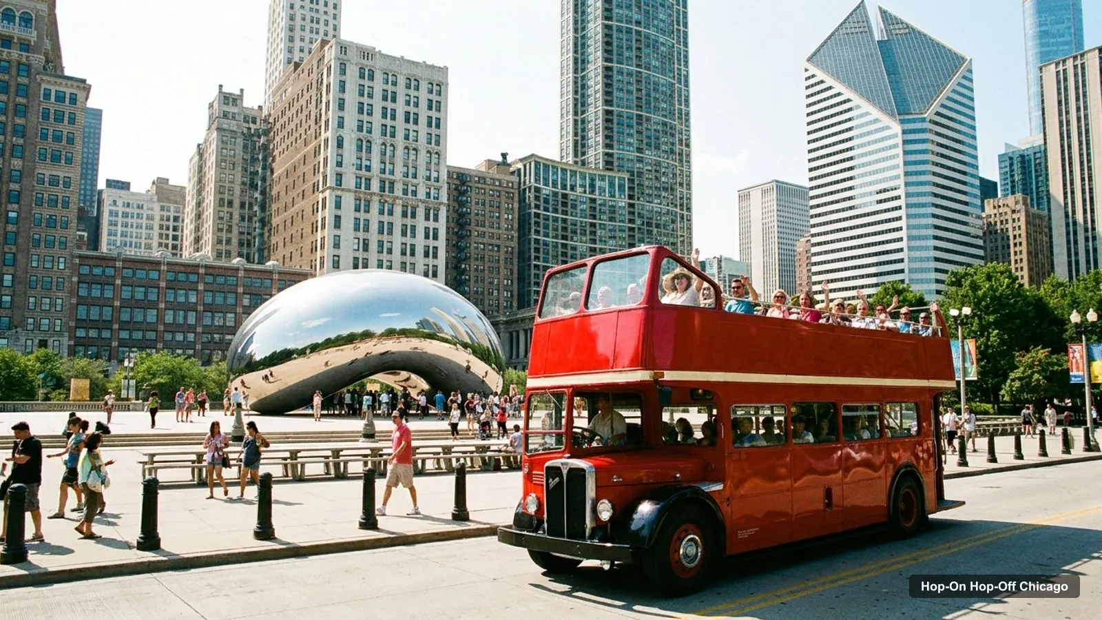
A Chicago tourist map makes more sense once you see the city as three clusters along the lake, joined by one bus loop. On this Chicago tourist map I’ve put the top 20 attractions, ranked by Google Maps reviews, and the sightseeing bus stops on one page, with coordinates and a Google Maps link for each. The route image follows the Big Bus stop order. To pick the ticket that rides it, see my comparison of hop-on hop-off in Chicago.
Chicago Sightseeing Map: The Bus Route
The Chicago sightseeing map below shows the Big Bus downtown loop as the classic pass lists it: from the Riverwalk west to Willis Tower, back to Millennium Park and the Art Institute, south along Michigan Avenue to Museum Campus, then north to the Water Tower, the Magnificent Mile and 360 CHICAGO. Stop 1 itself is at 98 E Wacker Drive, between Michigan and Wabash Avenues, where the loop starts and ends.
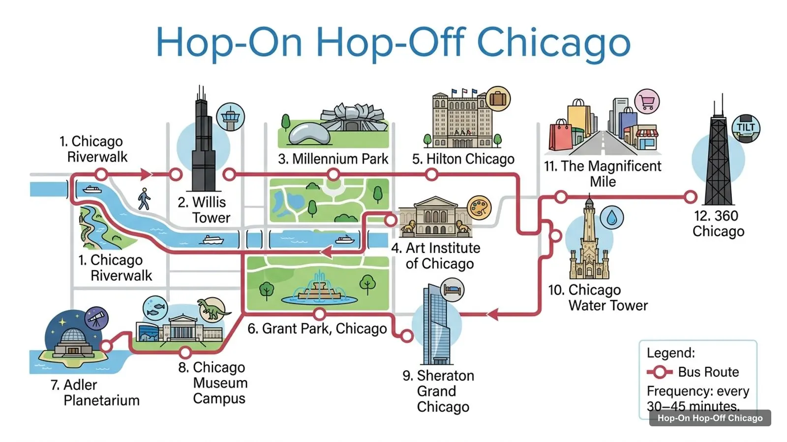
Stops on the route
- 1Chicago Riverwalk
- 2Willis Tower
- 3Millennium Park
- 4Art Institute of Chicago
- 5Hilton Chicago
- 6Grant Park, Chicago
- 7Adler Planetarium
- 8Chicago Museum Campus
- 9Sheraton Grand Chicago
- 10Chicago Water Tower
- 11The Magnificent Mile
- 12360 Chicago
Bus stops on the downtown loop
| # | Stop | Map |
|---|---|---|
| 1 | Chicago Riverwalk | Find on Google Maps |
| 2 | Willis Tower | Find on Google Maps |
| 3 | Millennium Park | Find on Google Maps |
| 4 | Art Institute of Chicago | Find on Google Maps |
| 5 | Hilton Chicago | Find on Google Maps |
| 6 | Grant Park, Chicago | Find on Google Maps |
| 7 | Adler Planetarium | Find on Google Maps |
| 8 | Chicago Museum Campus | Find on Google Maps |
| 9 | Sheraton Grand Chicago | Find on Google Maps |
| 10 | Chicago Water Tower | Find on Google Maps |
| 11 | The Magnificent Mile | Find on Google Maps |
| 12 | 360 Chicago | Find on Google Maps |
The classic pass names one more point after these, River North, and the 360 CHICAGO bundle also lists Navy Pier as a stop. The listings don’t publish a timetable for the loop, so check live bus positions in the Big Bus app. The only published schedule is for the South Side shuttle on the 72-hour ticket: daily from 9:30am to 2:30pm, every 30 to 45 minutes, from 98 E Wacker Drive.
Chicago Tourist Attractions: Top 20 with Coordinates
These are the Chicago tourist attractions in table form, ranked by Google Maps reviews, with exact coordinates. Each link opens the place in Google Maps, where you can save it to a list before you travel. Skydeck and Willis Tower share a building, and Museum Campus is the park that holds the Field Museum and Shedd Aquarium, so they appear as separate entries just as they do on Google Maps.
| # | Attraction | Coordinates | Google rating | Map |
|---|---|---|---|---|
| 1 | Millennium Park | 41.88255, -87.62255 | 4.8 (94,102) | Open in Google Maps |
| 2 | Navy Pier | 41.89186, -87.60509 | 4.6 (89,253) | Open in Google Maps |
| 3 | Cloud Gate | 41.88266, -87.62330 | 4.7 (41,973) | Open in Google Maps |
| 4 | The Art Institute of Chicago | 41.87960, -87.62235 | 4.8 (38,657) | Open in Google Maps |
| 5 | Skydeck Chicago | 41.87888, -87.63591 | 4.6 (37,782) | Open in Google Maps |
| 6 | Griffin Museum of Science and Industry | 41.79057, -87.58307 | 4.7 (36,165) | Open in Google Maps |
| 7 | Shedd Aquarium | 41.86757, -87.61404 | 4.5 (33,888) | Open in Google Maps |
| 8 | Field Museum | 41.86626, -87.61698 | 4.7 (32,167) | Open in Google Maps |
| 9 | The Museum Campus | 41.86622, -87.61563 | 4.7 (26,402) | Open in Google Maps |
| 10 | Willis Tower | 41.87888, -87.63591 | 4.5 (24,448) | Open in Google Maps |
| 11 | Chicago Riverwalk | 41.88847, -87.62323 | 4.8 (23,507) | Open in Google Maps |
| 12 | 360 CHICAGO | 41.89901, -87.62324 | 4.5 (21,394) | Open in Google Maps |
| 13 | Grant Park | 41.87393, -87.61988 | 4.7 (21,102) | Open in Google Maps |
| 14 | Clarence F. Buckingham Memorial Fountain | 41.87579, -87.61895 | 4.7 (17,356) | Open in Google Maps |
| 15 | The Chicago Theatre | 41.88530, -87.62775 | 4.7 (10,894) | Open in Google Maps |
| 16 | Medieval Torture Museum | 41.88538, -87.62767 | 4.9 (7,797) | Open in Google Maps |
| 17 | Museum Of Contemporary Art Chicago | 41.89721, -87.62099 | 4.4 (6,724) | Open in Google Maps |
| 18 | Chicago Cultural Center | 41.88375, -87.62495 | 4.7 (6,201) | Open in Google Maps |
| 19 | Crown Fountain | 41.88126, -87.62372 | 4.7 (5,624) | Open in Google Maps |
| 20 | Museum of Illusions Chicago | 41.88304, -87.62684 | 4.6 (5,332) | Open in Google Maps |
Chicago Tourist Map by Theme
The same Chicago tourist map reads differently depending on what you’re after. Here’s how I’d group the top 20 by theme, using the ratings and coordinates in the table above.
Free sights. Millennium Park, Cloud Gate, Crown Fountain, Grant Park, Buckingham Fountain, the Chicago Riverwalk and the Chicago Cultural Center cost nothing to visit. On the Chicago tourist map they form one strip along Michigan Avenue and the river, so you can see all seven in a morning on foot.
Views from the top. Skydeck Chicago at Willis Tower (4.6 from 37,782 reviews) and 360 CHICAGO (4.5 from 21,394) sit at opposite ends of the loop, about 2.5 km apart. Pick one. The 360 CHICAGO deck is included in one of the bus bundles, while Skydeck is always a separate ticket.
Big museums. The Art Institute, the Field Museum, Shedd Aquarium and the Griffin Museum of Science and Industry each need two to three hours. Three of them are on the bus loop; the fourth is the South Side outlier.
Smaller and quirkier. The Medieval Torture Museum is the highest-rated place in the top 20 at 4.9 from 7,797 reviews, and the Museum of Illusions sits close to Millennium Park. Both work as a short stop between the bigger sights.
Evening. The Chicago Theatre on State Street and Navy Pier are the two places in the table I’d save for the evening.
Chicago Sites Map: The Three Clusters
Read the coordinates above and you’ll see three tight groups on the Chicago sites map, plus one outlier:
- The Loop and Millennium Park (around 41.88, -87.62): Millennium Park, Cloud Gate, Crown Fountain, the Art Institute, the Chicago Cultural Center, the Riverwalk, the Chicago Theatre and the Museum of Illusions. You can walk all of it in a morning: the Riverwalk to Millennium Park is about 0.7 km. Willis Tower is the western edge, about 1.2 km from the park.
- Museum Campus (around 41.867, -87.615): the Field Museum, Shedd Aquarium and Adler Planetarium, about 1.9 km south of Millennium Park and 0.9 km past Grant Park. This is the stretch where the bus saves the most walking.
- The Magnificent Mile and Streeterville (around 41.89 to 41.90): 360 CHICAGO, the Museum of Contemporary Art and the historic Water Tower, with Navy Pier about 1.7 km east of 360 CHICAGO on the lake.
- The outlier: the Griffin Museum of Science and Industry at 41.79, -87.58, about 10.7 km south in Hyde Park. Only the 72-hour Big Bus ticket includes the shuttle there.
Plan one cluster of the Chicago tourist map per half day and you won’t waste time crossing the city. Museum Campus and 360 CHICAGO are about 3.7 km apart, the longest hop on the loop, so ride that one rather than walk.
Chicago Tourist Guide: Which Stop for Which Sight
This part of my Chicago tourist guide matches each big sight to its stop, using the stop lists in the bus listings and the distances from the coordinates:
- Cloud Gate, Crown Fountain and the Cultural Center: the Millennium Park stop. All three are within about 250 metres of it.
- The Art Institute of Chicago: its own stop, about 330 metres south of Millennium Park.
- Skydeck Chicago: the Willis Tower stop at 233 S Wacker Dr. Skydeck tickets aren’t included in any bus pass.
- Buckingham Fountain: the Grant Park stop, about 220 metres away.
- Field Museum, Shedd Aquarium and Adler Planetarium: the Museum Campus and Adler Planetarium stops. The Field Museum is about 100 metres from the Museum Campus point and Shedd about 200 metres.
- The Chicago Architecture Center and the river: Stop 1 and the Riverwalk. The Architecture Center at 111 E Wacker Dr is about 60 metres from the Riverwalk.
- 360 CHICAGO and the Museum of Contemporary Art: the 360 CHICAGO stop on the Magnificent Mile. The museum is about 270 metres away.
- The Chicago Theatre and State Street: no stop of its own; it’s about 500 metres from the Riverwalk.
For what to do at each of these places, see my ranked list of the best things to do in Chicago.
Chicago Travel Map: Getting Around Between Clusters
A Chicago travel map shows how much of the city sits beyond the bus loop. For anything off the route, like Lincoln Park, Pilsen or Hyde Park outside shuttle hours, use the L trains and city buses run by the Chicago Transit Authority. The bus loop is best for the first day or two, when you want commentary and a seat with a view. After that, the L is quicker for single trips. Walking works inside each cluster: the Loop sights in the table sit within about 1.5 km of each other.
Chicago Tourism Map: Saving It for Your Trip
The easiest way to use this Chicago tourism map on the ground is to save the places to Google Maps before you fly. Open each link in the tables, tap Save, and add it to one list; then download the downtown area for offline use. The city’s official tourism site, Choose Chicago, publishes event calendars and neighbourhood guides you can add on top. To turn the clusters into a day-by-day plan, follow my Chicago itinerary for 1, 2 and 3 days.
If you’d rather ride than walk between the clusters, my guide to the Chicago sightseeing bus compares the three tickets that cover this route. For the other cities I’ve mapped, head back to the homepage.
Frequently asked questions
Is there a printable Chicago tourist map?
This page works as one: the route map image shows the sightseeing bus loop with its stops in order, and the tables below list 12 bus stops and the top 20 attractions with coordinates. Print the page, or open any Google Maps link and save the places to a list on your phone for offline use.
Where are most Chicago attractions on the map?
In three clusters close to the lake. The Loop around Millennium Park has the Bean, the Art Institute, the Cultural Center and the Riverwalk. Museum Campus, about 1.9 km south, has the Field Museum, Shedd Aquarium and Adler Planetarium. The Magnificent Mile, about 1.8 km north, has 360 CHICAGO, with Navy Pier to the east.
How far apart are the main Chicago sights?
Millennium Park is about 1.2 km from Willis Tower, 1.8 km from Navy Pier and 360 CHICAGO, and 1.9 km from Museum Campus, measured in straight lines. The farthest big sight is the Museum of Science and Industry in Hyde Park, about 10.7 km south of Millennium Park.
Tours I compared in Chicago
My full review of each one, in the order I rank them:
- Chicago: Hop-on Hop-off Tour by Open-top Bus with 11 Stops★ 4.3 · from $49
- Chicago Architecture Boat Tour & Hop-on Hop-off Bus Tour★ 4.4 · from $99
- 360 CHICAGO Admission and Big Bus Hop-on Hop-off Tour★ 4.2 · from $84