Cartagena Tourist Map: Top Attractions & Bus Stops
By Jake Dawson · Updated · Affiliate links, explained in my disclosure
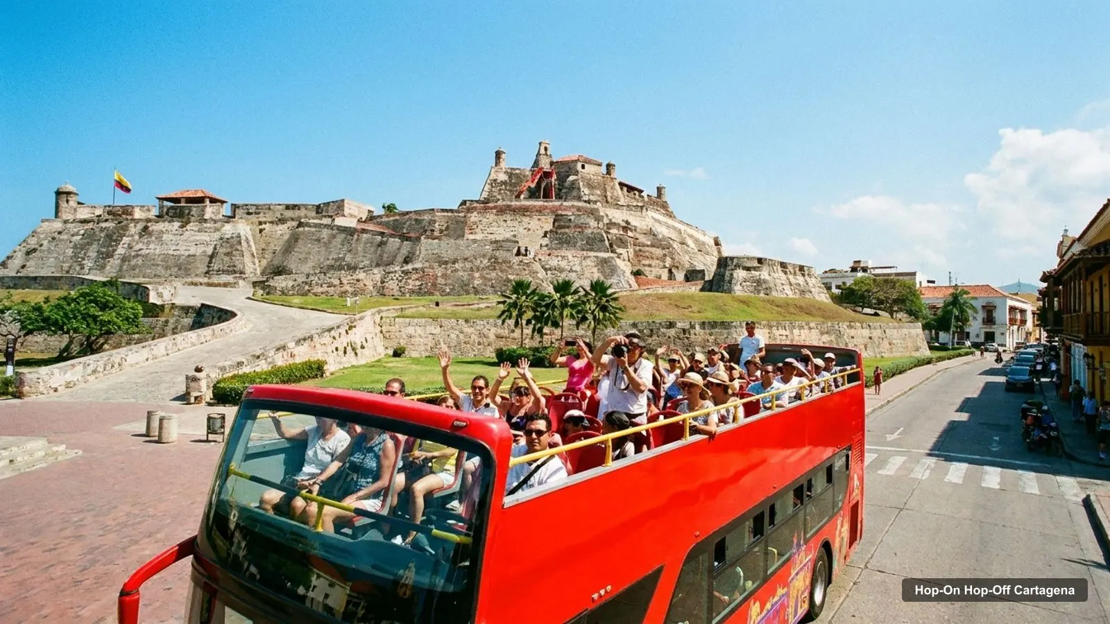
A good Cartagena tourist map should answer two questions: where are the sights, and which of them can you reach by bus? This page does both. It has the City Sightseeing stop list, the top twenty attractions from Google Maps with coordinates, and clusters that show what you can combine on foot. The bus itself is explained in my guide to hop on hop off Cartagena.
This map covers Cartagena de Indias in Colombia. The data is from Google Maps and the operator’s page, checked October 2026, and distances are straight lines from the Clock Tower.
Cartagena Tourist Attractions on the Route Map
The image shows the city and the numbered stops. It’s my own sketch from place names, not a survey, so use it for orientation and use Google Maps for navigation.
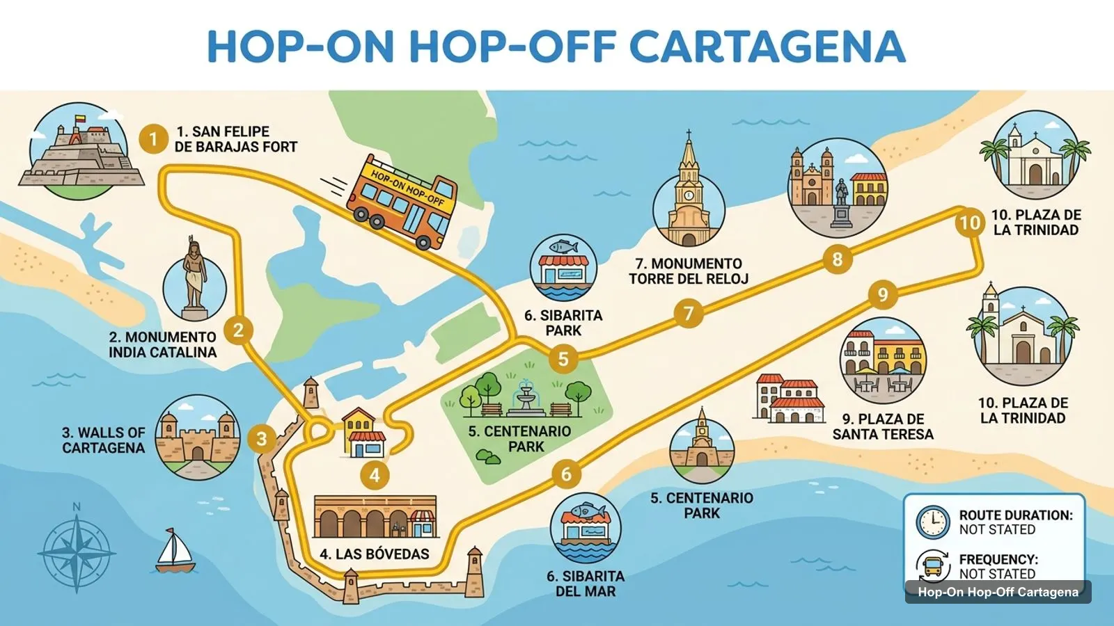
Stops on the route
- 1San Felipe de Barajas Fort
- 2Monumento India Catalina
- 3Walls of Cartagena
- 4Las Bóvedas
- 5Centenario Park
- 6Sibarita del Mar
- 7Monumento Torre del Reloj
- 8Plaza de Santo Domingo
- 9Plaza de Santa Teresa
- 10Plaza de la Trinidad
The picture lists ten places, but the operator’s own list is the one to trust, because it is the one printed on the bus. That list is below, with a Google Maps link for each stop.
Cartagena Colombia Map: The 10 Bus Stops
The City Sightseeing route has 10 stops on a single loop that begins at the Clock Tower. Nine are named on the operator’s page. Where a stop matches a place in my data, I show its Google rating and distance from the tower.
| # | Stop (operator’s name) | Google Maps rating | Distance from Clock Tower | Map |
|---|---|---|---|---|
| 1 | Clock Tower (Torre del Reloj) | 4.7 from 37,301 reviews | start | Open in Google Maps |
| 2 | San Felipe Castle | 4.7 from 67,933 reviews | 1.1 km | Open in Google Maps |
| 3 | Boquetillo | not in my data | no coordinates in my data | Open in Google Maps |
| 4 | Convention Center | not in my data | no coordinates in my data | Open in Google Maps |
| 5 | San Sebastian del Pastelillo | not in my data | no coordinates in my data | Open in Google Maps |
| 6 | Rafael Nunez Museum | 4.5 from 1,091 reviews | 1.1 km | Open in Google Maps |
| 7 | Walled City of Cartagena | 4.8 from 34,266 reviews | 0.9 km | Open in Google Maps |
| 8 | Casino Rio | not in my data | no coordinates in my data | Open in Google Maps |
| 9 | Parque Centenario | 4.4 from 4,680 reviews | 0.2 km | Open in Google Maps |
| 10 | Not named on the operator’s page | not in my data | not in my data | n/a |
Four stops match well-known sights: the Clock Tower, the fort, the walls and Parque Centenario. The Rafael Núñez Museum stop is the farthest from the old town, about 1.1 km from the tower. The others, such as Boquetillo and Casino Río, have no coordinates in my data, so use the map links.
Cartagena Attractions: The Top 20 with Coordinates
This table ranks the top twenty attractions by Google review count. I left out restaurants, tour offices and shops. The table was generated from my data, not typed by hand.
| # | Attraction | Rating | Reviews | Latitude, longitude | From Clock Tower | Map |
|---|---|---|---|---|---|---|
| 1 | San Felipe de Barajas Fort | 4.7 | 67,933 | 10.4225, -75.5393 | 1.09 km | Maps |
| 2 | Monumento Torre del Reloj | 4.7 | 37,301 | 10.4230, -75.5492 | 0.00 km | Maps |
| 3 | Walls of Cartagena | 4.8 | 34,266 | 10.4296, -75.5449 | 0.88 km | Maps |
| 4 | Plaza de la Trinidad | 4.7 | 12,846 | 10.4206, -75.5454 | 0.50 km | Maps |
| 5 | Monumento India Catalina | 4.5 | 11,011 | 10.4265, -75.5440 | 0.69 km | Maps |
| 6 | Plaza de Santo Domingo | 4.6 | 10,800 | 10.4243, -75.5520 | 0.34 km | Maps |
| 7 | Las Bóvedas | 4.5 | 8,584 | 10.4302, -75.5465 | 0.85 km | Maps |
| 8 | Plaza de Santa Teresa | 4.7 | 5,274 | 10.4217, -75.5523 | 0.37 km | Maps |
| 9 | Centenario Park | 4.4 | 4,680 | 10.4227, -75.5473 | 0.22 km | Maps |
| 10 | Museum of Cartagena de Indias | 4.2 | 4,679 | 10.4232, -75.5515 | 0.25 km | Maps |
| 11 | Centro Histórico de Cartagena | 4.8 | 4,298 | 10.4229, -75.5496 | 0.04 km | Maps |
| 12 | Museo Naval del Caribe | 4.6 | 3,907 | 10.4218, -75.5521 | 0.34 km | Maps |
| 13 | Plaza de la Aduana | 4.6 | 3,266 | 10.4222, -75.5503 | 0.15 km | Maps |
| 14 | Plaza de Bolívar | 4.6 | 2,859 | 10.4232, -75.5512 | 0.22 km | Maps |
| 15 | Catedral de Santa Catalina de Alejandría | 4.8 | 2,743 | 10.4236, -75.5507 | 0.18 km | Maps |
| 16 | Plaza San Pedro Claver | 4.7 | 1,809 | 10.4216, -75.5508 | 0.23 km | Maps |
| 17 | Museo del Oro Zenú | 4.6 | 1,390 | 10.4231, -75.5509 | 0.18 km | Maps |
| 18 | Baluarte de Santo Domingo | 4.6 | 1,228 | 10.4244, -75.5542 | 0.57 km | Maps |
| 19 | Casa Museo Rafael Núñez | 4.5 | 1,091 | 10.4312, -75.5441 | 1.07 km | Maps |
| 20 | Palacio de la Proclamación | 4.8 | 808 | 10.4235, -75.5507 | 0.17 km | Maps |
A note on reading it. Review counts say how popular a place is, not whether it’s worth your time. The top three have tens of thousands of reviews because they’re on every list, and the plazas rank lower because they are free and passed through, not visited.
Cartagena Colombia Map Tourist Clusters
Grouping sights by distance is the quickest way to plan a day. Here are the clusters I see in the coordinates.
- Old town core, within about 0.4 km of the Clock Tower: the cathedral, Plaza de Bolívar, Plaza de los Coches, Plaza San Pedro Claver, Plaza de Santo Domingo, Plaza de Santa Teresa, the Museo Naval, the Museo del Oro Zenú and the Palacio de la Proclamación. Walk all of it.
- Getsemaní, 0.5 to 0.6 km away: Plaza de la Trinidad, Plazuela del Pozo and the Getsemaní streets. Good for evenings.
- North walls, 0.7 to 0.9 km away: the India Catalina monument, Las Bóvedas and the walls. A pleasant sunset loop.
- The fort, about 1.1 km away: San Felipe de Barajas Fort, and the only major sight where the bus or a taxi clearly saves effort.
- Bay side, 2.5 to 3 km away: the bay and the Malecón Bahía de las Ánimas, outside the compact centre, where the bus operator’s office is also found.
My Cartagena itinerary turns these clusters into one, two and three day plans.
How to Use the Coordinates
Every row in the table has latitude and longitude, so you can paste them into any map app. The old town centre sits around 10.42 north and 75.55 west. The Clock Tower, at about 10.4230 and minus 75.5492, is my reference point for every distance on this page.
A few reading tips. Two points that differ by 0.01 degrees of latitude are roughly 1.1 km apart north to south, which is why the fort, at 10.4225 and minus 75.5393, looks close on paper but is about 1.1 km east of the tower. Distances are straight lines. Streets, walls and water add detours, particularly between the old town and the bay side.
Which Places Are Open 24 Hours
Google Maps lists many of the plazas and monuments as open 24 hours, including the Clock Tower, the walls, Plaza de la Trinidad, Plaza de Santo Domingo and Plaza de Bolívar. That doesn’t mean everything nearby is. The fort is listed as open 7 AM to 6 PM, Las Bóvedas 8:50 AM to 7 PM, Centenario Park 7 AM to 10 PM and the cathedral 7 AM to 8 PM. The Museo del Oro Zenú and the Museo de Arte Moderno show as closed on Mondays in the first listed day.
If you plan around a bus ride, remember the operator’s page shows 09:00 to 15:00 for the dates it lists, while a TripAdvisor snippet says 9am to 6pm. I’d confirm the timetable for your day.
Planning a Short Visit With This Map
If you only have a few hours, pick one cluster and one outlier. I’d take the old town core for the squares and the cathedral, then add the fort as the single long-distance stop. Together they cover the three most-reviewed sights in my data. If you are visiting on a cruise call, check the all-aboard time first, because the fort alone can take a good part of the morning once you add the trip out and back.
What the Map Doesn’t Show
My data doesn’t include walking routes, ticket prices or restaurant details, so the map above is about position and popularity only. It also can’t tell you how crowded a place will be, or whether a gate is open on a public holiday. For those, use the official sites. The fortifications site is fortificacionescartagena.com.co, and the Museo Naval is at museonavaldelcaribe.org.
Is Cartagena Safe for Tourists? What a Map Can and Can’t Tell You
A map can’t answer that. What I can say is that the sights here are in the busy central districts and that Google Maps lists many of the squares as open 24 hours. For official guidance, read the US State Department advisory for Colombia at travel.state.gov, and check the local tourism site, cartagenadeindias.travel, for plaza information.
For taxis, agree the fare before you start. Keep your phone out of sight on quiet streets. These are general tips, not data from this site’s sources.
Using This Map With the Bus and the Guides
If you only use the map, you’ll walk the old town and take a taxi to the fort. If you add the bus, you get the fort, the bay side and a commentary in one ride. The operator’s cancellation terms (free up to 24 hours before) make it a low-risk add-on, and the tickets are on the City Sightseeing booking page.
For sight-by-sight detail, see my ranked list of the best things to do in Cartagena. To go back to the bus guide, read Cartagena hop-on hop-off stops, hours and tickets. Everything else is on the home page.
Frequently asked questions
What are the top tourist attractions in Cartagena?
By Google Maps reviews, the top three are San Felipe de Barajas Fort (67,933 reviews, 4.7), the Clock Tower (37,301 reviews, 4.7) and the city walls (34,266 reviews, 4.8). The table below ranks twenty with coordinates, ratings and Google Maps links, so you can plot your own route.
Is Cartagena safe for tourists?
I'm not a security source, so check the current US State Department advisory for Colombia before you travel. The areas on this map, the walled city and Getsemaní, are busy and many squares are open 24 hours per Google Maps. Use the usual precautions with phones, bags and taxis.
Where does the Cartagena hop-on hop-off bus stop?
The operator lists 10 stops on one route, starting at the Clock Tower. Nine are named: San Felipe Castle, Boquetillo, Convention Center, San Sebastian del Pastelillo, Rafael Núñez Museum, Walled City, Casino Río and Parque Centenario. The tenth wasn't named on the page I read.
How big is the old town of Cartagena?
Small enough to walk. From the Clock Tower, the cathedral is about 0.18 km, Plaza de Santo Domingo 0.34 km and Plaza de la Trinidad in Getsemaní 0.5 km in a straight line. The fort is the main outlier at about 1.1 km, which is where the bus helps.
Is this the map for Cartagena, Spain?
No. Everything here is in Cartagena de Indias, Bolívar, Colombia. Searches for a Cartagena Colombia map and a Cartagena Spain map return different cities, so check the address and the coordinates. The old town of Cartagena de Indias is around 10.42 north, 75.55 west.