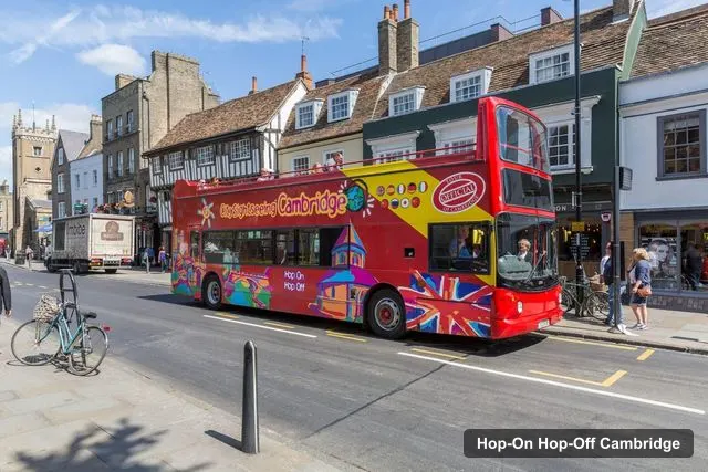
City Sightseeing UK
Cambridge: City Sightseeing Hop-On Hop-Off Bus Tour
- 4.5 (586 reviews)
- 24-hour ticket
- Free cancellation
My pick: Covers all 18 stops on this map in an 80-minute loop; $22.57 for 24 hours.
By Jake Dawson · Updated · Affiliate links, explained in my disclosure
City Sightseeing UK
Cambridge: City Sightseeing Hop-On Hop-Off Bus Tour
4.5 (586) · from $22.57
A Cambridge tourist map is easier to use when it shows two things at once: where the sights are and where the bus stops. This page does both. The first section numbers the 18 stops of the City Sightseeing loop, and the second lists the top 20 sights with coordinates, distances and Google Maps links. For the route itself, the price and the timetable, start with my guide to hop-on hop-off Cambridge.
All distances on this page are straight-line figures from the Silver Street stop, which is stop 1 at 52.20141, 0.11465 according to the listing’s meeting-point link. Walking times, where I give them, come from OpenStreetMap foot routing fetched 8 October 2026. Ratings and review counts come from Google Maps. I left out tour operators, bus stops and places outside the city, and I explain the one big exception, IWM Duxford, below.
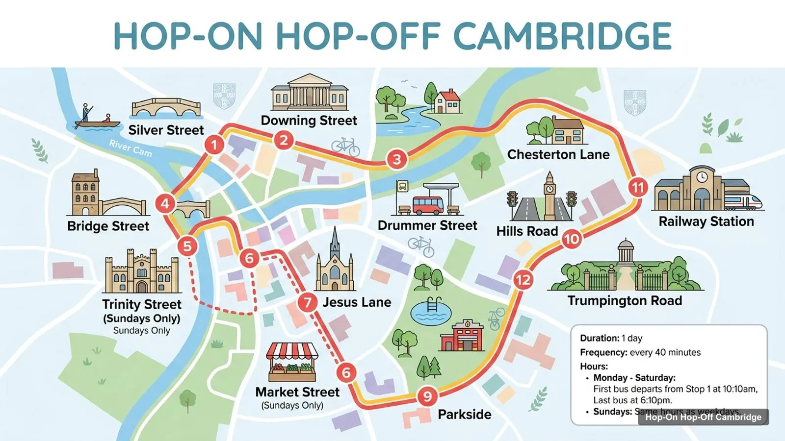
The City Sightseeing loop has 18 listed stops, 17 distinct names, and an 80-minute full circuit. It starts and ends the day at Silver Street, which appears twice, as stop 1 and as stop 14.
Stops on the route
| # | Stop | When served | Map |
|---|---|---|---|
| 1 | Silver Street | Every day | Find on Google Maps |
| 2 | Downing Street | Every day | Find on Google Maps |
| 3 | Chesterton Lane | Every day | Find on Google Maps |
| 4 | Bridge Street | Every day | Find on Google Maps |
| 5 | Trinity Street | Sundays only | Find on Google Maps |
| 6 | Market Street | Sundays only | Find on Google Maps |
| 7 | Jesus Lane | Every day | Find on Google Maps |
| 8 | Drummer Street | Every day | Find on Google Maps |
| 9 | Parkside | Every day | Find on Google Maps |
| 10 | Hills Road | Every day | Find on Google Maps |
| 11 | Railway Station | Every day | Find on Google Maps |
| 12 | Trumpington Road | Every day | Find on Google Maps |
| 13 | The Fitzwilliam Museum | Every day | Find on Google Maps |
| 14 | Silver Street | Every day | Find on Google Maps |
| 15 | Queen’s Road | Every day | Find on Google Maps |
| 16 | Cambridge American Cemetery and Memorial | Every day | Find on Google Maps |
| 17 | Madingley Road | Every day | Find on Google Maps |
| 18 | Grange Road | Every day | Find on Google Maps |
Stops 12 to 18 are not in service after the last bus leaves Stop 1 at 6:10pm. On Monday to Saturday, Trinity Street and Market Street are skipped, which leaves 16 stops. The listing’s own note numbers them as stops 4 and 5 in one line and 5 and 6 in the stop list, so go by the name. Stop numbers also differ for the railway station, which the list shows as stop 11 and the boarding note as stop 12.
The 20 most-reviewed sights in the city, from Google Maps, are below. The coordinates are those Google returns for each place, and the last column links straight to it.
| # | Place | Rating | Reviews | Latitude, longitude | Straight-line from Silver Street | Map |
|---|---|---|---|---|---|---|
| 1 | The Fitzwilliam Museum | 4.7 | 9,509 | 52.20021, 0.11952 | 358 m | Open in Google Maps |
| 2 | Cambridge University Botanic Garden | 4.7 | 7,734 | 52.19364, 0.12735 | 1,223 m | Open in Google Maps |
| 3 | Parker’s Piece | 4.5 | 6,672 | 52.20207, 0.12824 | 929 m | Open in Google Maps |
| 4 | Jesus Green | 4.6 | 4,693 | 52.21121, 0.12279 | 1,223 m | Open in Google Maps |
| 5 | Cambridge Market Square | 4.5 | 4,036 | 52.20537, 0.11903 | 533 m | Open in Google Maps |
| 6 | University of Cambridge | 4.6 | 3,743 | 52.20536, 0.11317 | 451 m | Open in Google Maps |
| 7 | University Museum Of Zoology | 4.7 | 2,426 | 52.20337, 0.12031 | 444 m | Open in Google Maps |
| 8 | Midsummer Common | 4.5 | 2,268 | 52.21032, 0.12913 | 1,399 m | Open in Google Maps |
| 9 | King’s College Chapel | 4.7 | 2,237 | 52.20480, 0.11657 | 399 m | Open in Google Maps |
| 10 | Great St Mary’s, the University Church | 4.6 | 1,609 | 52.20531, 0.11811 | 494 m | Open in Google Maps |
| 11 | Mathematical Bridge | 4.5 | 1,489 | 52.20222, 0.11507 | 95 m | Open in Google Maps |
| 12 | Kettle’s Yard | 4.6 | 1,448 | 52.21093, 0.11454 | 1,059 m | Open in Google Maps |
| 13 | Newton’s Apple Tree | 4.5 | 1,348 | 52.20730, 0.11776 | 689 m | Open in Google Maps |
| 14 | The Corpus Clock | 4.6 | 1,334 | 52.20372, 0.11768 | 330 m | Open in Google Maps |
| 15 | Sedgwick Museum of Earth Sciences | 4.7 | 1,096 | 52.20296, 0.12208 | 535 m | Open in Google Maps |
| 16 | Bridge of Sighs | 4.6 | 852 | 52.20841, 0.11580 | 783 m | Open in Google Maps |
| 17 | The Backs | 4.6 | 825 | 52.20424, 0.11302 | 335 m | Open in Google Maps |
| 18 | The Centre for Computing History | 4.8 | 820 | 52.20790, 0.14900 | 2,450 m | Open in Google Maps |
| 19 | Stourbridge Common | 4.6 | 768 | 52.21702, 0.14985 | 2,961 m | Open in Google Maps |
| 20 | The Polar Museum | 4.6 | 742 | 52.19851, 0.12625 | 854 m | Open in Google Maps |
I started from the 51 places in my Google Maps data for Cambridge, England, and removed everything that is not a sight: tour operators, bus stops and bus stations, a generic entry for the city itself, and shops or rooms with a handful of reviews. I then sorted what was left by review count, because a rating alone rewards places with five reviews and a perfect score. A 4.9 from 9 reviews tells you less than a 4.7 from 9,509.
Two things are worth knowing about the result. The University of Cambridge appears as one entry, at the Old Schools on Trinity Lane, but it is an institution and not a single building, so use the individual colleges for planning. And five of the twenty are open green spaces or river frontage: Parker’s Piece, Jesus Green, Midsummer Common, Stourbridge Common and the Backs. Google lists Parker’s Piece, Jesus Green, Midsummer Common and the Backs as open 24 hours.
Distances are straight lines, so a walk is longer, sometimes much longer. The three I measured with foot routing show it: the Mathematical Bridge is 95 metres in a straight line and 82 by foot, the Fitzwilliam is 358 and 542, and King’s College Chapel is 399 and 818, because the river and the college walls force a detour. Use the straight-line column to rank places, not to time a walk.
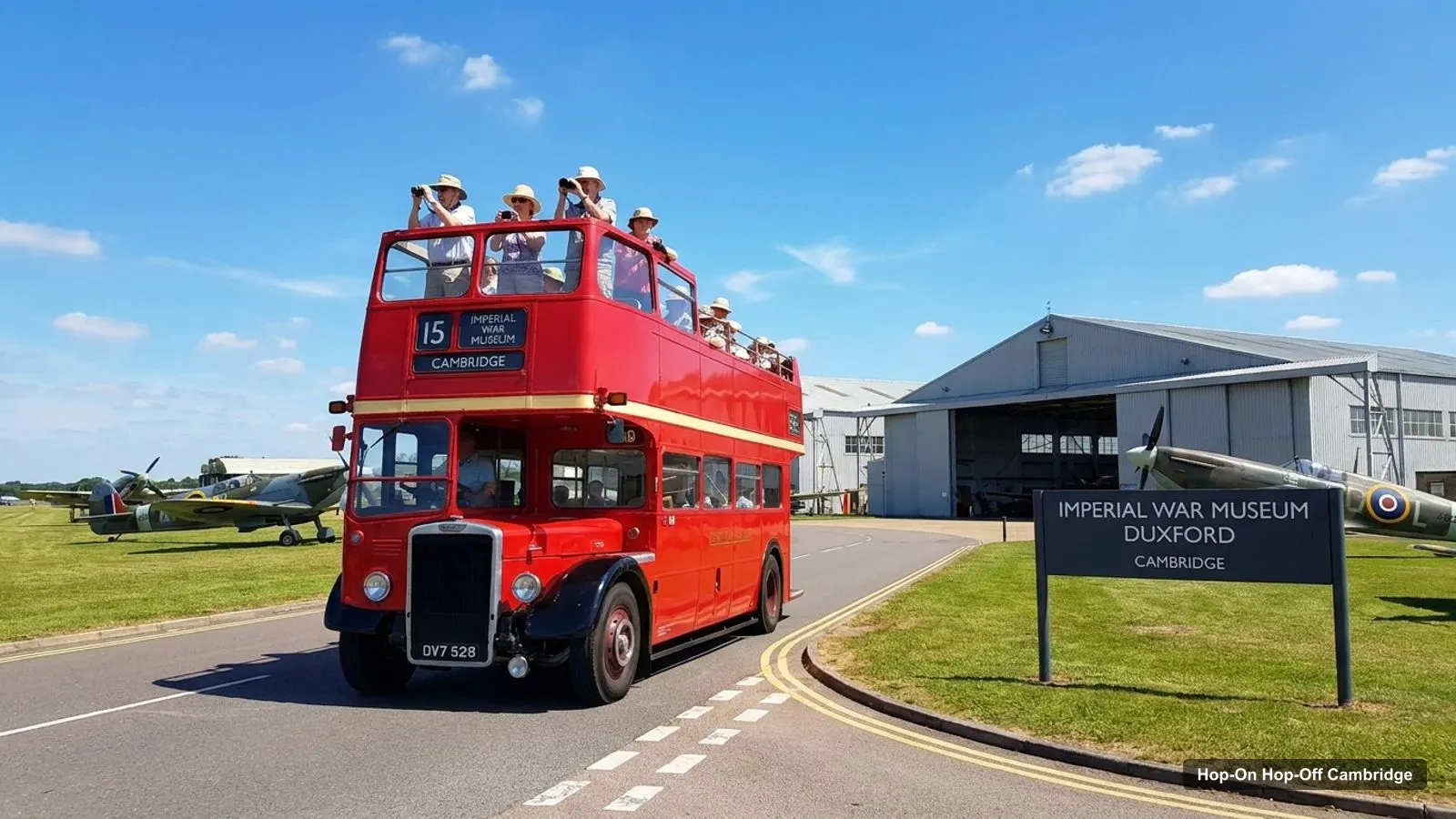
IWM Duxford is not in the table. It has 18,786 reviews at 4.8, more than anything above, but it is 11,763 metres from Silver Street in a straight line and no bus stop serves it. Treat it as its own trip.
The sights group into four clusters, and knowing them saves more time than any single stop does.
Only two matches are certain from the data: the Fitzwilliam Museum is stop 13, and the Mathematical Bridge sits on Silver Street, stops 1 and 14. For the rest I use addresses and street names.
| Sight | Nearest stop by name | Distance to Silver Street stop | Confidence |
|---|---|---|---|
| Fitzwilliam Museum | The Fitzwilliam Museum (13) | 542 m on foot | Listing names it |
| Mathematical Bridge | Silver Street (1, 14) | 82 m on foot | Same street |
| Museum of Archaeology and Anthropology | Downing Street (2) | 480 m straight line | Same street name |
| Newton’s Apple Tree | Trinity Street (5, Sundays) | 689 m straight line | Same street name |
| Market Square | Market Street (6, Sundays) | 533 m straight line | Adjacent street |
| Parker’s Piece | Parkside (9) | 929 m straight line | Street named for it |
| Cambridge American Cemetery | Cambridge American Cemetery and Memorial (16) | Out on Madingley Road | Listing names it |
There is one operator in my data, City Sightseeing UK, whose official route map is the first result when you search for the route. The SERP data for this keyword shows its own page at rank 1, and Golden Tours, Tripadvisor and Stagecoach among the first five results. Use the operator’s map for the exact road layout, and use this page for the walking context around each stop. The listing I follow is the GetYourGuide one, so any route change on the operator’s side may not appear here yet.
I do not host a printable PDF, and I did not find a free official one in my data. The simplest printable plan is to open the stop table above in your browser and print the page, or use the Google Maps links to save the stops in your own list. The listing says a coupon booklet comes with the ticket, but it does not say whether the booklet includes a map, so I would not count on it.
For tourist information, the official source is Visit Cambridge, and for local events and closures the council site Cambridge City Council is the other I trust. I could not confirm a visitor information desk address from my data, so check the site before you rely on one.
Some walking tips from the numbers. The college core is flat and compact: from the Silver Street stop, the Chapel is 818 metres, 11 minutes, and the Mathematical Bridge is 82 metres, 1 minute. The railway station is the exception, at 24 to 28 minutes to the centre. Many places close between 3:15pm and 6pm, so do the colleges first. For a day plan that follows the loop, see my Cambridge itinerary, and for the ranking behind this page, the best things to do in Cambridge.
One bus covers the whole map. City Sightseeing’s 18-stop loop passes the college core, the Fitzwilliam, the railway station and the cemetery, which no other transport in my data does.
City Sightseeing UK
My pick: Covers all 18 stops on this map in an 80-minute loop; $22.57 for 24 hours.
If you are choosing a ticket from the map, remember the limits: buses every 40 minutes, the first at 10:10am and the last from Stop 1 at 6:10pm. For anything else, go back to the homepage or read my Cambridge sightseeing bus review.
Yes. The map on this page numbers the 18 stops of the City Sightseeing loop, from Silver Street to Grange Road, and the table lists each stop with a Google Maps link. Two stops, Trinity Street and Market Street, run on Sundays only, so the Monday to Saturday loop has 16.
I could not confirm a current visitor desk address in my data, so I will not give one. Visit Cambridge, the official tourism site at visitcambridge.org, lists visitor information and events. The Cambridge Tour Guides business appears on Google Maps at 18 Rose Crescent, CB2 3LL, but that is a tour operator, not an information desk.
OpenStreetMap foot routing gives 2,075 metres and 28 minutes from Cambridge railway station to Market Square, and 1,792 metres and 24 minutes to the Fitzwilliam Museum. The bus has a Railway Station stop, so you can ride in instead of walking.
The Mathematical Bridge, the Corpus Clock, King's College Chapel and the Fitzwilliam Museum sit within about 850 metres of each other, around the Silver Street and Trumpington Street end of town. From the Silver Street stop, the bridge is 82 metres, the Fitzwilliam 542 metres and the Chapel 818 metres on foot.
My full review of each one, in the order I rank them: