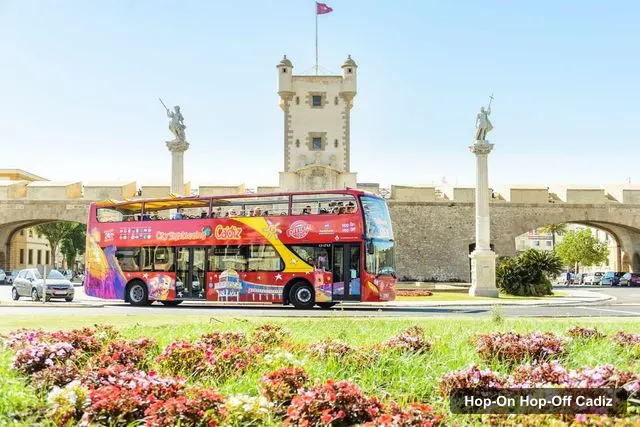
City Sightseeing Europe
Cadiz: City Sightseeing Hop-On Hop-Off Bus Tour
- 4.3 (929 reviews)
- 2-day ticket
- Free cancellation
My pick: The only bus on this map: red open-top route from $31.53, valid 2 days, with free cancellation up to 24 hours before.
By Jake Dawson · Updated · Affiliate links, explained in my disclosure
City Sightseeing Europe
Cadiz: City Sightseeing Hop-On Hop-Off Bus Tour
4.3 (929) · from $31.53
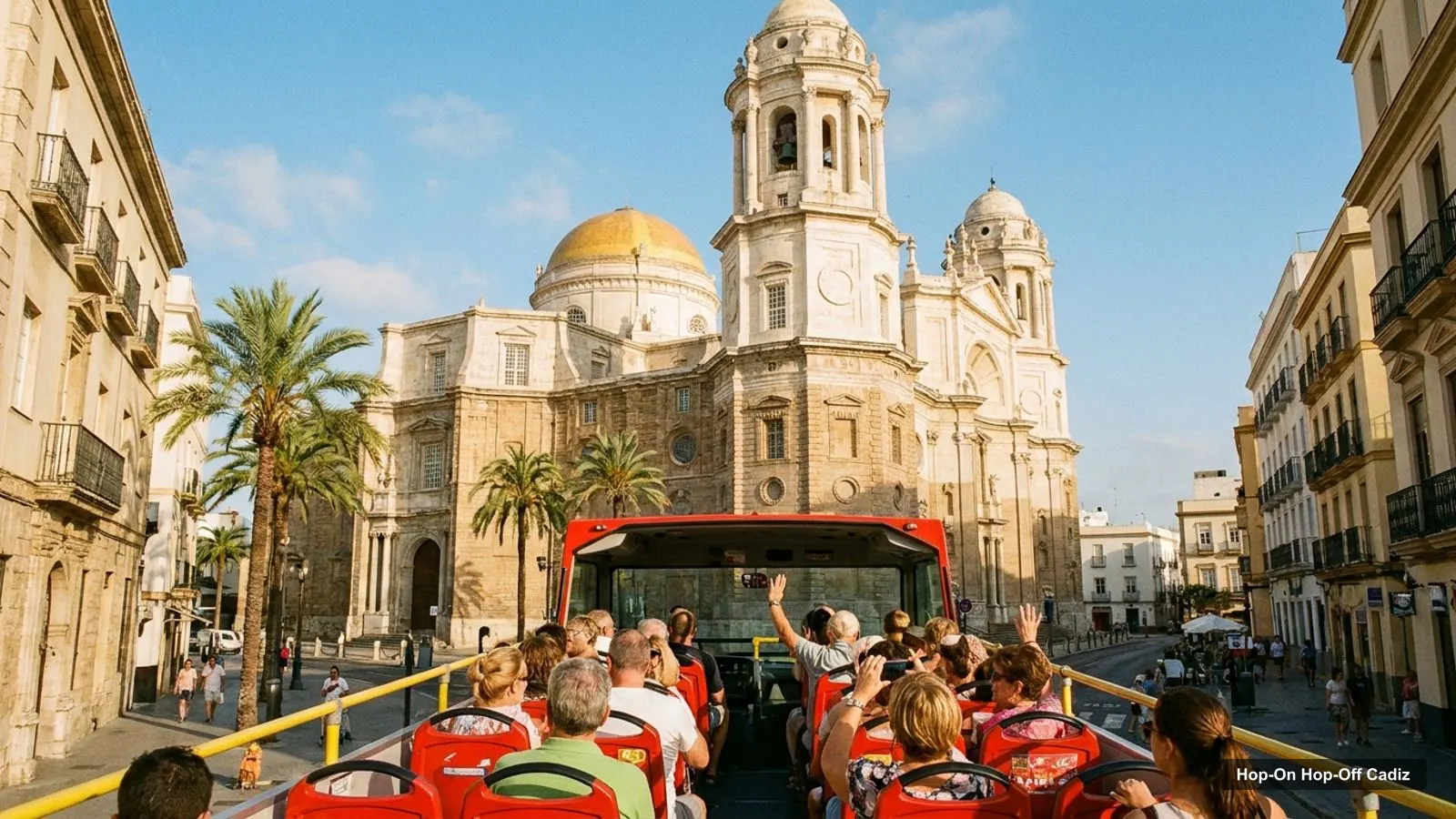
The Cadiz tourist map you need is really two maps: the bus route around the peninsula and the attractions people actually visit. Below I list all 15 stops from the City Sightseeing listing, then the top 20 sights by Google Maps reviews with coordinates and map links. For the ticket and how the route runs, start with my hop-on hop-off Cadiz guide.
Everything here comes from the bus listing and from Google Maps data I pulled on 7 October 2026. The tables were generated from that data rather than typed by hand. Distances are straight-line figures between the listed coordinates.
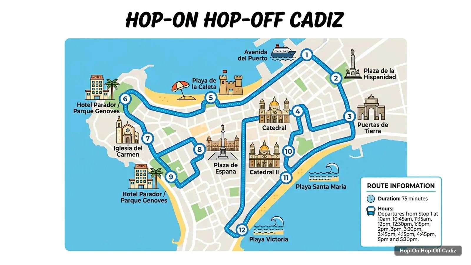
The red route starts on Avenida del Puerto, runs through the old town past the cathedral, loops along the Atlantic side to Parque Genovés and Plaza de España, and then follows the bay side. The route graphic below shows the stops in order.
Stops on the route
| # | Stop | Notes | Map |
|---|---|---|---|
| 1 | Avenida del Puerto | Start point | Find on Google Maps |
| 2 | Plaza de la Hispanidad | Find on Google Maps | |
| 3 | Puertas de Tierra | Find on Google Maps | |
| 4 | Catedral | Cathedral | Find on Google Maps |
| 5 | Playa de la Caleta | Find on Google Maps | |
| 6 | Hotel Parador / Parque Genoves | Parque Genovés | Find on Google Maps |
| 7 | Iglesia del Carmen | Find on Google Maps | |
| 8 | Plaza de Espana | Find on Google Maps | |
| 9 | Hotel Parador / Parque Genoves | Parque Genovés, second pass | Find on Google Maps |
| 10 | Catedral II | Cathedral, second pass | Find on Google Maps |
| 11 | Playa Santa Maria | Find on Google Maps | |
| 12 | Playa Victoria | Suspended until further notice | Find on Google Maps |
| 13 | Hotel Cadiz Bahia | Find on Google Maps | |
| 14 | Plaza de Sevilla | Find on Google Maps | |
| 15 | Bahia de Cadiz | Find on Google Maps |
The listing counts 15 stops, but Hotel Parador and Parque Genovés appear twice (stops 6 and 9) and the cathedral appears twice (stops 4 and 10), which I read as the same place on the outward and the return pass. The operator’s own page says 14 stops. Stop 12, Playa Victoria, has been suspended until further notice according to the listing, so check the booking page before you plan around it. The loop takes 75 minutes.
These are the 20 most-reviewed places in my Cadiz data, not counting the City Sightseeing office and one museum in Puerto Real outside the city. Every one of them is on the peninsula. Ratings are Google ratings with the number of reviews in brackets.
| # | Attraction | Coordinates | Google rating | Map |
|---|---|---|---|---|
| 1 | Catedral de Cádiz | 36.52900, -6.29529 | 4.5 (28,265) | Open in Google Maps |
| 2 | Parque Genovés | 36.53584, -6.30417 | 4.6 (15,441) | Open in Google Maps |
| 3 | Torre Tavira | 36.53202, -6.29838 | 4.6 (9,441) | Open in Google Maps |
| 4 | Castillo de Santa Catalina | 36.53289, -6.30816 | 4.5 (7,356) | Open in Google Maps |
| 5 | The 1812 Constitution Monument | 36.53513, -6.29318 | 4.6 (5,112) | Open in Google Maps |
| 6 | Teatro Romano de Cádiz | 36.52830, -6.29368 | 4.4 (4,580) | Open in Google Maps |
| 7 | Cadiz Museum | 36.53498, -6.29634 | 4.5 (4,497) | Open in Google Maps |
| 8 | Castillo de San Sebastian | 36.52801, -6.31522 | 4.3 (2,778) | Open in Google Maps |
| 9 | Baluarte de la Candelaria, Cadiz | 36.53774, -6.29945 | 4.5 (2,739) | Open in Google Maps |
| 10 | Mina Square | 36.53522, -6.29701 | 4.5 (2,081) | Open in Google Maps |
| 11 | Yacimiento Arqueológico Gadir | 36.53205, -6.29776 | 4.7 (1,648) | Open in Google Maps |
| 12 | Ibero-American House of Cádiz | 36.52664, -6.29129 | 4.6 (857) | Open in Google Maps |
| 13 | Puerta de Tierra | 36.52607, -6.28863 | 4.6 (855) | Open in Google Maps |
| 14 | Baluarte y Murallas de San Carlos | 36.53613, -6.29260 | 4.6 (823) | Open in Google Maps |
| 15 | Cueva del Pájaro Azul | 36.52931, -6.29626 | 4.6 (712) | Open in Google Maps |
| 16 | Oratorio de la Santa Cueva | 36.53330, -6.29537 | 4.5 (677) | Open in Google Maps |
| 17 | Museo de las Cortes de Cádiz | 36.53288, -6.29960 | 4.3 (591) | Open in Google Maps |
| 18 | Puerta de la Caleta | 36.52876, -6.30577 | 4.7 (519) | Open in Google Maps |
| 19 | Ruinas del acueducto romano de Gades | 36.51766, -6.28408 | 4.2 (332) | Open in Google Maps |
| 20 | Plaza de España | 36.53511, -6.29321 | 4.6 (298) | Open in Google Maps |
Cadiz is known for its age, its sea walls and its cathedral. Wikipedia describes it as one of the oldest continuously inhabited cities in Western Europe, traditionally dated to about 1100 BC, and says it was the home port of the Spanish treasure fleet in the Age of Exploration. The map above shows how that history is spread out: Gadir and the Roman theatre for the ancient city, the cathedral and Torre Tavira for the 18th-century boom, and the castles for the defences.
The top 20 collapse into four clusters, and I’d plan each outing around one of them. Cadiz must see means the old town first.
Old town, around the cathedral. The Catedral de Cádiz, the Roman theatre, the Gadir site, the Cueva del Pájaro Azul and Torre Tavira are within about 500 metres of the cathedral. The Roman theatre is 163 metres away and Torre Tavira 435 metres. This is the easiest cluster to walk.
Atlantic side. Parque Genovés, the Castillo de Santa Catalina, Playa de la Caleta, the Puerta de la Caleta and the Castillo de San Sebastián line the western sea wall. The Castillo de Santa Catalina is about 484 metres from the Parque Genovés stop, and the Castillo de San Sebastián about 849 metres from the Playa de la Caleta stop.
Plaza de España and the northern squares. The 1812 Constitution Monument, Plaza de España, the Cadiz Museum, Mina Square and the San Carlos bulwark sit within about 340 metres of the Plaza de España stop.
Land gate and the south-east. Puerta de Tierra, the Ibero-American House and the Roman aqueduct ruins are at the entrance to the city. The aqueduct ruins are about 1.6 km from the cathedral and 1,020 metres from the Puertas de Tierra stop.
If you have a particular sight in mind, this is the stop I’d use. It’s based on the stop names in the listing and the coordinates in my data. Walking times are OpenStreetMap foot routing, fetched 8 October 2026.
One more point about reading this Cadiz tourist map: the coordinates in the table are the points Google Maps uses for each place, not the ticket office or the entrance. For a large site such as the cathedral or the Castillo de Santa Catalina, the pin can be a few dozen metres from the door. I’d use the map links to get close, then follow the signs for the last stretch.
I don’t host a PDF of the Cadiz tourist map, and I’d rather not link a file I haven’t checked. The Google Maps links in the tables above do the same job: open one, save it to a list on your phone and you have an offline pin for each stop. For a paper map, ask at the City Sightseeing office on Avenida del Puerto, which Google Maps shows open 10am to 6pm every day, with 265 reviews at 3.8.
Walk the old town and ride between the sea walls. Everything in the first cluster is inside 500 metres of the cathedral, and the walk from the Stop 1 pin to the cathedral is 626 metres, about 8 minutes. The long stretch is the Atlantic side, where the bus saves you a walk of 1 to 2 km.
Opening hours differ, so use the map in the right order. The Roman theatre closes at 4:30pm Monday to Saturday and 2pm on Sunday. The Baluarte de la Candelaria is closed on Monday and Sunday. The Gadir site is closed on Fridays. The beaches, the parks and the Puerta de la Caleta are open 24 hours or all day.
There is only one bus, with one 2-day ticket. It covers every named stop that is running, and the stops that matter most for this map are the cathedral, Parque Genovés, Playa de la Caleta and Plaza de España. It does not include entry to the sights, and a reviewer found the cathedral fee expensive, so budget for that separately.
City Sightseeing Europe
My pick: The only bus on this map: red open-top route from $31.53, valid 2 days, with free cancellation up to 24 hours before.
For a day-by-day plan on this map, use my Cadiz itinerary, and for the sights ranked by reviews, see the best things to do in Cadiz. To compare the ticket again, go back to the hop-on hop-off bus guide for Cadiz, and for my other cities, start at the homepage.
The simplest free option is the Google Maps links on this page, one for every bus stop and one for each of the top 20 attractions. Save the ones you want to a list on your phone and you have an offline pin for each. The City Sightseeing office is listed on Google Maps at Avenida del Puerto 1, open 10am to 6pm daily.
Very close. From the Catedral de Cádiz, the Roman theatre is about 160 metres in a straight line, Torre Tavira about 435 metres, Parque Genovés about 1.1 km and the Castillo de Santa Catalina about 1.2 km. The farthest sight in my top 20 is the Castillo de San Sebastián, about 1.8 km from the cathedral.
The listing names Avenida del Puerto, Plaza de la Hispanidad, Puertas de Tierra, the Catedral, Playa de la Caleta, Hotel Parador and Parque Genovés, Iglesia del Carmen, Plaza de España, the beaches of Santa María and Victoria, Hotel Cádiz Bahía and Plaza de Sevilla. Stop 12, Playa Victoria, is suspended until further notice.
My full review of each one, in the order I rank them: