Busan Tourist Map: Top Attractions & Bus Stops
By Jake Dawson · Updated · Affiliate links, explained in my disclosure
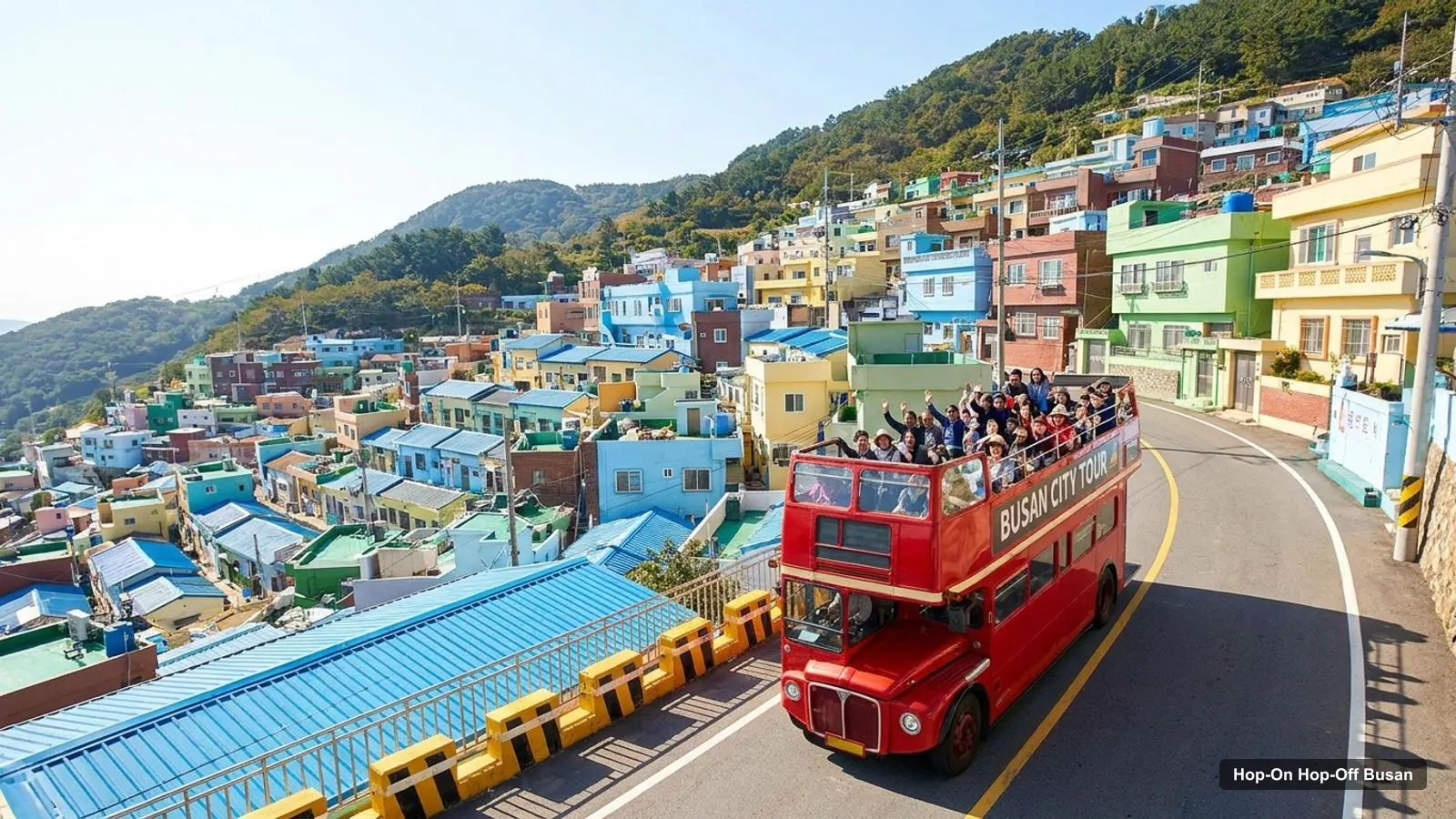
This Busan tourist map shows where the sights are and which ones sit close enough to combine. I built it from Google Maps place data and my own distance calculations, and I added what the Busan City Tour Bus site says about its lines. If you would like to ride between the farther sights, my guide to hop-on hop-off Busan explains what I could verify about the bus.
Coordinates and ratings come from Google Maps data checked in October 2026, and distances are straight-line figures. Real routes by road are longer, and Busan is hilly, so allow extra time. For ideas on what to do at each place read my best things to do in Busan.
Busan Tour Map: The Sightseeing Corridor
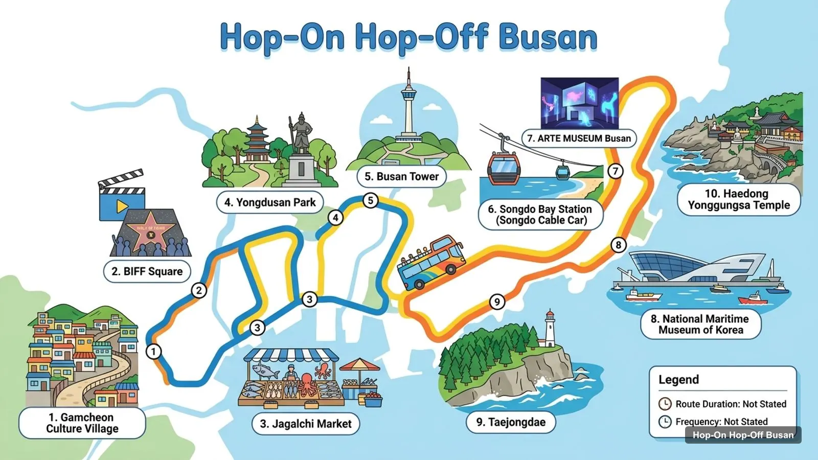
The map below shows the ten sights I use as my route of landmarks. It is not the operator’s official numbered stop list, which I could not read, so confirm the live stops on the bus company’s site.
Stops on the route
- 1Gamcheon Culture Village
- 2BIFF Square
- 3Jagalchi Market
- 4Yongdusan Park
- 5Busan Tower
- 6Songdo Bay Station (Songdo Cable Car)
- 7ARTE MUSEUM Busan
- 8National Maritime Museum of Korea
- 9Taejongdae
- 10Haedong Yonggungsa Temple
Sights on the Route Map
| # | Stop | Rating | Google Maps |
|---|---|---|---|
| 1 | Gamcheon Culture Village | 4.4 | Open map |
| 2 | BIFF Square | 4.1 | Open map |
| 3 | Jagalchi Market | 4 | Open map |
| 4 | Yongdusan Park | 4.3 | Open map |
| 5 | Busan Tower | 4.2 | Open map |
| 6 | Songdo Bay Station (Songdo Cable Car) | 4.4 | Open map |
| 7 | ARTE MUSEUM Busan | 4.8 | Open map |
| 8 | National Maritime Museum of Korea | 4.4 | Open map |
| 9 | Taejongdae | 4.4 | Open map |
| 10 | Haedong Yonggungsa Temple | 4.5 | Open map |
Busan Tourist Attractions: Top 20 With Coordinates
These are the top twenty places in my data by review count, leaving out bus offices and boarding points. Each link opens the place in Google Maps.
| # | Attraction | Rating | Reviews | Lat, Lng | Map |
|---|---|---|---|---|---|
| 1 | Gamcheon Culture Village | 4.4 | 33,447 | 35.0974, 129.0106 | Map |
| 2 | Haedong Yonggungsa Temple | 4.5 | 27,840 | 35.1885, 129.2231 | Map |
| 3 | Jagalchi Market | 4 | 27,406 | 35.0966, 129.0308 | Map |
| 4 | BIFF Square | 4.1 | 20,207 | 35.0982, 129.0292 | Map |
| 5 | Songdo Bay Station (Songdo Cable Car) | 4.4 | 19,268 | 35.0764, 129.0236 | Map |
| 6 | Busan Tower | 4.2 | 9,861 | 35.1012, 129.0324 | Map |
| 7 | Yongdusan Park | 4.3 | 6,623 | 35.1007, 129.0326 | Map |
| 8 | National Maritime Museum of Korea | 4.4 | 6,023 | 35.0783, 129.0799 | Map |
| 9 | Taejongdae | 4.4 | 4,785 | 35.0531, 129.0872 | Map |
| 10 | ARTE MUSEUM Busan | 4.8 | 2,962 | 35.0871, 129.0764 | Map |
| 11 | 국립부산과학관 | 4.6 | 2,681 | 35.2047, 129.2127 | Map |
| 12 | Museum of Contemporary Art, Busan | 4.3 | 2,642 | 35.1093, 128.9428 | Map |
| 13 | Busan Museum of Art | 4.3 | 2,616 | 35.1667, 129.1371 | Map |
| 14 | Busan Museum | 4.4 | 2,127 | 35.1295, 129.0942 | Map |
| 15 | 40 Stair Culture Tourist Theme Street | 3.9 | 1,797 | 35.1040, 129.0347 | Map |
| 16 | MUSEUM 1 | 4.3 | 1,585 | 35.1713, 129.1290 | Map |
| 17 | Busan Modern and Contemporary History Museum | 4.3 | 1,353 | 35.1026, 129.0313 | Map |
| 18 | Busan Museum of Movies | 4.2 | 977 | 35.1017, 129.0338 | Map |
| 19 | Busan Science Center | 4.3 | 935 | 35.1202, 129.0440 | Map |
| 20 | National Museum of Forced Mobilization under Japanese Occupation | 4.5 | 871 | 35.1250, 129.0923 | Map |
Busan Sightseeing Map: The Three Clusters
I group Busan’s sights into three clusters, and the grouping is the most useful thing a map can give you.
The old harbour cluster is Gamcheon Culture Village, Jagalchi Market, BIFF Square, 40 Stair Culture Tourist Theme Street, Busan Tower and Yongdusan Park. Jagalchi to BIFF Square is 0.2 km, BIFF Square to Busan Tower 0.4 km and Gamcheon to Jagalchi 1.8 km. The Songdo Cable Car is 2.3 km from Jagalchi.
The Yeongdo coast is the National Maritime Museum of Korea, ARTE MUSEUM Busan (1.0 km apart) and Taejongdae, which is 2.9 km from the museum and 3.9 km from the art museum.
The east is Haedong Yonggungsa Temple, about 19.9 km from Busan Tower. The Sky Capsule listing is also on this side, 4.2 km from the temple.
Distances Between Key Sights
These are straight-line distances I calculated from the coordinates in the table above. Roads and hills make real trips longer, so use them to compare, not to time a journey.
| From | To | Straight-line distance |
|---|---|---|
| Jagalchi Market | BIFF Square | 0.2 km |
| BIFF Square | Busan Tower | 0.4 km |
| Busan Tower | Jagalchi Market | 0.5 km |
| Gamcheon Culture Village | Jagalchi Market | 1.8 km |
| Jagalchi Market | Songdo Cable Car | 2.3 km |
| National Maritime Museum of Korea | ARTE MUSEUM Busan | 1.0 km |
| Taejongdae | National Maritime Museum of Korea | 2.9 km |
| Busan Tower | Taejongdae | 7.3 km |
| Busan Tower | Haedong Yonggungsa Temple | 19.9 km |
Sights Outside the Three Clusters
Several places in the top twenty don’t belong to any cluster. The science museum in Gijang-gun (listed under its Korean name, rated 4.6 from 2,681 reviews) is out in the north-east near the temple side of the city. Museum of Contemporary Art, Busan (4.3 from 2,642 reviews) is in Saha-gu, on the west side, 1191 Nakdongnam-ro. Busan Museum of Art (4.3 from 2,616 reviews) is in Haeundae-gu and MUSEUM 1 (4.3 from 1,585 reviews) is in Haeundae-gu too, at 20 Centum seo-ro. Busan Museum (4.4 from 2,127 reviews) is in Nam-gu.
I would only plan a trip to one of these if you already care about museums. Each of them needs its own journey, and none is near the sights most visitors come for.
How I Read the Coordinates
The latitude and longitude columns are there so you can sort sights by position. In Busan, higher latitude means further north and higher longitude means further east. Haedong Yonggungsa Temple, at about 35.1885 N and 129.2231 E, is the furthest north-east of the main sights. Taejongdae, at about 35.0531 N and 129.0872 E, is the furthest south. Gamcheon and Songdo, around 129.01 to 129.02 E, are the furthest west. That gives you a quick sense of why one bus loop can’t cover everything.
Walking, Subway and Taxi Notes
Inside the old harbour cluster I’d walk, with one exception: Gamcheon is a climb, and I’d take a taxi up and walk down. For the Yeongdo coast, a taxi between the two museums and Taejongdae saves time. For the temple, plan a longer journey and an early start. I can’t give you fares or subway line numbers from my data, so check a transit app for the day you travel.
Busan Tourist Map for First-Timers: My Order of Visits
For a first visit, I’d work through the clusters in order: old harbour first, Yeongdo second, the temple last. That order puts the easiest walking at the start, when you are fresh, and the longest transfer at the end. My Busan itinerary turns this order into one, two and three-day plans.
Busan Tour Bus Lines on the Official Site
The official Busan City Tour Bus site shows three daytime lines and a night tour. The Red Line connects the Busan Station area toward Haeundae, the Green Line features Oryukdo, and the Orange Line covers Dadaepo and Molundae. The site states a regular closure on Mondays and Tuesdays.
In my places data, the operator’s headquarters office is at 192 Jungang-daero in Dong-gu, and a boarding point sits at 1204-1 in Choryang, also in Dong-gu. A Red Line stop numbered 6 shows up in Haeundae-gu, at about 35.1568 N, 129.1413 E. Those are listings, not a full stop list, so don’t plan around them without checking.
Busan Tourist Guide: Which Sight for Which Interest
- Views: Busan Tower, the Songdo Cable Car and Taejongdae.
- Food: Jagalchi Market, with BIFF Square nearby for street snacks.
- Photography: Gamcheon Culture Village in the morning.
- Art and history: ARTE MUSEUM Busan (4.8), the National Maritime Museum of Korea and United Nations Peace Memorial Hall.
- Quiet and spiritual: Haedong Yonggungsa Temple, which opens at 4 AM.
Busan Tourist Map 2026: Check Before You Go
Opening days change. In my data the National Maritime Museum of Korea and United Nations Peace Memorial Hall are closed on Mondays, and the bus operator states a closure on Mondays and Tuesdays. Entry fees and ticket prices are not in my data, so check each official site. Save your chosen places in Google Maps before you leave, so the pins are available offline.
Why I Left Out Bus Offices
My places data includes several listings for the bus operator: a headquarters office, a boarding station and a jumbo bus boarding point. They are useful if you plan to ride, but they are not attractions, and their review counts are tiny, from 9 to 164. I kept them off the top twenty so the table shows what people actually travel to see, and I mention them only in the bus section above.
Getting Around Between Clusters
Use the subway and taxis for the long jumps, and walk inside the old harbour cluster. The bus is the other option for the coast, if its day and line match your plans. For the full picture of what it offers and what I could not confirm, see my page on hop on hop off Busan, or go back to the home page for my other city maps.
Frequently asked questions
What are the main tourist attractions in Busan?
By Google Maps reviews the top five are Gamcheon Culture Village (33,447 reviews, 4.4), Haedong Yonggungsa Temple (27,840, 4.5), Jagalchi Market (27,406, 4.0), BIFF Square (20,207, 4.1) and the Songdo Cable Car station (19,268, 4.4). The table below lists the top 20 with coordinates and a map link for each.
Is there an official Busan tour bus map?
The Busan City Tour Bus site lists Red, Green and Orange daytime lines and a night tour, so there is a line map on the operator's site. I could not read the stop-by-stop order, so my map shows sights and not the official stop list. Check the operator's page for the current numbered stops.
Which Busan sights are close enough to walk between?
In the old harbour cluster, BIFF Square is 0.2 km from Jagalchi Market and Busan Tower is 0.4 km from BIFF Square, by my straight-line coordinates. Gamcheon is 1.8 km from Jagalchi and steep, so I would take a taxi for that leg. The coast sights are far apart and need transport.
Can I download a Busan tourist map for offline use?
The Google Maps links in my tables open each place in the Maps app, where you can save it to a list or download an offline area before you travel. I do not host a PDF map. Save your five or six chosen sights in advance, since mobile data may be patchy at the hillside and coastal sights.