Buenos Aires Tourist Map: Top Attractions & Bus Stops
By Jake Dawson · Updated · Affiliate links, explained in my disclosure
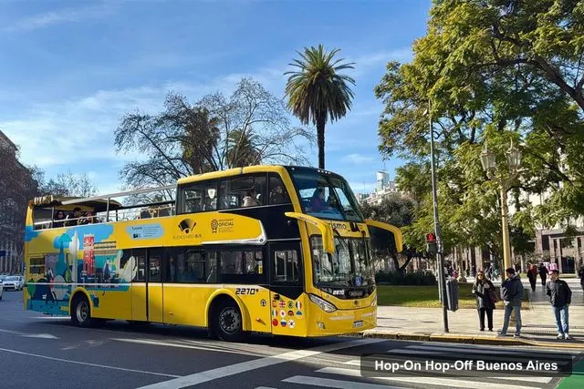
Buenos Aires Bus (Hop-On Hop-Off)
Buenos Aires Hop-On Hop-Off Bus and Exclusive Benefits
4.4 (2,090) · from $37
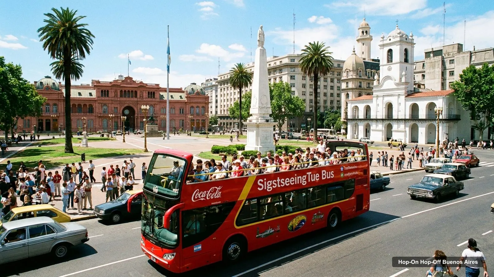
A Buenos Aires tourist map makes more sense once you split the city into four clusters. I’ve put the top 20 attractions (ranked by Google Maps reviews) and the first 12 sightseeing bus stops on one page, with coordinates and a Google Maps link for each. The route image follows the Gray Line stop order. To pick the ticket that rides it, see my comparison of hop-on hop-off in Buenos Aires.
Buenos Aires Tourist Attractions on the Bus Route
The Gray Line route lists 24 stops in the Buenos Aires listing. The image below shows the first twelve, from Stop 0 on Diagonal Norte to Plaza General San Martín, where stop 12 is Gray Line’s office on Av. Santa Fe 808. Buses run 9:30 a.m. to 6:00 p.m. on the Gray Line listings, and the Explorer pass runs every 30 minutes. Buenos Aires Bus runs every 15 minutes and takes about 3 hours 20 minutes for the full circuit without stops.
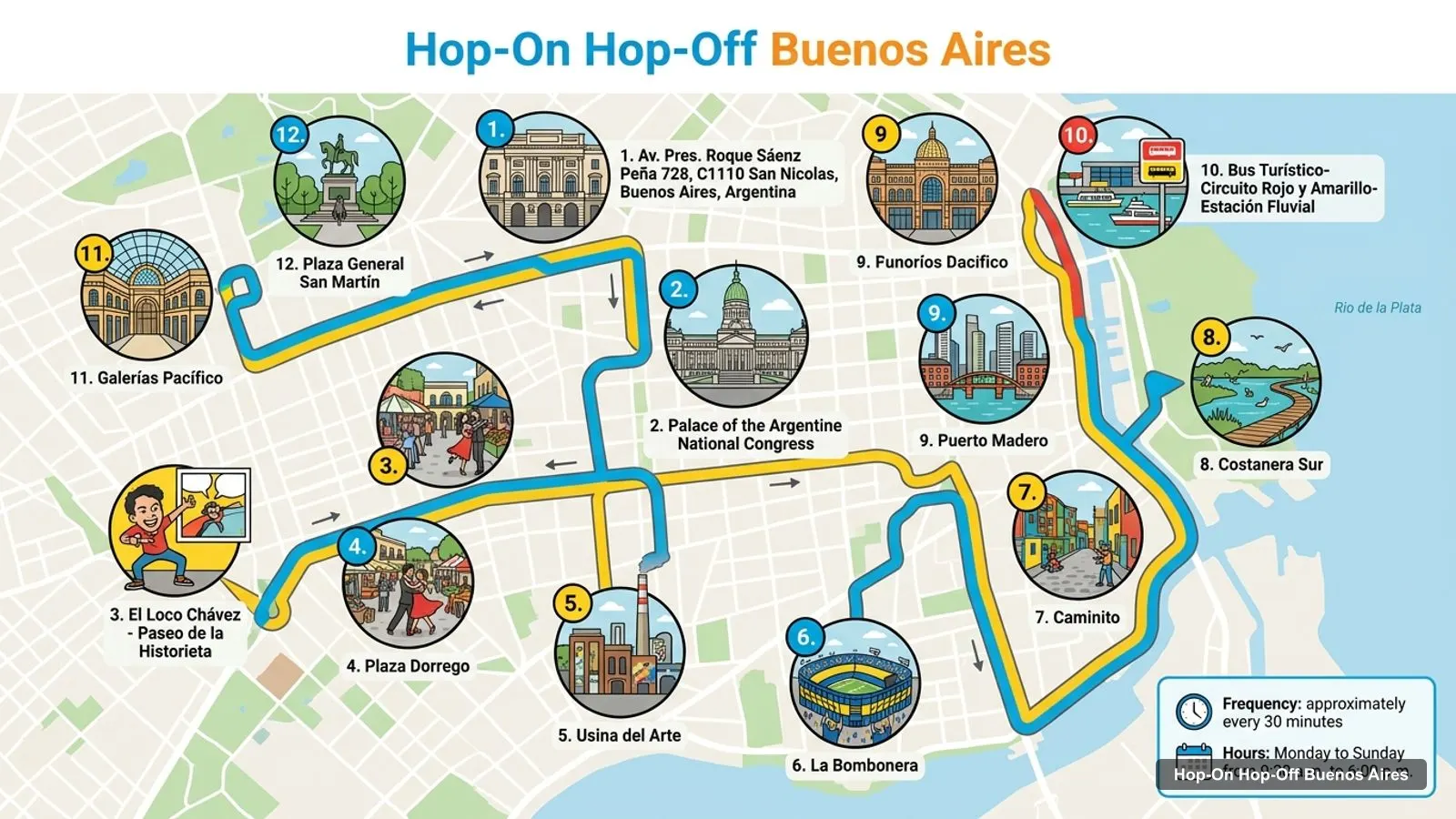
Stops on the route
- 1Av. Pres. Roque Sáenz Peña 728, C1110 San Nicolas, Buenos Aires, Argentina
- 2Palace of the Argentine National Congress
- 3El Loco Chávez - Paseo de la Historieta
- 4Plaza Dorrego
- 5Usina del Arte
- 6La Bombonera
- 7Caminito
- 8Costanera Sur
- 9Puerto Madero
- 10Bus Turístico-Circuito Rojo y Amarillo-Estación Fluvial
- 11Galerías Pacífico
- 12Plaza General San Martín
Bus stops on the main loop
| # | Stop | Map |
|---|---|---|
| 1 | Diagonal Norte, Av. Pres. Roque Sáenz Peña 728 (Stop 0) | Find on Google Maps |
| 2 | Palace of the Argentine National Congress | Find on Google Maps |
| 3 | El Loco Chávez - Paseo de la Historieta | Find on Google Maps |
| 4 | Plaza Dorrego | Find on Google Maps |
| 5 | Usina del Arte | Find on Google Maps |
| 6 | La Bombonera | Find on Google Maps |
| 7 | Caminito | Find on Google Maps |
| 8 | Costanera Sur | Find on Google Maps |
| 9 | Puerto Madero | Find on Google Maps |
| 10 | Bus Turístico-Circuito Rojo y Amarillo-Estación Fluvial | Find on Google Maps |
| 11 | Galerías Pacífico | Find on Google Maps |
| 12 | Plaza General San Martín | Find on Google Maps |
After stop 12 the Gray Line list continues with Floralis Genérica, the Museum of Latin American Art of Buenos Aires, the Galileo Galilei Planetarium, Club de Pescadores, Jorge Newbery Airfield, Parque de la Memoria, the Monumental Stadium, Chinatown, the Argentine Polo Association, the Carta Magna monument, Recoleta and Teatro Colón. The stops I’d hop off at first are Plaza Dorrego, Caminito and Recoleta.
Buenos Aires Attractions: Top 20 Sights with Coordinates
These are the Buenos Aires attractions ranked by Google Maps reviews, with exact coordinates. Each link opens the place in Google Maps, where you can save it to a list before you travel. I left out tour agencies and bus company listings, and only counted sights.
| # | Attraction | Rating | Reviews | Coordinates | Map |
|---|---|---|---|---|---|
| 1 | Plaza de Mayo | 4.6 | 143,280 | -34.60837, -58.37228 | Open in Google Maps |
| 2 | Teatro Colón | 4.8 | 90,137 | -34.60115, -58.38333 | Open in Google Maps |
| 3 | Jardín Botánico Carlos Thays | 4.6 | 66,826 | -34.58288, -58.41899 | Open in Google Maps |
| 4 | Museo de Arte Latinoamericano de Buenos Aires | 4.6 | 41,047 | -34.57690, -58.40340 | Open in Google Maps |
| 5 | National Museum of Fine Arts | 4.8 | 40,525 | -34.58399, -58.39300 | Open in Google Maps |
| 6 | Tres de Febrero Park | 4.7 | 40,197 | -34.57088, -58.41710 | Open in Google Maps |
| 7 | Plaza Dorrego | 4.4 | 36,864 | -34.62049, -58.37175 | Open in Google Maps |
| 8 | Palacio Barolo | 4.6 | 30,049 | -34.60959, -58.38584 | Open in Google Maps |
| 9 | Museo Nacional de Arte Decorativo | 4.7 | 16,867 | -34.58267, -58.40108 | Open in Google Maps |
| 10 | Museo Moderno | 4.5 | 13,877 | -34.62205, -58.37054 | Open in Google Maps |
| 11 | Museo Nacional del Cabildo | 4.6 | 12,074 | -34.60876, -58.37379 | Open in Google Maps |
| 12 | National Historic Museum | 4.7 | 11,419 | -34.62700, -58.37059 | Open in Google Maps |
| 13 | Museo Evita | 4.5 | 10,096 | -34.58065, -58.41470 | Open in Google Maps |
| 14 | Museo del Bicentenario | 4.5 | 10,023 | -34.60882, -58.36950 | Open in Google Maps |
| 15 | Museo del Agua y de la Historia Sanitaria | 4.6 | 9,974 | -34.60034, -58.39454 | Open in Google Maps |
| 16 | Buenos Aires Metropolitan Cathedral | 4.7 | 9,460 | -34.60757, -58.37326 | Open in Google Maps |
| 17 | Block of the Lights Historical-Cultural Complex | 4.4 | 8,701 | -34.61059, -58.37480 | Open in Google Maps |
| 18 | Museo Larreta | 4.6 | 7,683 | -34.56127, -58.45563 | Open in Google Maps |
| 19 | Recoleta Cemetery | 4.3 | 7,247 | -34.58736, -58.39296 | Open in Google Maps |
| 20 | Benito Quinquela Martín Museum | 4.7 | 7,100 | -34.63900, -58.36099 | Open in Google Maps |
How to Use This Buenos Aires Tourist Map
I use a map like this in three steps. First, open the stop table and save the stops closest to your hotel in Google Maps, because the bus lets you board at any stop. Second, pick one cluster per half day from the section below, so you aren’t crossing the city twice. Third, check the distance column in your head: anything under about 1.5 km I’d walk, anything over 3 km I’d ride. In my data the centre sights are within 1.4 km of Plaza de Mayo, while Recoleta Cemetery is 3.01 km away and the Quinquela Martín Museum in La Boca 3.56 km away, which is exactly where the bus earns its fare.
The Gray Line listing lets you start at any stop, and the app shows the map and live bus positions. That is the practical difference between a paper map and this page: the tables tell you where things are, and the app tells you when the next bus will arrive. Download the offline map before you leave the hotel.
Reading the Ratings on the Map
The rating column is worth a second look, because the review counts differ by a factor of twenty between the first and the twentieth row. Plaza de Mayo has 143,280 reviews while the Benito Quinquela Martín Museum has 7,100, so a 4.7 at the bottom of the table is based on far fewer opinions than a 4.6 at the top. I treat anything above 4.5 with more than 10,000 reviews as proven: Teatro Colón (4.8), the Fine Arts Museum (4.8), Tres de Febrero Park (4.7) and the Decorative Arts Museum (4.7). The lowest score among the top 20 is Recoleta Cemetery at 4.3, and it is still one of the stops I would not skip. Ratings here come from Google Maps, checked October 2026, and they will move over time. Plaza Dorrego and the Block of the Lights complex both sit at 4.4, which I read as a sign of crowds rather than disappointment. For a first trip, I would let the map decide the order, not the rating: start in the centre, add San Telmo by bus, then keep the north and La Boca for separate half days so that nothing feels rushed.
Which Stop Serves Which Sight
Matching sights to stops is the part the operators don’t spell out, so here is how I read their lists. Teatro Colón is the last named stop on the Gray Line list. Plaza Dorrego and the Paseo de la Historieta are named stops in San Telmo. La Bombonera and Caminito are consecutive stops in La Boca, which makes them an easy pair. Puerto Madero and Costanera Sur are named waterfront stops, and the Estación Fluvial stop is the river station. In the north, the Museum of Latin American Art and Recoleta are named stops. Plaza de Mayo is named in the Buenos Aires Bus description rather than the Gray Line list, so look at the stop map in the app before you hop off there.
Buenos Aires Tourist Attractions: Four Clusters
Most of the top sights fall into four clusters, which is how I’d read this Buenos Aires tourist guide.
The centre. Plaza de Mayo, the Cabildo museum, the cathedral and the Casa Rosada are all within about 0.2 km of each other, and Palacio Barolo (1.25 km) and Teatro Colón (1.29 km) are a short walk away. This is where I’d begin.
San Telmo. Plaza Dorrego is 1.35 km from Plaza de Mayo and is a named stop. The National Historic Museum is 0.73 km from the square.
Recoleta and Palermo. Recoleta Cemetery is 3.01 km from Plaza de Mayo. The Fine Arts Museum is 0.38 km from the cemetery, MALBA is 1.51 km from it, and the Botanical Garden is 1.35 km from Tres de Febrero Park. The bus saves you the most time here.
La Boca and the south. Caminito and La Bombonera are bus stops. The Benito Quinquela Martín Museum is 3.56 km from Plaza de Mayo.
Buenos Aires Attractions Top 10 and Is It Worth Visiting?
If you only want the Buenos Aires attractions top 10, take the first ten rows of the table above: Plaza de Mayo, Teatro Colón, the Botanical Garden, MALBA, the Fine Arts Museum, Tres de Febrero Park, Plaza Dorrego, Palacio Barolo, the Decorative Arts Museum and Museo Moderno. Is Buenos Aires worth visiting? On these reviews, yes: nine of those ten score 4.5 or higher. For a more detailed ranking with addresses, I wrote up the best things to do in Buenos Aires, and for a day-by-day plan see my Buenos Aires itinerary.
The official Buenos Aires tourism board publishes current opening hours and events. I have no metro or Subte data, so I haven’t added transit tips here. If you’d rather not plan the transport, the Buenos Aires sightseeing bus tickets I’d book are in my full comparison, and my other city maps are on the homepage.
Frequently asked questions
Is Buenos Aires worth visiting?
I think so. The city has some of the best-rated sights in my data: Teatro Colón scores 4.8 from 90,137 reviews, the Fine Arts Museum 4.8 from 40,525, and Plaza de Mayo has 143,280 reviews. A sightseeing bus links most of them, so even a short stay covers the highlights without much planning.
Where are the main Buenos Aires attractions on the map?
They fall into four clusters. The centre has Plaza de Mayo, Palacio Barolo and Teatro Colón. San Telmo has Plaza Dorrego. Recoleta and Palermo have the cemetery, MALBA, the Fine Arts Museum and the parks. La Boca has Caminito and the Quinquela Martín Museum, about 3.56 km from Plaza de Mayo.
How far apart are the main Buenos Aires sights?
Plaza de Mayo is about 1.25 km from Palacio Barolo, 1.29 km from Teatro Colón and 1.35 km from Plaza Dorrego, all in a straight line. Recoleta Cemetery is 3.01 km from Plaza de Mayo, so I'd take the bus between the centre and the northern museums.
Is there a printable Buenos Aires tourist map?
This page works as one. The route image shows the first twelve bus stops, and the tables list those stops and the top 20 attractions with coordinates. Each Google Maps link lets you save the place to your phone for offline use. Print the page or save the links before you travel.
Tours I compared in Buenos Aires
My full review of each one, in the order I rank them:
- Buenos Aires Hop-On Hop-Off Bus and Exclusive Benefits★ 4.4 · from $37
- Buenos Aires Hop-On Hop-Off Bus and Free Walking Tours★ 4.2 · from $39
- Explorer: 48Hs Hop-on Hop-off Bus and River Cruise★ 4.1 · from $60
- Buenos Aires: Hop-On Hop-Off Bus and Football Museums★ 4.4 · from $120