electroconcept Kft.
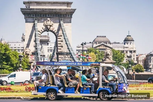
Budapest: Official Buda Castle Electric Hop-On Hop-Off Bus
- 4.4 (509 reviews)
- 2-day ticket
- Free cancellation
My pick: The only ticket that covers the Castle Hill cluster stop by stop, from $20.27.
By Jake Dawson · Updated · Affiliate links, explained in my disclosure

City Sightseeing Europe
Budapest: City Sightseeing Hop-On Hop-Off Bus Tour & Extras
4.1 (5,703) · from $43.91
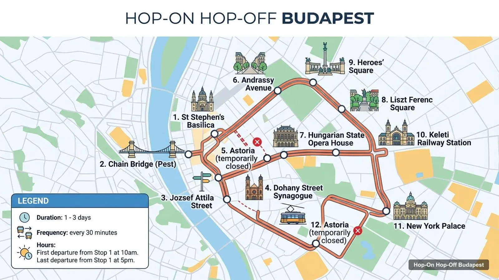
A Budapest tourist map makes more sense once you see the city as two banks and four clusters. I’ve put the top 20 attractions (ranked by Google Maps reviews) and all 20 stops of the City Sightseeing bus on one page, with coordinates and a Google Maps link for each. The route image follows City Sightseeing’s stop order on the Pest side. To pick the ticket that rides it, see my comparison of hop-on hop-off in Budapest.
The Budapest tour map below shows the first 12 stops of City Sightseeing’s loop: from St Stephen’s Basilica to the Chain Bridge, along Andrássy Avenue to Heroes’ Square, and back past Keleti station and the New York Palace. Buses run every 30 minutes. The first leaves Stop 1 at 10am and the last at 5pm.
Stops on the route
| # | Stop | Map |
|---|---|---|
| 1 | St Stephen’s Basilica | Find on Google Maps |
| 2 | Chain Bridge (Pest) | Find on Google Maps |
| 3 | Jozsef Attila Street | Find on Google Maps |
| 4 | Dohany Street Synagogue | Find on Google Maps |
| 5 | Astoria (temporarily closed) | Find on Google Maps |
| 6 | Andrassy Avenue | Find on Google Maps |
| 7 | Hungarian State Opera House | Find on Google Maps |
| 8 | Liszt Ferenc Square | Find on Google Maps |
| 9 | Heroes’ Square | Find on Google Maps |
| 10 | Keleti Railway Station | Find on Google Maps |
| 11 | New York Palace | Find on Google Maps |
| 12 | Astoria (temporarily closed) | Find on Google Maps |
| 13 | Parisi Passage Cafe | Find on Google Maps |
| 14 | Gellert Square | Find on Google Maps |
| 15 | Castle Garden | Find on Google Maps |
| 16 | Funicular | Find on Google Maps |
| 17 | Batthyany Square | Find on Google Maps |
| 18 | Margaret Bridge (Buda) | Find on Google Maps |
| 19 | WestEnd Shopping Centre | Find on Google Maps |
| 20 | Parliament | Find on Google Maps |
Astoria appears twice because the loop passes it on the way out and on the way back, and the listing marks it as temporarily closed, so check before you plan to board there. Stops 13 to 20 are the second half of the route, which crosses to the Buda side at Gellért Square and comes back over Margaret Bridge to the Parliament.
These are the top Budapest tourist attractions in table form, ranked by Google Maps reviews, with exact coordinates. I left out bus-company offices and places more than 6 km from the centre, like the Hungarian Railway Museum and Memento Park. Each link opens the place in Google Maps, where you can save it to a list before you travel. Number 10, the Church of Our Lady of Buda Castle, is better known as Matthias Church.
| # | Attraction | Coordinates | Google rating | Map |
|---|---|---|---|---|
| 1 | Fisherman’s Bastion | 47.50218, 19.03478 | 4.8 (118,726) | Open in Google Maps |
| 2 | Heroes’ Square | 47.51494, 19.07786 | 4.7 (88,089) | Open in Google Maps |
| 3 | City Park | 47.51579, 19.08207 | 4.7 (84,259) | Open in Google Maps |
| 4 | St. Stephen’s Basilica | 47.50089, 19.05399 | 4.7 (80,962) | Open in Google Maps |
| 5 | Buda Castle | 47.49620, 19.03957 | 4.7 (71,210) | Open in Google Maps |
| 6 | Széchenyi Chain Bridge | 47.49899, 19.04370 | 4.7 (65,411) | Open in Google Maps |
| 7 | Hungarian Parliament Building | 47.50712, 19.04567 | 4.8 (31,785) | Open in Google Maps |
| 8 | Vajdahunyad Castle | 47.51489, 19.08306 | 4.7 (27,722) | Open in Google Maps |
| 9 | Shoes on the Danube Bank | 47.50393, 19.04480 | 4.7 (27,106) | Open in Google Maps |
| 10 | The Church of Our Lady of Buda Castle | 47.50195, 19.03416 | 4.8 (26,820) | Open in Google Maps |
| 11 | House of Terror Museum | 47.50689, 19.06513 | 4.1 (24,743) | Open in Google Maps |
| 12 | Citadel | 47.48702, 19.04570 | 4.6 (22,997) | Open in Google Maps |
| 13 | Vörösmarty Square | 47.49648, 19.05070 | 4.6 (19,354) | Open in Google Maps |
| 14 | Museum of Fine Arts | 47.51580, 19.07690 | 4.7 (16,962) | Open in Google Maps |
| 15 | Elisabeth Bridge | 47.49088, 19.04920 | 4.6 (16,832) | Open in Google Maps |
| 16 | Hungarian National Museum | 47.49120, 19.06248 | 4.5 (16,073) | Open in Google Maps |
| 17 | IKONO Budapest | 47.49296, 19.05291 | 4.7 (15,556) | Open in Google Maps |
| 18 | Kossuth Lajos Square | 47.50704, 19.04763 | 4.7 (12,909) | Open in Google Maps |
| 19 | Hungarian National Gallery | 47.49603, 19.03943 | 4.7 (11,346) | Open in Google Maps |
| 20 | Hospital in the Rock | 47.50076, 19.03151 | 4.6 (9,749) | Open in Google Maps |
Read the coordinates above and you’ll see four tight groups on the Budapest sightseeing map:
Plan one cluster per half day and you won’t waste time crossing the city. My best things to do in Budapest guide has what to see at each place, and my Budapest itinerary turns the clusters into 1, 2 and 3-day plans.
A Budapest travel map gets easier once you know which stop serves which sight. Here’s how the main attractions line up with the stops in the operators’ listings:
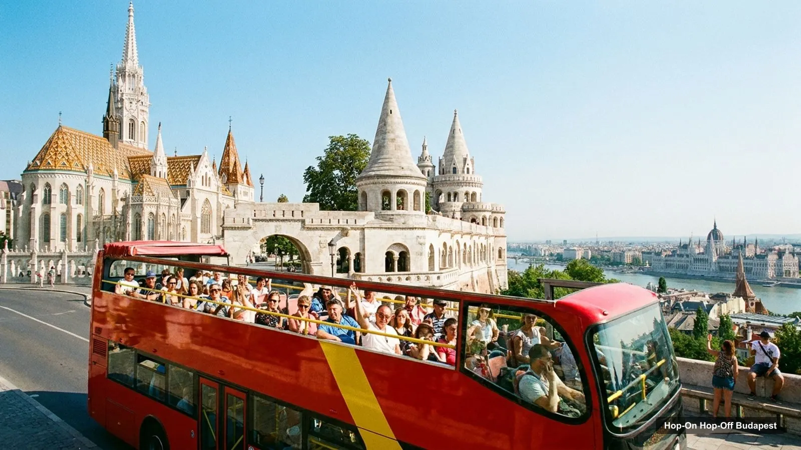
Each operator draws its own route, and the maps differ more than the brochures suggest. City Sightseeing lists 20 stops, the longest stop list in my data, and it’s the one plotted above. Big Bus lists 20 sights on its route from József Attila utca 24, including the Széchenyi Thermal Bath, Margaret Island and the Gellért Baths, which City Sightseeing doesn’t name. The Official Buda Castle Electric Bus covers only Castle Hill, and its listing names 16 points along the way, from the Royal Palace to Vienna Gate. The Mahart boat has three stops: Vigadó tér (Dock 5), Batthyány tér and Margaret Island. If one sight on this map is a must for you, check that your operator stops there before you book.
electroconcept Kft.
My pick: The only ticket that covers the Castle Hill cluster stop by stop, from $20.27.
If you want a Budapest tourist map PDF, you can make one free in under a minute. Open this page in your browser, choose Print, then Save as PDF. The route image and the two tables fit on a few pages and keep the stop numbers next to the sights. The Google Maps links stay clickable when you open the PDF on a phone or tablet. I’d also save the 20 attractions to a starred list in Google Maps. It takes a couple of minutes with the links above, and the list works offline once you download the area.
The metro is the other way to join up this Budapest tourist map. The M1, the old yellow line, runs under Andrássy Avenue from the centre to Heroes’ Square, along the same stretch as the bus. Kossuth Lajos Square at the Parliament and Batthyány Square on the Buda side are metro stops too, and Big Bus lists Deák Ferenc tér, the main interchange in Pest. For live maps and fares, the official source is BKK, Budapest’s transport authority.
If you’re walking rather than riding, follow the Danube. The Pest riverside from the Parliament past the Shoes on the Danube Bank to the Chain Bridge is about 1 km and flat. Cross the Chain Bridge to Clark Ádám Square for Castle Hill, then come back over Elisabeth Bridge after the Citadel. The one walk I’d avoid on a hot day is the climb to the castle district, which is where the Castle Bus earns its price. For events and opening times, check Budapest Info, the city’s official tourism site.
City Sightseeing covers the most of this tourist map in my data, with 20 stops on both banks, from Heroes’ Square to the Parliament and Castle Garden. Big Bus has the best reach to the baths and Margaret Island. Neither drives onto Castle Hill, so pair either one with the Castle Bus. If you want the bus tour I’d book in Budapest for this route, it’s on my Budapest sightseeing bus comparison, and the rest of my city maps start from the homepage.
City Sightseeing Europe
My pick: Covers the most stops on this map: 20, on both banks of the Danube.
This page works as one: the route map image shows the sightseeing bus loop with numbered stops, and the tables below list the top 20 attractions and all 20 City Sightseeing stops with coordinates. Print the page, or open any Google Maps link to save the places to your phone for offline use.
In four clusters. Castle Hill in Buda has Fisherman's Bastion, Matthias Church, Buda Castle and the National Gallery. The Pest riverside has the Parliament, the Shoes on the Danube Bank, the Chain Bridge and the Basilica. Heroes' Square and City Park sit at the end of Andrássy Avenue, and Gellért Hill has the Citadel.
Closer than they look. St Stephen's Basilica to Heroes' Square is about 2.4 km, the length of Andrássy Avenue. The Parliament to Fisherman's Bastion is about 1 km across the river, and Buda Castle to the Citadel about 1.1 km. Heroes' Square to Fisherman's Bastion, the widest gap, is about 3.5 km.
Yes. Open this page in your browser and choose Print, then Save as PDF. You get the route image, the 20 bus stops and the top 20 attractions with coordinates in one free file. The Google Maps links in the tables stay clickable when you open the PDF on a phone.
My full review of each one, in the order I rank them: