Brussels Tourist Map: Top Attractions & Bus Stops
By Jake Dawson · Updated · Affiliate links, explained in my disclosure
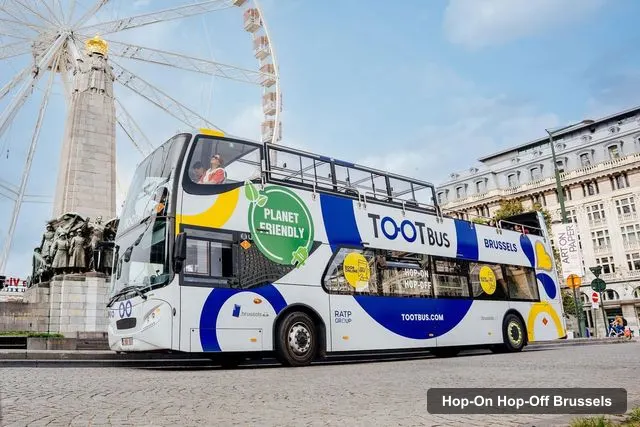
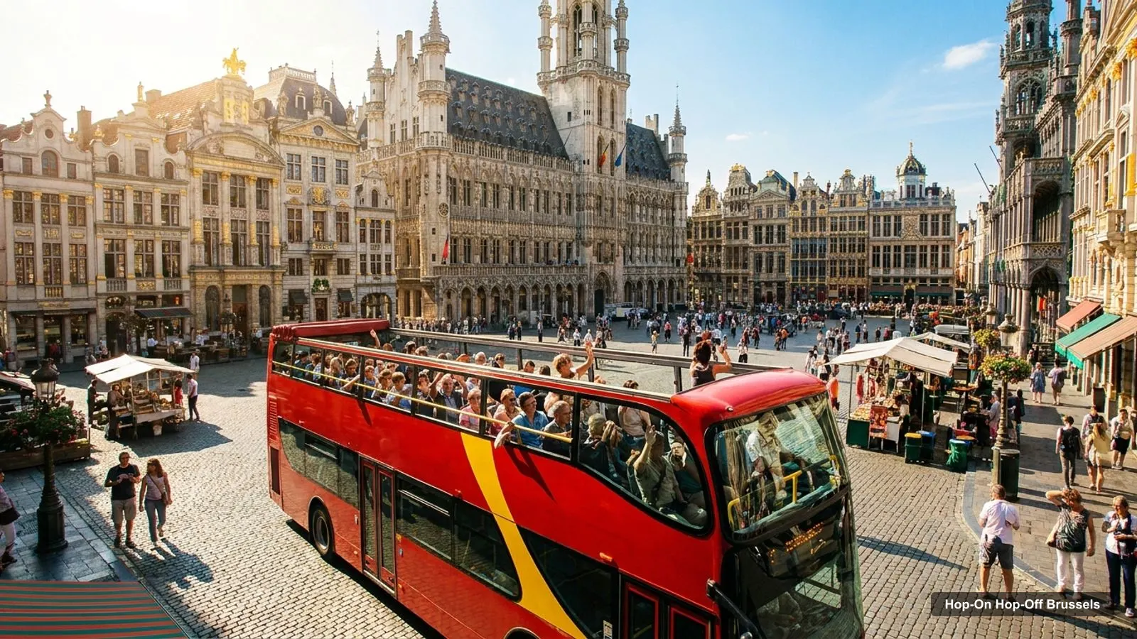
A Brussels tourist map makes more sense once you see the city as four clusters. I’ve put the nine bus stops and the top 20 attractions, ranked by Google Maps reviews, on one page, with coordinates and a Google Maps link for each. The route image follows the Tootbus stop list. To pick the ticket that rides it, see my comparison of hop-on hop-off in Brussels.
Brussels Belgium Tourist Map: The Bus Route
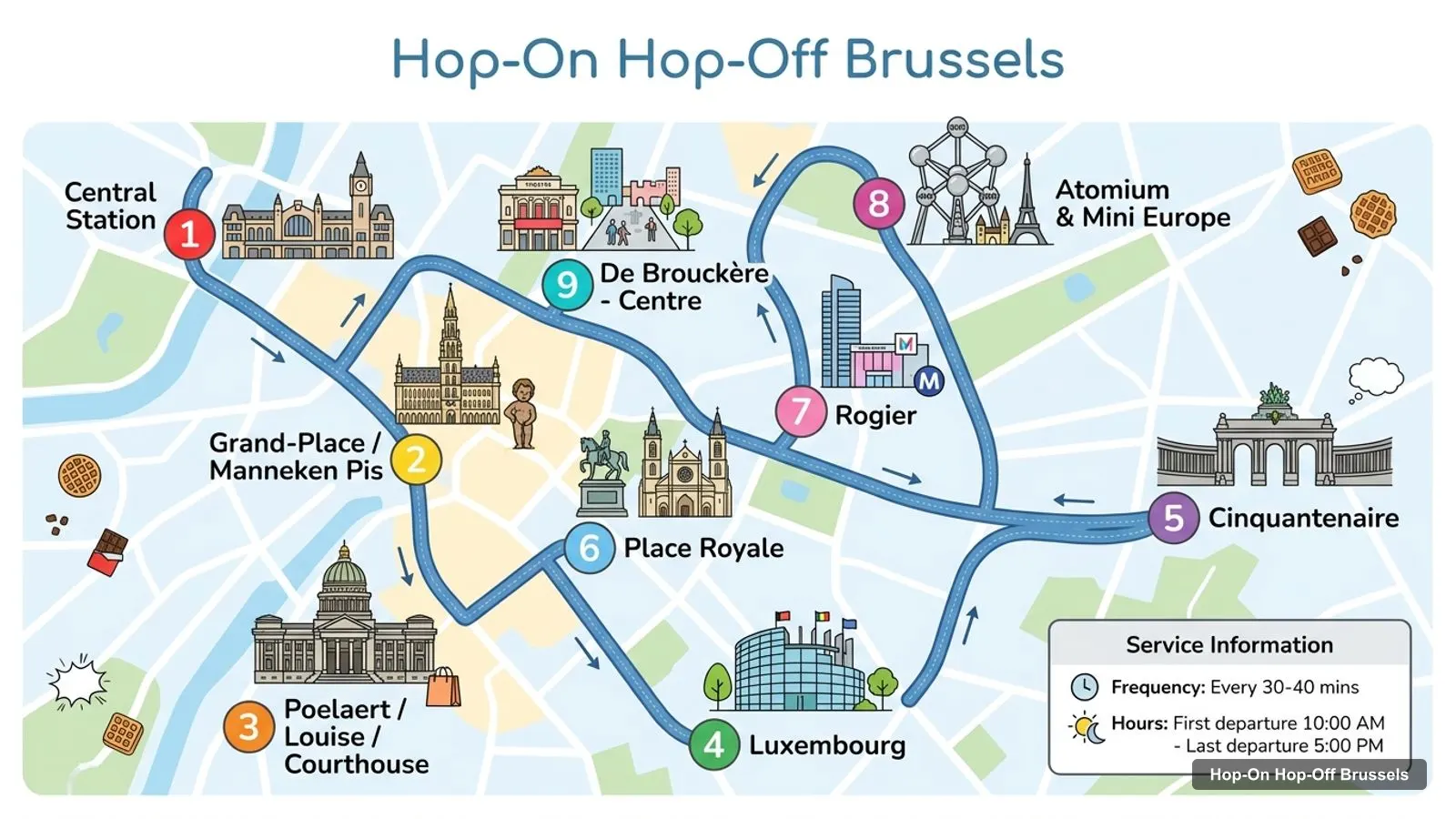
The Brussels sightseeing map below shows the nine named stops of the Tootbus route. The buses run every 30 to 40 minutes, with a first departure at 10:00 AM and a last one at 5:00 PM. The listing describes a Central red route and a Mini Europe and Atomium route, but doesn’t say which stops belong to which, so I’ve numbered the stops in the order the operator lists them. Check the printed map on the bus before you rely on the sequence.
Stops on the route
- 1Central station
- 2Grand-Place/Manneken Pis
- 3Poelaert/Louise/Courthouse
- 4Luxembourg
- 5Cinquantenaire
- 6Place Royale
- 7Rogier
- 8Atomium & Mini Europe
- 9De Brouckère - Centre
Bus stops on the Tootbus route
| # | Stop | Map |
|---|---|---|
| 1 | Central station | Find on Google Maps |
| 2 | Grand-Place/Manneken Pis | Find on Google Maps |
| 3 | Poelaert/Louise/Courthouse | Find on Google Maps |
| 4 | Luxembourg | Find on Google Maps |
| 5 | Cinquantenaire | Find on Google Maps |
| 6 | Place Royale | Find on Google Maps |
| 7 | Rogier | Find on Google Maps |
| 8 | Atomium & Mini Europe | Find on Google Maps |
| 9 | De Brouckère - Centre | Find on Google Maps |
The 9 stops cover the old town, the Royal Quarter, the European Quarter and the Atomium. The Ferris wheel combo mentions 11 stops, so some extra stops exist on the network; the listing doesn’t name them. Central station is at Rue du Cardinal Mercier 33, which is also where the Ferris wheel combo has its meeting point.
Brussels Tourist Attractions Map: Top 20 Sights with Coordinates
This is the Brussels tourist attractions map in table form, ranked by Google Maps reviews, with exact coordinates. Each link opens the place in Google Maps, where you can save it to a list before you travel. I left out the Tootbus office listing, since it is a booking point and not a sight.
| # | Attraction | Coordinates | Google rating | Map |
|---|---|---|---|---|
| 1 | Grand Place | 50.84679, 4.35244 | 4.7 (177,950) | Open in Google Maps |
| 2 | Atomium | 50.89488, 4.34155 | 4.4 (114,091) | Open in Google Maps |
| 3 | Manneken Pis | 50.84499, 4.34999 | 4 (85,525) | Open in Google Maps |
| 4 | Parc du Cinquantenaire | 50.84139, 4.39048 | 4.6 (41,188) | Open in Google Maps |
| 5 | St Michael & St Gudula Cathedral | 50.84791, 4.36015 | 4.7 (24,844) | Open in Google Maps |
| 6 | Mont des Arts | 50.84348, 4.35742 | 4.6 (17,909) | Open in Google Maps |
| 7 | Brussels Royal Palace | 50.84200, 4.36234 | 4.5 (16,522) | Open in Google Maps |
| 8 | Royal Belgian institute of Natural Sciences | 50.83666, 4.37663 | 4.5 (14,849) | Open in Google Maps |
| 9 | Autoworld | 50.83934, 4.39342 | 4.6 (12,811) | Open in Google Maps |
| 10 | Jeanneke Pis | 50.84848, 4.35404 | 4 (12,712) | Open in Google Maps |
| 11 | Belgium Royal Museums of Fine Arts | 50.84162, 4.35818 | 4.5 (10,488) | Open in Google Maps |
| 12 | Choco-Story Brussels | 50.84531, 4.35017 | 4.4 (10,430) | Open in Google Maps |
| 13 | Magritte Museum | 50.84241, 4.35864 | 4.3 (8,830) | Open in Google Maps |
| 14 | Train World | 50.87776, 4.37905 | 4.6 (6,651) | Open in Google Maps |
| 15 | Royal Museum of the Armed Forces and Military History | 50.84080, 4.39336 | 4.5 (6,499) | Open in Google Maps |
| 16 | Musical Instruments Museum | 50.84289, 4.35900 | 4.4 (6,405) | Open in Google Maps |
| 17 | House of European History | 50.83996, 4.37855 | 4.5 (5,658) | Open in Google Maps |
| 18 | Comics Art Museum | 50.85103, 4.36015 | 3.9 (4,049) | Open in Google Maps |
| 19 | Halle Gate | 50.83292, 4.34484 | 4.3 (3,936) | Open in Google Maps |
| 20 | Art & History Museum | 50.83935, 4.39150 | 4.4 (3,302) | Open in Google Maps |
Grand Place leads with 177,950 reviews. The Atomium and Manneken Pis follow, at 114,091 and 85,525. After the top three the scores jump to museums and parks, which is why the order changes if you care more about art or history than about landmarks.
Brussels Sightseeing Map: The Four Clusters
Read the coordinates above and you’ll see four groups on the Brussels sightseeing map:
- The old town (around 50.846, 4.352): Grand Place, Manneken Pis, Jeanneke Pis, Choco-Story, the Brussels City Museum and the comics figurines museum. Grand Place to Manneken Pis is about 260 metres, and to Jeanneke Pis about 220 metres. You can walk all of it in a morning, and the cathedral is about 560 metres from Grand Place.
- The Royal Quarter (around 50.842, 4.359): Mont des Arts, the Royal Palace, the Royal Museums of Fine Arts, the Magritte Museum and the Musical Instruments Museum. Mont des Arts to the Palace is about 380 metres. Mont des Arts to the Magritte Museum is only about 150 metres. The Place Royale stop serves this group.
- The European Quarter (around 50.840, 4.390): the Parc du Cinquantenaire, Autoworld, the Art and History Museum and the Armed Forces museum, all within about 300 metres of each other. The House of European History is about 850 metres west of the park, and the Natural Sciences museum about 1.1 km.
- The north (around 50.89, 4.34): the Atomium and Mini Europe, about 5.4 km from Grand Place. Train World is about 3.3 km south-east of the Atomium, and the nearest big sight to it.
Brussels Tourist Attractions: What Each Cluster Is Best For
The old town is for first impressions and food. Grand Place is rated 4.7, Choco-Story 4.4 and the Brussels COMICS Figurines Museum 4.6, and none of them is more than a few hundred metres from the next. If you only have a morning, spend it here, then use the Grand-Place/Manneken Pis stop to leave.
The Royal Quarter is for art. The Royal Museums of Fine Arts are rated 4.5, the Magritte Museum 4.3 and the Musical Instruments Museum 4.4, and all three are within about 250 metres of Mont des Arts. Most of them close on Mondays, and open from 10 AM to 5 PM on weekdays, so check the day before you plan this stretch. The Place Royale stop is the one to use.
The European Quarter is for space and variety. The Parc du Cinquantenaire is rated 4.6 and is listed from 6 AM to 10 PM, and the museums around it cover cars, history and the armed forces. Autoworld is rated 4.6, the Armed Forces museum 4.5 and the Art and History Museum 4.4. It’s the best cluster for a family day, because you can move between museums without any transport.
The north is for one landmark. The Atomium is rated 4.4 and open 10 AM to 6 PM daily, and Mini Europe sits next to it. Train World, rated 4.6, is closed on Mondays and is the only other sight in this part of the map. I’d go north with a plan, not by accident, since it is the most distant stop on the route.
If you’re short on time, here is how I’d rank the clusters by what you get for the time spent: the old town first, the Royal Quarter second, then Cinquantenaire, and the Atomium last unless the building is why you came.
Brussels Tourist Guide: How to Use the Map
My use of this map is simple. Pick one cluster per half-day, ride the bus between them, and don’t try to do the north and the European Quarter on the same afternoon. The bus stops at 5:00 PM, and the Atomium is listed as open until 6 PM, so the last bus is the constraint, not the opening hours.
For metro, tram and bus times beyond the sightseeing bus, the operator is STIB-MIVB, and for visitor information the city site is visit.brussels. My data doesn’t include metro stations, so I can’t give you line numbers; check the operator’s journey planner for the best connection.
Brussels Tourist Map PDF: Print or Save It
There’s no official PDF in my data, but this page prints well. If you prefer your phone, open the Google Maps links above and save the places to a list. The Brussels Card, if you buy it, is collected at the Grand Place office (Monday to Saturday, 9 AM to 5 PM) or at the Mont des Arts information point, Rue Royale 2.
Where to Go Next
For a plan that follows these clusters hour by hour, read my Brussels itinerary for 1, 2 and 3 days. For a ranked list of what to see at each stop, with opening hours, see the best things to do in Brussels. When you’re ready to book, the sightseeing bus I’d book in Brussels is on the hub page, and the homepage has every other city.
Frequently asked questions
Is there a printable Brussels tourist map?
This page works as one. The route image shows the sightseeing bus stops in order, and the tables below list the nine stops and the top 20 attractions with coordinates. Print the page, or open any Google Maps link and save the places to a list so they work offline on your phone.
Where are most Brussels attractions on the map?
In four groups. The old town around Grand Place, the Royal Quarter on the hill with Mont des Arts and the Fine Arts museums, the European Quarter with Cinquantenaire to the east, and the Atomium alone to the north. The first two are within about 600 metres of each other, so they are the easy walking part.
How far apart are the main Brussels sights?
Grand Place to Manneken Pis is about 260 metres, and to Mont des Arts about 510 metres. Grand Place to the Parc du Cinquantenaire is about 2.7 km east, and to the Atomium about 5.4 km north, both in a straight line. Those two longer hops are where the bus or metro saves you time.
Tours I compared in Brussels
My full review of each one, in the order I rank them:
- Brussels: Hop-On Hop-Off Bus Tour★ 4.0 · from $27.87
- Brussels: Hop-On Hop-Off Bus Tour and Ferris Wheel Combo★ 4.0 · from $33.50
- Brussels: City Card with Hop-On Hop-Off Bus★ 3.9 · from $70.94
- Brussels: Hop-On Hop-Off Bus Tour& Belgian Beer World Museum★ 4.4 · from $50.67