Bordeaux Tourist Map: Top Attractions & Bus Stops
By Jake Dawson · Updated · Affiliate links, explained in my disclosure
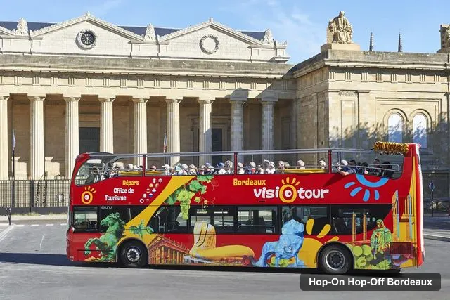
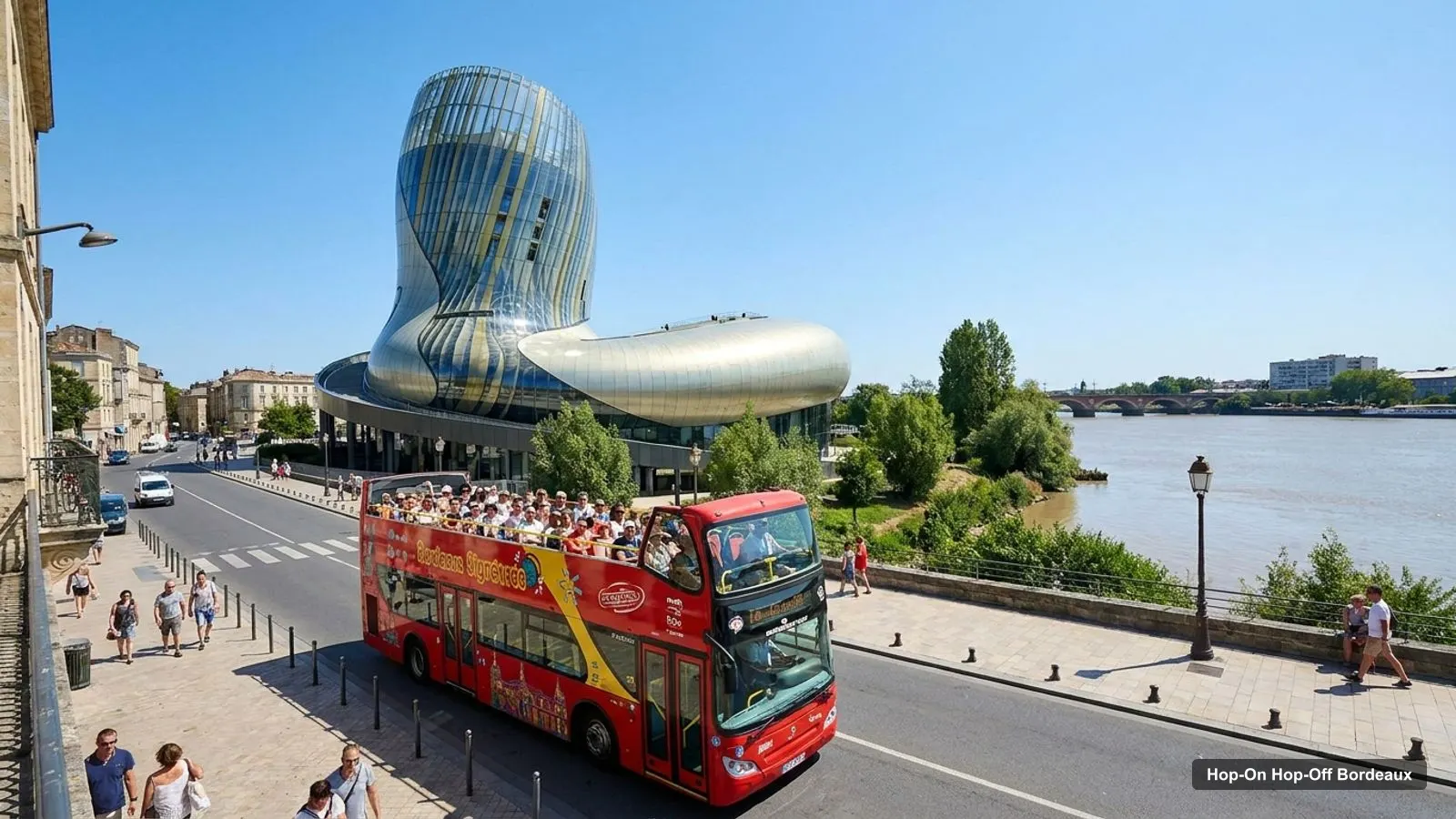
A Bordeaux tourist map is easier to use once you know the city has four clusters of sights. I put the top 20 attractions, ranked by Google Maps reviews, and the 10 hop-on hop-off bus stops on one page, with coordinates and a Google Maps link for each. For the bus itself, see my hop-on hop-off Bordeaux guide.
Ratings and coordinates are from Google Maps, and the bus stops are from the GetYourGuide listing and the operator’s site. All checked on 8 October 2026.
Bordeaux Tourist Attractions Map: The Bus Route
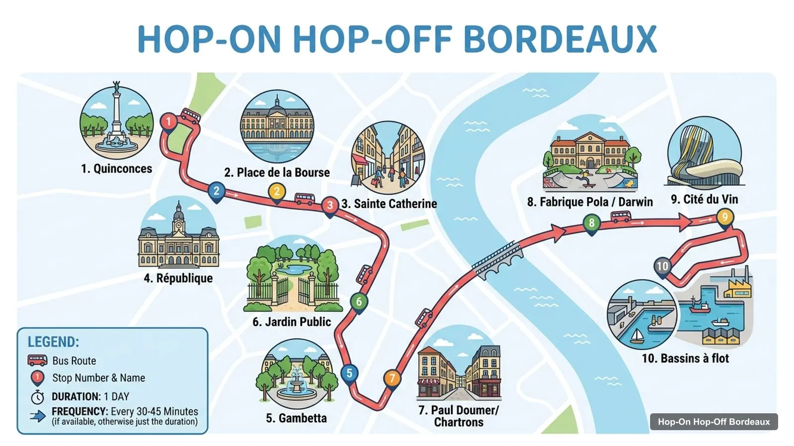
The Bordeaux tourist attractions map below is a sketch of the 10 stops, drawn from the stop names in the listing. It is not the operator’s route, so use their leaflet for exact streets. The loop runs from Quinconces through the old centre, up the Garonne to the Jardin Public and Chartrons, and ends at the Cité du Vin and the Bassins à flot.
Stops on the route
- 1Quinconces
- 2Place de la Bourse
- 3Sainte Catherine
- 4République
- 5Gambetta
- 6Jardin Public
- 7Paul Doumer/Chartrons
- 8Fabrique Pola / Darwin
- 9Cité du Vin
- 10Bassins à flot
Hop-on hop-off bus stops
| # | Stop | Address | Map |
|---|---|---|---|
| 1 | Quinconces | 10 cours du 30 Juillet | Find on Google Maps |
| 2 | Place de la Bourse | opposite 1 quai de la Douane | Find on Google Maps |
| 3 | Sainte Catherine | 117 bis cours Victor Hugo | Find on Google Maps |
| 4 | République | place de la République | Find on Google Maps |
| 5 | Gambetta | opposite 44 place Gambetta | Find on Google Maps |
| 6 | Jardin Public | 32 cours de Verdun | Find on Google Maps |
| 7 | Paul Doumer/Chartrons | 130 cours de Verdun | Find on Google Maps |
| 8 | Fabrique Pola / Darwin | 40 quai de Brazza | Find on Google Maps |
| 9 | Cité du Vin | 118 quai de Bacalan | Find on Google Maps |
| 10 | Bassins à flot | opposite 30 cours Henri Brunet | Find on Google Maps |
The full loop takes about 1 hour 20 minutes without getting off, and the operator’s site gives a 50-minute interval between buses. The 24-hour pass I can book is $29.28 per person.
Bordeaux Tourist Attractions: Top 20 with Coordinates
This is the Bordeaux tourist attractions list in table form, ranked by Google Maps reviews, with coordinates. I left out tour operators, the city’s own Google Maps entry and sights outside the city. Each link opens the place in Google Maps.
| # | Attraction | Coordinates | Google rating | Map |
|---|---|---|---|---|
| 1 | Cité du Vin | 44.86240, -0.55062 | 4.3 (28,911) | Open in Google Maps |
| 2 | Place de la Bourse | 44.84152, -0.56987 | 4.7 (20,435) | Open in Google Maps |
| 3 | Miroir d’eau | 44.84181, -0.56914 | 4.5 (16,627) | Open in Google Maps |
| 4 | Cathédrale Saint-André de Bordeaux | 44.83764, -0.57767 | 4.6 (16,106) | Open in Google Maps |
| 5 | Opéra National de Bordeaux - Grand-Théâtre | 44.84259, -0.57420 | 4.6 (9,995) | Open in Google Maps |
| 6 | Monument aux Girondins | 44.84539, -0.57487 | 4.6 (9,910) | Open in Google Maps |
| 7 | Base sous-marine | 44.87054, -0.55967 | 4.6 (7,980) | Open in Google Maps |
| 8 | Porte de Bourgogne | 44.83634, -0.56624 | 4.2 (7,007) | Open in Google Maps |
| 9 | Museum of Illusions Bordeaux | 44.83889, -0.58283 | 4.4 (6,705) | Open in Google Maps |
| 10 | Grosse Cloche | 44.83542, -0.57132 | 4.6 (6,554) | Open in Google Maps |
| 11 | Porte Cailhau | 44.83877, -0.56849 | 4.6 (6,133) | Open in Google Maps |
| 12 | Basilique Saint-Michel | 44.83437, -0.56507 | 4.5 (5,753) | Open in Google Maps |
| 13 | Musée d’Aquitaine | 44.83570, -0.57491 | 4.5 (4,859) | Open in Google Maps |
| 14 | SCIENCE EXPERIENCES BORDEAUX | 44.84017, -0.57479 | 4.8 (4,541) | Open in Google Maps |
| 15 | Place du Parlement | 44.84071, -0.57208 | 4.5 (4,316) | Open in Google Maps |
| 16 | Tour Pey Berland | 44.83757, -0.57662 | 4.5 (3,704) | Open in Google Maps |
| 17 | CAPC Musée d’art Contemporain de Bordeaux | 44.84828, -0.57216 | 4.1 (3,601) | Open in Google Maps |
| 18 | Cap Sciences | 44.85957, -0.55426 | 4.3 (3,576) | Open in Google Maps |
| 19 | Muséum de Bordeaux | 44.84847, -0.57995 | 4.6 (3,545) | Open in Google Maps |
| 20 | Bordeaux Museum of Fine Arts | 44.83737, -0.58054 | 4.3 (3,375) | Open in Google Maps |
The first three are the sights I’d put on any first day: the Cité du Vin has the most reviews, Place de la Bourse the best rating among the big ones, and the Miroir d’eau sits right in front of it.
Bordeaux Sightseeing Map: Four Clusters
Reading the coordinates, the sights fall into four clusters. Knowing them saves you from crossing the city twice.
- The quays. Place de la Bourse, the Miroir d’eau, Porte Cailhau and the Musée national des Douanes all sit within about 0.5 km of each other, around bus stop 2.
- The old centre. The Cathédrale Saint-André, the Tour Pey Berland, the Grand-Théâtre and the Place du Parlement are all within about 0.8 km of Quinconces.
- The Jardin Public and Chartrons. The Muséum de Bordeaux is about 0.7 km from Quinconces, and the Musée du Vin et du Négoce is about 1.3 km away. Stops 6 and 7 serve this side.
- The north docks. The Cité du Vin, Cap Sciences and the Base sous-marine are 2.4 to 3.2 km from Quinconces, so I’d ride there.
Bordeaux Walking Tour Map
A Bordeaux walking tour map is mostly the first two clusters. Start at Quinconces, walk 0.4 km to the Bourse and the Miroir d’eau, then 0.3 km to Porte Cailhau. From there the cathedral is a short walk inland, and Saint-Michel is about 1.3 km from your starting point in a straight line.
Straight lines understate the real walk, because streets bend. I’d treat the numbers as a lower bound. For a day plan that follows this order, my Bordeaux itinerary puts the stops and hours together.
Bordeaux Tourist Information
Bordeaux tourist information starts at the office next to bus stop 1. The operator’s site describes stop 1 as being at the tourist office, 10 cours du 30 Juillet. The bus listing says it comes with a city map and a gourmet guide featuring 22 dining spots near the stops.
I could not source the office’s hours, so I would check the Bordeaux tourism site before you rely on a desk visit. The same site lists the guided visits and events that I have not covered.
Bordeaux Tourist Map Pdf
Bordeaux tourist map PDF searches usually want something to print. The operator hands out a city map with the pass, according to the listing, and the tourism office is the other source. I don’t host a PDF, but this page prints cleanly, and the tables above give you coordinates and map links.
If you want to build your own map, open the links in the top 20 table and save each place to a Google Maps list. That keeps ratings and hours up to date in a way a static PDF does not.
Bordeaux Tourist Guide: Hours at a Glance
This is the hours cheat sheet from Google Maps for the sights people ask about most.
| Sight | Hours | Note |
|---|---|---|
| Cité du Vin | 10 AM to 7 PM daily | Bus stop 9 |
| Base sous-marine | 10 AM to 7 PM, 8 PM Saturday | Near the Bassins à flot |
| Place de la Bourse | Open 24 hours | Bus stop 2 |
| Cathédrale Saint-André | 2 to 7 PM Monday, 10 AM to 12 PM and 2 to 7 PM Tuesday to Saturday | Sunday 9:30 AM to 12 PM and 2 to 6 PM |
| Porte Cailhau | 10 AM to 1 PM and 2 to 6 PM daily | Short walk from the Bourse |
| Grosse Cloche | Monday and Saturday slots only | Closed on other days |
Check each venue’s own site for holiday closures. The next French public holidays are 1 November, 11 November and 25 December.
Bordeaux Travel Map: Distances Between Clusters
A Bordeaux travel map is mostly about the gap between the centre and the docks. From Quinconces, straight-line distances are about 0.4 km to Place de la Bourse, 0.7 km to the cathedral, 0.7 km to the Muséum de Bordeaux, 1.3 km to Saint-Michel, 2.4 km to Cap Sciences, 2.8 km to the Cité du Vin and 3.2 km to the Base sous-marine.
That means the first four sights make a walking morning, and the last three are the reason to buy a bus pass. The Musée de l’Histoire Maritime de Bordeaux and the Musée Mer Marine are also up on the docks, about 2.6 km and 3.1 km from Quinconces, which makes the north end a half-day area on its own.
I would not plan the docks and the old town for the same afternoon. Ride up, spend two hours, and come back through the centre on foot. With a 50-minute bus interval, that is the more reliable way to finish on time.
Bordeaux Tourist Map Tips
Four habits make the map work better in practice.
- Save the top 20 to a Google Maps list. The links open each place by its Google ID, so ratings and hours stay current.
- Check the day. The Grosse Cloche has visits only on Mondays and Saturdays, and several museums, including the Muséum de Bordeaux and the Musée d’Aquitaine, are closed on Mondays.
- Pick your hop-offs before you board. The Cité du Vin and the Bourse are the two easiest, because both are named stops.
- Allow for the interval. The operator says 50 minutes between buses, so a short stop can cost you an hour.
Using the Map With the Bus
The map is most useful with the bus in mind. The pass covers the 10 stops, and the GetYourGuide listing says you can board at any of them. The Cité du Vin and Place de la Bourse are both stops, which makes them the easiest hop-offs on the route.
If you are deciding whether to ride or walk, the numbers above answer it. The centre is a walk, the docks are a ride. My best things to do in Bordeaux ranks the sights with hours, and the home page lists the other cities I cover. When you are ready to book, see the Bordeaux hop-on hop-off ticket guide for prices and my pick.
Frequently asked questions
Is there a printable Bordeaux tourist map?
This page works as one. The route sketch shows the 10 bus stops in order, and the tables list the stops and the top 20 attractions with coordinates and Google Maps links. Print the page, or open any link to save the places to your own map.
Where are most Bordeaux attractions on the map?
In four groups. The quays have Place de la Bourse and the Miroir d'eau. The old centre has the cathedral, Porte Cailhau and the Grand-Théâtre. The north docks have the Cité du Vin and the Base sous-marine. The museums sit around the Jardin Public and the Chartrons.
How far apart are the main Bordeaux sights?
Place de la Bourse and Quinconces are about 0.4 km apart in a straight line. The Cité du Vin is about 2.8 km from Quinconces, and the Base sous-marine about 3.2 km. That gap between the centre and the docks is where the bus helps most.
Where is the Bordeaux tourist information office?
The operator's site places the first bus stop, Quinconces, at the tourist office, 10 cours du 30 Juillet. Google Maps lists the Bordeaux Visiotour bus agency at the same address. I did not find the office's opening hours in my data, so check the Bordeaux tourism site before you go.
Are there free tourist attractions in Bordeaux?
Yes. Place de la Bourse, Place du Parlement, Place des Quinconces and the Monument aux Girondins are listed as open 24 hours on Google Maps. The Miroir d'eau has no hours listed. All of them are in the centre, within about 0.6 km of the first bus stop.
Tours I compared in Bordeaux
My full review of each one, in the order I rank them:
- Bordeaux: 24-hour Hop-on Hop-off Pass★ 4.3 · from $29.28