Boracay Tourist Map: Top Attractions & Bus Stops
By Jake Dawson · Updated · Affiliate links, explained in my disclosure
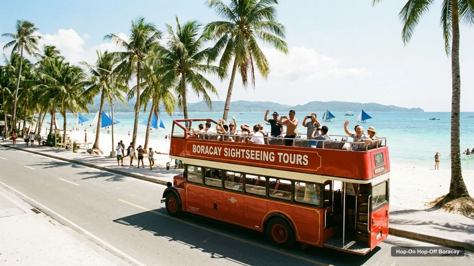
A Boracay tourist map is useful because the island is long and thin and the best sights are bunched in a few places. This page puts the top attractions on the map in table form, with coordinates and Google Maps links. I used Google Maps data pulled for this site, and I ranked places by how many people reviewed them. If you plan to ride the island shuttle, my hop-on hop-off Boracay guide explains what I could and couldn’t confirm.
Distances in this guide are straight-line figures worked out from the coordinates. Treat them as the minimum. The roads wind, so your real trip will be longer. I haven’t copied a bus stop list, because I couldn’t reach the operator’s own map.
Boracay Tourist Attractions
This is the infographic for the island. It plots the main landmarks from Google Maps and numbers them, so you can see the shape of the place before you read the tables.
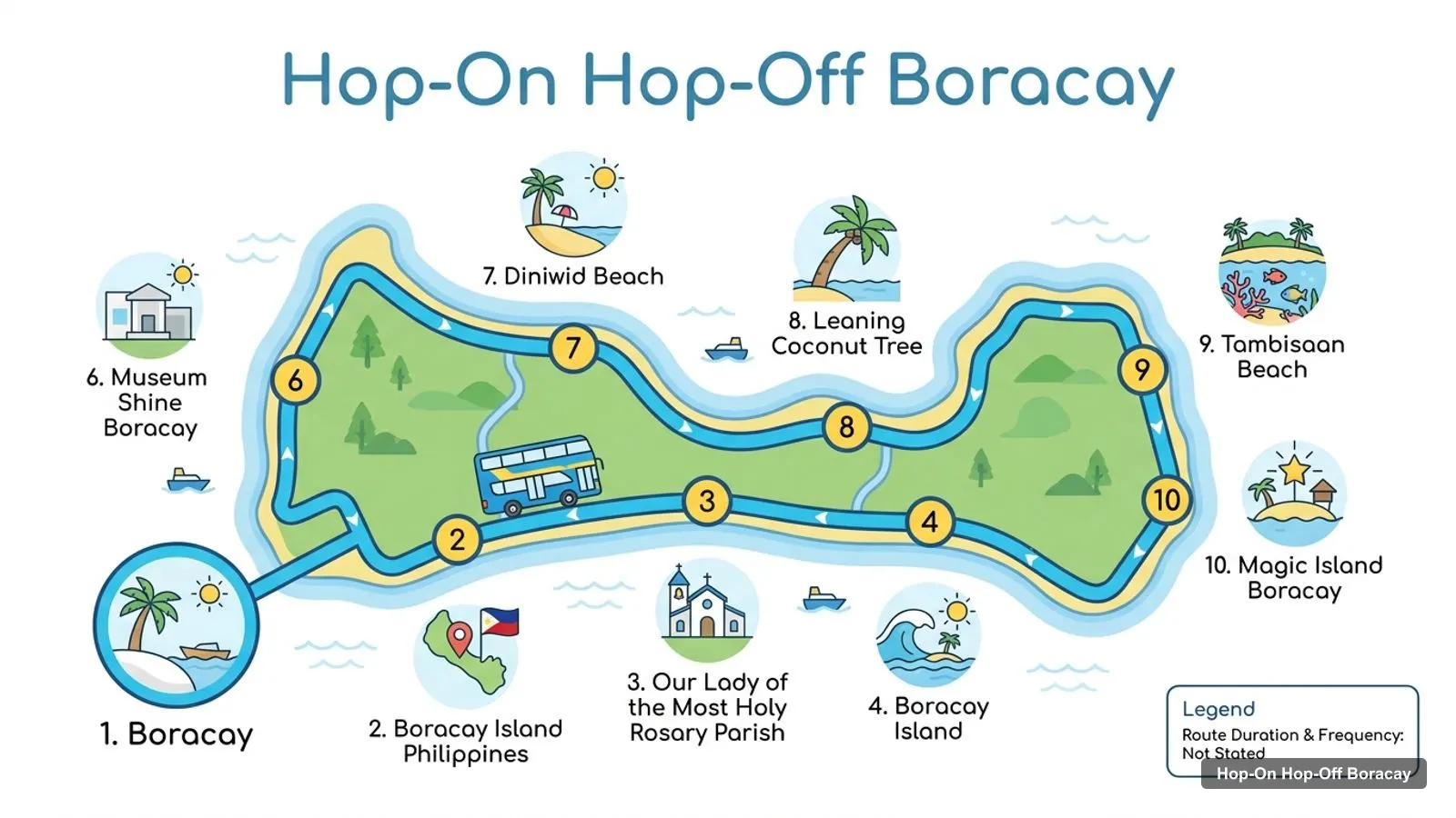
Stops on the route
- 1Boracay
- 2Boracay Island Philippines
- 3Our Lady of the Most Holy Rosary Parish
- 4Boracay Island
- 5Willy's Rock
- 6Museum Shine Boracay
- 7Diniwid Beach
- 8Leaning Coconut Tree
- 9Tambisaan Beach
- 10Magic Island Boracay
The numbered landmarks below match the picture. Note that the infographic shows landmarks, not confirmed shuttle stops, and two entries are Google’s names for the island as a whole.
Landmarks on the map
| # | Landmark on the map | Map |
|---|---|---|
| 1 | Boracay | Find on Google Maps |
| 2 | Boracay Island Philippines | Find on Google Maps |
| 3 | Our Lady of the Most Holy Rosary Parish | Find on Google Maps |
| 4 | Boracay Island | Find on Google Maps |
| 5 | Willy’s Rock | Find on Google Maps |
| 6 | Museum Shine Boracay | Find on Google Maps |
| 7 | Diniwid Beach | Find on Google Maps |
| 8 | Leaning Coconut Tree | Find on Google Maps |
| 9 | Tambisaan Beach | Find on Google Maps |
| 10 | Magic Island Boracay | Find on Google Maps |
The links open Google Maps with a search, so you can save any of them to a list before you travel.
Attractions in Boracay Philippines: Top 20 With Coordinates
This is the Boracay map in table form, ranked by Google Maps reviews. I left out a shuttle terminal and a tour operator, since they are not sights. Each link opens the place in Google Maps.
| # | Attraction | Coordinates | Google rating | Map |
|---|---|---|---|---|
| 1 | Boracay | 11.96738, 121.92481 | 4.6 (4,260) | Open in Google Maps |
| 2 | Diniwid Beach | 11.97630, 121.91167 | 4.5 (2,438) | Open in Google Maps |
| 3 | Willy’s Rock | 11.96823, 121.91871 | 4.6 (1,409) | Open in Google Maps |
| 4 | Boracay Island | 11.96830, 121.91895 | 4.7 (674) | Open in Google Maps |
| 5 | Tambisaan Beach | 11.95004, 121.94678 | 4.5 (643) | Open in Google Maps |
| 6 | Our Lady of the Most Holy Rosary Parish | 11.96850, 121.92036 | 4.8 (429) | Open in Google Maps |
| 7 | Museum Shine Boracay | 11.97401, 121.91890 | 4.9 (392) | Open in Google Maps |
| 8 | Magic Island Boracay | 11.94205, 121.95712 | 4.5 (312) | Open in Google Maps |
| 9 | Leaning Coconut Tree | 11.96492, 121.92930 | 4.4 (291) | Open in Google Maps |
| 10 | Boracay Island Philippines | 11.96363, 121.92310 | 4.8 (209) | Open in Google Maps |
| 11 | Ariel’s Point | 11.86497, 121.87749 | 4.7 (145) | Open in Google Maps |
| 12 | Lambros Point | 11.97454, 121.91265 | 4.5 (118) | Open in Google Maps |
| 13 | Bulabog Beach | 11.96640, 121.92828 | 4.5 (108) | Open in Google Maps |
| 14 | Secret Beach PH | 11.94143, 121.93326 | 4.3 (95) | Open in Google Maps |
| 15 | Boracay Newcoast Cove 2 Beach | 11.98335, 121.92560 | 4.5 (82) | Open in Google Maps |
| 16 | I Love Boracay | 11.96575, 121.92862 | 4.6 (76) | Open in Google Maps |
| 17 | West Cove Ruins | 11.97727, 121.90976 | 4.3 (67) | Open in Google Maps |
| 18 | Motag Living Museum | 11.90195, 121.92375 | 4.7 (56) | Open in Google Maps |
| 19 | Ati Tribe Village | 11.95801, 121.93383 | 4.7 (52) | Open in Google Maps |
| 20 | Boracay Beach Path | 11.95742, 121.92667 | 4.5 (52) | Open in Google Maps |
Two cautions. First, generic listings such as Boracay and Boracay Island are the island itself, so read them as context and not as a single spot. Second, the weakest rating in my data is Laguna de Boracay at 3.3 from 39 reviews, which is why it is not high on any of my plans.
Boracay Map Tourist Spot: The Clusters
Read the coordinates and three groups stand out on the map.
- North-west cluster (around 11.97, 121.92): Willy’s Rock, Museum Shine Boracay, Our Lady of the Most Holy Rosary Parish, Diniwid Beach, Lambros Point and the West Cove Ruins. Willy’s Rock to Museum Shine is 0.6 km, and Willy’s Rock to Diniwid Beach is 1.2 km. You can walk all of it in a morning.
- East coast (around 11.96, 121.93): Bulabog Beach, the Leaning Coconut Tree and the Ati Tribe Village. Bulabog is 1.1 km from Willy’s Rock and the Ati Tribe Village is about 2.0 km away, so this is a short ride or a long walk.
- South-east and the port (around 11.95, 121.94): Tambisaan Beach, the Boracay Rotunda and the hop-on hop-off terminal that Google lists. Tambisaan is 3.7 km from Willy’s Rock, and Magic Island is 1.4 km from Tambisaan across the water.
Outside the island, Ariel’s Point is about 12.3 km from Willy’s Rock on the mainland coast, and the Motag Living Museum is about 7.4 km away. Both need their own transport.
Is Boracay Worth Visiting?
Based on the data, yes. The island itself rates 4.6 from 4,260 reviews, and the best-rated sights, Museum Shine Boracay at 4.9 and the parish church at 4.8, are in the walkable north-west cluster. What lowers the score is timing: in the rainy months wind can limit boat trips and beach days, so I’d choose the drier season if I could. My best things to do in Boracay page explains each sight in more detail.
Boracay Must Do
If I had to pick a short list, I’d go with these:
- Willy’s Rock and Museum Shine together, since they are 0.6 km apart.
- Sunset at Diniwid Beach, 1.2 km north.
- One boat trip, such as Ariel’s Point, if the weather is calm.
- A slow loop through Bulabog and the Ati Tribe Village on a different day.
That is two days of sights, with a boat trip in the middle. My Boracay itinerary turns the same list into one, two and three-day plans.
Boracay Tourist Information
A few practical points, none of which I’d treat as a substitute for the official sources. Boracay is in Aklan, in the Western Visayas, and most visitors arrive via Caticlan or Kalibo and then cross by boat. White Beach is divided into Station 1 in the north, Station 2 in the middle and Station 3 in the south. These are beach zones and not shuttle stops. The Boracay article on Wikipedia has background on the island’s history and geography.
The hop-on hop-off shuttle is the main way to cover the length of the island without a tricycle. Search listings describe it as running between Cagban or Tambisaan port and Puka Beach, with between 19 and 29 stops depending on the source, and passes of one to three days. I couldn’t confirm current fares or the stop list, so ask when you buy.
How to Use This Boracay Map on Your Phone
Open each Google Maps link above and save the place to a list called Boracay. Once you are on the island, the list shows every sight as a pin, so you can see what is near your hotel at a glance. Pins for Willy’s Rock, Museum Shine Boracay and the parish church sit almost on top of one another, which is the quickest way to see that the north-west cluster is a walk, not a ride.
Download the offline map for the island before you leave home, because signal can drop at the quieter ends. Add your hotel and the port you arrive at as pins too. Tambisaan Beach is the closest pin in my data to the arrival port, and the hop-on hop-off terminal that Google lists is about 1.3 km from it. If a boat trip starts at a different beach, add that pin on the day.
Check opening hours on the pin before you walk. Museum Shine Boracay shows 8 AM to 10 PM and the parish church 6 AM to 6 PM, while the Motag Living Museum shows 10 AM to 4 PM and is closed on Mondays in its listing. Hours change, so treat these as a starting point.
Which Sight Is Near Which Part of the Route
Since I have no verified stop list, here is the rule I use: match each sight to the part of the island, then look for the nearest stop on the operator’s map. The south end holds Tambisaan Beach and the port area. The middle holds Willy’s Rock, the museum and the parish. The north holds Diniwid Beach and Lambros Point. If a stop name on the map is not in this list, search it on Google Maps before you hop off.
For the full guide to passes and pricing clues, go back to my hop-on hop-off Boracay page, and for more cities, start from the home page.
Frequently asked questions
What are the main tourist attractions in Boracay?
By Google reviews, the main ones are Diniwid Beach (2,438 reviews), Willy's Rock (1,409), Tambisaan Beach (643), Our Lady of the Most Holy Rosary Parish (429) and Museum Shine Boracay (392). Magic Island, the Leaning Coconut Tree and Ariel's Point are the next group, and the last two need a boat or a longer ride.
Is Boracay worth visiting?
I think so, if you want beaches and an easy, walkable island. The island scores 4.6 from 4,260 Google reviews and its top sights are close together. It is a weaker choice in the rainy months, so check the season and weather before you book boats.
What is the must-do in Boracay?
If I could do one thing, I'd walk to Willy's Rock and Museum Shine, then watch the sunset at Diniwid Beach. Those three are within about 1.2 km of one another and carry ratings of 4.6, 4.9 and 4.5. A boat trip to Ariel's Point is the best second choice.
How long is Boracay?
From my coordinates, Tambisaan Beach in the south-east to Diniwid Beach in the north-west is about 4.8 km in a straight line. The island is commonly described as roughly 7 km long, so allow for the road, which is longer than the straight line.
Is there a hop-on hop-off bus map for Boracay?
The operator publishes its own route map, which I could not access, so I haven't copied a stop list. Listings describe a shuttle between the jetty port end and Puka Beach with 19 to 29 stops. Ask for the current map when you buy a pass.