
Tours & Tickets
Berlin: Hop-On-Hop-Off Bus with Boat Cruise Option
- 3.8 (943 reviews)
- 2-day ticket
- Free cancellation
My pick: Covers the most named sights on this map: 33 stops, from the Kaiser Wilhelm Memorial Church to the TV Tower.
By Jake Dawson · Updated · Affiliate links, explained in my disclosure
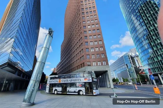
Tempelhofer Sightseeing
Berlin: Hop-on Hop-off Bus Tour with Live Commentary
4.3 (8,834) · from $23.65
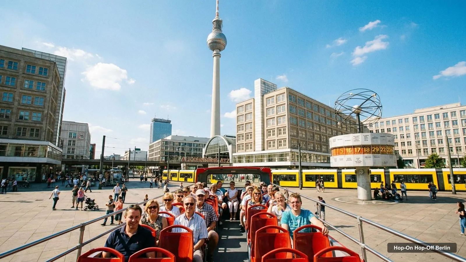
A Berlin tourist map makes more sense once you see the city as four areas strung along an east–west line. I’ve put the top 20 attractions (ranked by Google Maps reviews) and the main sightseeing bus stops on one page, with coordinates and a Google Maps link for each. The route image follows Tempelhofer Sightseeing’s live-commentary loop. To pick the ticket that rides it, see my comparison of hop-on hop-off in Berlin.
The Berlin tour map below shows the first 12 stops of Tempelhofer Sightseeing’s 21-stop loop, from Kurfürstendamm 231 east through Potsdamer Platz and Checkpoint Charlie to Alexanderplatz and Museum Island. Buses run every 20–30 minutes from about 9:30am to 5pm. After Humboldt University the loop returns west via Unter den Linden, Madame Tussauds, the Brandenburg Gate, the Reichstag, the Hauptbahnhof, Bellevue Palace, Bikini Berlin and Zoologischer Garten station.
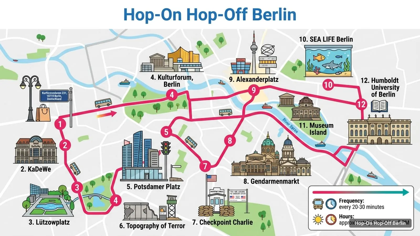
Stops on the route
| # | Stop | Map |
|---|---|---|
| 1 | Kurfürstendamm 231, 10719 Berlin, Deutschland | Find on Google Maps |
| 2 | KaDeWe | Find on Google Maps |
| 3 | Lützowplatz | Find on Google Maps |
| 4 | Kulturforum, Berlin | Find on Google Maps |
| 5 | Potsdamer Platz | Find on Google Maps |
| 6 | Topography of Terror | Find on Google Maps |
| 7 | Checkpoint Charlie | Find on Google Maps |
| 8 | Gendarmenmarkt | Find on Google Maps |
| 9 | Alexanderplatz | Find on Google Maps |
| 10 | SEA LIFE Berlin | Find on Google Maps |
| 11 | Museum Island | Find on Google Maps |
| 12 | Humboldt University of Berlin | Find on Google Maps |
The other operators follow a similar line with different extras. City Sightseeing adds a second route through East Berlin, Big Bus a red and a blue route from Alexanderstraße, and Tours & Tickets the longest list of named sights. The table above is the core loop most visitors ride first.
This is the Berlin sightseeing map in table form, ranked by Google Maps reviews, with exact coordinates. I left out bus stops and tour companies. Each link opens the place in Google Maps, where you can save it to a list before you travel.
| # | Attraction | Coordinates | Google rating | Map |
|---|---|---|---|---|
| 1 | Alexanderplatz | 52.52198, 13.41331 | 4.3 (246,480) | Open in Google Maps |
| 2 | Brandenburg Gate | 52.51627, 13.37770 | 4.7 (190,540) | Open in Google Maps |
| 3 | Potsdamer Platz | 52.50923, 13.37611 | 4.4 (72,504) | Open in Google Maps |
| 4 | East Side Gallery | 52.50502, 13.43970 | 4.6 (67,061) | Open in Google Maps |
| 5 | Berlin TV Tower | 52.52081, 13.40942 | 4.4 (53,487) | Open in Google Maps |
| 6 | Topography of Terror | 52.50675, 13.38371 | 4.6 (40,939) | Open in Google Maps |
| 7 | Victory Column | 52.51452, 13.35011 | 4.6 (32,379) | Open in Google Maps |
| 8 | DDR Museum | 52.51934, 13.40231 | 4.3 (28,509) | Open in Google Maps |
| 9 | German Museum of Technology | 52.49870, 13.37788 | 4.7 (27,546) | Open in Google Maps |
| 10 | German Spy Museum | 52.50892, 13.37931 | 4.3 (19,992) | Open in Google Maps |
| 11 | Jewish Museum Berlin | 52.50231, 13.39545 | 4.4 (18,127) | Open in Google Maps |
| 12 | Neues Museum | 52.52013, 13.39765 | 4.5 (15,958) | Open in Google Maps |
| 13 | German Historical Museum | 52.51861, 13.39636 | 4.4 (10,667) | Open in Google Maps |
| 14 | Alte Nationalgalerie | 52.52081, 13.39835 | 4.5 (10,216) | Open in Google Maps |
| 15 | Stasi Museum | 52.51453, 13.48728 | 4.5 (9,610) | Open in Google Maps |
| 16 | Hamburger Bahnhof - Contemporary Art National Gallery | 52.52834, 13.37214 | 4.3 (7,839) | Open in Google Maps |
| 17 | Bode-Museum | 52.52198, 13.39440 | 4.5 (7,611) | Open in Google Maps |
| 18 | Berlin Story Bunker | 52.50290, 13.38039 | 4.7 (7,232) | Open in Google Maps |
| 19 | New National Gallery | 52.50699, 13.36760 | 4.6 (6,864) | Open in Google Maps |
| 20 | Altes Museum | 52.51947, 13.39874 | 4.6 (6,085) | Open in Google Maps |
Read the coordinates above and you’ll see four groups on the Berlin sights map:
Plan one area per half day and you won’t waste time crossing the city. My best things to do in Berlin guide has what to see at each place, and my Berlin itinerary turns the areas into 1, 2 and 3-day plans.
The Berlin things to do map gets easier once you know which stop serves which sight. Here’s how the main attractions line up with the bus stops in the operators’ listings:
Each sightseeing bus company draws its own Berlin tourist map, and the routes differ more than the brochures suggest. Tours & Tickets has the longest list in my data, with up to 37 named stops and sights on its Icebar combo, including the TV Tower, the DDR Museum and the Holocaust Memorial. City Sightseeing lists 26 stops across two routes: the Classic Route from Tauentzienstrasse and the Trendy East Berlin and Wall Route from the Neptune Fountain by Rotes Rathaus, which reaches Oranienburger Strasse, the Mauerpark, Karl-Marx-Allee and the East Side Gallery. Big Bus lists 21 stops on a red and a blue route, both from Alexanderstraße. Tempelhofer lists 21 on its live-commentary loop, and City Circle 19, with a full loop taking about 2.5 hours. If one sight on this map is a must for you, check that your operator stops there before you book.
If you want a Berlin tourist map PDF, print this page to PDF from your browser: the route image and the two tables fit on a few sheets and keep the stop numbers next to the sights. The PDF keeps the Google Maps links clickable on a phone or tablet. Some tickets come with a paper map too: City Circle includes a free map of the city centre, and Tours & Tickets includes a city map with the route and stops. I’d also save the 20 attractions to a starred list in Google Maps. It takes two minutes with the links above, and the list works offline once the area is downloaded.
Several sightseeing bus stops share a name with a train station, which helps if you switch between the bus and public transport. On the routes in my data, the Hauptbahnhof, Zoologischer Garten, Ostbahnhof, Friedrichstraße, Alexanderplatz and Potsdamer Platz are all stops, and all are also major stations. On a Berlin travel map, those are the easiest places to change from the bus to the S-Bahn or U-Bahn. The Stasi Museum is the one place in my top 20 that sits far from any bus stop, so that’s where I’d use the trains. For network maps and fares, the official source is BVG, the city’s transport operator.
If you’re walking rather than riding, follow Unter den Linden. It runs from the Brandenburg Gate to Museum Island, past the German Historical Museum, and from there it’s a short walk to Alexanderplatz. That covers the two busiest areas on the map in about 2.5 km. Do Potsdamer Platz and the Topography of Terror as a separate loop from the Brandenburg Gate, and save the Victory Column and the East Side Gallery for the bus.
Tours & Tickets covers the most named sights on this Berlin tourist map, with 33 stops on its classic ticket, including the DDR Museum, the TV Tower, the German Spy Museum, the Neues Museum and the German Historical Museum. Big Bus is the one to pick if you need the East Side Gallery. If you want the bus tour I’d book in Berlin for this route, it’s on my Berlin sightseeing bus comparison, and the rest of my city maps start from the homepage.
Tours & Tickets
My pick: Covers the most named sights on this map: 33 stops, from the Kaiser Wilhelm Memorial Church to the TV Tower.
This page works as one: the route map image shows the sightseeing bus loop with numbered stops, and the tables below list the top 20 attractions and 12 bus stops with coordinates. Print the page, or open any Google Maps link to save the places to your phone for offline use.
In four areas. Museum Island and Alexanderplatz in the old East hold the TV Tower, the DDR Museum and five museums. The Brandenburg Gate and Potsdamer Platz area holds the Topography of Terror and the Spy Museum. The Victory Column is west in the Tiergarten, and the East Side Gallery is 2.6 km east of Alexanderplatz.
The Brandenburg Gate and Alexanderplatz are about 2.5 km apart in a straight line. The Brandenburg Gate to Potsdamer Platz is about 800 m, and to the Victory Column about 1.9 km. The East Side Gallery is about 4.4 km from the Brandenburg Gate, which is where a bus or the S-Bahn saves the most time.
My full review of each one, in the order I rank them: