Benidorm Tourist Map: Top Attractions & Bus Stops
By Jake Dawson · Updated · Affiliate links, explained in my disclosure
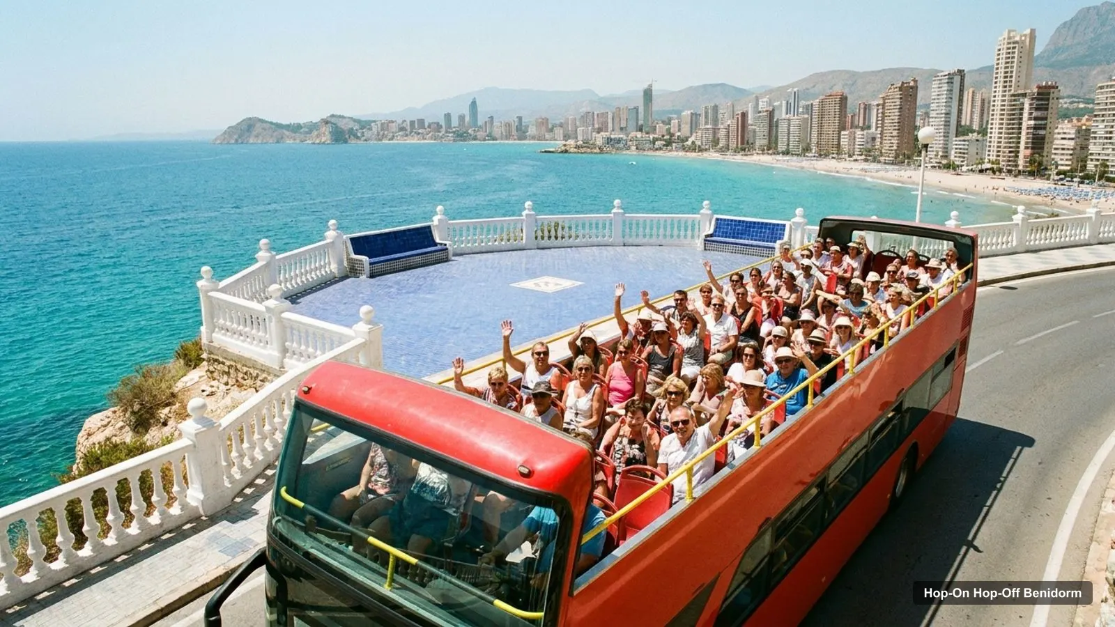
A Benidorm tourist map makes more sense once you see the town as three groups of places: the Old Town on the headland, the two beaches either side, and the longer-distance attractions inland and along the coast. I’ve put the top 20 attractions, ranked by Google Maps reviews, on one page with coordinates and a Google Maps link for each. To see which of them the sightseeing buses reach, read my page on hop-on hop-off in Benidorm.
Benidorm Tourist Map Pdf
There’s no PDF on this page, but the route map below does the same job, and you can print the page. If you want a paper map with street names, ask at the tourist office. The official sightseeing bus page gives a tourist assistance phone, 965 85 13 11, and an email address, benidorm@touristinfo.net, and I haven’t verified whether they hand out a printed map. The numbers in the image match the first table.
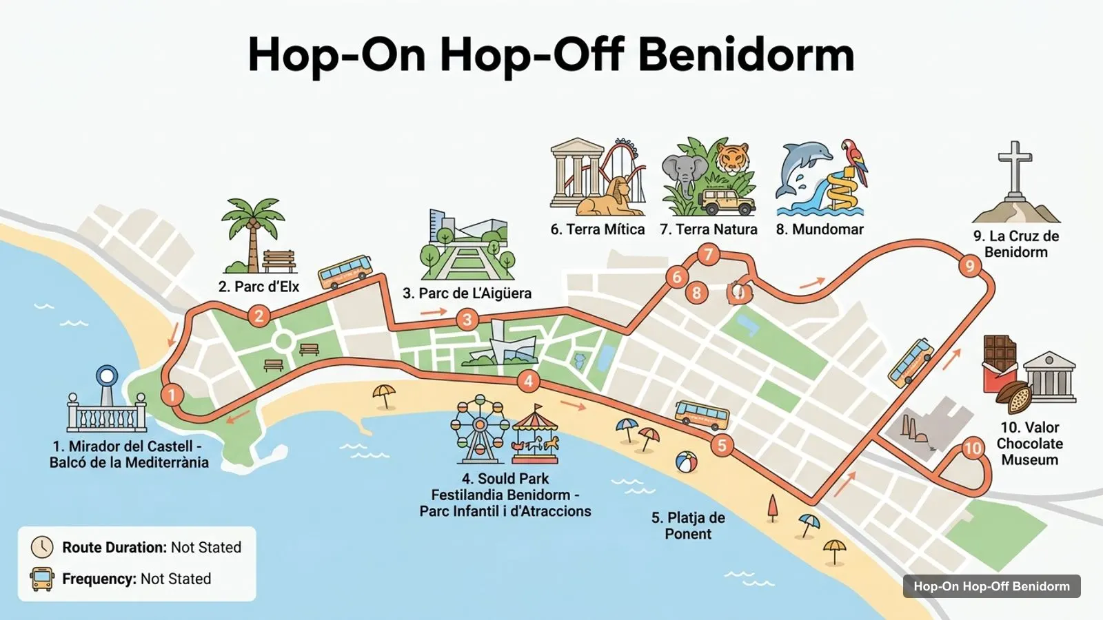
Stops on the route
- 1Mirador del Castell - Balcó de la Mediterrània
- 2Parc d'Elx
- 3Parc de L'Aigüera
- 4Sould Park Festilandia Benidorm - Parc Infantil i d'Atraccions
- 5Platja de Ponent
- 6Terra Mítica
- 7Terra Natura
- 8Mundomar
- 9La Cruz de Benidorm
- 10Valor Chocolate Museum
Benidorm Tourist Bus Stops Map
The map shows ten places in the order I’d visit them. It is a map of sights, not a list of confirmed bus stops, because the official page names streets and areas rather than numbered stops. What the official text does say is this. Line 30 runs Av. Mediterraneo, city centre, Parque de Elche, Poniente promenade, Cala de Finestrat. Line 31 runs Av. Ametlla de Mar, Av. Severo Ochoa, El Albir beach, Altea.
| # | Place | Address | Map |
|---|---|---|---|
| 1 | Mirador del Castell - Balcó de la Mediterrània | Plaça de Castelar | Find on Google Maps |
| 2 | Parc d’Elx | C. del Alcalde José Such Ortega | Find on Google Maps |
| 3 | Parc de L’Aigüera | C. Primavera | Find on Google Maps |
| 4 | Sould Park Festilandia Benidorm - Parc Infantil i d’Atraccions | Av. del Mediterráneo | Find on Google Maps |
| 5 | Platja de Ponent | 03502 Benidorm | Find on Google Maps |
| 6 | Terra Mítica | Partida del Moralet | Find on Google Maps |
| 7 | Terra Natura | Foia del Verdader | Find on Google Maps |
| 8 | Mundomar | Carrer Serra Gelada | Find on Google Maps |
| 9 | La Cruz de Benidorm | C. Taywan | Find on Google Maps |
| 10 | Valor Chocolate Museum | Avinguda Pianista Gonzalo Soriano | Find on Google Maps |
Benidorm Tourist Attractions
These are the top 20 tourist attractions in Benidorm by Google Maps review count. I left out bus stations, tour offices and places outside the Benidorm area, such as the Valor Chocolate Museum in La Vila Joiosa, which is about 9.1 km away. The distance column is the straight-line distance from the Mirador del Castell, the Old Town viewpoint.
| # | Attraction | Rating | Reviews | Lat, Lng | km from viewpoint | Map |
|---|---|---|---|---|---|---|
| 1 | Mirador del Castell - Balcó de la Mediterrània | 4.8 | 24,287 | 38.5332, -0.1315 | 0.0 | Map |
| 2 | Terra Mítica | 4 | 18,826 | 38.5594, -0.1578 | 3.7 | Map |
| 3 | Terra Natura | 4.3 | 14,309 | 38.5689, -0.1446 | 4.1 | Map |
| 4 | Platja de Ponent | 4.5 | 11,654 | 38.5363, -0.1469 | 1.4 | Map |
| 5 | Mundomar | 4.5 | 10,735 | 38.5428, -0.0930 | 3.5 | Map |
| 6 | Parc d’Elx | 4.4 | 7,742 | 38.5365, -0.1327 | 0.4 | Map |
| 7 | La Cruz de Benidorm | 4.7 | 6,485 | 38.5317, -0.0959 | 3.1 | Map |
| 8 | Sould Park Festilandia Benidorm - Parc Infantil i d’Atraccions | 4 | 5,368 | 38.5366, -0.1216 | 0.9 | Map |
| 9 | Parc de L’Aigüera | 4.3 | 3,015 | 38.5422, -0.1304 | 1.0 | Map |
| 10 | Cala Tio Ximo | 4.4 | 2,940 | 38.5280, -0.1040 | 2.5 | Map |
| 11 | Mirador de l’Ermita Verge del Mar | 4.7 | 1,838 | 38.5261, -0.1622 | 2.8 | Map |
| 12 | Passeig Marítim de Benidorm | 4.6 | 1,700 | 38.5358, -0.1209 | 1.0 | Map |
| 13 | Llevant Beach, Benidorm | 4.6 | 1,624 | 38.5352, -0.1175 | 1.2 | Map |
| 14 | Tossal de la cala | 4.7 | 1,338 | 38.5253, -0.1616 | 2.8 | Map |
| 15 | Mirador de Sant Jaume | 4.7 | 682 | 38.5335, -0.1312 | 0.0 | Map |
| 16 | Benidorm Viewpoint | 4.7 | 379 | 38.5277, -0.1059 | 2.3 | Map |
| 17 | Museo Boca del Calvari | 4.3 | 323 | 38.5364, -0.1311 | 0.4 | Map |
| 18 | Finestrat Cove | 4.7 | 212 | 38.5247, -0.1674 | 3.3 | Map |
| 19 | Torre Punta del Cavall o Seguró | 4.6 | 92 | 38.5250, -0.0963 | 3.2 | Map |
| 20 | Puerto de Alejandría | 4.2 | 86 | 38.5600, -0.1594 | 3.8 | Map |
Benidorm Tourist Information
The tourist office page for the city sightseeing tour is the best official source I found. It lists the lines, the ticket types (24-hour, 72-hour and 7-day tourist cards, single tickets and the rechargeable TarjetaBus) and the languages, which are Spanish, English, French, German and Russian. It gives no fares or timetable, so call Tourist Assistance on 965 85 13 11 or email benidorm@touristinfo.net. You can read the page yourself on the Benidorm tourism site.
Benidorm Tourist Guide
Here is how I’d read the map as a short guide, in three groups.
The Old Town. The Mirador del Castell (24,287 reviews, 4.8) is the centre of the group. Parc d’Elx is 0.38 km away, the Plaza de SS. MM. els Reis d’Espanya is about 0.7 km away, and the Hort de Colon Museum is about 0.45 km away. This is the walking group.
The beaches and the strip. The Passeig Maritim and Llevant beach are about 1 and 1.2 km east of the viewpoint. Poniente beach is about 1.4 km west. Sould Park Festilandia is on Av. del Mediterraneo, about 0.9 km away. This is the group served by the line 30 route text.
Outlying places. La Cruz de Benidorm is about 3.1 km east. Mundomar is about 3.5 km, Terra Mitica 3.7 km and Terra Natura 4.1 km. Cala Tio Ximo is about 2.5 km and the Ermita viewpoints about 2.8 km. These need a bus, taxi or car, and the official route text does not name the theme parks. For a day plan, see my Benidorm itinerary, and for ratings and notes on every place, see the best things to do in Benidorm.
Places to Avoid in Benidorm
I don’t have data that tells me to avoid any area, and I won’t invent warnings. What the data does show is where the lower ratings are. Among the attractions, Terra Mitica is rated 4.0 and Sould Park Festilandia 4.0, against 4.3 to 4.5 for the other parks, and the main bus station on Carrer Francisco Llorca Anton is rated 3.4. I’d read recent reviews before paying for an attraction, check the bus timetable before relying on it, and keep the usual care with belongings in crowded places.
Getting Between the Clusters
The first thing the coordinates tell you is that the Old Town and the beaches are close and everything else is not. The viewpoint to the Passeig Maritim is under 1 km, so walking is the sensible choice there. The viewpoint to Terra Natura is about 4.1 km, and the table gives the straight-line figure, so the real road distance will be longer. For those trips I’d look at the sightseeing bus lines first, then at the public bus and taxis.
The sightseeing buses help most on the long thin axis of the town. Line 30 follows Av. Mediterraneo, the centre, Parque de Elche and the Poniente promenade to Cala de Finestrat, according to the official route text. That links the strip, the Old Town edge, the western beach and the cove at the far end. Line 31 leaves town for El Albir beach and Altea. If a place on the map is not on those routes, treat the bus as unconfirmed and check before you commit your day to it.
Reading the Coordinates
The table gives latitude and longitude to four decimals, which is accurate to roughly ten metres, and a Google Maps link that opens the place itself. If you paste the coordinates into a map app instead, you’ll land on the same spot. The distance column uses the Mirador del Castell as the centre because it is the most-reviewed place in my data and sits in the middle of the Old Town. Distances are straight lines, so use them to compare places, not to time a walk.
A few quick comparisons help. The three most-reviewed places after the viewpoint are all theme parks, Terra Mitica, Terra Natura and Mundomar, so a map sorted by popularity looks very different from a map sorted by distance. If you sort by distance instead, the closest places are the Old Town park, the museums, the main square, the amusement park, the promenade and the two beaches. That is why I’d start a first morning in the Old Town and save the outlying places for a second or third day.
Which Places Suit Which Visitor
For a short stay, I’d use the first six places on the map and nothing else: the Mirador del Castell, Parc d’Elx, the Passeig Maritim, Levante beach, Poniente beach and Sould Park. They sit inside about 1.4 km of the viewpoint and need no ticket except the amusement park. For a longer stay, add La Cruz de Benidorm, rated 4.7 from 6,485 reviews, and one of the three big parks. For a quiet afternoon, the coves and the Ermita viewpoints are rated 4.4 to 4.7 and are less busy by their review counts, though I haven’t checked how crowded they get.
Using the Map
Pick one cluster per half day, check the ride before you commit, and save the Google Maps links you need to your phone. When you’ve chosen a base, my page on the Benidorm sightseeing bus explains the lines and ticket types, and the home page has the rest of the site.
Frequently asked questions
Is there a printable Benidorm tourist map?
This page works as one. The route map image numbers ten places, and the tables below list the top 20 attractions with coordinates and Google Maps links. Print the page, or open any Google Maps link and save the place to your phone for offline use. I don't host an official PDF, and I haven't verified one from the tourist office.
Where are most Benidorm attractions on the map?
In three groups. The Old Town cluster has the Mirador del Castell, Parc d'Elx and the museums. The beach cluster runs along Levante and Poniente. The outlying cluster has the theme parks, Terra Natura, Terra Mitica and Mundomar, roughly 3.5 to 4.1 km from the Old Town viewpoint, plus La Cruz de Benidorm at about 3.1 km.
Where does the Benidorm tourist bus go?
Per the official tourist office page, line 30 runs Av. Mediterraneo, city centre, Parque de Elche, Poniente promenade, Cala de Finestrat. Line 31 runs Av. Ametlla de Mar, Av. Severo Ochoa, El Albir beach, Altea. The page names areas rather than a numbered stop list, so I don't publish one.
How far apart are the main sights in Benidorm?
The Old Town viewpoint is about 0.4 km from Parc d'Elx, 1 km from the Passeig Maritim and 1.4 km from Poniente beach. The theme parks are 3.5 to 4.1 km away in a straight line, and the Valor Chocolate Museum in La Vila Joiosa is about 9.1 km away.