Bath Tourist Map: Top Attractions & Bus Stops
By Jake Dawson · Updated · Affiliate links, explained in my disclosure
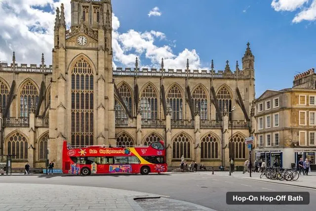
City Sightseeing UK
Bath: City Sightseeing Hop-On Hop-Off Bus & Bookable Extras
4.5 (500) · from $33.19
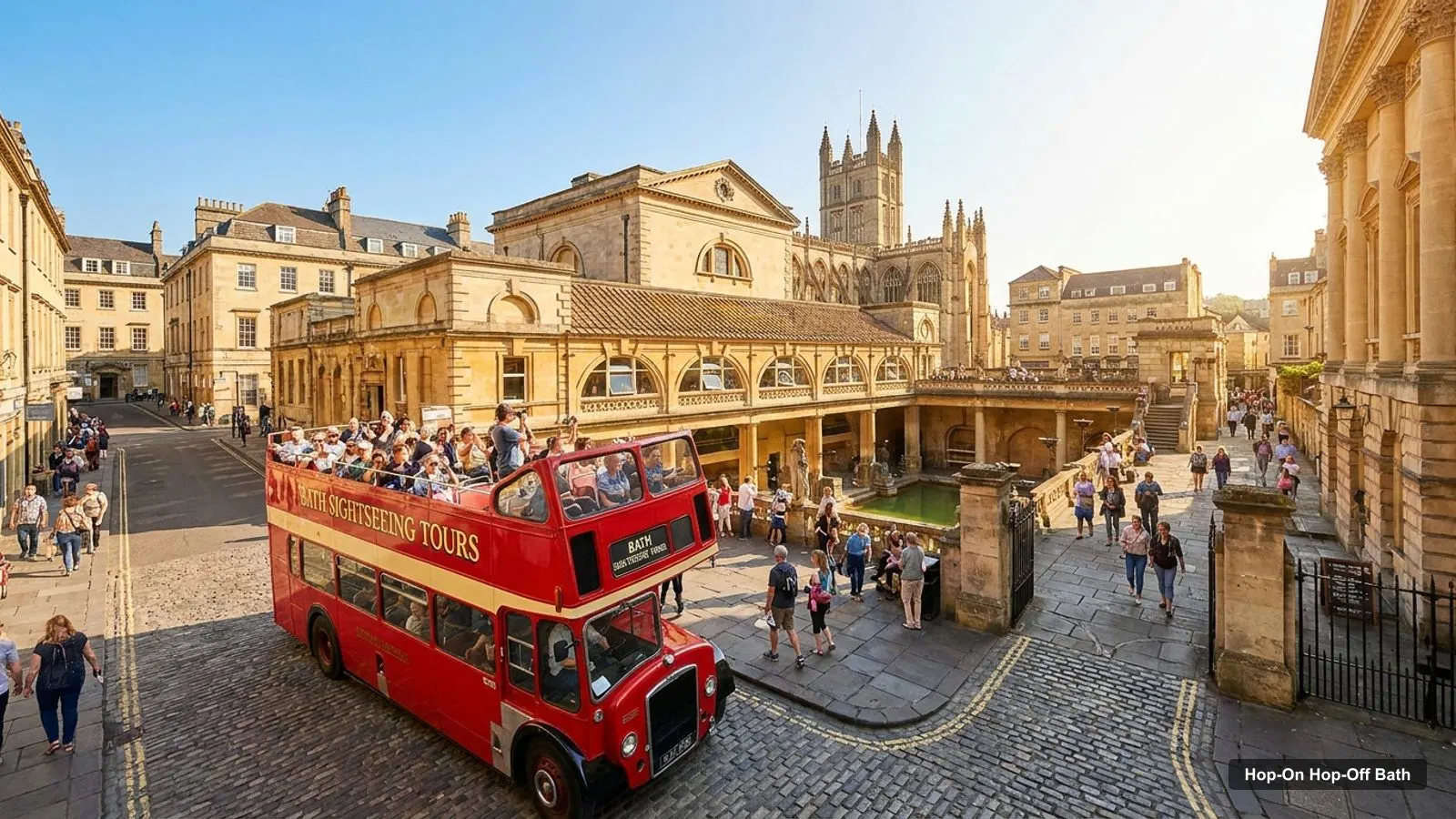
This Bath tourist map page puts the City Sightseeing bus stops and the most-reviewed attractions on one page, with links that open in Google Maps. It is the companion to my hop-on hop-off Bath guide, which has the ticket price and timetable. I’m Jake, and everything here comes from my files: the stop list in the listing, the Google Maps place cards and distances I worked out from the coordinates.
I haven’t drawn a map by hand, so use the Google Maps links when you need the exact pin. Bath is a city in Somerset, England, and every attraction below is in the city or, where I say so, a named distance away.
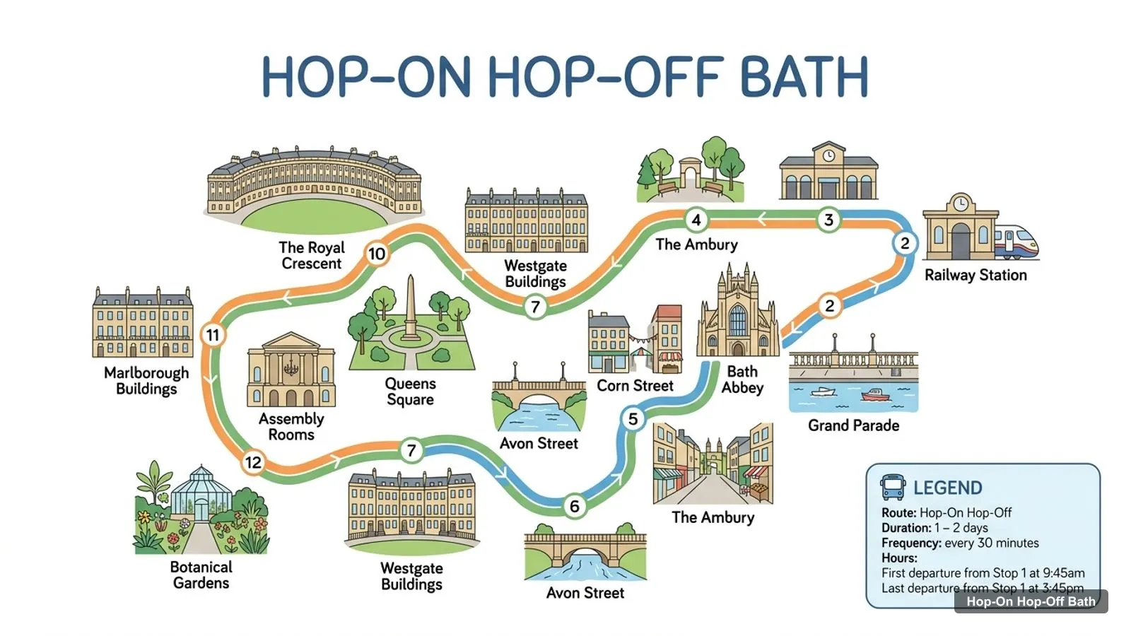
Stops on the route
- 1Bath Abbey
- 2Grand Parade
- 3Railway Station
- 4The Ambury
- 5Corn Street
- 6Avon Street
- 7Westgate Buildings
- 8Queens Square
- 9Assembly Rooms
- 10The Royal Crescent
- 11Marlborough Buildings
- 12Botanical Gardens
Bath Tour Map: The Bus Stops
The listing names 37 stops in all, split across the City Tour with 16 and the Skyline Tour with 21. The table below is the first 12 City Tour stops in order, starting at Bath Abbey, which is also the meeting point. Each link opens a Google Maps search for the stop name in Bath, so check the pin on the day, because stops can move or be out of service.
| # | Stop | Map |
|---|---|---|
| 1 | Bath Abbey | Find on Google Maps |
| 2 | Grand Parade | Find on Google Maps |
| 3 | Railway Station | Find on Google Maps |
| 4 | The Ambury | Find on Google Maps |
| 5 | Corn Street | Find on Google Maps |
| 6 | Avon Street | Find on Google Maps |
| 7 | Westgate Buildings | Find on Google Maps |
| 8 | Queens Square | Find on Google Maps |
| 9 | Assembly Rooms | Find on Google Maps |
| 10 | The Royal Crescent | Find on Google Maps |
| 11 | Marlborough Buildings | Find on Google Maps |
| 12 | Botanical Gardens | Find on Google Maps |
The City Tour continues past the Botanical Gardens to Playground, Comfortable Place, Royal Avenue and Milsom Street, which is stop 16. The Skyline Tour then has its own 21 stops: Dorchester Street, Terrace Walk, North Parade, Great Pulteney Street and the Holburne Museum, followed by the hillside run through Bathwick Hill, Widcombe Hill, Claverton Down and Prior Park, ending at Widcombe. That gives you the shape of the loop: the first covers the middle of town, the second climbs east and south and returns.
Bath Tourist Attractions: The Top 20 on the Map
This table ranks the 20 most-reviewed places in my Google Maps data. I removed the City Sightseeing bus stop listing and a railway buffet, which are not sights. The coordinates are latitude and longitude, and each map link opens the place on Google Maps. Six of the 20 are outside the city centre: Lacock Abbey, Haynes Motor Museum, Avebury Manor, Farleigh Hungerford Castle, the American Museum & Gardens and Dundas Aqueduct.
| # | Attraction | Rating | Reviews | Coordinates | Map |
|---|---|---|---|---|---|
| 1 | The Roman Baths | 4.6 | 40,902 | 51.3811, -2.3596 | Open map |
| 2 | Thermae Bath Spa | 4.2 | 10,671 | 51.3804, -2.3615 | Open map |
| 3 | Pulteney Bridge | 4.6 | 10,364 | 51.3830, -2.3580 | Open map |
| 4 | Royal Victoria Park | 4.6 | 8,523 | 51.3862, -2.3720 | Open map |
| 5 | Bath Abbey | 4.6 | 7,453 | 51.3815, -2.3587 | Open map |
| 6 | Lacock Abbey | 4.6 | 6,610 | 51.4156, -2.1171 | Open map |
| 7 | Sally Lunn’s Historic Eating House & Museum | 4.4 | 6,450 | 51.3808, -2.3582 | Open map |
| 8 | Royal Crescent | 4.6 | 4,825 | 51.3862, -2.3687 | Open map |
| 9 | Haynes Motor Museum | 4.7 | 3,105 | 51.0409, -2.5577 | Open map |
| 10 | No. 1 Royal Crescent | 4.5 | 2,755 | 51.3866, -2.3671 | Open map |
| 11 | The Circus - Bath | 4.5 | 2,590 | 51.3859, -2.3641 | Open map |
| 12 | The Holburne Museum | 4.4 | 1,893 | 51.3857, -2.3509 | Open map |
| 13 | National Trust - Avebury Manor | 4.6 | 1,537 | 51.4289, -1.8589 | Open map |
| 14 | American Museum & Gardens | 4.5 | 1,336 | 51.3750, -2.3113 | Open map |
| 15 | Farleigh Hungerford Castle | 4.6 | 1,178 | 51.3174, -2.2866 | Open map |
| 16 | Victoria Art Gallery | 4.3 | 1,108 | 51.3827, -2.3586 | Open map |
| 17 | Dundas Aqueduct | 4.7 | 978 | 51.3615, -2.3107 | Open map |
| 18 | Bath Skyline | 4.7 | 959 | 51.3781, -2.3419 | Open map |
| 19 | The Bath Lookout | 4.8 | 833 | 51.3743, -2.3582 | Open map |
| 20 | Herschel Museum of Astronomy | 4.5 | 622 | 51.3825, -2.3669 | Open map |
Which Bath Attractions Sit Together
Bath is small enough that clusters matter more than distance. Here is how I group the top sights, using the coordinates above and Bath Abbey, Stop 1, as the reference point.
The Abbey cluster. The Roman Baths are about 60 metres from the Abbey stop, Sally Lunn’s about 90 metres, the Victoria Art Gallery about 140 metres, Pulteney Bridge about 190 metres and Thermae Bath Spa about 220 metres. That is five sights in a 230 metre radius, and it is why I tell people the bus is not for this part.
The Crescent cluster. The Royal Crescent is about 860 metres from the Abbey stop, and No. 1 Royal Crescent is about 120 metres from the Crescent. The Circus is about 320 metres from the Crescent, the Herschel Museum of Astronomy about 430 metres from The Circus, and Royal Victoria Park about 230 metres from the Crescent. The Royal Crescent is a named bus stop, so this is the easiest cluster to reach by bus.
The east side. The Holburne Museum is about 730 metres from the Abbey stop, a named Skyline stop, and about 580 metres from Pulteney Bridge. Bath Skyline is about 1.05 km further on, and Bathwick Hill is a named stop there.
Outside the centre. The American Museum & Gardens is about 3.4 km away, Dundas Aqueduct about 4 km, Farleigh Hungerford Castle about 9 km and Lacock Abbey about 17 km. Avebury Manor is about 35 km and Haynes Motor Museum about 40 km. None are on the bus route, so treat them as separate trips.
Is Bath Worth Visiting? What the Map Tells You
The map answers that question better than any slogan. Fourteen of the 20 places are within about 1.5 km of Bath Abbey, and the ratings are tightly bunched: of the 20 places in the table, only Thermae Bath Spa (4.2) and the Victoria Art Gallery (4.3) fall below 4.4. The Bath Lookout has the top rating, 4.8, though from only 833 reviews. So I would not choose between sights on the score. Distance, opening hours and the weather matter more.
The Roman Baths lead with 40,902 reviews, nearly four times the next place, and I would put them at the centre of your Bath tourist map. Wikipedia describes Bath as known for and named after its Roman-built baths, and the city became a UNESCO World Heritage Site in 1987. That is why the other sights feel like a supporting cast.
What Is Bath Famous For
Bath is famous for the Roman Baths and for Georgian architecture in Bath stone: the Royal Crescent, The Circus and the Assembly Rooms, where Beau Nash presided over social life from 1705 until his death in 1761, according to Wikipedia. Jane Austen lived in the city in the early 19th century. Wikipedia also lists Bath among the Great Spa Towns of Europe.
On the map, you can see all of that in about two kilometres. The Georgian crescent and circus sit in the north-west, the Roman and Abbey sights in the middle, and the Holburne Museum and Pulteney Bridge on the east side, with the hills beyond. If you want the official side, the Roman Baths site and Visit Bath have current hours, events and any closures.
Bath Visitor Map: Using It With a Ticket
A good visitor map is one you can act on. Mine is built so you can copy a pair of coordinates into Google Maps, drop a pin, and save the three or four places you care about to a list. Then add the nearest bus stops from the stop table, and you have a route that fits the half-hour timetable. I would also screenshot the map before you leave your hotel, in case your signal drops.
The easiest way to use this page is to pick three or four sights from the table, check which cluster each belongs to, and choose the nearest stops. The City Sightseeing ticket starts at $33.19 and covers all 37 listed stops. The buses run every 30 minutes, with the City Tour’s last departure from Stop 1 at 3:45pm and the Skyline Tour’s at 5:30pm, so pick your last hop-off before that.
If you want help planning days, my Bath itinerary puts these clusters into one, two and three-day plans, and the best things to do in Bath ranks the top 12 sights. When you are ready to book, go back to the Bath bus tour guide for prices and ratings. And for the rest of the site, the home page has more cities.
Frequently asked questions
What are the main tourist attractions in Bath?
By Google reviews, the Roman Baths lead with 40,902 reviews and a 4.6 rating, followed by Thermae Bath Spa, Pulteney Bridge, Royal Victoria Park and Bath Abbey. Lacock Abbey and Haynes Motor Museum also rank high, but they are 17 km and 40 km from the Abbey stop, so they are separate trips.
Is Bath worth visiting?
Yes, if you like history and architecture on a walkable scale. Bath is a UNESCO World Heritage Site, and 14 of the 20 places in my table are within about 1.5 km of the first bus stop. Ratings are high too, with most sights between 4.4 and 4.7 on Google, so you will not struggle to fill a day.
What is Bath famous for?
Bath is famous for its Roman-built baths, which gave the city its name, and for Georgian architecture in Bath stone, including the Royal Crescent and The Circus. Wikipedia also notes Jane Austen lived there in the early 19th century. It became a UNESCO World Heritage Site in 1987.
Where is the hop-on hop-off bus stop in Bath?
The City Tour starts at Bath Abbey, Bath BA1 1NA, which is Stop 1. Google Maps shows the bus stop beside the Abbey, about 60 metres from the Roman Baths. It lists the stop open 9:45 AM to 5 PM. The Skyline Tour list starts at Dorchester Street, so check the stop name before you board.
Is there a printable Bath visitor map?
The listing gives me a stop list but no map file, so I have not found one I can link. This page gives Google Maps links for every stop and attraction instead. Visit Bath, the city's official tourism site, is the place I would check for a printed visitor map.
How far is the Royal Crescent from Bath Abbey?
The Royal Crescent is about 860 metres from Bath Abbey in a straight line, using the coordinates in my Google Maps data. That is a 10 to 15 minute walk, or a short City Tour ride, because The Royal Crescent is a named bus stop. The Circus sits roughly 320 metres from the Crescent.
Tours I compared in Bath
My full review of each one, in the order I rank them:
- Bath: City Sightseeing Hop-On Hop-Off Bus & Bookable Extras★ 4.5 · from $33.19