
TopView®
Austin: Tea Around Town Bus Tour with Live Music
- 3.7 (13 reviews)
- 1.5 hours
My pick: The one tour I can book in Austin: a tea bus loop of the downtown core, worth it as an event, not as transport.
By Jake Dawson · Updated · Affiliate links, explained in my disclosure
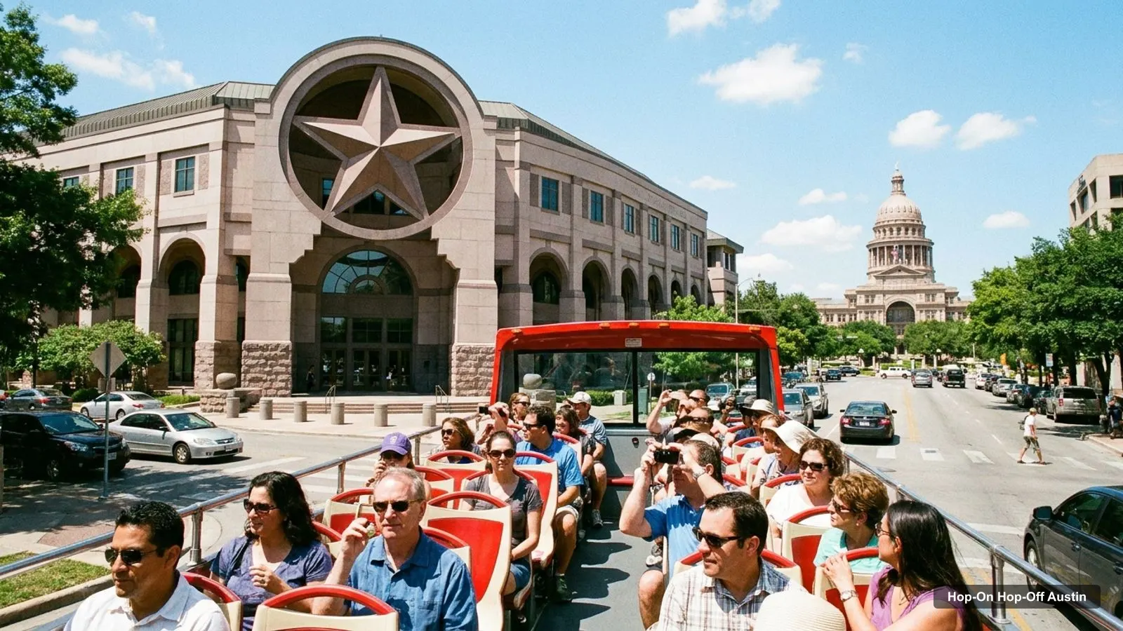
An Austin tourist map is easier to use once you know the city has three groups of sights. I’ve put the top 20 attractions, ranked by Google Maps reviews, and the seven Double Decker bus stops on one page, with coordinates and a Google Maps link for each. For the bus itself, see my hop-on hop-off Austin guide.
Ratings and coordinates are from Google Maps, and the bus stops are from the operator’s site. All checked 8 October 2026.
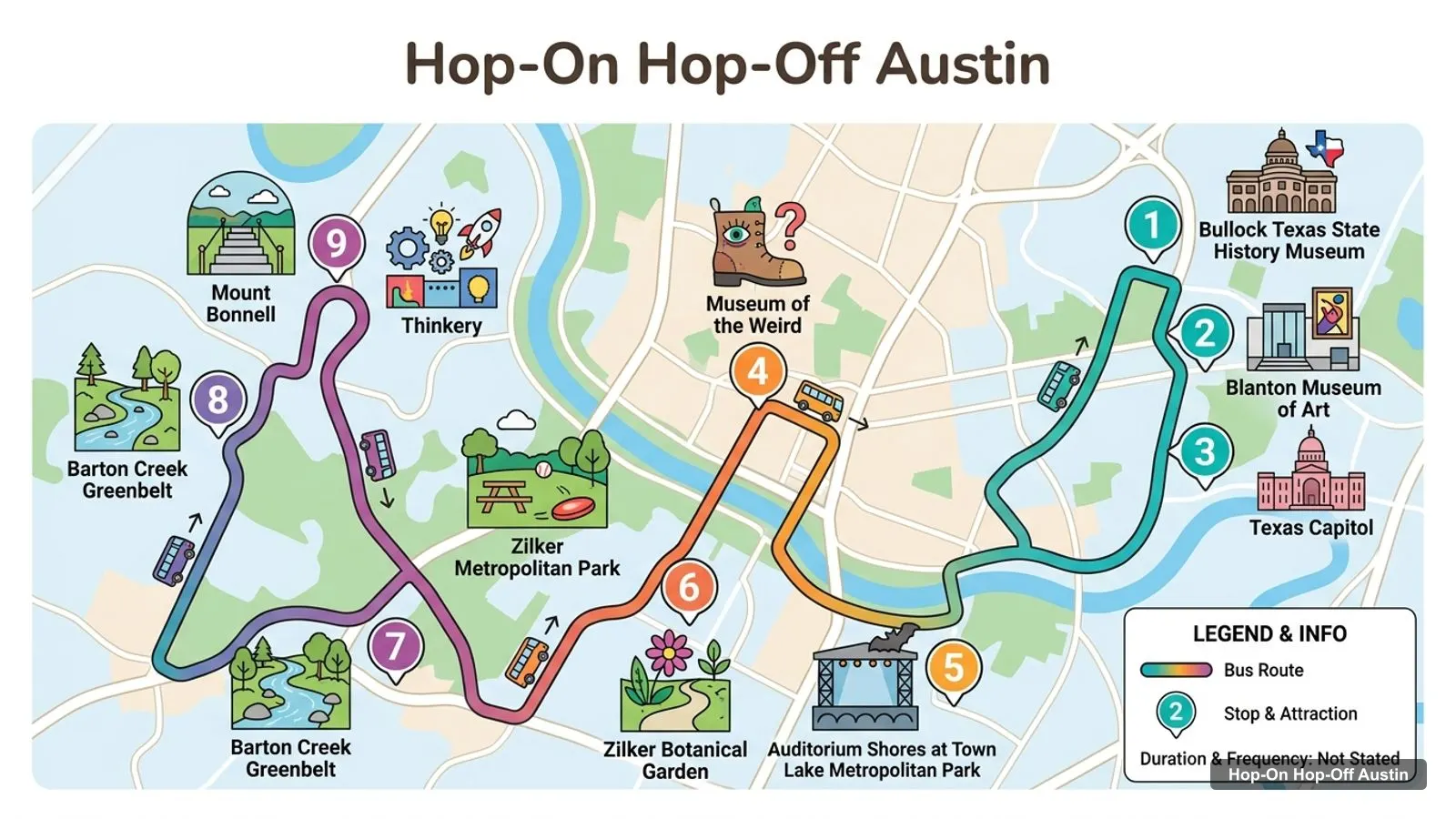
The Austin tourist attractions map below is a sketch of the main sights, drawn from place names. It is not the operator’s route, so use their map for exact streets. The Double Decker loop has seven stops, starting at the Austin Visitor Center and running through downtown, the Capitol and the university area to South Congress.
Stops on the route
| # | Stop | Address | Map |
|---|---|---|---|
| 1 | Austin Visitor Center | 103 E. 5th Street | Find on Google Maps |
| 2 | 6th Street / Driskill Hotel | 604 Brazos Street | Find on Google Maps |
| 3 | State Capitol | 1100 Congress Avenue | Find on Google Maps |
| 4 | LBJ Presidential Library | 2313 Red River Street | Find on Google Maps |
| 5 | Bullock Texas State History Museum | 1800 Congress Avenue | Find on Google Maps |
| 6 | South Congress District, South Stop (Joanne’s Fine Foods) | 1224 South Congress Avenue | Find on Google Maps |
| 7 | South Congress District, North Stop (The South Congress Hotel) | 1603 South Congress Avenue | Find on Google Maps |
The loop takes about 75 to 90 minutes depending on traffic, according to the operator. Prices and departure times were not on the pages I read.
| # | Place | Map |
|---|---|---|
| 1 | Bullock Texas State History Museum | Open in Google Maps |
| 2 | Blanton Museum of Art | Open in Google Maps |
| 3 | Texas Capitol | Open in Google Maps |
| 4 | Museum of the Weird | Open in Google Maps |
| 5 | Auditorium Shores at Town Lake Metropolitan Park | Open in Google Maps |
| 6 | Zilker Metropolitan Park | Open in Google Maps |
| 7 | Zilker Botanical Garden | Open in Google Maps |
| 8 | Barton Creek Greenbelt | Open in Google Maps |
| 9 | Mount Bonnell | Open in Google Maps |
| 10 | Thinkery | Open in Google Maps |
This is the Austin tourist attractions list in table form, ranked by Google Maps reviews, with coordinates. I left out tour operators and bus charters. Each link opens the place in Google Maps.
| # | Attraction | Coordinates | Google rating | Map |
|---|---|---|---|---|
| 1 | Bullock Texas State History Museum | 30.28034, -97.73907 | 4.7 (7,492) | Open in Google Maps |
| 2 | Zilker Metropolitan Park | 30.26698, -97.77297 | 4.8 (6,285) | Open in Google Maps |
| 3 | Zilker Botanical Garden | 30.26976, -97.77218 | 4.6 (6,029) | Open in Google Maps |
| 4 | Thinkery | 30.29742, -97.70497 | 4.6 (5,700) | Open in Google Maps |
| 5 | Texas Capitol | 30.27467, -97.74035 | 4.7 (5,297) | Open in Google Maps |
| 6 | Auditorium Shores at Town Lake Metropolitan Park | 30.26147, -97.75221 | 4.7 (4,880) | Open in Google Maps |
| 7 | Barton Creek Greenbelt | 30.24717, -97.81269 | 4.7 (4,518) | Open in Google Maps |
| 8 | Museum of the Weird | 30.26717, -97.73867 | 4.2 (3,895) | Open in Google Maps |
| 9 | Blanton Museum of Art | 30.28081, -97.73768 | 4.7 (3,785) | Open in Google Maps |
| 10 | Mount Bonnell | 30.32116, -97.77354 | 4.8 (1,664) | Open in Google Maps |
| 11 | Texas Military Forces Museum | 30.31382, -97.76117 | 4.8 (1,643) | Open in Google Maps |
| 12 | LBJ Presidential Library | 30.28586, -97.72925 | 4.7 (1,548) | Open in Google Maps |
| 13 | Umlauf Sculpture Garden + Museum | 30.26326, -97.76616 | 4.5 (1,362) | Open in Google Maps |
| 14 | Cathedral of Junk | 30.21865, -97.77157 | 4.5 (1,234) | Open in Google Maps |
| 15 | Mexic-Arte Museum | 30.26684, -97.74279 | 4.4 (1,116) | Open in Google Maps |
| 16 | Statesman Bat Observation Center | 30.25982, -97.74548 | 4.3 (1,108) | Open in Google Maps |
| 17 | Texas Science & Natural History Museum | 30.28703, -97.73235 | 4.5 (1,040) | Open in Google Maps |
| 18 | Sculpture Falls | 30.26185, -97.82353 | 4.6 (753) | Open in Google Maps |
| 19 | Pioneer Farms | 30.36846, -97.65908 | 4.5 (704) | Open in Google Maps |
| 20 | Stevie Ray Vaughan Statue | 30.26309, -97.75069 | 4.8 (684) | Open in Google Maps |
Austin’s sights fall into three clusters, and the distances show why. Downtown holds the Texas Capitol, the Mexic-Arte Museum (0.0 km from the Visitor Center) and the Museum of the Weird (0.4 km). The Bullock Museum is 0.6 km north of the Capitol, and the Blanton is 0.1 km further.
South of the river, Zilker Metropolitan Park, Zilker Botanical Garden and Auditorium Shores sit within about 2.1 km of each other. Barton Creek Greenbelt is 4.4 km west of Zilker Park. Mount Bonnell is 6.8 km from the Visitor Center, and Thinkery is 5.0 km.
The Double Decker loop covers the downtown cluster and the university stops. For the south side, I’d use a city bus or a rideshare. CapMetro lists a local ride at $1.25 and a day pass at $2.50.
Downtown is the walkable cluster. From the Texas Capitol, the Museum of the Weird is 0.8 km away and the Mexic-Arte Museum is 0.9 km away. The O. Henry Museum, at 409 E 5th St, is 1.0 km from the Capitol and rated 4.6 from 109 reviews. All four are within a short stroll of the Austin Visitor Center, so this is where I’d start with the map open.
The Bullock Museum is the northern end of this cluster. It sits 0.6 km north of the Capitol along Congress Avenue and has 7,492 Google reviews, the most of any Austin attraction. The Double Decker loop stops at both.
North of the Capitol, the University of Texas campus holds the Blanton Museum of Art, the LBJ Presidential Library, the Harry Ransom Center and the Texas Science and Natural History Museum. The Blanton is 0.7 km from the Capitol, and the LBJ Library is 1.6 km. The Harry Ransom Center (4.8 from 189 reviews) is 0.5 km from the Blanton. The LBJ Library is stop 4 on the Double Decker loop, so it is the easiest campus sight to reach by bus.
South of Lady Bird Lake, Auditorium Shores is 1.9 km from the Capitol in a straight line. From there the Stevie Ray Vaughan Statue is 0.2 km along the trail, and the Statesman Bat Observation Center is 0.7 km east. Zilker Metropolitan Park is 2.1 km west of Auditorium Shores. The Umlauf Sculpture Garden (4.5 from 1362 reviews) sits between them, 0.8 km from Zilker Park, but it is closed on Mondays and Fridays.
The Double Decker loop reaches this side only at the two South Congress stops, so most south-side sights need a separate ride.
Mount Bonnell is 6.1 km from the Capitol, and Barton Creek Greenbelt is further still. I’d treat both as outdoor half days with a rideshare, and not try to add them to a downtown day.
The quickest way to use this page is to open three or four Google Maps links and save them to a list. Pick a cluster for each half day. Mix one museum and one outdoor stop, and check opening hours before you go: Thinkery, the Blanton and the Umlauf Sculpture Garden are closed on some weekdays. Coordinates in the table are from Google Maps, so you can paste them into any navigation app.
The Austin Visitor Center is at 103 E 5th Street, in downtown Austin. It is also stop 1 on the Double Decker loop. I don’t have its opening hours, so check before you go. The Museum of the Weird and the Mexic-Arte Museum are both within about 0.4 km of it, which makes it a good place to start on foot.
Moving between clusters is the part of an Austin tourist map that people underestimate. Downtown to the university area is a walk of 1 to 2 km, which is fine in cool weather and tiring in August, when Open-Meteo shows an average high of 35.8 C. Downtown to Zilker is further, and the Double Decker loop does not stop there.
My routine would be simple. Walk within a cluster, ride between clusters, and keep the longest outdoor walk for the morning. CapMetro’s local day pass at $2.50 covers a whole service day, from 4 a.m. to 3:59 a.m., which is cheaper than a single rideshare. If you want the commentary, the Double Decker loop is the one to choose for the downtown and university stops.
Is Austin worth visiting? On the data, yes: the 20 attractions in the table have ratings between 4.2 and 4.8, and the top five have more than 4,500 reviews each. The weather is hot, with 2025 average highs above 30 C from May to October in Open-Meteo data. I’d visit in spring or autumn, or plan outdoor stops early in the day.
Free attractions in Austin on this map include Zilker Metropolitan Park, Auditorium Shores, Mount Bonnell, Barton Creek Greenbelt, the Stevie Ray Vaughan Statue and the Congress Avenue bat observation area. Parking and entry rules vary, and I have no fee data, so check the city park pages.
If you’d rather book one thing, the Tea Around Town bus tour costs $69 per person for 1.5 hours and meets at 650 E 10th St, 0.7 km from the Capitol.
TopView®
My pick: The one tour I can book in Austin: a tea bus loop of the downtown core, worth it as an event, not as transport.
For a day-by-day plan, see my Austin itinerary. For a ranked list with hours, read the best things to do in Austin. My home page lists the other cities. If you are weighing the bus, my Austin bus tour and ticket guide explains the options.
This page works as one. The route sketch shows the main attractions, and the tables list the seven Double Decker bus stops and the top 20 attractions with coordinates. Print the page or open any Google Maps link to save the places to your own map.
In three groups. Downtown has the Texas Capitol, the Museum of the Weird and the Mexic-Arte Museum. The university area has the Blanton and the LBJ Library. South of the river has Zilker Park, the botanical garden and Auditorium Shores. Mount Bonnell and Barton Creek sit further out.
The Texas Capitol and the Bullock Museum are about 0.6 km apart in a straight line. Zilker Metropolitan Park is about 3.2 km south-west of the Capitol. Mount Bonnell is about 6.1 km north-west of it.
Several. Zilker Metropolitan Park, Auditorium Shores, Mount Bonnell and Barton Creek Greenbelt are open daily 5 AM to 10 PM on Google Maps, and the bat observation area and the Stevie Ray Vaughan Statue are listed as open 24 hours. Check each for parking fees.
My full review of each one, in the order I rank them: