Auckland Tourist Map: Top Attractions & Bus Stops
By Jake Dawson · Updated · Affiliate links, explained in my disclosure

Fullers360
Waiheke Island: Ferry & Hop-On Hop-Off Explorer Bus Tickets
4.6 (3,851) · from $58.48
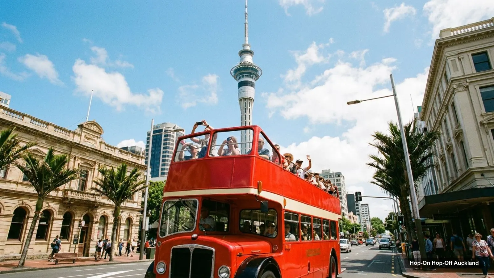
An Auckland tourist map makes more sense once you see the city as four clusters. I’ve put the top 20 attractions, ranked by Google Maps reviews, and every hop-on hop-off bus stop I found on one page, with coordinates and a Google Maps link for each. To choose the ticket that rides the route, see my comparison of hop-on hop-off in Auckland.
I made the tables from the Google Maps and GetYourGuide data I collected, checked October 2026. Distances are straight-line measures from the Explorer Bus main stop outside 23 Customs Street East, using the coordinates in the tables.
Auckland Sightseeing Map: The Bus Routes
The Auckland sightseeing map has two bus systems on it, and they are far apart. The Explorer Bus covers the city on a Red route (all year) and a Blue route (October to April). The Fullers360 bus covers Waiheke Island, a 40-minute ferry ride away. The image below shows the Waiheke loop from Matiatia Ferry Terminal to Onetangi Beach. It is not the city.
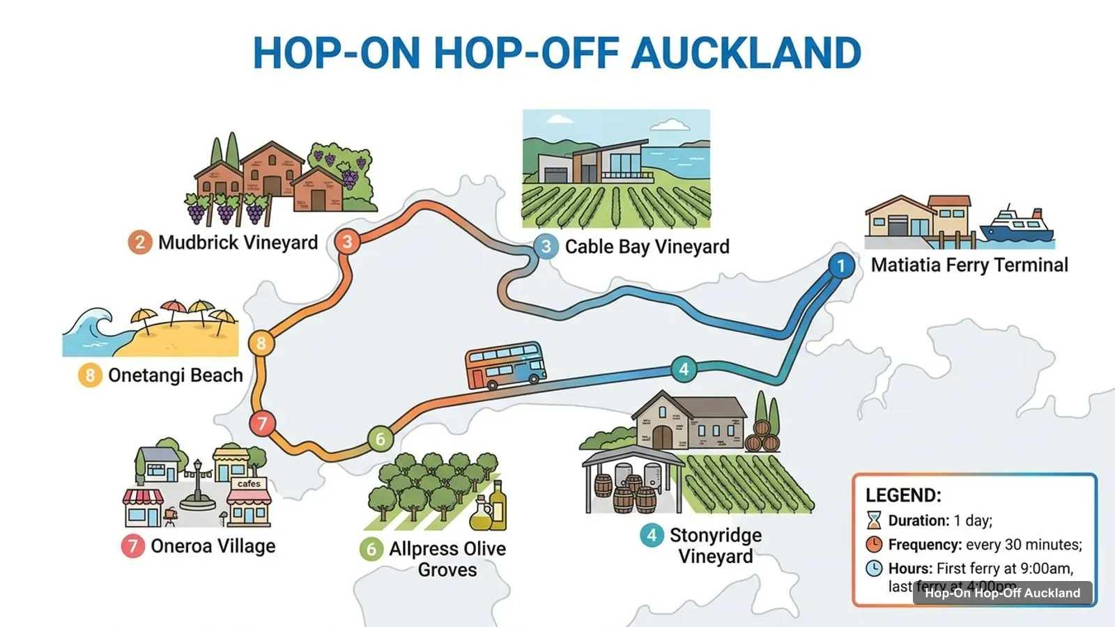
Stops on the route
- 1Matiatia Ferry Terminal
- 2Mudbrick Vineyard
- 3Cable Bay Vineyard
- 4Stonyridge Vineyard
- 5Batch Winery
- 6Allpress Olive Groves
- 7Oneroa Village
- 8Onetangi Beach
Bus stops on the Waiheke Western Explorer loop
The ticket page names eight of its 16 stops. This is the order shown on the route image.
| # | Stop | Map |
|---|---|---|
| 1 | Matiatia Ferry Terminal | Find on Google Maps |
| 2 | Mudbrick Vineyard | Find on Google Maps |
| 3 | Cable Bay Vineyard | Find on Google Maps |
| 4 | Stonyridge Vineyard | Find on Google Maps |
| 5 | Batch Winery | Find on Google Maps |
| 6 | Allpress Olive Groves | Find on Google Maps |
| 7 | Oneroa Village | Find on Google Maps |
| 8 | Onetangi Beach | Find on Google Maps |
Explorer Bus Red route stops
The Red route has 12 stops and takes about 60 minutes for a full non-stop loop. It starts and ends at the Downtown stop.
| # | Red route stop | Map |
|---|---|---|
| 1 | Downtown Auckland | Find on Google Maps |
| 2 | Sky City / Sky Tower | Find on Google Maps |
| 3 | Weta Workshop Unleashed | Find on Google Maps |
| 4 | The All Blacks Experience | Find on Google Maps |
| 5 | Queen Street | Find on Google Maps |
| 6 | Auckland Art Gallery | Find on Google Maps |
| 7 | Newmarket | Find on Google Maps |
| 8 | Auckland Museum | Find on Google Maps |
| 9 | Holy Trinity Cathedral | Find on Google Maps |
| 10 | Parnell | Find on Google Maps |
| 11 | Bastion Point | Find on Google Maps |
| 12 | SEA LIFE Kelly Tarlton’s | Find on Google Maps |
Explorer Bus Blue route stops
The Blue route has 6 stops, runs from October to April and also takes about 60 minutes. It joins the Red route at Auckland Museum.
| # | Blue route stop | Map |
|---|---|---|
| 1 | Auckland Museum | Find on Google Maps |
| 2 | Wintergardens Auckland Domain | Find on Google Maps |
| 3 | Mt Eden | Find on Google Maps |
| 4 | Kingsland/Eden Park | Find on Google Maps |
| 5 | Auckland Zoo | Find on Google Maps |
| 6 | MOTAT | Find on Google Maps |
Auckland Tourist Attractions: Top 20 with Coordinates
These are the Auckland tourist attractions with the most Google reviews, with exact coordinates. Each link opens the place in Google Maps, where you can save it to a list before you travel. I’ve left bus stops and tour offices out.
| # | Attraction | Coordinates | Google rating | Map |
|---|---|---|---|---|
| 1 | Sky Tower | -36.84845, 174.76219 | 4.6 (22,129) | Open in Google Maps |
| 2 | Auckland Museum | -36.86072, 174.77775 | 4.7 (14,941) | Open in Google Maps |
| 3 | Auckland Domain | -36.85893, 174.77549 | 4.7 (13,237) | Open in Google Maps |
| 4 | Cornwall Park | -36.89745, 174.78431 | 4.8 (11,412) | Open in Google Maps |
| 5 | SEA LIFE Kelly Tarlton’s Aquarium | -36.84696, 174.81743 | 4.3 (9,224) | Open in Google Maps |
| 6 | Maungawhau / Mount Eden | -36.87743, 174.76428 | 4.7 (8,419) | Open in Google Maps |
| 7 | Aotea Square | -36.85234, 174.76315 | 4.4 (6,867) | Open in Google Maps |
| 8 | Auckland Art Gallery | -36.85120, 174.76617 | 4.6 (6,752) | Open in Google Maps |
| 9 | MOTAT Museum of Transport and Technology | -36.86782, 174.72694 | 4.5 (4,865) | Open in Google Maps |
| 10 | Albert Park | -36.85064, 174.76789 | 4.6 (4,791) | Open in Google Maps |
| 11 | Victoria Park | -36.84692, 174.75418 | 4.5 (4,361) | Open in Google Maps |
| 12 | Silo Park | -36.84034, 174.75549 | 4.5 (3,571) | Open in Google Maps |
| 13 | New Zealand Maritime Museum | -36.84146, 174.76333 | 4.6 (2,911) | Open in Google Maps |
| 14 | Michael Joseph Savage Memorial Park | -36.84840, 174.82631 | 4.6 (2,314) | Open in Google Maps |
| 15 | Maungauika / North Head Historic Reserve | -36.82720, 174.81039 | 4.7 (1,811) | Open in Google Maps |
| 16 | Bastion Point | -36.84706, 174.82569 | 4.7 (1,703) | Open in Google Maps |
| 17 | Saint Patrick’s Cathedral | -36.84645, 174.76348 | 4.8 (1,677) | Open in Google Maps |
| 18 | Manukau Heads Lighthouse | -37.05061, 174.54577 | 4.6 (1,618) | Open in Google Maps |
| 19 | Ferry Building | -36.84298, 174.76692 | 4.4 (1,514) | Open in Google Maps |
| 20 | Torpedo Bay Navy Museum | -36.82882, 174.80903 | 4.6 (1,421) | Open in Google Maps |
Auckland NZ Attractions: The Four Clusters
The Auckland NZ attractions fall into four clusters, and knowing them saves a lot of backtracking.
CBD and waterfront. The Sky Tower, Auckland Art Gallery, Aotea Square, Albert Park, Saint Patrick’s Cathedral, the Ferry Building and the Maritime Museum are all within about 1 km of the main bus stop. Victoria Park and Silo Park are about 1.2 km away. I’d walk this cluster, using the Red route only for the Sky Tower and the Art Gallery.
Parnell and the Domain. Auckland Museum is 1.9 km from the main stop and Auckland Domain is 1.7 km. Holy Trinity Cathedral is on Parnell Road. Both routes meet at the museum, so this is where I’d change lines.
Eastern bays. Bastion Point and Michael Joseph Savage Memorial Park are about 5.2 km from the main stop, and SEA LIFE Kelly Tarlton’s is about 4.4 km away. Across the harbour, North Head is 4.3 km and Torpedo Bay Navy Museum is 4.1 km, but neither is on a route.
West and south. Mount Eden is 3.6 km from the main stop, MOTAT is 4.4 km and Cornwall Park is 6.0 km. Mount Eden and MOTAT are Blue route stops from October to April. Cornwall Park has no stop. The Manukau Heads Lighthouse is about 30 km away, so it is a car trip.
Auckland Attractions on the Map: Which Stop for Which Sight
If you want to ride, this is which stop gets you to which sight. The bus stop names are from the Explorer Bus listing.
- Sky Tower: the Sky City / Sky Tower stop, which is also the second departure point at Victoria and Federal Streets.
- Auckland Art Gallery: the Auckland Art Gallery stop on the Red route.
- Auckland Museum: the Auckland Museum stop, which serves both routes.
- Auckland Domain: the Wintergardens Auckland Domain stop on the Blue route (October to April).
- SEA LIFE Kelly Tarlton’s: the last stop on the Red route.
- Mount Eden: the Mt Eden stop on the Blue route (October to April).
- MOTAT: the last stop on the Blue route.
- Bastion Point: the Bastion Point stop on the Red route.
For ideas on what to do at each one, see my guide to the best things to do in Auckland.
Is Auckland Worth Visiting? What the Map Tells Me
Is Auckland worth visiting? The map says yes for a short trip, because 19 places have more than 1,500 Google reviews and most of them sit in two compact areas. The CBD cluster can be walked in half a day. The two bus routes then reach the museums, the aquarium and the volcanic cones.
The weak spot is distance. Three of the top ten are more than 4 km from the main stop, so a bus helps. The Explorer Bus ticket is $39.36 for 24 hours and the Waiheke ferry and bus ticket is $58.48.
NZ Tourist Map: Where Auckland Fits
An NZ tourist map would show Auckland at the top of the North Island, and this page covers only the city and Waiheke Island. For official visitor maps and events, the AucklandNZ visitor site is the city’s tourism portal. For ferry times to Waiheke, use Fullers360.
Reading the Auckland Tourist Map by Review Score
Reviews tell a different story from review counts. Among the top 20, the highest ratings are 4.8 for Cornwall Park and Saint Patrick’s Cathedral, and 4.7 for Auckland Museum, Auckland Domain, Mount Eden, North Head and Bastion Point. The lowest are 4.3 for SEA LIFE Kelly Tarlton’s and 4.4 for Aotea Square and the Ferry Building. A low score isn’t a reason to skip: the aquarium has 9,224 reviews, and it is the one I’d pick for a wet day.
The map also shows which sights have no bus. Cornwall Park, Albert Park, Victoria Park, Silo Park, the Maritime Museum, Saint Patrick’s Cathedral and the Ferry Building are not stops on the Explorer Bus lists. The first is far out. The rest are inside the walking cluster, so you don’t need a bus for them.
Practical Notes for Using the Tourist Map
Open hours matter when you plan from a map. Google shows Monday hours of 10am to 5pm for Auckland Museum and Auckland Art Gallery, 10am to 4pm for MOTAT, 9:30am to 5pm for SEA LIFE and 9:30am to 8pm for the Sky Tower. Weekends and holidays can differ, so check each site before you go.
The two Explorer Bus departure points are the Customs Street East stop and the Sky Tower corner at Victoria and Federal Streets. On the Waiheke side, the ferry leaves from Pier 11 or 12 at the Downtown Ferry Terminal, which is 0.3 km from the Explorer Bus main stop. That means you can combine a morning Red route ride with the afternoon ferry, though the listing says ferries run until 4:00pm.
How to Use This Map
Pick a cluster, not a list. Save the places you like in Google Maps, then plan the day around the Red route or the Blue route. My Auckland itinerary for 1, 2 and 3 days does that for you. If you are still choosing a ticket, the Auckland hop-on hop-off guide compares both, and the home page links to my other cities.
Frequently asked questions
Is Auckland worth visiting?
I think so, especially for two or three days. The city has more than 50 places in my data, 19 of them with over 1,500 Google reviews. The Sky Tower, Auckland Museum and Auckland Domain each have more than 13,000 reviews at 4.6 or 4.7, and the Explorer Bus connects most of them.
What are the main tourist attractions in Auckland?
The most-reviewed are the Sky Tower (22,129 reviews), Auckland Museum (14,941), Auckland Domain (13,237), Cornwall Park (11,412), SEA LIFE Kelly Tarlton's (9,224) and Mount Eden (8,419). I list the top 20 with coordinates and Google Maps links on this page.
Where does the Auckland hop-on hop-off bus start?
The Explorer Bus has two departure points: the stop outside 23 Customs Street East, which is its main Downtown stop, and the Sky Tower corner of Victoria and Federal Streets. The Waiheke bus starts at Matiatia Ferry Terminal on the island, after the ferry from Pier 11 or 12.
Is there a sightseeing map of the Explorer Bus route?
I couldn't find a route map in my data, so I list every stop in order with a Google Maps link instead. The Red route has 12 stops and runs all year. The Blue route has 6 stops and runs from October to April. The route image on this page shows the Waiheke bus.
Which tourist attractions in Auckland are far from the centre?
Cornwall Park is 6.0 km from the main bus stop, and Bastion Point is 5.2 km. SEA LIFE Kelly Tarlton's and MOTAT are both about 4.4 km away. The Manukau Heads Lighthouse is about 30 km away and no hop-on hop-off route goes there.
Tours I compared in Auckland
My full review of each one, in the order I rank them:
- Waiheke Island: Ferry & Hop-On Hop-Off Explorer Bus Tickets★ 4.6 · from $58.48
- Auckland: Hop-On Hop-Off Explorer Bus Ticket★ 4.3 · from $39.36