Alicante Tourist Map: Top Attractions & Bus Stops
By Jake Dawson · Updated · Affiliate links, explained in my disclosure
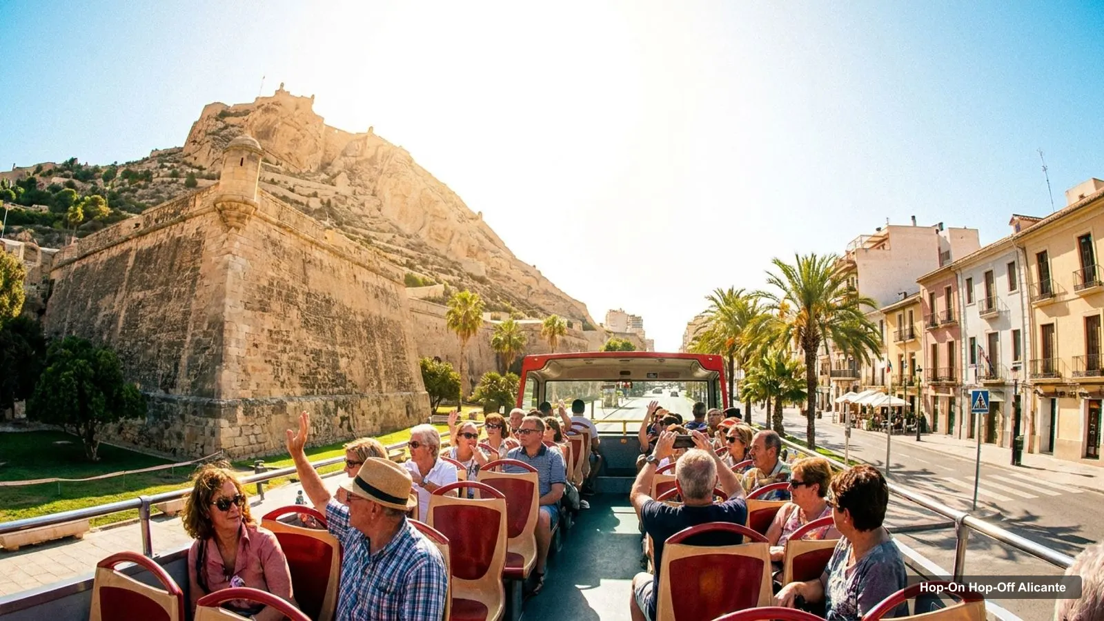
If you searched for an Alicante tourist map, here is the one I would actually use: ten stops from Santa Barbara Castle to the Palmeral park, in an order that avoids backtracking. It is the same route I explain on my page about hop-on hop-off in Alicante, and I have added coordinates and Google Maps links for each stop so you can load them on your phone. This is a map of Alicante’s sights, not an operator’s bus map, because I could not verify a bus operator.
The infographic below shows the route. The tables after it give the stops with live map links and the top attractions with coordinates, generated from my Google Maps data. Opening hours are not in these tables, because they change; check the venue sites.
Alicante Tourist Attractions
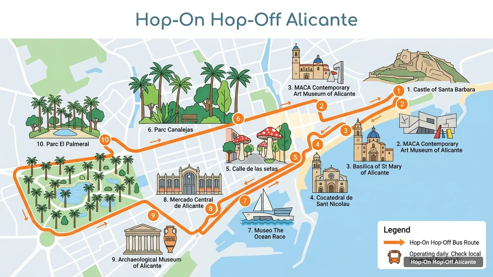
Stops on the route
- 1Castle of Santa Barbara
- 2MACA Contemporary Art Museum of Alicante
- 3Basilica of St Mary of Alicante
- 4Cocatedral de Sant Nicolau
- 5Calle de las setas
- 6Parc Canalejas
- 7Museo The Ocean Race
- 8Mercado Central de Alicante
- 9Archaeological Museum of Alicante
- 10Parc El Palmeral
The ten numbered stops are the ones I would build any visit around. Nine of them are within about a kilometre or so of the next, in a straight line. The only long leg is the last one, from the Archaeological Museum to Parc El Palmeral, which is about 4.7 km, so plan a taxi, bus or tram connection for it.
| # | Stop | Rating | Map |
|---|---|---|---|
| 1 | Castle of Santa Barbara | 4.7 | Open in Google Maps |
| 2 | MACA Contemporary Art Museum of Alicante | 4.5 | Open in Google Maps |
| 3 | Basilica of St Mary of Alicante | 4.5 | Open in Google Maps |
| 4 | Cocatedral de Sant Nicolau | 4.5 | Open in Google Maps |
| 5 | Calle de las setas | 4.5 | Open in Google Maps |
| 6 | Parc Canalejas | 4.5 | Open in Google Maps |
| 7 | Museo The Ocean Race | 4.4 | Open in Google Maps |
| 8 | Mercado Central de Alicante | 4.6 | Open in Google Maps |
| 9 | Archaeological Museum of Alicante | 4.7 | Open in Google Maps |
| 10 | Parc El Palmeral | 4.4 | Open in Google Maps |
Each link opens a Google Maps search for the place. The straight-line gaps between stops are 0.33, 0.04, 0.29, 0.34, 0.36, 0.69, 1.06, 1.01 and 4.74 km, in route order.
Alicante Tourist Guide
Think of the route in three clusters.
The hill and the old town (stops 1 to 5). Santa Barbara Castle, MACA, the Basilica of Santa Maria, the co-cathedral of Sant Nicolau and Calle de las setas. Each is 0.3 to 0.4 km from the next, so this is the part you walk. It is the heart of the city and the most photogenic cluster.
The centre and the harbour (stops 6 to 8). Parc Canalejas, the Ocean Race museum and the central market. The gaps grow to 0.7 and 1.1 km, so a short taxi or a longer walk. The market is a morning stop, open Tuesday to Thursday 7am to 2:30pm and Saturday 7am to 3pm, closed Monday, Friday and Sunday.
The outliers (stops 9 and 10). The Archaeological Museum MARQ is about 1.0 km from the market, and the Palmeral park is a further 4.7 km. I treat them as separate outings.
For a ranked write-up of each sight, see my best things to do in Alicante.
Top 20 Alicante Attractions With Coordinates
This table lists the 20 best-rated attractions in my data within the city area, with latitude and longitude from Google Maps. Places in other towns and bus stops are left out. Ratings are Google Maps ratings, and ties are listed in the order they appear in my data.
| # | Place | Rating | Latitude | Longitude | Map |
|---|---|---|---|---|---|
| 1 | Torre Fabián | 5 | 38.38129 | -0.43652 | Map |
| 2 | Castle of Santa Barbara | 4.7 | 38.34897 | -0.47803 | Map |
| 3 | Archaeological Museum of Alicante | 4.7 | 38.35353 | -0.47688 | Map |
| 4 | La casita de las macetas azules | 4.7 | 38.34814 | -0.48187 | Map |
| 5 | Mirador Alicante | 4.7 | 38.34760 | -0.48134 | Map |
| 6 | Patio de Armas | 4.7 | 38.34894 | -0.47761 | Map |
| 7 | Mercado Central de Alicante | 4.6 | 38.34806 | -0.48611 | Map |
| 8 | Museu de les Fogueres | 4.6 | 38.34581 | -0.48434 | Map |
| 9 | Museum of Illusions Alicante | 4.6 | 38.34001 | -0.48824 | Map |
| 10 | Aura Museum Alicante | 4.6 | 38.34704 | -0.49330 | Map |
| 11 | Plaça de la Santissima Faç | 4.6 | 38.34552 | -0.48135 | Map |
| 12 | CASCO HISTORICO | 4.6 | 38.34615 | -0.48205 | Map |
| 13 | Subida al Castillo de Santa Bárbara | 4.6 | 38.35028 | -0.47419 | Map |
| 14 | Calle de las setas | 4.5 | 38.34384 | -0.48588 | Map |
| 15 | Cocatedral de Sant Nicolau | 4.5 | 38.34546 | -0.48257 | Map |
| 16 | Parc Canalejas | 4.5 | 38.34077 | -0.48718 | Map |
| 17 | Basilica of St Mary of Alicante | 4.5 | 38.34608 | -0.47935 | Map |
| 18 | MACA Contemporary Art Museum of Alicante | 4.5 | 38.34626 | -0.47968 | Map |
| 19 | Platja Postiguet | 4.5 | 38.34439 | -0.47894 | Map |
| 20 | Casa Carbonell | 4.5 | 38.34446 | -0.48081 | Map |
How to Use This Map by Time of Day
I like to match the map to the clock. In the morning, begin with the central market, because its hours are short and it is closed on Monday, Friday and Sunday. From the market, the Postiguet seafront is about 0.8 km away in a straight line, which makes a gentle first walk before the heat builds. Late morning is for the old town, where the Basilica of Santa Maria, MACA and the co-cathedral of Sant Nicolau give you shade and indoor cool.
In the afternoon, the Archaeological Museum is the best indoor choice, open until 7pm on weekdays and Saturday, and until 2pm on Sunday, closed Monday. Late afternoon belongs to the castle, listed open until 8pm, when the light on the bay is at its best. Evening is for the seafront and the harbour, where the Ocean Race museum sits at Muelle de Levante.
Moving Between the Stops
For the first five stops, walk. The straight-line gaps are 0.33, 0.04, 0.29 and 0.34 km, so the whole cluster takes well under an hour on foot, plus the climb to the castle. Between stops 6 and 9 the gaps are 0.4, 0.7, 1.1 and 1.0 km, which is where some people prefer a short taxi. Real walking distances are longer than straight lines, so allow extra time, especially on the castle hill.
The last leg, to the Palmeral, is the only one I would not walk. It is about 4.7 km from MARQ in a straight line. A bus, a taxi or a connection with the local transport network is the practical choice, and the official tourism site is the place to start for public transport.
Places Just Off the Route
A few places in my data sit close to the route and are worth a detour if you have time. Postiguet beach is at the foot of the castle. The Museu de les Fogueres, the Museum of Illusions and the Gravina Museum of Fine Arts all sit within the city centre and score 4.5 to 4.6. The small viewpoint called Mirador Alicante and the La casita de las macetas azules street are in the old town and score 4.7, the same as the castle, so they are an easy extra on the way up the hill. All of them appear in the top 20 table above with coordinates.
Alicante Activities
If you want to do something rather than only see it, the activity listings I found for Alicante include walking tours, tuk-tuk rides, bike tours, boat trips and day trips to Tabarca, Guadalest and Elche. I have no prices or durations in my files, so check the booking pages. For how I would sequence a trip, my Alicante itinerary has one, two and three day plans.
Alicante Tourist Map Pdf
Many people search for a PDF. I do not host one, and I will not pretend to. The Alicante tourism board lists maps, brochures and apps on its official site at alicanteturismo.com, and the tourist office can be reached on +34 965 177 201. If you want something printable, those are the official sources. For use on your phone, the Google Maps links in the tables above are quicker.
Alicante Sightseeing Map
For a sightseeing map you can use on the move, I suggest saving the ten stop links in a Google Maps list, in the numbered order. Start at the castle if you want to climb in the morning light, or reverse the order if you want the castle at sunset. The route works in either direction, because the old town cluster sits in the middle.
Alicante Tourist Information
For official help, use the city tourism board. Its site, alicanteturismo.com, lists maps, brochures and apps, plus public transport information, including the TRAM that links Alicante with El Campello and Benidorm. For timetables and fares, use the TRAM d’Alacant website. If you want the overview first, return to my home page for my city guides, or read my notes on hop-on hop-off in Alicante for the bus question.
Frequently asked questions
Can you show me a map of the hop-on hop-off bus in Alicante?
I could not verify an operator, so I do not have an official bus map. What I made instead is a ten-stop sightseeing route from Santa Barbara Castle to the Palmeral park, shown in the infographic above, with coordinates and Google Maps links for each stop.
Is Alicante a walkable city?
The centre is. The first five stops on my map, from the castle through the old town to Calle de las setas, are each 0.3 to 0.4 km from the next in a straight line. Only the Palmeral park, about 4.7 km from the Archaeological Museum, needs a ride.
Where does the tram from Alicante go?
According to the city tourism site, the TRAM links Alicante with nearby areas such as El Campello and Benidorm. For lines, stops and fares, check the official TRAM d'Alacant website before you travel.
Where can I get an Alicante tourist map PDF?
The tourism board lists maps, brochures and apps at alicanteturismo.com, and the tourist office is on +34 965 177 201. I do not host a PDF myself, but the Google Maps links on this page work on any phone.